Order Total (1 Item Items):
Shipping Destination:

Map Minnesota, First Edition (63 results)
Skip to main search results
Search filters
Product Type
- All Product Types
- Books (32)
- Magazines & Periodicals (No further results match this refinement)
- Comics (No further results match this refinement)
- Sheet Music (No further results match this refinement)
- Art, Prints & Posters (26)
- Photographs (No further results match this refinement)
- Maps (5)
- Manuscripts & Paper Collectibles (No further results match this refinement)
Condition Learn more
- New (No further results match this refinement)
- As New, Fine or Near Fine (6)
- Very Good or Good (48)
- Fair or Poor (3)
- As Described (6)
Binding
Collectible Attributes
- First Edition (63)
- Signed (No further results match this refinement)
- Dust Jacket (6)
- Seller-Supplied Images (40)
- Not Print on Demand (63)
Language (2)
Free Shipping
Seller Location
Seller Rating
-

Cold Comfort: Life at the Top of the Map (Minnesota)
Language: English
Published by Univ Of Minnesota Press (edition First Edition), 2000
ISBN 10: 081663260X ISBN 13: 9780816632602
First Edition
Paperback. Condition: Very Good. First Edition. It's a well-cared-for item that has seen limited use. The item may show minor signs of wear. All the text is legible, with all pages included. It may have slight markings and/or highlighting.
-
Cold Comfort: Life at the Top of the Map (Minnesota)
Language: English
Published by Univ Of Minnesota Press, 2000
ISBN 10: 081663260X ISBN 13: 9780816632602
First Edition
Soft cover. Condition: Near Fine. 1st Edition. Trade softcover with bright clean cover. Short note on front endpaper. Otherwise near fine inside and out.
-

Minnesota on the Map: A Historical Atlas
Language: English
Published by Minnesota Historical Society Press, 2008
ISBN 10: 0873515935 ISBN 13: 9780873515931
First Edition
Hardcover. Condition: Fine. Dust Jacket Condition: Very Good. 1st Edition. First Edition of this illustrated history of the portrayal of Minnesota in maps from early European exploration to late 20th century tourism and land use. 215 pages, cloth, illustrated. Has a tear at the bottom edge of the spine of the dust jacket. Otherwise, minimal sign of previous use.
-

Minnesota on the Map: A Historical Atlas
Language: English
Published by Minnesota Historical Society, St. Paul, 2008
ISBN 10: 0873515935 ISBN 13: 9780873515931
First Edition
1st. 4to. 215pp. NO INTERNATIONAL OR PRIORITY. "to-from" on down end paper. Slightest. rubbing to DJ. Near Fine/Near Fine (see notes).
-
Minnesota On The Map: A Historical Atlas
Language: English
Published by Minnesota Historical Society Press, St. Paul, 2008
ISBN 10: 0873515935 ISBN 13: 9780873515931
Seller: Archer's Used and Rare Books, Kent, OH, U.S.A.
Seller rating 5 out of 5 stars

First Edition
Hardcover. Condition: Fine. Dust Jacket Condition: Fine. 1st Edition. Dust Jacket is in fine condition without tears or chips or other damage. Dust Jack in mylar guard. Quantity Available: 1. Category: Minnesota; ISBN: 0873515935. ISBN/EAN: 9780873515931. Pictures of this item not already displayed here available upon request. Inventory No: 15896.
-
Minnesota On The Map: A Historical Atlas
Language: English
Published by Minnesota Historical Society, St. Paul, MN., 2008
ISBN 10: 0873515935 ISBN 13: 9780873515931
Seller: Ross & Haines Old Book Co., Hudson, WI, U.S.A.
Seller rating 4 out of 5 stars

First Edition
Cloth. Condition: Fine. Dust Jacket Condition: Near Fine. 1st Edition. Almost square quarto, viii + 215 pp., some b/w but mostly color reproductions of maps, bib., list of maps, index. A history of Minnesota in 5 centuries of maps. Cloth bound hard cover book in fine cond., d/w near fine cond.
-
Minnesota on the Map: A Historical Atlas
Language: English
Published by Minnesota Historical Society Press, St Paul, Minnesota, 2008
ISBN 10: 0873515935 ISBN 13: 9780873515931
First Edition
Hardcover. Condition: Fine. Dust Jacket Condition: Fine. 1st Edition. viii, 215 pages : illustrations, maps ; 27 x 25 cm. A perfect copy.
-

Soft cover. Condition: Good. 1st Edition. 1 map : color ; 55 x 42 cm folded to 22 x 15 cm. Includes text and inset.Text on verso. On verso: Downtown Minneapolis.--Downtown St. Paul.--St. Paul-Minneapolis metropolitan area. An early map of made during the construction period of Minnesota's Interstate highways. About half of he system was completed and half under construction. Some closed tears along the edge of the map.
-

MAP: "Minnesota".colored map, Disbound, source Unknown
Published by Dodd, Mead & Company, NY, 1903
Seller: Dorley House Books, Inc., Hagerstown, MD, U.S.A.
Seller rating 4 out of 5 stars
Art / Print / Poster First Edition
Unbound. Condition: Very Good. 1st. 9.5"x12"' colored map. with railroad lines, etc . suitable for framing Size: 9.5" x 12".
-

MAP: "Northern States, Western Section" (Minnesota & the Dakota Terriroty).from Van Antwerp, Bragg & Company's Commerical Atlas
Published by Van Antwerp, Bragg & Company, NY, 1882
Seller: Dorley House Books, Inc., Hagerstown, MD, U.S.A.
Seller rating 4 out of 5 stars
Art / Print / Poster First Edition
Unbound. Condition: Very Good. Colored Map (illustrator). 1st. lovely colored amtique map.includes the Dakotas & Minnesota; suitable for framing Size: 6" x 8.5".
-
Simple Bouguer Gravity Map of Minnesota: Stillwater Sheet
Published by Minnesota Geological Survey, St. Paul, 1977
First Edition
Soft cover. Condition: Good. First. Folding map in manilla sleeve; ex-research library; some edgewear to sleeve. Miscellaneous Map Series M-35. Scale 1:250,000. Book.
-
Simple Bouguer Gravity Map of Minnesota: Bemidji Sheet
Published by Minnesota Geological Survey, St. Paul, 1978
First Edition
Soft cover. Condition: Good. First. Folding map in manilla sleeve; ex-research library; some edgewear to sleeve. Miscellaneous Map Series M-41. Scale 1:250,000. Book.
-
Quaternary geologic map index of Minnesota
Published by University of Minnesota, Saint Paul, Minnesota, 1976
First Edition
Soft cover. Condition: Fine. 1st Edition. iii, 22 pages : map (folded, laid in) ; 22 cm. The book references sites located on the map. A perfect copy of a rare work.
-
Soil survey, Roseau County, Minnesota (with map)
Published by GPO, Washington, D.C., 1942
First Edition
Soft cover. Condition: Fair. 1st Edition. 80 pages : illustrations, maps ; 23 cm. Cover title. In cooperation with the University of Minnesota Agricultural Experiment Station. The cover somewhat toned; the back cover, along with the pocket containing the map is detached. The large colored map itself is in fine condition.
-
Standard map of Fillmore County, Minnesota
Published by Minnesota Map Publishing Co., St. Paul, Minn., 1913
First Edition
Soft cover. Condition: Very Good. 1st Edition. 1 map : hand colored ; 54 x 71 cm, on sheet 57 x 74 cm., folded down to approx. 18 x 11 cm. in brown printed wrappers; wrappers with some minor bending, the map itself in fine condition except for some minor holes at the corners.
-

MAP: "Geological Map of Gunflint Lake and Vicinity, Minnesota".from The Penokee Iron-Bearing Series of Michigan and Wisconsin (Volume XIX, Monographs of the United States Geological Survey)
Language: English
Published by Government Printing Office, Washington D.C., 1892
Seller: Dorley House Books, Inc., Hagerstown, MD, U.S.A.
Seller rating 4 out of 5 stars
Map First Edition
No Binding. Condition: Very Good. Dust Jacket Condition: New. colored map (illustrator). 1st. 11.5" x 9" colored map, archival joining of seam.
-

"Tower Sheet": Map from the Atlas to Accompany Monograph XLV on the Vermilion Iron-Bearing District of Minnesota
Published by Government Printing Office, Washingtion, D.C, 1903
Seller: Dorley House Books, Inc., Hagerstown, MD, U.S.A.
Seller rating 4 out of 5 stars
Art / Print / Poster First Edition
Unbound. Condition: Very Good. Colored Map (illustrator). 1st. 17" x 21.5" colored map of the area around Vermilion Lake and the Pike Rver Bay. The margins have moderate ruffling & age related staining, but are large for easy trimming and framing Size: 17" x 21.5".
-

Basswood and Fall Lakes Sheet": Map from the Atlas to Accompany Monograph XLV on the Vermilion Iron-Bearing District of Minnesota
Published by Government Printing Office, Washingtion, D.C, 1903
Seller: Dorley House Books, Inc., Hagerstown, MD, U.S.A.
Seller rating 4 out of 5 stars
Art / Print / Poster First Edition
Unbound. Condition: Very Good. Colored Map (illustrator). 1st. 17" x 21.5" colored map of the area south from Basswood lake to The Kawishiwi River. The margins have moderate ruffling & age related staining, marginal repairs, but are large for easy trimming and framing Size: 17" x 21.5".
-

Ely Sheet": Map from the Atlas to Accompany Monograph XLV on the Vermilion Iron-Bearing District of Minnesota
Published by Government Printing Office, Washingtion, D.C, 1903
Seller: Dorley House Books, Inc., Hagerstown, MD, U.S.A.
Seller rating 4 out of 5 stars
Art / Print / Poster First Edition
Unbound. Condition: Very Good. Colored Map (illustrator). 1st. 17" x 21.5" colored map of the area southeast from Burnside Lake to White Iron lake. The margins have moderate ruffling & age related staining, but are large for easy trimming and framing Size: 17" x 21.5".
-

"Soudan Sheet": Map from the Atlas to Accompany Monograph XLV on the Vermilion Iron-Bearing District of Minnesota
Published by Government Printing Office, Washingtion, D.C, 1903
Seller: Dorley House Books, Inc., Hagerstown, MD, U.S.A.
Seller rating 4 out of 5 stars
Art / Print / Poster First Edition
Unbound. Condition: Very Good. Colored Map (illustrator). 1st. 17" x 21.5" colored map of the area west of Vermilion Lake past Armstrong Lake; The margins have moderate ruffling & age related staining, but are large for easy trimming and framing Size: 17" x 21.5".
-
MAP: "Minnesota".from the New Indexed Atlas of the World
Published by Rand McNally & Co, Chicago, IL, 1887
Seller: Dorley House Books, Inc., Hagerstown, MD, U.S.A.
Seller rating 4 out of 5 stars
First Edition
Unbound. Condition: Very Good. Handcolored Map (illustrator). 1st. very nice w/decorative border; suitable for framing [2 scans=full imge] Size: 20.5" x 11.25".
-
Map of Michigan, Wisconsin and Minnesota - Sheet 72 (part of USA) Disbound from the 1890 'The Library Reference Atlas of the World'
Published by Macmillan and Co., London, 1890
First Edition
US$ 35.49
US$ 19.51 shipping
Ships from United Kingdom to U.S.A.Quantity: 1 available
Add to basketSoftcover. Condition: Very Good. Dust Jacket Condition: No Dust Jacket. First Edition. Single disbound coloured map sheet, from John Bartholomew's Library Reference Atlas, covering part of the United States of America. Suitable for framing. Approx size 35 x 46 cm, vertical centre fold. Map is clean, crisp, clear and bright. Sheet covers the part of USA including: Michigan, Wisconsin, Minnesota, Lake Superior, Lake Michigan, Lake Huron, Milwaukee, Chicago, Bay City, Manistee, Detroit, Apostle Islands, Madison, Winona, Hastings and Isle Royal. No dust jacket, as published. Quantity Available: 1. Shipped Weight: under 1 kg. Pictures of this item not already displayed here available upon request. Inventory No: 45020124069. All our books are sent by tracked mail.
-
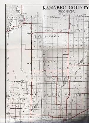
STANDARD MAP OF KANABEC COUNTY, MINNESOTA: Showing State Trunk Highways and other Improved Roads in Red
Published by McGill-Warner Co, St. Paul, Minn, 1941
Seller: R & A Petrilla, Booksellers & Appraisers, Roosevelt, NJ, U.S.A.
Seller rating 4 out of 5 stars
First Edition
Softcover. Condition: Very Good. First Edition. Map by M.J. Grindhem, opens to 17.5" x 12.5", printed in black and red. Folds into printed stiff wrappers, 7" x 4.5".
-

MAP: "Detailed Geological Map Showing Actual Exposures in the NE Sec T63 N.R. 12 W., Minnesota, Geology Sheet XXVI. from The Atlas to accompany Monograph XLV on the Vermillion Iron-Bearing District of Minnesota.
Published by U.S. Geological Survey, Washingtion, D.C, 1898
Seller: Dorley House Books, Inc., Hagerstown, MD, U.S.A.
Seller rating 4 out of 5 stars
Art / Print / Poster First Edition
Unbound. Condition: Very Good. Colored Map (illustrator). 1st. 18" x 24" colored mining map showing observed rock exposures Size: 18'' x 24". Map.
-
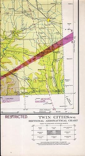
MAP: Twin Cities (W-6) (Minneapolis & St. Paul, Minnesota) Sectional Aeronautical Chart. "Restricted"
Published by U.S. Coast and Geodetic Survey, Washington D.C., 1944
Seller: Dorley House Books, Inc., Hagerstown, MD, U.S.A.
Seller rating 4 out of 5 stars
Art / Print / Poster First Edition
Unbound. Condition: Very Good. Colored Map (illustrator). 1st. World war II restricted map of the area between Austin, Texas & Mobile, Alaabama zones, and shows air fields, seaplane bases, hazards, radio and communcation items; landmarks, lookout towers, marine lightings and beacons, and more.has warnings.Marked Restricted, "Due to war conditions, lights, radio facilities and other aids to navigation may be changed or discontinued without notice.". Size: 24" x 42".
-
Minnesota state business directory : containing explanations to map, the congressional, senatorial, assembly, and land office districts, and judicial circuits, and population tables from the tenth United States census : also name and address of many leading business men.
Language: English
Published by Warner & Foote, Minneapolis, Minnesota, 1881
First Edition
Hardcover. Condition: Fair. 1st Edition. 119 p. : ill. ; 22 cm. The gutters are broken, front and back. The front free end paper is missing so that the text block is quite loose from the binding. An early book plate on the back of the title page. The date is estimated, base primarily on the heavy use of the 1880 census. Much interesting early information on Minnesota, especially the twin cities area. No map present.
-

Rand McNally Junior Auto Road Map of Minnesota
Publication Date: 1930
Seller: Art Source International Inc., Boulder, CO, U.S.A.
Seller rating 5 out of 5 stars
First Edition
Rand McNally & Company, still a major name in map publishing to this day, began as a small print shop opened in Chicago in 1856 by William H. Rand. The shop originally printed guidebooks and directories. In 1858, Rand hired Andrew McNally who was later to become a partner. Within the next few years, the shop got into the railroad business by starting to print railway tickets and schedules, a key step in the development of the company. The ticket printing led to the publishing of railway guides, and by 1872 Rand McNally and Company had the capacity to publish maps. This road map of Minnesota came from Rand McNallys Commercial Atlas, sixty-first Edition dated 1930. A highly successful run of atlases that lasted over a decade. This map includes a detailed plan of all existing highways (in red) and all other roads in existance at the time. This map measures 11 inches by 17 inches.
-
Atlas of Pipestone County, Minnesota, containing plats of each township, a county road map, a rural directory of farmers, a farm numbering system and other features.
Published by Thomas O. Nelson, Fergus Falls, Minnesota, 1954
First Edition
Plastic Ring Binding. Condition: Very Good. First Edition. 34 cm. 147 pages. 16 pages of township maps, followed by a "Rural Directory of Pipestone County, Minnesota, showing name of the farm occupant, mailing address, O for owner, R for renter and farm code number showing exact location of each farm building." (including my Grandfather's farm). This is followed by an "Atlas of Minnesota" which contains full page maps of each county in Minnesota as of 1954. Some minor wear and smudges.
-
Atlas of Grant County, Minnesota : containing plats of each township, a county road map, a rural directory of farmers, and other features : 20 June 1954
Published by Thomas O. Nelson, Fergus Falls, Minnesota, 1954
First Edition
Plastic Ring, Hard Covers. Condition: Very Good. First Edition. 34 cm. 147 pages. 16 pages of township maps for each of the County's townships, followed by a "Rural Directory of Grant County, Minnesota, showing name, township, mailing address, section number and whether renter or owner." This is followed by an "Atlas of Minnesota: containing a map of each county in the state, a listing of the cities and towns of the state." and a great deal addtional information. Some slight moisture rippling to a few pages, but still a very good copy.
-

Rand McNally Standard Map of Minnesota
Publication Date: 1930
Seller: Art Source International Inc., Boulder, CO, U.S.A.
Seller rating 5 out of 5 stars
First Edition
Rand McNally & Company, still a major name in map publishing to this day, began as a small print shop opened in Chicago in 1856 by William H. Rand. The shop originally printed guidebooks and directories. In 1858, Rand hired Andrew McNally who was later to become a partner. Within the next few years, the shop got into the railroad business by starting to print railway tickets and schedules, a key step in the development of the company. The ticket printing led to the publishing of railway guides, and by 1872 Rand McNally and Company had the capacity to publish maps. This map of Minnesota came from Rand McNally's Commercial Atlas, sixty-first Edition dated 1930. A highly successful run of atlases that lasted over a decade. These maps were primarily used by business, because of their accurate listing of railroads in operation as well as tables of statistical information. This map is unique in several ways, their large format makes an impressive display, and offers additional room where many small towns and extra details are included. Additionally a list of every railroad operating in the state in 1930 is included. All railroad routes are shown on the map. This map includes all cities and towns, lakes, rivers, and bodies of water. All topographical features are also included as well as political features such as counties and Native American Indian reservations. This map measures 26 inches by 19 inches.