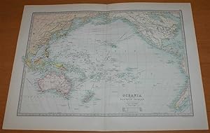
Map Oceania (131 results)
 More images
Published by Rand McNally. Chicago. No date (Circa 1930's). 1935
- Softcover
Seller: The Book Scot, mansfield, MO, U.S.A.The Book Scot
Contact seller5-star sellerCondition: Used - Good
US$ 10.00
US$ 5.50 shippingShips within U.S.A.Quantity: 1 available
Soft cover. Condition: Good. No Jacket. Map folded and contained in a folder size about 4 by 6 1/2 inches. Map opens up to 21 by 28 inches. Covers Oceania and Malaysia which was a very different place in those days at least as far as political definitions went. Map with tears and fold intersection separations; folder with spine…taped. Needs a bit of work to make it beautiful. GOOD Language: eng Language: eng 0.0 Language: eng Language: eng Language: eng.

Language: English
Published by J. W. Clement Co., Buffalo 1937
Seller: Legacy Books II, Louisville, KY, U.S.A.Legacy Books II
Contact seller4-star sellerCondition: Used - Very good
Original price: US$ 10.02; 30% offCurrent price: US$ 7.02
US$ 5.85 shippingShips within U.S.A.Quantity: 1 available
No Binding. Condition: VG. Sized 10 x 14 inches, very clean and bright. Unrelated map on verso.

Language: English
Published by Rand McNally & Company, Chicago
Seller: Legacy Books II, Louisville, KY, U.S.A.Legacy Books II
Contact seller4-star sellerCondition: Used - Very good
Original price: US$ 10.02; 30% offCurrent price: US$ 7.02
US$ 5.85 shippingShips within U.S.A.Quantity: 1 available
No Binding. Condition: VG. Circa 1937, sized about 11 x 14 inches, Australia on verso.

Seller: GreatBookPrices, Columbia, MD, U.S.A.GreatBookPrices
Contact seller5-star sellerCondition: Used - As new
US$ 17.98
US$ 2.64 shippingShips within U.S.A.Quantity: 2 available
Condition: As New. Unread book in perfect condition.

Published by Geographia Map Co., New York.
- Softcover
Seller: The Book Bin, Salem, OR, U.S.A.The Book Bin
Contact seller5-star sellerCondition: Used - Fair
US$ 31.25
US$ 5.75 shippingShips within U.S.A.Quantity: 1 available
Paperback. Condition: Fair. No date [c.1942]. Size 41 x 27 inches, Extra Large Scale. Folds to 8 x 9 inches. There are tears along many of the folds, but it is still in one piece, large print, colors bright, fair. > Language: English | > Size: Folio | > Media/Binding: Soft cover |.
Seller: GreatBookPricesUK, Woodford Green, United KingdomGreatBookPricesUK
Contact seller5-star sellerCondition: Used - As new
US$ 22.92
US$ 19.75 shippingShips from United Kingdom to U.S.A.Quantity: 2 available
Condition: As New. Unread book in perfect condition.

- Softcover
Seller: SEATE BOOKS, APO, AP, U.S.A.SEATE BOOKS
Contact seller5-star sellerCondition: Used - Good
US$ 40.95
US$ 20.00 shippingShips within U.S.A.Quantity: 1 available
Paperback. Condition: Good. no dj. Reference Map of Oceania. Book.

Published by Royal Society, UK 1899
- Softcover
Seller: Maynard & Bradley, Leicester, United KingdomMaynard & Bradley
Contact seller5-star sellerCondition: Used - Very good
US$ 13.49
US$ 28.90 shippingShips from United Kingdom to U.S.A.Quantity: 1 available
Softcover. Condition: Very Good. 1899. A clean and very well-presented 1899 colour printed map, unmarked across the entire image surface, and with a central fold line as originally presented but no other notable creases or wear. Why on Amazon do most sellers not describe their actual book? Buy with confidence and support a genui…ne Independent Bricks & Mortar Real Bookshop. We are Maynard & Bradley CAMBO & PBFA(now lapsed) members here in Leicester City Centre. Size: 365 x 470 mm. 1. Item Type: Book. Quantity Available: 1. Shipped Weight: Under 500 grams. Category: Geography & Maps; Britain/UK; 19th century; Inventory No: 42127.
 More images
Published by Reclus
- Softcover
- Art Print
Seller: Artisans-lane Maps & Prints, Sidney, BC, CanadaArtisans-lane Maps & Prints
Contact seller4-star sellerCondition: Used - Very good
US$ 14.47
US$ 19.00 shippingShips from Canada to U.S.A.Quantity: 1 available
no binding. Condition: very good. Actual Map Image Size: 3 1/2 x 4 1/2 ins. Overall Size including text and borders : 10 1/2 x 7 Ins . CONDITION: This is a Intext map with text on the back. Clear and sharp with beautiful detail. As scanned. NOTE THE FOLLOWING BEFORE YOU PURCHASE: This is a GENUINE ANTIQUE VINTAGE 1890 MAP. It is… NOT a modern reproduction, ie. a laser scan, photocopy etc. It is the original from the antique or vintage atlas or book publication. This intext map was published on the date mentioned, or circa of the date mentioned at the top of the page. The map I have for sale, like many antique vintage prints and maps that you see online, originate from an antique vintage book or atlas publication. The publication may not always be known. If you have any questions, emails are welcome. List of Explorers Include: M. 1521. Magellan, Guahan, Philippines. Me. 1526. Menezes, 2Cew Guinea. S. 1528. A. de Saavedi'a, Carolines. S. 1529. A. de Saavedra, Marshall. G. 1531. Guillaume le Testu, Australia. v. 1?43. Villalobos, Carolines, Ptlew. Md. 1567. Mendana, Ellice, Solomon, Sandwich. Md. 1595. Mendana, Marquesas, Sta. Cruz. Q. 1606. Queiros, Low Islands, Falcaofo, New H?brides. T. 1606. Torres, Torres Straits, Lnuisiades. X/. M. 1616. Lemaire, yiua/u, 2\ew Ireland. H. 1616. Hartog-, Endrachtsland. E. 1619. Edel, Edelsland. L. 1622. Leeuwlns, Leeuwinsland. N. 1627. Nuyts, Suytsland. W. 1628. Witts, Wittsland. T. 1642. Tasman, Tusnania, New Zealand. T. 1643. Tasman, Tonga, Fiji, Neiv Britoi7i. T. 1644. Tasman, Tnsmanland, Carpentaria. U. 1699. Dampier, New Guinea. B. 1765. Byron, Gilhert Island. Wa. 1767. Wallis, Tahiti. Ca. 1767. Carteret, Pitcaim, Carteret, Low Islands. Bo 1763. Bougainville, Samoa, Solomon. C. 1769. Cook. Austral Islands. C. 1770. Cook, Aew Zealand, Australia. C. 1773. Cook, Hervey Islands. C. 1774. Cook, Savage Island, New Caledonia. La. 1787. liap?rouse. Sawaii. Br. 1791. Broughton, Chatham Island. Ba. 1798. Bass, Pass's Strait. Ha. 1810. Hazelburg, Macquarie. Wk. 1811. Walker, Campbell. D. U. 1827. Dumont D'Urville, Fiji.

Published by Brockhaus, Germany 1894
- Softcover
Seller: Maynard & Bradley, Leicester, United KingdomMaynard & Bradley
Contact seller5-star sellerCondition: Used - Very good
US$ 17.56
US$ 28.90 shippingShips from United Kingdom to U.S.A.Quantity: 1 available
Softcover. Condition: Very Good. 1894. A well-presented colour lithograph print produced in 1894 by Brockhaus. Clean and well-presented across the entire image surface, with a central fold line as originally presented, and neatly trimmed to prevent edge wear. Why on Amazon do most sellers not describe their actual book? Buy with… confidence and support a genuine Independent Bricks & Mortar Real Bookshop. We are Maynard & Bradley CAMBO & PBFA(now lapsed) members here in Leicester City Centre. Size: 250 x 300 mm. 1. Text is in German. Item Type: Book. Quantity Available: 1. Shipped Weight: Under 500 grams. Category: Art & Design; Germany; 19th century; German Language; Inventory No: 35132.

Published by W. & A.K. Johnston, UK 1904
- Softcover
Seller: Maynard & Bradley, Leicester, United KingdomMaynard & Bradley
Contact seller5-star sellerCondition: Used - Very good
US$ 25.70
US$ 28.90 shippingShips from United Kingdom to U.S.A.Quantity: 1 available
Softcover. Condition: Very Good. 1904. A very presentable original engraving published in 'The Handy Royal Atlas of Modern Geography', 1904. Margins have some mild browning and thumb marks, but the image itself is clean and unmarked, with a vertical fold line as originally published, but no significant creases or wear. Why do mo…st sellers not describe their actual item? Buy with confidence, support a genuine Independent Bricks & Mortar Real Bookshop and help to preserve our High Streets as interesting places to shop. We are Maynard & Bradley CAMBO & PBFA (now lapsed) members here in Leicester City Centr Size: 480 x 370 mm. 1 pages. Item Type: Book. Quantity Available: 1. Shipped Weight: Under 1 kilogram. Category: Geography & Maps; Britain/UK; 1900-1920; Pictures of this item not already displayed here available upon request. Inventory No: 27912.

Published by Christian Missionary Conference, UK 1910
- Softcover
Seller: Maynard & Bradley, Leicester, United KingdomMaynard & Bradley
Contact seller5-star sellerCondition: Used - Very good
US$ 27.05
US$ 28.90 shippingShips from United Kingdom to U.S.A.Quantity: 1 available
Softcover. Condition: Very Good. 1910. An original 1910 chromolithograph, clean and well-presented across the entire image surface with no notable creases or signs of wear, and just some reinforcement with conservation tape at ends of the central fold line. Why on Amazon do most sellers not describe their actual book? Buy with c…onfidence and support a genuine Independent Bricks & Mortar Real Bookshop. We are Maynard & Bradley CAMBO & PBFA(now lapsed) members here in Leicester City Centre. Size: 465 x 360 mm. 1. Item Type: Book. Quantity Available: 1. Shipped Weight: Under 500 grams. Category: Geography & Maps; Britain/UK; 1900-1920; Inventory No: 37094.

Published by Johnston/Forsyth, UK 1887
- Softcover
Seller: Maynard & Bradley, Leicester, United KingdomMaynard & Bradley
Contact seller5-star sellerCondition: Used - Very good
US$ 31.12
US$ 28.90 shippingShips from United Kingdom to U.S.A.Quantity: 1 available
Softcover. Condition: Very Good. 1887. A clean and well-presented map produced for Johnston's atlas of 1887, with tastefully hand-coloured borders and boundaries. Some minor bumps and nicks at the outer edges reinforced with conservation tape, and neatly trimmed to prevent edge wear, butno major encroachment onto the printed ima…ge itself which remains clear, bold, and unmarked, with no notable wear. Why on Amazon do most sellers not describe their actual book? Buy with confidence and support a genuine Independent Bricks & Mortar Real Bookshop. We are Maynard & Bradley CAMBO & PBFA(now lapsed) members here in Leicester City Centre. Size: 235 x 310 mm. 1 pages. Item Type: Print. Quantity Available: 1. Shipped Weight: Under 500 grams. Category: Geography & Maps; Britain/UK; 19th century; Inventory No: 55171.
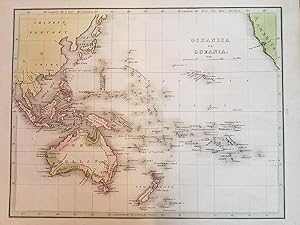
 More images
Published by Macmillan and Co., London 1890
- Softcover
- First Edition
Seller: Bailgate Books Ltd, Doncaster, United KingdomBailgate Books Ltd
Contact seller5-star sellerCondition: Used - Very good
US$ 41.22
US$ 19.09 shippingShips from United Kingdom to U.S.A.Quantity: 1 available
Softcover. Condition: Very Good. No Dust Jacket. First Edition. Single disbound coloured map sheet, from John Bartholomew's Library Reference Atlas. Map covers Oceania and the Pacific from China to America with Austrialasia and the Pacific Islands. Suitable for framing. Approx size 35 x 46cm, vertical centre fold. Occasional fai…nt marks in margin, map is otherwise clean, crisp and bright. Map includes: Australia, New Zealand, Hawaii or Sandwich Islands, Galapogos Islands, Polynesia, East Indain Archipelago, Melanesia, Fiji, Tonga, Papua or New Guinea, Philippines, Borneo, Sumatra, Java, Timor, Japan, Formosa (Taiwan), Yellow Sea, Okhotsk Sea, Berring Sea, Aleutian Islands, and parts of China, Alaska, Canada, USA and South and Central America. No dust jacket, as published. Quantity Available: 1. Shipped Weight: under 1 kg. Pictures of this item not already displayed here available upon request. Inventory No: 45021014023. All our books are sent by tracked mail.

Seller: Art Source International Inc., Boulder, CO, U.S.A.Art Source International Inc.
Contact seller5-star sellerWith the 19th century innovations of publishing and technology, the world became a smaller place and one which anyone could become acquainted with. As these changes blossomed, the fledgling company of Rand McNally realized the interest in small accessible material, and produced a pocket atlas. These maps carry handy reference in…formation, and were up to date for the period. They include cities, some towns as well as some roads. They have their own charm and would be great for framing, and decorative use. This map measures 3 inches by 5 inches.

Seller: Antique Paper Company, ASHFORD, KENT, United KingdomAntique Paper Company
Contact seller2-star sellerCondition: Used
US$ 20.34
US$ 7.90 shippingShips from United Kingdom to U.S.A.Quantity: 1 available
Listing Template 2018 Home About Us View Feedback Contact Us c1912 Map of OCEANIA PACIFIC OCEAN on Mercators Projection Chart Regions (BS72)Click image to enlargeDescriptionc1912An original coloursmall antique maptaken from 'Handy Reference Atlas of the world' titled:OCEANIA AND THE PACIFIC OCEAN on Mercators ProjectionOverall s…ize of thismapis approx 22cm x 18cm with central fold as issued.Published by John Bartholomew Co, Edinburgh.Shipping View Our Categories Decorative Prints World Wide Maps Scotland Maps Architecture Design England Maps Royalty About UsWe specialise in selling all items that can be considered to be Antique Paper. * PRINTS * MAPS * HISTORICAL DOCUMENTS * POSTAL HISTORY * BOOKS * POSTERS * STAMPS * POSTCARDS * EPHEMERA And anything else that is considered Antique and made of Paper. ALL OF OUR ITEMS ARE ORIGINAL ANTIQUES - NOT MODERN COPIES. We are also very keen buyers of anything similar and especially after better collections, original archives, whole libraries and better single items and have and#163;250,000 in cash funds at anyone time to buy the right items. Contact UsIf you have any questions then please do not hesitate to contact us through the eBay messaging system. Feedback We will always help you to have a 100% positive happy buying experience. Contact us if you are unhappy about any aspect of your purchase from us. We only want five star feedback from you so buy with confidence.

Seller: LIBRERIA IL TEMPO CHE FU, Enna, EN, ItalyLIBRERIA IL TEMPO CHE FU
Contact seller5-star sellerCondition: Used - Fine
US$ 19.99
US$ 9.65 shippingShips from Italy to U.S.A.Quantity: 1 available
Condition: Ottimo. Antica carta geografica o mappa di fine '800 - Ancient map Oceania fisica - Oceania physics Australia, Nuova Zelanda, Nuova Guinea - Australia, New Zealand, New Guinea Geo - 002 Dimensioni Cm 30,00 x 24,00 Qualora vogliate delle scansioni migliori contattateci, soddisferemo ogni vostra richiesta. PaypalCarta d…i creditoBonifico bancario Accuratamente adagiate su un cartoncino e protette da pellicola trasparente rigida,il tutto viene inserito dentro plico di adeguate dimensioni per proteggerne l'integrità. Geo - 002.

Published by H. Cowperthwait & Company, Philadelphia 1852
Seller: Cultural Connection, Cape Coral, FL, U.S.A.Cultural Connection
Contact seller5-star sellerSee picture. Map is dated 1852. A single plate from the book. Map numbers 31 and 32. 11 1/2" x 9 1/2". Engraving hand-colored in red and yellow. A few spots. Rounded corners.

Seller: Antique Paper Company, ASHFORD, KENT, United KingdomAntique Paper Company
Contact seller2-star sellerCondition: Used
US$ 22.38
US$ 7.90 shippingShips from United Kingdom to U.S.A.Quantity: 1 available
Listing Template 2018 Home About Us View Feedback Contact Us 1912 Original Colour Antique Map - AUSTRALIA OCEANIA MAP (82)Click image to enlargeDescriptionAn original colour folded antique Map titledOCEANIAPublished by the EDINBURGH GEOGRAPHICAL INSTITUTE under the patronage of the Royal Scottish Geographical Society taken from…the ATLAS OF THE WORLD, designed and prepared under the direction of J G Bartholomew.Size overall approx 35cm x 26cmand perfect for mounting and framing.Condition is excellent with central fold as issued, large margins with vibrant colours.ALL OUR PRINTS MAPS ARE GENUINE ANTIQUES OF AT LEAST 100 YEARS OLD AND ARE DATED AS STATED IN THE DESCRIPTION.WE WILL HAPPILY COMBINE LOTS INTO SINGLE POSTAL CHARGE.PaymentWe accept a variety of payment methods. For UK customers, we can accept Paypal, Personal/Company Cheques (please allow 5 working days for clearance) and Postal Orders.For non-UK customers, Paypal is prefered. We are also able to accept Cash Payments in US Dollars or Euros, but by prior arrangement only and sent entirely at the risk of the buyer. Payment is asked for within 7 days of the end of the listing. For bulk buys/multiple/single purchases over and#163;500, payment terms can be agreed over a period of 3 - 12 months on the basis that the item(s) will not be released until full payment is received.ShippingOur shipping charges are clearly displayed on our our listings. Please read carefully to make sure you understand and accept our shipping costs. All of our shipping charges are taken up by mainly the actual postal costs, but we have built in a nominal amount to cover appropriate packaging for each lot. For any items sent via Recorded/Special Delivery within the UK and International Signed for (overseas), are covered under the Royal Mail insurance scheme as published in their website. If you are particularly concerned about obtaining the correct amount of insurance, please contact us and we will provide you with a firm quote for the insurance you require, if it is over the basicamounts advertised by Royal Mail.Terms of SaleOur terms of sale are clearly displayed with every listing. If you have any query on this or any other matter, please do not hesitate to contact us via the Ebay messaging serviceAbout UsWe have been buying and selling all forms of ANTIQUE PAPER items for over 30 years with the main emphasis on sourcing original archives, estates, collections and highly prized individual items. We are prepared to travel to almost any point on the globe for the opportunity of purchasing an exciting collection or archive and can have funds of up to and#163;250,000 available immediately for the right purchase opportunity. We are always looking for Prints (mainly 1500 - 1800's), Maps, Atlases, Old Documents, Letters, Postal History,Correspondences, Archives, Posters, Ephemera, Stamps, Antiquarian Illustrated Books (up to late 1800's especially the Illustrated London News, The Graphic etc), runs of Periodicals, Postcards - in fact anything that can be considered to be antique, as long as it is in some kind of paper form!We have alsoworked closely with Libraries, Solicitors, Estates etc to advise on the most appropriate method of disposal for Archives and Private Collections and have provided a Private Treaty Service for many clients in order to maximise the best possible return, with complete discretion.All items we well are guaranteed to be as described and original antiques.If you have anything that you wish to sell or dispose of, please can you initially contact us via the Ebay messaging service.Contact UsFor any contact, please can you initially contact us via the Ebay messaging service View Our Categories Decorative Prints World Wide Maps Scotland Maps Architecture Design England Maps Royalty About UsWe specialise in selling all items that can be considered to be Antique Paper. * PRINTS * MAPS * HISTORICAL DOCUMENTS * POSTAL HISTORY * BOOKS * POSTERS * STAMPS * POSTCARDS * EPHEMERA And anything.
 More images
- Softcover
- Map
Seller: RareMapsandBooks, Dover, NH, U.S.A.RareMapsandBooks
Contact seller4-star sellerCondition: Used - Good
US$ 34.00
US$ 6.95 shippingShips within U.S.A.Quantity: 1 available
Condition: good. Kadavu Fiji Islands.(Old Maps, 19th Century Maps, Oceania, Fiji Islands, Kadavu, Nautical Charts). Issued 1890, Edinburgh by John Bartholomew & Co for the Edinburgh Geographical Institute. Scarce late 19th century color lithographed map issued for the Scottish Geographical Magazine, possibly unique to that publi…cation. Nice looking example with pleasing age patina. Original fold lines as issued. Sheet Measures c. 10" H x 12 3/4" W. Printed Area Measures c. 8 1/2" H x 11" W. Cartographic Reference (s):Tooley's Dictionary of Mapmakers, vol. 1.[R30024].

Seller: LIBRERIA IL TEMPO CHE FU, Enna, EN, ItalyLIBRERIA IL TEMPO CHE FU
Contact seller5-star sellerCondition: Used - Fine
US$ 22.11
US$ 9.65 shippingShips from Italy to U.S.A.Quantity: 1 available
Condition: Ottimo. Antica carta geografica o mappa di fine '800 - Ancient map Oceania politica - Oceania policy Australia, Nuova Zelanda, Nuova Guinea - Australia, New Zealand, New Guinea Geo - 002 Dimensioni Cm 30,00 x 24,00 Qualora vogliate delle scansioni migliori contattateci, soddisferemo ogni vostra richiesta. PaypalCarta…di creditoBonifico bancario Accuratamente adagiate su un cartoncino e protette da pellicola trasparente rigida,il tutto viene inserito dentro plico di adeguate dimensioni per proteggerne l'integrità. Geo - 002.
Published by T. G. Bradford, Boston, MA?
- Map
Seller: Barry Cassidy Rare Books, Sacramento, CA, U.S.A.Barry Cassidy Rare Books
Contact seller5-star sellerCondition: Used - Fine
US$ 50.00
US$ 6.00 shippingShips within U.S.A.Quantity: 1 available
No Binding. Condition: Collectible-Fine. Original publisher's hand-colored map of Oceania. A beautiful map that features pink, green, blue, and yellow watercoloring. A few major cities are shown along with natural geographic features such as rivers and seas. Countries and islands are labeled. This map shows China and the Chinese… Tartary to the northwest, part of North America and the Port of San Francisco to the northeast, and Southeast Asia, Australia, and the Pacific Islands of Polynesia, Micronesia, and Melanesia in the center. Australia is labeled as "New Holland." The Sandwich Islands (Hawai'ian Islands) are also shown. No date, circa 1835. Map with margins measures 11 5/8" x 9"; actual map area measures 10" x 7 3/4." Map is very clean and intact except for minimal age wear. A fine copy. Title printed in upper-right corner. Scale of distance in miles printed beneath the title. Lines of latitude and longitude also included. Printed to the right on the outside of the neatline is "136" which denotes this map as Plate 136 of T. G. Bradford's Comprehensive Atlas: Geographical, Historical, & Commercial. Thomas G. Bradford (1802-1887) was an American map publisher and assistant editor of the Encyclopedia Americana. It is likely that George W. Boynton (fl. c. 1830-1850), a Boston-based cartographer, engraved this map.
 More images
1963 AUSTRALIA Vintage Map - National Geographic - Continent & Oceanía - 63x48cm - Collector's Grade
Language: Spanish
Published by National Geographic, Washington, D.C. 1963
- Map
Seller: Librería Clío, Humanes de Mohernando, GU, SpainLibrería Clío
Contact seller5-star sellerAssociation member: LIBRIS
Condition: Used - Good
US$ 18.71
US$ 39.63 shippingShips from Spain to U.S.A.Quantity: 1 available
Sin Encuadernar. Condition: Bien. MARCO NO INCLUIDO/ FRAME NOT INCLUDED. Precioso mapa original de septiembre de 1963. Una ventana cartográfica a la Australia de mediados de siglo, con una paleta de colores crema y pastel característica de la época. Detalla el continente completo, incluyendo el Outback, la Gran Barrera de Coral…y recuadros detallados de Sídney y Melbourne. Por su año y estado, es una pieza ideal para enmarcar o como regalo de aniversario para personas nacidas en 1963. Estado: Muy bueno. El papel conserva su textura y flexibilidad original, sin amarilleamiento excesivo. Colores nítidos. Pliegues de edición limpios, sin roturas ni desgaste en las intersecciones. Una pieza muy cuidada. Original vintage map from September 1963. A beautiful mid-century cartographic piece featuring Australia, the Outback, and the Great Barrier Reef. Includes detailed insets of Sydney and Melbourne. Due to its condition and year, it is a perfect piece for framing or as a 1963 anniversary gift. Condition: High Grade. Sturdy and flexible paper with crisp colors and no significant yellowing. Original publisher's folds are pristine, with no tears or wear. A well-preserved collector's copy.

Language: German
- Art Print
Seller: Antiquariat Steffen Völkel GmbH, Seubersdorf, GermanyAntiquariat Steffen Völkel GmbH
Contact seller5-star sellerCondition: Used
US$ 4.67
US$ 34.06 shippingShips from Germany to U.S.A.Quantity: 1 available
Original Grafik-Karte von ca. 1890 - Blatt-Maße: ca. 39 x 25 cm - gut erhalten. -- original graphic map from circa 1890 - good condition. | Dies ist ein Original! - Kein Nachdruck! - Keine Kopie! -- This is an original! No copy! - No reprint!- No reprint! // Wir, das Antiquariat Steffen Völkel, kaufen und verkaufen alte Bücher,…Handschriften, Zeichnungen, Autographen, Grafiken und Fotografien. Wir sind stets am Ankauf von kompletten Bibliotheken, Sammlungen und Nachlässen interessiert. Sprache: Deutsch Gewicht in Gramm: 10.
 More images
- Map
Seller: RareMapsandBooks, Dover, NH, U.S.A.RareMapsandBooks
Contact seller4-star sellerCondition: Used - Good
US$ 27.50
US$ 6.95 shippingShips within U.S.A.Quantity: 1 available
Condition: good. Carte Physique et Politique de L'Oceanie.(Old Maps, 19th Century Prints, Oceania, Southeast Asia, Philippines, Indonesia, Java, Sumatra, Borneo, Celebes, Papua New Guinea, Australia, New Zealand, Polynesia, Hawaii). Issued 1902, Paris by Belin. Map by Drioux & Leroy. Engraved by Lamblin. Late 19th century map wi…th original hand color. Interesting map with a large detailed close-up of SE Australia including NSW. Well preserved, nice looking example with pleasing age patina. Sheet Measures c. 9 3/4" H x 13" W. Engraved Area Measures c. 9" H x 11 3/4" W. Cartographic Reference (s):Tooley's Dictionary of Mapmakers, vol. 1.[R34090].
 More images
- Map
Seller: RareMapsandBooks, Dover, NH, U.S.A.RareMapsandBooks
Contact seller4-star sellerCondition: Used - Good
US$ 27.50
US$ 6.95 shippingShips within U.S.A.Quantity: 1 available
Condition: good. Map of Oceanica, Exhibiting Its Various Divisions, Island Groups, &c.(Oceania, Australia, Malaysia, Polynesia, Pacific Ocean, New Zealand, Papua New Guinea, Hawaii, Fiji). Issued c. 1873, Philadelphia by S. A. Mitchell. Note the erroneous and apocryphal prominent hook shape assigned to Lake Torrens in southern A…ustralia. Fine 19th century engraved (lithographed) map, with original hand color. Mitchell maps of this mid-century era were issued with a range of variant decorative borders. Attractive example, pleasing age patina, overall clean, any minor age flaws easy to overlook or forgive. Sheet Measures c. 15 1/4" x 12 1/2". Engraved Area Measures c. 13 3/4" x 11 1/4". Cartographic Reference (s):Reps, American Maps and Mapmakers, p. 313. Tooley's Dictionary of Mapmakers, vol. 4, pp. 260.[R23652].
- Softcover
Seller: liu xing, Nanjing, JS, Chinaliu xing
Contact seller5-star sellerCondition: Used - Good
US$ 41.58
US$ 18.00 shippingShips from China to U.S.A.Quantity: 1 available
paperback. Condition: Good. Pub Date :1995-06 Publisher: China Cartographic Publishing House Binding: Paperback sheets: 1 Pages: 1 new map. unused. 1 open big.

Published by Newnes, London 1902
- Map
Seller: Neil Carver Books, SOUTHPORT, United KingdomNeil Carver Books
Contact seller4-star sellerCondition: Used - Near fine
US$ 16.96
US$ 46.08 shippingShips from United Kingdom to U.S.A.Quantity: 1 available
Condition: Near Fine. A very nice example of this item, the map being clean, sharp and undamaged. There is slight tanning to the margins. Disbound from The XXth. Century Citizen's Atlas sheets 155 / 156, with central fold, as issued. Overall size is 18in 47cm x 14in 36cm, landscape format.
 More images
- Map
Seller: RareMapsandBooks, Dover, NH, U.S.A.RareMapsandBooks
Contact seller4-star sellerCondition: Used - Good
US$ 30.00
US$ 6.95 shippingShips within U.S.A.Quantity: 1 available
Condition: good. Map of Asia Showing its Gt. Political Divisions, and also the Various Routes of Travel Between London & India, China & Japan, &c.(Old Maps, 19th Century Maps, Asia, Continent, Ottoman Empire, Turkey, Arabia, Persia, Iran, Afghanistan, Baluchistan, India, Russia, Siberia, China, Southeast Asia, Japan, Korea, Mala…ysia). Issued c. 1873, Philadelphia by S. A. Mitchell. Fine 19th century engraved (lithographed) map, with original hand color. Mitchell maps of this mid-century era were issued with a range of variant decorative borders. Attractive example, pleasing age patina, overall clean, any minor age flaws easy to overlook or forgive. Sheet Measures c. 15 1/4" H x 12 1/2" W. Engraved Area Measures c. 13 3/4" H x 11 1/4" W. Cartographic Reference (s):Reps, American Maps and Mapmakers, p. 313. Tooley's Dictionary of Mapmakers, vol. 4, pp. 260.[R35402].


