Order Total (1 Item Items):
Shipping Destination:

Map Paris by Society Diffusion Useful Knowledge (3 results)
Skip to main search results
Search filters
Product Type
- All Product Types
- Books (No further results match this refinement)
- Magazines & Periodicals (No further results match this refinement)
- Comics (No further results match this refinement)
- Sheet Music (No further results match this refinement)
- Art, Prints & Posters (2)
- Photographs (No further results match this refinement)
- Maps (1)
- Manuscripts & Paper Collectibles (No further results match this refinement)
Condition Learn more
- New (No further results match this refinement)
- As New, Fine or Near Fine (2)
- Very Good or Good (No further results match this refinement)
- Fair or Poor (No further results match this refinement)
- As Described (1)
Binding
- All Bindings
- Hardcover (No further results match this refinement)
- Softcover (1)
Collectible Attributes
- First Edition (1)
- Signed (No further results match this refinement)
- Dust Jacket (No further results match this refinement)
- Seller-Supplied Images (3)
- Not Print on Demand (3)
Language (1)
Price
- Any Price
- Under US$ 25 (No further results match this refinement)
- US$ 25 to US$ 50 (No further results match this refinement)
- Over US$ 50
Free Shipping
- Free Shipping to U.S.A. (No further results match this refinement)
Seller Location
Seller Rating
-
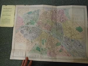
Map of Paris
Published by Published by Edward Stanford no date given c1870, London, 1870
Seller: Keoghs Books, Skipton, United Kingdom
Association Member: PBFA
Seller rating 5 out of 5 stars

Map First Edition
US$ 104.29
US$ 37.80 shipping
Ships from United Kingdom to U.S.A.Quantity: 1 available
Add to basket, fold out coloured map on card of Paris First Edition , spine torn along most of its length, edges of covers very worn with pieces missing, title label rubbed, edges of map worn, folds worn and some split with some loss to map, small split to fold near the bottom of the map, fair condition , card map in card covers , 19 x 12 cm (folded), 43 x 58 cm (open) Paperback ISBN:
-

Map of the Environs of Paris, France
Published by London, 1857
Seller: Trillium Antique Prints & Rare Books, Franklin, TN, U.S.A.
Seller rating 4 out of 5 stars

Art / Print / Poster
Condition: Fine. This originally hand-colored engraving is from "The Complete Atlas of Modern, Classical and Celestial Maps, together with Plans of the Principal Cities of the World". The work was published in 1857 by Edward Stanford for the Society for the Diffusion of Useful Knowledge. --- The work is in very good to excellent condition. There may be a few minor imperfections to be expected with age. Please review the image carefully for condition and contact us with any questions. --- Paper Size ~ 14" by 16 7/8".
-

Map of Paris, France (in two sheets)
Published by London, 1857
Seller: Trillium Antique Prints & Rare Books, Franklin, TN, U.S.A.
Seller rating 4 out of 5 stars
Art / Print / Poster
Condition: Fine. This originally hand-colored engraving is from "The Complete Atlas of Modern, Classical and Celestial Maps, together with Plans of the Principal Cities of the World". The work was published in 1857 by Edward Stanford for the Society for the Diffusion of Useful Knowledge. --- The work is in very good to excellent condition. There may be a few minor imperfections to be expected with age. Please review the image carefully for condition and contact us with any questions. - The map is to two sheets, both are shown here with one digitally stitched together to show how it can look joined. --- Paper Size ~ 14" by 16 7/8".