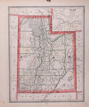
Map Utah: First Edition (27 results)

Published by United States Geological Survey, Washington, D. C. 1987
- Softcover
- First Edition
Seller: Crossroads Books, Reno, NV, U.S.A.Crossroads Books
Contact seller5-star sellerCondition: Used - Very good
Original price: US$ 10.00; 25% offCurrent price: US$ 7.50
US$ 5.05 shippingShips within U.S.A.Quantity: 1 available
Paperback. Condition: Very Good. First Edition. Unmarked. Plate in rear pocket, folded. ; Book Description; Spine has staples. Pages are clean and not marred by notes or folds. Covers are square with wear as noted. Ships Safe and Fast. ; U. S. Geological Survey Bulletin; Vol. 1714A; 4to 11" - 13" tall; 10 pages DL2.

Published by National Geographic, United States 1977
- Softcover
- First Edition
- Map
Seller: Joseph M Zunno, ROY, WA, U.S.A.Joseph M Zunno
Contact seller4-star sellersoft. Condition: See Pic.

Published by U.S. Geological Survey, Washington 1973
- Softcover
- First Edition
Seller: Quickhatch Books, Ottawa, ON, CanadaQuickhatch Books
Contact seller5-star sellerCondition: Used - Good
US$ 10.00
US$ 14.00 shippingShips from Canada to U.S.A.Quantity: 1 available
Soft cover. Condition: Good. First. Folding colour map in manilla sleeve, textual material, diagram, references, scale 1:24,000. Ex-institutional reference collection, light wear to sleeve. Map I-766-F. Book.
Published by U.S. Geological Survey, Washington 1973
- First Edition
Seller: Quickhatch Books, Ottawa, ON, CanadaQuickhatch Books
Contact seller5-star sellerCondition: Used - Very good
US$ 5.00
US$ 14.00 shippingShips from Canada to U.S.A.Quantity: 1 available
Condition: Very Good. First. Richard Van Horn, Map Showing Urban Growth in the Sugar House Quadrangle, Salt Lake County, Utah. USGS, Map I-766-G, 1973. Scale 1:24K. Ex-reference library, in original manilla envelope. Full-colour map with additional textual commentary and biblio. references. Book.
Published by U.S. Geological Survey, Washington 1973
- First Edition
Seller: Quickhatch Books, Ottawa, ON, CanadaQuickhatch Books
Contact seller5-star sellerCondition: Used - Very good
US$ 6.50
US$ 14.00 shippingShips from Canada to U.S.A.Quantity: 1 available
Condition: Very Good. First. Paul L. Williams and Harry R. Covington, Map Showing Scenic Features and Recreation Facilities of the Salina Quadrangle, Utah. USGS Map I-561-0, 1973. Scale 1:250K. Colour map with additional textual material, biblio. references, and tables. Ex-reference library, in original manilla folder. Book.
 More images
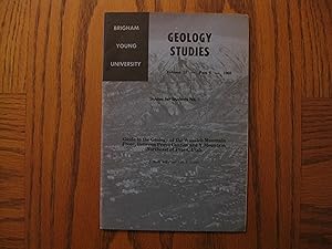
Published by Department of Geology Brigham Young University, Provo, Utah 1968
- Softcover
- First Edition
Seller: Clarkean Books, Stoney Creek, ON, CanadaClarkean Books
Contact seller5-star sellerCondition: Used - Near fine
US$ 15.00
US$ 14.00 shippingShips from Canada to U.S.A.Quantity: 1 available
Soft cover. Condition: Near Fine. 1st Edition. First edition/printing 1968 pamphlet sized soft cover and laid in map each in Near Fine condition with slight upper right corner bend to book. B&W photos and drawings.
 More images
Language: English
Published by The National Geographic Society, Washington, DC 2000
- Softcover
- First Edition
Seller: Singularity Rare & Fine, Baldwinsville, NY, U.S.A.Singularity Rare & Fine
Contact seller5-star sellerCondition: Used - Near fine
US$ 35.00
US$ 8.95 shippingShips within U.S.A.Quantity: 1 available
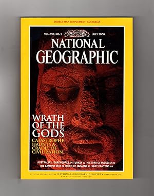
Soft cover. Condition: Near Fine. 1st Edition. Near Fine. See scans and description. Washington, DC: The National Geographic Society, 2000. The July, 2000 issue, Volume 198, No. 1. With Double Map Supplement, 'Australia Under Siege' and Map of AustraliaQuarto, wraps, 138 pp. Near Fine; modest soil at cover top edges (zoom on cov…er scans), else fine. Double Map Supplement is Fine; see scan of that (in folded state). Australia; Earthquakes in Turkey; Samoa; Paleoanthropology; Flash Floods in Utah - Arizona. See contents page scan. Departments: On Assignment, Geographica, Forum, On Screen, Earth Almanac, From the Editor, Flashback, Behind the Scenes, Cartographic, OnLine. Scarce, with the double map supplement retained. Shipped in a protective box - no bag for this one. L-PR16.
 More images
Published by Hartford Publishing Company, Hartford, CT 1869
- Hardcover
- First Edition
Seller: BIBLIOPE by Calvello Books, Oakland, CA, U.S.A.BIBLIOPE by Calvello Books
Contact seller4-star sellerHardcover. Hardcover quarto with leather boards and missing spine. 524 pages: frontispiece (portraits), illustrations, map; 23 cm. Introductions by Colfax, Schuyler and Bross, William. Abstract: Details the author's journeys and experiences across the North American continent in the summers of 1865 and 1866, exploring the Wester…n United States.9707. Binder's copy. Acceptable. Boards still attached though shaken. Spine wrap is missing. Moderate rubbing to edges and corners of leather boards. Mild fraying and bumping to corners of boards. Front and back boards are loose at hinge. Mild spotting to end papers. Moderate foxing to prelimniariesand edges of text block. First Edition (presumed; no prior editions or printings cited).
 More images
Published by Macmillan and Co., London 1890
- Softcover
- First Edition
Seller: Bailgate Books Ltd, Doncaster, , United KingdomBailgate Books Ltd
Contact seller5-star sellerCondition: Used - Very good
US$ 35.36
US$ 19.44 shippingShips from United Kingdom to U.S.A.Quantity: 1 available
Softcover. Condition: Very Good. No Dust Jacket. First Edition. Single disbound coloured map sheet, from John Bartholomew's Library Reference Atlas, covering part of the United States of America. Suitable for framing. Approx size 46 x 35 cm, horizontal centre fold. Map is clean, crisp, clear and bright. Sheet covers the part of…USA or the 'Pacific States' including: California, Nevada, Oregon, Washington, Idaho, Utah, Arizona, part of Montana and Wyoming, Santa Barbara, San Francisco, Sacramento, Prescott, Salt Lake City, Carson City, Yellowstone, Salem, Olympia and San Diego. No dust jacket, as published. Quantity Available: 1. Shipped Weight: under 1 kg. Pictures of this item not already displayed here available upon request. Inventory No: 45020124071. All our books are sent by tracked mail.

- First Edition
Seller: Art Source International Inc., Boulder, CO, U.S.A.Art Source International Inc.
Contact seller5-star sellerRand McNally & Company, still a major name in map publishing to this day, began as a small print shop opened in Chicago in 1856 by William H. Rand. The shop originally printed guidebooks and directories. In 1858, Rand hired Andrew McNally who was later to become a partner. Within the next few years, the shop got into the railroa…d business by starting to print railway tickets and schedules, a key step in the development of the company. The ticket printing led to the publishing of railway guides, and by 1872 Rand McNally and Company had the capacity to publish maps. This road map of Utah came from Rand McNallys Commercial Atlas, sixty-first Edition dated 1930. A highly successful run of atlases that lasted over a decade. This map includes a detailed plan of all existing highways (in red) and all other roads in existance at the time. This map measures 11 inches by 17 inches.

- First Edition
Seller: Art Source International Inc., Boulder, CO, U.S.A.Art Source International Inc.
Contact seller5-star sellerRand McNally & Company, still a major name in map publishing to this day, began as a small print shop opened in Chicago in 1856 by William H. Rand. The shop originally printed guidebooks and directories. In 1858, Rand hired Andrew McNally who was later to become a partner. Within the next few years, the shop got into the railroa…d business by starting to print railway tickets and schedules, a key step in the development of the company. The ticket printing led to the publishing of railway guides, and by 1872 Rand McNally and Company had the capacity to publish maps. This map of Utah came from Rand McNally's Commercial Atlas, sixty-first Edition dated 1930. A highly successful run of atlases that lasted over a decade. These maps were primarily used by business, because of their accurate listing of railroads in operation as well as tables of statistical information. This map is unique in several ways, their large format makes an impressive display, and offers additional room where many small towns and extra details are included. Additionally a list of every railroad operating in the state in 1930 is included. All railroad routes are shown on the map. This map includes all cities and towns, lakes, rivers, and bodies of water. All topographical features are also included as well as political features such as counties and Native American Indian reservations. This map measures 19 inches by 26 inches.
Published by S. Augustus Mitchell, Philadelphia 1867
- First Edition
- Map
Seller: T. W. Palmer Books, Eugene, OR, U.S.A.T. W. Palmer Books
Contact seller5-star sellerCondition: Used - Near fine
US$ 75.00
US$ 4.00 shippingShips within U.S.A.Quantity: 1 available
No Binding. Condition: Near Fine. No Jacket. 1st Edition. 32 x 40 cm, colored counties, numerous well labeled roads and trails, verso blank, grape border, #49, "drawn ad engraved by W. H. Gamble Pholadelphia" top slightly nicked, otherwise fine.
Published by R.R. Donnelley and Sons Co, Chicago 1889
- Hardcover
- First Edition
Seller: Ziern-Hanon Galleries, Frontenac, MO, U.S.A.Ziern-Hanon Galleries
Contact seller1-star sellerCondition: Used - Good
US$ 149.50
US$ 5.50 shippingShips within U.S.A.Quantity: 1 available
Full Cloth. Condition: Good. First Edition. FIRST EDITION, first printing. Complete with two folding maps, one of which is full color. Full brown cloth with stamped black design and lettering on the front cover and the spine, light wear, decorative endpapers. Front free endpaper is loose with the webbing starting at the gutter.…Large color folding map of Colorado, Utah, Arizona and California. Small black & white folding map of Colorado. Railroad name & city stamped on the front endpaper. Map Sizes: 10" x 7" (for the small b&w) and 20" x 14" (for the color). Pages age toned. Overall in GOOD condition. Photos available upon request. Size: 8vo - over 7¾" - 9¾" tall. Hardcover.
[Lot of 42 Photogeologic Maps of Utah] (United States Geological Survey) (Miscellaneous Geologic Investigations Map I-17 Through Map I-31 ; Map I-36 Through Map I-45 ; Map I-51 Through Map I-54 ; Map I-58 Through Map I-62 ; Map I-64 ; I-66 ;I-77 Thru I-80
United States Geological Survey ; J.S. Detterman ; R.J. Hackman ; B.H. Kent ; J.C. Reed, Jr. ; V.H. Sable ; H.S. Bennett ; C.H. Marshall ; P.P. Orkild ; C.F. Miller ; J.N. Platt
Published by U.S.G.S. 1955
- Softcover
- First Edition
Seller: Katsumi-san Co., Cambridge, MA, U.S.A.Katsumi-san Co.
Contact seller5-star sellerCondition: Used - Very good
US$ 150.00
US$ 5.95 shippingShips within U.S.A.Quantity: 1 available
Soft cover. Condition: Very Good. 1st Edition. This is a lot of 42 photogeologic maps of Utah, with a few duplicates; each map is in the Survey's printed beige envelope (11 3/4" x 9 1/4"), folding out to 27 5/8" x 23 1/2"; each envelope and map have a stamp indicating withdrawal from an academic library; most maps and envelopes…are otherwise in Very Good or better condition, with one envelope having a tear and other envelopes having some edgewear; includes maps of (in Map I numerical order): Circle Cliffs-1 Quadrangle, Garfield County; Circle Cliffs-2 Quadrangle; Circle Cliffs-3; Circle Cliffs-4 (hereafter designated as CC); CC-5; CC-6; CC-7 (2 copies); CC-8; CC-9; CC-10; CC-11; CC-13; CC-14; CC-15; CC-16; White Canyon-2 Quadrangle, San Juan and Garfield Counties; Straight Cliffs-2 Quadrangle, Kane County; Straight Cliffs-9 [hereafter SC]; SC-7; SC-1; Navajo Mountain-6 Quadrangle, Kane and San Juan Counties; Navajo Mountain-3 [hereafter NM]; NM-4; NM-5; NM-12; Clay Hills-1 Quadrangle, San Juan County; CC-12; Bluff-6 Quadrangle, San Juan County; Bluff-6; Bluff-11; Clay Hills-8; Bluff-4; Bluff-5; Bluff-8; Clay Hills-7; Bluff 1; NM-2 (2 copies); NM-7; Clay Hills-10; Clay Hills-9; Bluff-12. Large, heavy lot. [otob: 46].
Published by Henry S. Stebbins, Chicago 1886
- First Edition
- Map
Seller: Tennyson Williams Books and Fine Art, Williamsburg, VA, U.S.A.Tennyson Williams Books and Fine Art
Contact seller3-star sellerCondition: Used - Very good
US$ 85.00
US$ 6.50 shippingShips within U.S.A.Quantity: 1 available
Single Sheet. Condition: Very Good+. First Edition Thus. Original 1886 lithographed map of Utah Territory, with outline color from Cram's Unrivaled Family Atlas of the World. Image is 12 inches by 10 inches on a 13 5/8 " by 11 1/2" sheet. The map features topography, railroads, Indian reservations, cities, and small towns and us…es outline color to set off counties from each other. It is guaranteed to be at least 135 years old. In very good condition: clean and bright, with minor smudging limited to the blank margin; binding edge is untrimmed; one small spot of foxing in the image. Size: Folio - over 12" - 15" tall. Map.
 More images
Published by Franklin D. Richards, Liverpool 1855
- Hardcover
- First Edition
Seller: Ken Sanders Rare Books, ABAA, Salt Lake City, UT, U.S.A.Ken Sanders Rare Books, ABAA
Contact seller5-star sellerCondition: Used - Very good
US$ 15,000.00
US$ 7.50 shippingShips within U.S.A.Quantity: 1 available
Condition: Very Good. First edition. viii [1] - 120 pp. With the frontispiece folding map by F. D. Richards and all engravings and woodcuts present. Folio [31 cm] Rebacked in red leather with gilt bands and gilt stamped title on the spine. Original marble boards, with underlying boards exposed along the edges. Sprinkled edges. N…ew gray endpapers. Hinges reinforced. Ex-library, with a single library label on the front pastedown. The front flyleaf has several minor tears to the fore-edge, and there are light tide marks (the majority of them small) in the margins of the plates. These marks occasionally just begin to bleed into the images. Caption title of bottom engraving on plate facing p. 44 trimmed close. The celebrated map shows the Utah Territory, outlined by hand in red, with its various counties; the Mormon trail is shown in brown and blue. In this map, Utah still includes Nevada and shows up as the only important Territory of the Great Basin. Fremont's routes are marked as well. The work was issued with 9 woodcuts and 30 engraved plates; all are present in this copy. There is a small pencil tick-mark next to the title of each of these on the list of plates. Lacking the tissue protectors. Scarce in any condition. A collection of engravings of the most significant landmarks and points of interest on the Route between Liverpool and Great Salt Lake City, such as "New Orleans," "St. Louis," "Camp at Keokuck," "Ruins of the Temple at Nauvoo," "Room in which Joseph and Hyrum Smith were imprisoned," "Wall against which Joseph Smith was placed and shot at after his assassination," "Council Bluffs Ferry & group of Cotton-wood trees," and "Great Salt Lake City in 1853." The book also includes portraits of prominent Latter-day Saints, including Joseph Smith, Hyrum Smith, Lucy Smith, and Brigham Young. Extremely high quality illustrations made from the drawings that talented young artist Frederick Piercy made along the trail. Bibliographer Peter Crawley states that "Route from Liverpool ranks as the most beautiful book published by the Latter-day Saints." Wright Howes refers to this work as "One of the most elaborately and beautifully illustrated of western books," and Carl Wheat called the Richards map "one of the most illuminating maps of the West". Wheat further declares, "This is not only an important map in the history of Mormonism, but is in every sense an important map of the West, giving as it does a carefully drawn picture of that entire area. Practically nothing is shown in the whole of New Mexico, including present Arizona, but for regions to the east, west and north the map is accurate and reasonably detailed." Wheat closes by claiming, "The map was excellent for the period." Originally serialized in fifteen issues starting in July of 1854, this impressive volume was the brainchild of young convert Frederick Piercy, and Samuel Richards, president of the Liverpool Mission. They envisioned a travel guide for English converts who wanted to make the trek to the Salt Lake Valley. Piercy (1830-1891) was a gifted artist and engraver whose beautiful work fills this volume. The overland journey of the Piercy party was made in 1853. Starting from New Orleans, the party proceeded up the Mississippi to Saint Louis and Nauvoo, back to Saint Louis, and then across Missouri and Nebraska to Wyoming, and over the South Pass into the Great Salt Lake Valley. The woodcuts and engravings that illustrate this work provide a rare visual glimpse of the overland trail and the Mormon trail west to the valley of the Great Salt Lake. Crawley 1070. Mormon Fifty 46. Wagner-Camp 259. Graff 2501. Howes L359. Sabin 41325. Streeter sale 2296. Scallawagiana 51. Mormon Imprints 52. Wheat 858. Flake/Draper 6381. Auerbach 1: 728. Moffat 40.
 More images
Published by H. H. Hardesty, New York, Richmond, Chicago, & Toledo 1885
- First Edition
- Map
Seller: Tennyson Williams Books and Fine Art, Williamsburg, VA, U.S.A.Tennyson Williams Books and Fine Art
Contact seller3-star sellerCondition: Used - Very good
US$ 65.00
US$ 6.50 shippingShips within U.S.A.Quantity: 1 available
Single Sheet. Condition: Very Good-. Original. Original color lithographed map printed by Rand, McNally & Company, Engravers and published in HARDESTY'S HISTORICAL AND GEOGRAPHICAL ENCYCLOPEDIA: SPECIAL VIRGINIA EDITION. 19 3/8 inches by 13 1/4 inches on a 21" X 14 1/2" sheet. The map depicts the Territory of Utah in its final f…orm--large areas had been removed and ceded to Nevada, Colorado, Wyoming, and Nebraska since Utah became a U. S. Territory in 1850. The issue of polygamy prevented statehood until it was finally granted in 1896. This map features railroads and topography and uses color to set off counties from each other. Unlike most atlas maps of the period, this map identifies most small towns. The map is guaranteed to be moe than 135 years old. The map is in about very good condition: generally clean and bright, with slight toning of paper and one faint water stain near the center-left edge of the map. Size: Elephant Folio - over 15" - 23" tall. Map.
Published by S. Augustus Mitchell, Philadelphia 1870
- First Edition
- Map
Seller: T. W. Palmer Books, Eugene, OR, U.S.A.T. W. Palmer Books
Contact seller5-star sellerCondition: Used - Fine
US$ 100.00
US$ 4.00 shippingShips within U.S.A.Quantity: 1 available
No Binding. Condition: Fine. No Jacket. 1st Edition. 32 x 40 cm, colored counties, numerous well labeled roads and trails, verso blank, grape border, #52, "drawn and engraved by W. H. Gamble Pholadelphia" otherwise fine Differs from 1869 (#1919) at least by a larger Nye County and smaller Lincoln County both in Nevada.
 More images
Published by S. Augustus Mitchell, Philadelphia, PA 1860
- First Edition
Seller: Aardvark Rare Books, EUGENE, OR, U.S.A.Aardvark Rare Books
Contact seller5-star sellerCondition: Used - Very good
US$ 138.00
Free ShippingShips within U.S.A.Quantity: 1 available
Map. Condition: Very Good Plus. First Edition. Hand-colored map of California's with inset maps of the Salt Lake region and San Francisco Bay; coloration denotes counties. Map: 13.5 in. x 10.5 in. Paper: 15.25 in. x 12.25 in. Ornate floral frame. In upper right corner outside of neatline is the number "51"; below the neatline ia…t bottom left is written: "Entered according to Act of Congress in the year 1860 by S. Augustine Mitchell, Jr. in the Clerks Office of the District Court of the U.S. for the Eastern District of Pennsylvania." Touch of tanning along top and bottom edges. Corners sharp. Published as page 51 in the first edition of "Mitchell's New General Atlas.".
 More images
Published by Forest Service United States Deptartment of Agriculture 1917
- First Edition
- Map
Seller: Ernestoic Books, Clarence, NY, U.S.A.Ernestoic Books
Contact seller5-star sellerMeasuring approximately 13" x 7.75" with large fold out map. This proclamation is in very good condition. Minor sunning to all edges. Large fold out map intact and clean. Please view the many other rare titles available for purchase at our store. We are always interested in purchasing individual or collections of fine books. Inv…entory # (P1-36).
 More images
Published by Forest Service United States Deptartment of Agriculture 1917
- First Edition
- Map
Seller: Ernestoic Books, Clarence, NY, U.S.A.Ernestoic Books
Contact seller5-star sellerMeasuring approximately 13" x 7.75" with large fold out map. This proclamation is in very good condition. Minor bumping to all edges. Large fold out map intact and clean. Please view the many other rare titles available for purchase at our store. We are always interested in purchasing individual or collections of fine books. Inv…entory # (P1-35).
 More images
Published by Forest Service United States Deptartment of Agriculture 1918
- First Edition
- Map
Seller: Ernestoic Books, Clarence, NY, U.S.A.Ernestoic Books
Contact seller5-star sellerMeasuring approximately 13" x 7.75" with large fold out map. This proclamation is in very good condition. Minor staining to all edges. Large fold out map intact and clean. Please view the many other rare titles available for purchase at our store. We are always interested in purchasing individual or collections of fine books. In…ventory # (P1-26).
 More images
Published by Forest Service United States Deptartment of Agriculture 1910
- First Edition
- Map
Seller: Ernestoic Books, Clarence, NY, U.S.A.Ernestoic Books
Contact seller5-star sellerMeasuring approximately 13" x 7.75" with large fold out map. This proclamation is in very good condition. Minor sunning and bumping to all edges. "1034" written in red colored pencil on top right corner. Large fold out map intact and clean. Please view the many other rare titles available for purchase at our store. We are always… interested in purchasing individual or collections of fine books. Inventory # (P1-19).
 More images
Published by Forest Service United States Deptartment of Agriculture 1910
- First Edition
- Map
Seller: Ernestoic Books, Clarence, NY, U.S.A.Ernestoic Books
Contact seller5-star sellerMeasuring approximately 13" x 7.75" with large fold out map. This proclamation is in very good condition. Moderate wear to the edges. Minor staining to the front panel near spine. Large fold out map intact and clean. Please view the many other rare titles available for purchase at our store. We are always interested in purchasin…g individual or collections of fine books. Inventory # (P1-5).
 More images
Published by Utah State Department of Publicity and Industrial Development, Salt Lake City, UT 1948
- First Edition
Seller: Ken Sanders Rare Books, ABAA, Salt Lake City, UT, U.S.A.Ken Sanders Rare Books, ABAA
Contact seller5-star sellerCondition: Used - Very good
US$ 300.00
US$ 7.50 shippingShips within U.S.A.Quantity: 1 available
Condition: Very good. First printing. Map [56.5 cm x 43 cm] Modern roads are printed in black ink and the trails are printed in red ink. With folds as issued. Short split at fold. Minor crinkling. First printing with Morgan's name printed incorrectly. Printed in black and red and showing all of the historical trails through the…state of Utah. The legend in the lower left corner lists these trails chronologically, beginning with Escalante (1776) and ending with the Pony Express (1860). Included are all of the major US surveys (Fremont, Powell, Simpson and Stansbury), the known mountain men and fur trader routes (Ashley, Ogden and Smith), and the overland trails (California, Oregon, Mormon) and those who crossed the salt flat desert (Donner, Hastings, Clyman, Bryant-Russell). Thirty historic trails are shown in all. Drawn by Fehmel. On the reverse is a short introduction by Rulon S. Howells. Followed by brief descriptions of all of the trails listed, and a short history of Forts in Utah. Saunders 73. According to Saunders, "Though this was a publicity item Howells introduced it as a general trail guide, cautioning those who venture off-road to be well prepared. This map is actually not detailed enough to be much of a help to anyone intent on tracing the actual trails." Clearly the cornerstone for the Utah Centennial Trails Map (1996) that was prepared by several members of the Utah Westerners.
 More images
Published by United States Dept. of Agriculture 1919
- First Edition
- Map
Seller: Ernestoic Books, Clarence, NY, U.S.A.Ernestoic Books
Contact seller5-star sellerMeasuring approximately 13" x 7.75" with large fold out map. This proclamation is in very good condition. Moderate bumping and sunning to all edges. Large fold out map intact and clean. Please view the many other rare titles available for purchase at our store. We are always interested in purchasing individual or collections of…fine books. Inventory # (P1-11).
 More images
Stansbury's Report Maps - Map of a reconnaissance between Fort Leavenworth on the Missouri River and Map of the Great Salt Lake and Adjacent Country in the Territory of Utah. made in 1849 and 1850 under the orders of Col. J.J. Abert, Chief of the Topographical Bureau, by Capt. Howard Stansbury of the Corps of Topographical Engineers, aided by Lieut. J.W. Gunnison, Corps Topographical Engineers, and Albert Carrington ; drawn by Lieut. Gunnison and Charles Preuss
Capt. Howard Stansbury of the Corps of Topographical Engineers, aided by Lieut. J.W. Gunnison, Corps Topographical Engineers, and Albert Carrington ; drawn by Lieut. Gunnison and Charles Preuss.
- Hardcover
- First Edition
- Map
Seller: Sapience Bookstore, Hexham, , United KingdomSapience Bookstore
Contact seller3-star sellerCondition: Used - Good
US$ 552.38
US$ 23.46 shippingShips from United Kingdom to U.S.A.Quantity: 1 available
Hardcover. Condition: Good. 1st Edition. Good. Contemporary cloth binding. Provenance - from Glasgow University Library, with the stamp sized coat of arms pasted beside the title of each map, as pictured. The map is paper and has a few splits to creases and the occasional hole to corners where creases intersect, all as pictured.… In 1852, Stansbury was ordered to travel from Fort Leavenworth, Kansas, to survey the Great Salt Lake in Utah, evaluate emigration trails, especially in Oregon and Mormon trails, and to scout for possible locations for a transcontinental railroad. The expedition consisted of 18 men including his second in command Lieutenant John Williams Gunnison. Over the few years to follow the expedition covered the Great Salt Lake, Utah Lake and Cache Valley of northern Utah all the way to Fort Hall in Southern Idaho. Stansbury's seminal 1852 map of the Great Salt lake region in Utah is considered to be the first accurate survey of the Great Basin as well as a cornerstone achievement in the mapping of the American West. Measurements: Map of the Great Salt Lake and Adjacent Country in the Territory of Utah: 44" x 32" Map of Reconnaissance between Fort Leavenworth on Missouri River, and the Great Salt Lake in the Territory of Utah: 30" x 69". Lt. Gunnison and Charles Preuss (illustrator).


