Map World Eastern Western Hemispheres (4 results)

Language: English
Published by H.G. COLLINS, London 1840
- First Edition
Seller: K Books Ltd ABA ILAB, York, YORKS, United KingdomK Books Ltd ABA ILAB
Contact seller5-star sellerCondition: Used - Very good
US$ 55.10
US$ 26.14 shippingShips from United Kingdom to U.S.A.Quantity: 1 available
Single Sheet. Condition: Very Good. No Jacket. First Edition. HEMISPHERE MAP, DOUBLE HEMISPHERE MAP OF THE WORLD SHOWING THE WESTERN AND EASTERN HEMISPHERES, CIRCA 1840 MEASURES 23 X 11 INCHES, DISPATCHED IN A STRONG TUBE, WELL PACKED, REASONABLY PRICED .
Published by William Collins Sons & Company, London
- Art Print
Seller: Artisans-lane Maps & Prints, Sidney, BC, CanadaArtisans-lane Maps & Prints
Contact seller4-star sellerCondition: Used - Very good
US$ 36.82
US$ 25.00 shippingShips from Canada to U.S.A.Quantity: 1 available
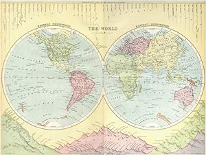
no binding. Condition: very good. Engraved by John Bartholomew, F.R.G.S. Provenance: "The Student's Atlas"; Constructed and Engraved by John Bartholomew, F.R.G.S.; Published by William Collins Sons & Company, London. Shows the Comparative view of the principal rivers and Mountains. Approximate Image Size: 12 ins x 9 ins Approxim…ate Overall Size: 12 1/2 ins x 10 ins. CONDITION: Folded map, Suitable browning from age. Very Good Condition. Image is clean, clear, sharp with beautiful exquisite detail and in Very Good Condition. As scanned. Blank on the back . This beautiful print would look great matted and framed. An art supply store can provide you with a selection of frames for old art treasures. This is a GENUINE ANTIQUE MAP It is NOT a modern reproduction, ie. a laser scan, photocopy etc. It is the original from the antique publication. This print was published on the date mentioned, or circa of the date mentioned at the top of the page. The term "print" is referred to an image on a piece of paper. The print I have for sale, like many antique maps prints that you see online, originate from an antique book or atlas publication. The publication may not always be known. If you have any questions, emails are welcome.

Seller: Art Source International Inc., Boulder, CO, U.S.A.Art Source International Inc.
Contact seller5-star sellerThis map was issued as part of "Johnson's New Illustrated Family Atlas of the World." This atlas was awarded the first prize medal at the Universal Expositions in Paris in 1867 and 1878. A.J. Johnson published his first atlas in 1860 as successors to J.H. Colton & Co. Editions of this atlas ceased in 1885. These later editions o…f the Johnson atlas are some of the finest the company ever produced and are known for the geometric border. This map measures 23 inches by 17 inches.

Seller: Bartele Gallery - The Netherlands, Langweer, FRL, NetherlandsBartele Gallery - The Netherlands
Contact seller5-star sellerCondition: Used
US$ 548.34
US$ 19.67 shippingShips from Netherlands to U.S.A.Quantity: 1 available
Antique Map with Title: "Mappemonde en Deux Hémisphères" Publication Details: - **Atlas Title:** Nouvel Atlas Universel de Géographie Ancienne et Moderne - **Purpose:** For the Nouvelle Edition de la Géographie de Guthrie - **Mapmakers:** P. F. Tardieu, with contributions from various geographical works - **Publisher:** Chez Hya…cinthe Langlois, Libraire, quai des Augustins, n° 45 - **Year:** An X - 1802 (French Revolutionary Calendar) **Geographical Scope:** This antique map illustrates a double-hemisphere world map, showing both the Eastern (Old World) and Western (New World) hemispheres. It provides a global perspective, capturing the entire known world as understood in the early 19th century. **Map Features:** - **Hemispheres Displayed:** - **Western Hemisphere:** The Americas, labeled as "Hémisphère Occidental ou Nouveau Monde." - **Eastern Hemisphere:** Europe, Africa, Asia, and Australia, labeled as "Hémisphère Oriental ou Ancien Monde." - **Notable Regions and Territories:** Detailed depictions of continents and major regions, including North and South America, Europe, Asia, Africa, and Australia. - **Seas and Oceans:** All major oceans and seas are labeled, including the Atlantic Ocean, Pacific Ocean, Indian Ocean, and others. - **Ancient and Modern Names:** Uses a combination of historical and contemporary names for countries, regions, and bodies of water. - **Topographical Details:** Includes mountain ranges, rivers, and other significant geographical features as understood in the early 19th century. - **Cartographic Style:** Detailed engraving with hand-colored boundaries, emphasizing both historical accuracy and artistic presentation. **Purpose and Use:** This map serves as a comprehensive visual representation of the world, reflecting the geographical understanding and cartographic style of the early 19th century. It is part of a larger atlas that includes 60 maps, providing a detailed view of both ancient and modern geography as known in 1802. ### Condition Report The map is in good condition with minor age-related wear. Hand-colored boundaries are well-preserved, enhancing the clarity of regions and features. Slight fold lines and edge wear are visible, with some age spots. ### Coloring The hand-colored boundaries on the map highlight regions and territories, adding clarity and visual appeal, typical of early 19th-century cartographic practices.


