

Order Total (1 Item Items):
Shipping Destination:

Maps Two Sheets (11 results)
Skip to main search results
Search filters
Product Type
- All Product Types
- Books (7)
- Magazines & Periodicals (No further results match this refinement)
- Comics (No further results match this refinement)
- Sheet Music (No further results match this refinement)
- Art, Prints & Posters (No further results match this refinement)
- Photographs (No further results match this refinement)
- Maps (4)
- Manuscripts & Paper Collectibles (No further results match this refinement)
Condition Learn more
- New (2)
- As New, Fine or Near Fine (3)
- Very Good or Good (5)
- Fair or Poor (No further results match this refinement)
- As Described (1)
Binding
- All Bindings
- Hardcover (5)
- Softcover (No further results match this refinement)
Collectible Attributes
- First Edition (1)
- Signed (No further results match this refinement)
- Dust Jacket (No further results match this refinement)
- Seller-Supplied Images (6)
- Not Print on Demand (9)
Language (2)
Free Shipping
Seller Location
Seller Rating
-

Geographia Two Miles to One Inch Maps of England and Wales (published in 19 sheets) Sheets 16 & 17 Devon, Dorset & Part Wiltshire
Published by Geographia Ltd, London, 1111
Seller: Victoria Bookshop, BERE ALSTON, DEVON, United Kingdom
Seller rating 4 out of 5 stars

US$ 19.42
US$ 13.25 shipping
Ships from United Kingdom to U.S.A.Quantity: 1 available
Add to basketHardcover. Condition: G. 1st thus. 2 fold-out cloth maps enclosed in green cloth hard cover. Cover a little soiled and bumped and with ink stains to front. Tears along spine cover edges, A few minor closed tears to map fold corners and slight creasing to top corners, otherwise very good. nd but poss 1920s. Immediate despatch from the UK. Maps. Book.
-
Geological Maps of Schuylkill, Carbon, Berks and Dauphin Counties and Topographical Map of the Blue Mountain at Port Clinton in two sheets
Published by Geological Survey of Pennsylvania, Harrisburg, PA, 1891
Seller: Prairie Creek Books LLC., Torrington, WY, U.S.A.
Seller rating 4 out of 5 stars
First Edition
Hardcover. Condition: Very Good. No Jacket. 1st Edition. VG/none. used, 6 fold-out sheets laid in to a ribbon tied hard cover folder. Folder has gilt text on the upper describing what is enclosed. Two of the ribbons are torn off close to edge. Sheets in very good condition.
-
Two (2) Stanford's Ordnance Maps of Devon: (1) South of Clovelly; and (2) South of Torrington. Being Sheets 308 & 309 of the Ordnance Survey of England and Wales.
Published by 1906, 1906
Seller: Berkelouw Rare Books, Berrima, NSW, Australia
Association Member: ANZAAB ILAB
Seller rating 4 out of 5 stars
London 1906. Each map measuring approx. 48 x 34cm. hand-col. in outline linen backed & folded into its orig. 8vo. size slip-case with all printed titles & publishers labels in tact.
-
[Serbia, Bosnia, Bulgaria] 4 maps on two sheets
Published by Trubner and Co, London, 1876
Seller: JF Ptak Science Books, Hendersonville, NC, U.S.A.
Seller rating 5 out of 5 stars

Map
No Binding. Condition: Good. [Serbia, Bosnia, Bulgaria] Article on "Turkey in Europe" in the Geographical Magazine, vol III, October 1876, in the monthly issue of pp 257-284, with four maps on two sheets (16x4.5" 425x135mm to sightlines) (1) Turkey in Europe, Muhammadans; (2) Turkey in Europe Political divisions; (3) Turkey in Europe, Nationalities; (4) Turkey in Europe, Density of Population. 1 and 2 measure 20x6", 3 and 4 measure 15x9.5". There is an old oval rubberstamp on the face of each map sheet. Disbound from a larger bound volume, though this comes with the original front wrapper. GOOD, only.
-
[Two adjoining RAF pilot's maps] Asia 1:2,000,000 (Arabia) Sheets S.E. Arabia Layered (M.D.R. 538 / 6215) AND Gulf of Aden (M.D.R. 538 / 6216) Not to be Published
Language: English
Published by 512 Forward Survey Company, Royal Engineers, (Cairo), 1943
Map
US$ 1,177.54
US$ 33.62 shipping
Ships from United Kingdom to U.S.A.Quantity: 1 available
Add to basketNo Binding. Condition: Good. Two adjoining colour printed paper sheets from the Asia 1/2M (Arabia) series: Sheet S.E. Arabia Layered 80x63cm, and Sheet Gulf of Aden (sitting off-centre below) 80x46cm. Both good, neatly folded with short closed tears, dusting and marks, and flight-related ms annotations. They were reproduced by 512 Forward Survey Company in February and March 1943 respectively, from Survey of India first editions 1934 and 1935. The former is layered with air information for March 1943 from HQ RAF Middle East, the latter with revised communications. Their issue coincides with major reorganisation of Allied air forces in the North African and Mediterranean Theater in February 1943. This made HQ British Forces Aden a sub-command of RAF Middle East Command primarily responsible for anti-submarine operations and escort missions. Centred on the Rub al Khali, the SE Arabia sheet is bounded by the Dahana Sands (NW), Muscat and Ras al Hadd (NE), and the Oman coast as far as Haifif in the Hadhramaut (S). The Gulf of Aden sheet continues along the Aden Protectorate and Yemen coasts to the Red Sea port of Luhaiya (thus including major locations including Masirah Island, Mukalla, Aden, Hodeida, Sana'a etc), with Socotra (SE). Altitudes are shown by colour tints with approximate contours and spot heights. Features include settlements, a web of mainly pack animal tracks, wadis, descriptive notes about terrain in the image, with a large area in the Rub al Khali bounded by Qaamiyat and Awamir labelled "Unexplored desert". Communications include steamer services with destinations and distances and submarine cables especially off the coasts at Aden and Hodeida highlighting the strategic importance of the Bab el Mandeb Strait, and Muscat. RAF data includes airfields, landing grounds, airfields whose local position or existence is not confirmed, landing grounds not regularly visited or unconfirmed, airfields and landing grounds abandoned etc. The annotations include a flight line connecting Aden (RAF Khormaksar) to Masirah Island, which largely follows the coast via Ras Quseir, Mukalla, Quishn, Salalah, Murbat etc with additional points written on. During WW2 RAF Khormaksar played a key role in the East African Campaign, and as a USAAF stopover. The RAF established a permanent detachment on Masirah Island in 1942, building a major base in 1943 to serve as remote refuelling point, staging post on the Aden to India route, and base for anti-submarine patrols. RAF Mirbat and RAF Salalah on the Dhofar coast were early bases established by the RAF to exert control over the Peninsula, the latter providing a staging post during WW2. The annotated route bypasses Khor Gharim, which with Bayt al Falaj and Ras Al-Hadd offered emergency landing grounds. (Reference: RAF Museum website).
-
![Seller image for Gazetteer to maps of Korea, map series AMS L551, 1:250,000 (First edition) and two sheets from AMS L401, 1:500,000 1944 [LeatherBound] for sale by S N Books World](https://pictures.abebooks.com/inventory/md/md30863573180.jpg)
Gazetteer to maps of Korea, map series AMS L551, 1:250,000 (First edition) and two sheets from AMS L401, 1:500,000 1944 [LeatherBound]
Language: English
Publication Date: 2025
Leatherbound. Condition: NEW. BOOKS ARE EXEMPT FROM IMPORT DUTIES AND TARIFFS; NO EXTRA CHARGES APPLY. Leatherbound edition. Condition: New. Leather Binding on Spine and Corners with Golden leaf printing on spine. Bound in genuine leather with Satin ribbon page markers and Spine with raised gilt bands. Pages: 330. A perfect gift for your loved ones. Reprinted from 1944 edition. NO changes have been made to the original text. This is NOT a retyped or an ocr'd reprint. Illustrations, Index, if any, are included in black and white. Each page is checked manually before printing. As this print on demand book is reprinted from a very old book, there could be some missing or flawed pages, but we always try to make the book as complete as possible. Fold-outs, if any, are not part of the book. If the original book was published in multiple volumes then this reprint is of only one volume, not the whole set. IF YOU WISH TO ORDER PARTICULAR VOLUME OR ALL THE VOLUMES YOU CAN CONTACT US. Resized as per current standards. Sewing binding for longer life, where the book block is actually sewn (smythe sewn/section sewn) with thread before binding which results in a more durable type of binding. Language: English Pages: 330.
-
Geological Maps of Schuykill, Carbon, Berks and Dauphin Counties; Topographical Map of Blue Mountain at Port Clinton, in Two Sheets
Published by Geological Survey of Pennsylvania, Harrisburg, 1891
Condition: Good. No Jacket. Six large maps in ribbon-tied boards. Maps are VG, apparently never opened. X-private library, with small label on bottom front and handstamp rear end papers. Size: Octavo.
-

'CARTE GÉNÉRALE DES ÉTATS-UNIS ET DU MEXIQUE COMPRENANT L'AMÉRIQUE CENTRALE ET LES ANTILLES'. Large map of the United States, Mexico and West Indies, with inset maps of Central America, Lesser Antilles, New York and Long Island, and the Atlantic connections to Europe. The advancing and existing railway lines to the West are of great interest. Printed on two sheets
Published by Eugene Andriveau-Goujon ca. 1875, 1875
Map
US$ 124.68
US$ 40.35 shipping
Ships from United Kingdom to U.S.A.Quantity: 1 available
Add to basketCondition: Fine. 63x92cm, when joined. Full original colour. Excellent condition.
-
Condition: COME NUOVO. Vilnius, At head of portfolios title: Lietuva 1009-2009. Cartographic material in the period 1490-1772.
-
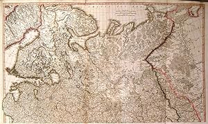
'THE RUSSIAN DOMINIONS IN EUROPE' drawn from the latest Maps, printed, by the Academy of Sciences, St. Petersburg; revised and corrected, withe POST ROADS & NEW GOVERNMENTS, from the Russian Atlas of 1806; by Jasper Nantiat'. Large (wall) map of Russia, printed on two double sheets, not joined. Published by
Published by William Faden 1808, 1808
Map
US$ 623.40
US$ 40.35 shipping
Ships from United Kingdom to U.S.A.Quantity: 1 available
Add to basketCondition: Fine. 106x91cm when joined. Original outline colour. Excellent condition.
-
Leather Bound. Condition: New. Language: English. Language: English. Presenting an Exquisite Leather-Bound Edition, expertly crafted with Original Natural Leather that gracefully adorns the spine and corners. The allure continues with Golden Leaf Printing that adds a touch of elegance, while Hand Embossing on the rounded spine lends an artistic flair. This masterpiece has been meticulously reprinted in 2025, utilizing the invaluable guidance of the original edition published many years ago in 1944. The contents of this book are presented in classic black and white. Its durability is ensured through a meticulous sewing binding technique, enhancing its longevity. Imprinted on top-tier quality paper. A team of professionals has expertly processed each page, delicately preserving its content without alteration. Due to the vintage nature of these books, every page has been manually restored for legibility. However, in certain instances, occasional blurriness, missing segments, or faint black spots might persist. We sincerely hope for your understanding of the challenges we faced with these books. Recognizing their significance for readers seeking insight into our historical treasure, we've diligently restored and reissued them. Our intention is to offer this valuable resource once again. We eagerly await your feedback, hoping that you'll find it appealing and will generously share your thoughts and recommendations. Lang: - English, Pages:- 330, Print on Demand. If it is a multi-volume set, then it is only a single volume. We are specialised in Customisation of books, if you wish to opt different color leather binding, you may contact us. This service is chargeable. Product Disclaimer: Kindly be informed that, owing to the inherent nature of leather as a natural material, minor discolorations or textural variations may be perceptible. Explore the FOLIO EDITION (12x19 Inches): Available Upon Request. 330 330.


![Seller image for [Serbia, Bosnia, Bulgaria] 4 maps on two sheets for sale by JF Ptak Science Books](https://pictures.abebooks.com/inventory/md/md22750940573.jpg)

![Seller image for [Two adjoining RAF pilot's maps] Asia 1:2,000,000 (Arabia) Sheets S.E. Arabia Layered (M.D.R. 538 / 6215) AND Gulf of Aden (M.D.R. 538 / 6216) Not to be Published for sale by Dendera](https://pictures.abebooks.com/inventory/md/md32321895883.jpg)
![Seller image for Gazetteer to maps of Korea, map series AMS L551, 1:250,000 (First edition) and two sheets from AMS L401, 1:500,000. 1944 [Leather Bound] for sale by Gyan Books Pvt. Ltd.](https://pictures.abebooks.com/inventory/md/md31222796978.jpg)