Order Total (1 Item Items):
Shipping Destination:

New Map Ohio (78 results)
Skip to main search results
Search filters
Product Type
- All Product Types
- Books (57)
- Magazines & Periodicals (No further results match this refinement)
- Comics (No further results match this refinement)
- Sheet Music (No further results match this refinement)
- Art, Prints & Posters (5)
- Photographs (No further results match this refinement)
- Maps (16)
- Manuscripts & Paper Collectibles (No further results match this refinement)
Condition Learn more
Binding
Collectible Attributes
Language (3)
Free Shipping
Seller Location
Seller Rating
-

Rand McNally & Co.'s New Ideal State and County Survey and Atlas, containing a large county and railway map of Ohio printed in colors
Published by Rand McNally
Seller: Wonder Book, Frederick, MD, U.S.A.
Seller rating 5 out of 5 stars

Condition: Fair. Acceptable condition. Maps at pp. 5 & 20 missing. (United States, Ohio).
-

PAP. Condition: New. New Book. Shipped from UK. Established seller since 2000.
-
Ensign, Bridgman and Fanning''s Travellers'' Guide Through the States of Ohio, Michigan, Indiana, Illinois, Missouri, Iowa, and Wisconsin: With Railroad, Canal, Stage and Steamboat Routes; Accompanied With a New Map of the Above States (Classic Reprint)
Seller: PBShop.store UK, Fairford, GLOS, United Kingdom
Seller rating 5 out of 5 stars
US$ 27.97
US$ 4.40 shipping
Ships from United Kingdom to U.S.A.Quantity: 15 available
Add to basketPAP. Condition: New. New Book. Shipped from UK. Established seller since 2000.
-

Ensign, Bridgman & Fanning's Travellers' Guide Through the States of Ohio, Michigan, Indiana, Illinois, Missouri, Iowa, and Wisconsin: With Railroad, ... With a New Map of the Above States
Seller: Ria Christie Collections, Uxbridge, United Kingdom
Seller rating 5 out of 5 stars
US$ 18.02
US$ 16.02 shipping
Ships from United Kingdom to U.S.A.Quantity: Over 20 available
Add to basketCondition: New. In.
-

HRD. Condition: New. New Book. Shipped from UK. Established seller since 2000.
-
Ensign, Bridgman and Fanning's Travellers' Guide Through the States of Ohio, Michigan, Indiana, Illinois, Missouri, Iowa, and Wisconsin: With Railroad, Canal, Stage and Steamboat Routes; Accompanied With a New Map of the Above States (Classic Reprint)
Seller: PBShop.store UK, Fairford, GLOS, United Kingdom
Seller rating 5 out of 5 stars
US$ 37.63
US$ 5.56 shipping
Ships from United Kingdom to U.S.A.Quantity: 15 available
Add to basketHRD. Condition: New. New Book. Shipped from UK. Established seller since 2000.
-
Structure and isopach map of the New Albany-Chattanooga-Ohio shale (Devonian and Mississippian) in Kentucky: Western, Eastern, and Central Sheets
Published by Kentucky Geological Survey,, 1979
Paperback. Condition: Very Good. 3 large folded maps in printed envelopes. Envelopes stamped with name of previous owner (business). Light wear to envelopes. Maps clean.
-
NEW GOVERNMENTS WEST OF THE ALLEGHENIES BEFORE 1780 (MAP OF TRANSYLVANIA, WESTSYLVANIA AND OTHER OHIO RIVER PROPOSALS SUCH AS 1777 PURCHASE OF VANDALIA TRACT BY BRITISH FROM SIX NATIONS) 1897 PHD THESIS
Published by UNIVERSITY OF WISCONSIN, 1897
First Edition
Trade paperback. Condition: Fine in very good dust jacket. First edition. UNIVERSITY OF WISCONSIN, 1897. First edition. Fine in very good dust jacket. 75 p. SCARCE MAPS AND INFO ON VANDALIA, TRANSYLVANIA AND WESTSYLVANIA PROPOSALS OF 1770S, BEN FRANKLINBJJJJJJHJJ, colonel henderson.
-

Ensign, Bridgman & Fanning's Travellers' Guide Through the States of Ohio, Michigan, Indiana, Illinois, Missouri, Iowa, and Wisconsin: With Railroad, ... With a New Map of the Above States
Seller: Ria Christie Collections, Uxbridge, United Kingdom
Seller rating 5 out of 5 stars
US$ 34.84
US$ 16.02 shipping
Ships from United Kingdom to U.S.A.Quantity: Over 20 available
Add to basketCondition: New. In.
-

MAP: "Cincinnati (Ohio)".from New Family Atlas of the World
Language: English
Published by Rand McNally & Co, Chicago, IL, 1888
Seller: Dorley House Books, Inc., Hagerstown, MD, U.S.A.
Seller rating 4 out of 5 stars

Map First Edition
No Binding. Condition: Very Good. Colored Map (illustrator). 1st. 11" x 14"; colored 1888 map of Cincinnati, Ohio. suitable for framnig.
-
Rand McNally & Co's New Ideal State and County Survey and Atlas containing a Large County and Railway Map of Ohio Printed in Color
Published by Rand McNally, 1911
US$ 48.00 25% offUS$ 36.00
US$ 5.50 shipping
Ships within U.S.A.Quantity: 1 available
Add to basketHardcover. Condition: Fair. Dust Jacket Condition: No Dust Jacket. Oversized book, the pages measure about 11 x 14 inches. Soiling and wear to the covers; broken binding, the cover is pulled away. The pages have some discoloring and soiling; a couple tears; missing the large folding map of Ohio otherwise all maps are present though. The large folding map is of Columbiana Co., Ohio and is stained and worn; pencil scribbling on one side. Includes state maps and a couple others. Additional photos upon request. Quantity Available: 1. Category: Antiquarian & Rare; Inventory No: 181201. This book is extra heavy, and may involve extra shipping charges to some countries.
-
National Society New England Women Cleveland Colony Map of Ohio Showing Locations of Towns in Which are Historic Buildings
Published by Privately Printed
Seller: Open Door Books MABA, Bath, ME, U.S.A.
Association Member: MABA
Seller rating 3 out of 5 stars

First Edition
Original Wraps. Condition: Very Good. First Edition. Tan/red card covers, stapled, two page map. Location, Building, Erected, owners, notes, rare copy. 16mo - over 5�" - 6�" tall.
-
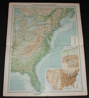
Map of North-Eastern States from the 1920 Times Survey Atlas (Plate 93) including Michigan, New York, Pensylvania, Indiana, Ohio, West Virginia, etc.
Published by The Times, London, 1920
Map First Edition
US$ 24.24
US$ 19.39 shipping
Ships from United Kingdom to U.S.A.Quantity: 1 available
Add to basketSoftcover. Condition: Very Good. Dust Jacket Condition: No Dust Jacket. First Edition. Disbound single sheet with vertical centre fold from the 1920 "The Times Survey Atlas of the World". Map is in colour and suitable for framing. Colour on both land and sea according to contour. Map at scale 1:2,500,000. Map covers; Lake Michigan (part), Lake Erie, Lake Ontario (part), New York, Pensylvania, Connecticut, Massachusetts (part), Long Island, Kentucky, Indiana, Ohio, West Virginia, Virginia, Tennessee (part), North Carolina (part) and Atlantic Ocean (part). Slightly darkened edges and light foxing in margins but sheet is otherwise clean and crisp. Item Type: Map. Single sheet map/chart which is suitable for framing and will be shipped rolled and in a cardboard tube. Quantity Available: 1. Shipped Weight: under 1 kg. Pictures of this item not already displayed here available upon request. Inventory No: 45020034014. All our books are sent by tracked mail.
-
Map of Eastern Section of United States from the 1920 Times Survey Atlas (Plate 90) including Michigan, Indiana, Ohio, Pennsylvania, New York, Maine, Virginia, Kentucky, North Carolina, Alabama, Georgia, Florida, Niagara Falls etc.
Published by The Times, London, 1920
Map First Edition
US$ 26.45
US$ 19.39 shipping
Ships from United Kingdom to U.S.A.Quantity: 1 available
Add to basketSoftcover. Condition: Very Good. Dust Jacket Condition: No Dust Jacket. First Edition. Disbound single sheet with horizontal centre fold from the 1920 "The Times Survey Atlas of the World". Map is in colour and suitable for framing. Colour on both land and sea according to contour. Map at scale 1:5,000,000. Map covers; Michigan, Indiana, Ohio, Pennsylvania, New York, Maine, Vermont, New Hampshire, Massachusetts, West Virginia, Kentucky, North and South Carolina, Alabama, Georgia, Florida, Nova Scotia, Lake Erie, Lake Ontario, Lake Michigan, Lake Huron, Boston, New York, Philadelphia, Montreal, Ottawa, etc. Sheet contains two inset maps; Niagara Falls and environs and Population Denisity for USA. Slightly darkened edges and occasional light foxing in margins but sheet is otherwise clean and crisp. Item Type: Map. Single sheet map/chart which is suitable for framing and will be shipped rolled and in a cardboard tube. Quantity Available: 1. Shipped Weight: under 1 kg. Pictures of this item not already displayed here available upon request. Inventory No: 45020034017. All our books are sent by tracked mail.
-
RAND, MCNALLY & CO.'S INDEXED COUNTY AND RAILROAD POCKET MAP AND SHIPPER'S GUIDE OF OHIO Accompanied by a New and Original Compilation and Ready Reference Index, Showing in Detail the Entire Railroad System
Published by Rand, McNally & Co.: NY/Chicago, 1900
Seller: John K King Used & Rare Books, Detroit, MI, U.S.A.
Seller rating 4 out of 5 stars
Paperback. Condition: Very Good. Illus., ads, map (foldout), 4 x 6.5", 104pp, brown sewn wraps. DISBOUND, front cover and textblock intact but FOLDOUT MAP AT BACK AND BACK COVER COMPLETELY DETACHED but present. Covers soiled and worn (especially at extremities), some creasing at corners, remnants of a sticker or label (old bookseller?) at bottom of front cover, spine chipping and mostly gone, foldout map in good shape minus tearing at fold crease in center of map. A well-used copy but still intact and readable.
-

New Rail Road and County Map of Ohio & Indiana
Language: English
Published by George F. Cram, [Chicago], 1882
Seller: Kaaterskill Books, ABAA/ILAB, East Jewett, NY, U.S.A.
Association Member: ABAA ILAB IOBA
Seller rating 5 out of 5 stars
One sheet (30 x 35 cm). 29 x 23.5 cm. (11 1/2 x 9 1/4 inches). Hand colored. Title inside oval cartouche. Scale 36 miles to 1 inch. Taken from "Cram's Illustrated Family Atlas of the World." There were numerous versions of the New Rail Road and County maps by published by Cram and Henry S. Stebbins, with later versions machine colored due to the expense of hand coloring. Phillips 901. Very good, some marginal browning.
-
New Atlas Map of Montgomery County, Ohio
Published by Reprint edition, published by The Bookmark, Knightstown, Indiana, 1996. Originally published by Herman S. Fox, 1895., 1996
Soft cover. Condition: Near Fine. No Jacket. Special Edition. Near fine condition. This is a folio size softcover book. Top corner is lightly bumped. Minor crease on back cover. 36 pages with index.
-

Paperback. Condition: new. New Copy. Customer Service Guaranteed.
-
Rand McNally & Co.'s New Ideal State and County Survey and Atlas, containing a large county and railway map of Ohio printed in colors
Published by Rand McNally, 1909
Seller: GLOVER'S BOOKERY, ABAA, Lexington, KY, U.S.A.
Association Member: ABAA ILAB MWABA
Seller rating 4 out of 5 stars
Hardcover. Condition: Very Good-. 104 pp; Front inner hinge is cracked, book block is weak but holding firm, covers have edge wear at the corners. A nice attractive book. Complete with all maps, large world folding map in rear is fine.
-
-

"Topographic Map of Ohio and Parts of Michigan, Indiana, Kentucky, West Virginia, Pennsylvania and New York". MAP from Monographs of the US Geological Survey, Volume XLI, Plate I)
Published by Government Printing Office, Washington D.C., 1902
Seller: Dorley House Books, Inc., Hagerstown, MD, U.S.A.
Seller rating 4 out of 5 stars
Art / Print / Poster First Edition
Unbound. Condition: Very Good. Colored Map (illustrator). 1st. 17" x 11.5" colored topographic map as surveyed in 1901 Size: 17" x 11.5".
-

"Glacial Map of Areas of Michigan, Ohio, New York, Pennsylvania, Lake Erie, Lake Ontario".:MAP from Monographs of the US Geological Survey, Volume XLI, Plate II)
Published by Government Printing Office, Washington D.C., 1902
Seller: Dorley House Books, Inc., Hagerstown, MD, U.S.A.
Seller rating 4 out of 5 stars
Art / Print / Poster First Edition
Unbound. Condition: Very Good. Colored Map (illustrator). 1st. 17" x 11.5" colored geological survey map as surveyed in 1900 Size: 17" x 11.5".
-
![Seller image for Ensign, Bridgman & Fanning's travellers' guide through the States of Ohio, Michigan, Indiana, Illinois, Missouri, Iowa and Wisconsin : with railroad, canal, stage and steamboat routes, accompanied with a new map of the above states 1857 [LeatherBound] for sale by S N Books World](https://pictures.abebooks.com/inventory/md/md30638114907.jpg)
Leatherbound. Condition: NEW. BOOKS ARE EXEMPT FROM IMPORT DUTIES AND TARIFFS; NO EXTRA CHARGES APPLY. Leather Binding on Spine and Corners with Golden leaf printing on spine. Bound in genuine leather with Satin ribbon page markers and Spine with raised gilt bands. A perfect gift for your loved ones. Reprinted from 1857 edition. NO changes have been made to the original text. This is NOT a retyped or an ocr'd reprint. Illustrations, Index, if any, are included in black and white. Each page is checked manually before printing. As this print on demand book is reprinted from a very old book, there could be some missing or flawed pages, but we always try to make the book as complete as possible. Fold-outs, if any, are not part of the book. If the original book was published in multiple volumes then this reprint is of only one volume, not the whole set and contains approximately 46 pages. IF YOU WISH TO ORDER PARTICULAR VOLUME OR ALL THE VOLUMES YOU CAN CONTACT US. Resized as per current standards. Sewing binding for longer life, where the book block is actually sewn (smythe sewn/section sewn) with thread before binding which results in a more durable type of binding. Language: English.
-
-
-
Ensign, Bridgman & Fanning's Travellers' Guide Through the States of Ohio, Michigan, Indiana, Illinois, Missouri, Iowa, and Wisconsin: With Railroad, Canal, Stage, and Steamboat Routes, Accompanied With a New Map of the Above States
Seller: THE SAINT BOOKSTORE, Southport, United Kingdom
Seller rating 5 out of 5 stars
US$ 21.33
US$ 15.40 shipping
Ships from United Kingdom to U.S.A.Quantity: Over 20 available
Add to basketPaperback / softback. Condition: New. This item is printed on demand. New copy - Usually dispatched within 5-9 working days.
-

McNally's 1922 Auto Trails Map of Eastern Ohio, Western Pennsylvania, S.E. Michigan, Northern West Virginia, Southern Ontario, Western New York, and Western Maryland
Publication Date: 1922
Seller: Art Source International Inc., Boulder, CO, U.S.A.
Seller rating 5 out of 5 stars
This map of Ohio, Pennsylvania, Michigan, West Virginia, Ontario, New York, and Maryland was produced by Rand McNally and Co. as part of its Commercial Atlas of America. The detail shown on each map is exceptional because of the map size. These maps were intended to be used by business for shipping, etc. Roads, railroads, and rivers are clearly shown. There is more detail on these maps than any others during this time period. This map measures 19 inches by 24 inches.
-
New England Eastern Canada New York Pennsylvania Ohio 1876 A. & C. Black map
Publication Date: 1876
Seller: RareMapsandBooks, Dover, NH, U.S.A.
Seller rating 4 out of 5 stars
Map
Condition: good. United States, North Eastern Section and Canada.(North America, United States, New England, Maine, New Hampshire, Massachusetts, Vermont, Connecticut, Rhode Island, New York, Pennsylvania, Ohio, Ontario, Quebec). Issued 1876, Edinburgh by A. & C. Black. Late 19th Century color lithographed� map. Well preserved, nice looking example with pleasing age patina. Original center fold as issued. Sheet Measures c. 17 1/2" H x 24 1/2" W. Engraved Area Measures c. 16 1/2" H x 20 1/2" W. Cartographic Reference (s):Tooley's Dictionary of Mapmakers, vol. 1.[R25488].
-
NEW TOPOGRAPHICAL ATLAS AND GAZETTEER OF INDIANA: COMPRISING A TOPOGRAPHICAL VIEW OF THE SEVERAL COUNTIES OF THE STATE, TOGETHER WITH A RAILROAD MAP OF OHIO, INDIANA, AND ILLINOIS, ETC.
Published by Unigraphic, Inc., Evansville, IN, 1975
Hardcover. Condition: Near Fine. Dust Jacket Condition: No Dust Jacket. Reprint. Bookplate inside the front, else sharp and clean. ; This is a facsimile of the 1871 book that was published by Geo. H. Adams & Co. All in black-and-white. No color. ; Folio 13" - 23" tal.
-
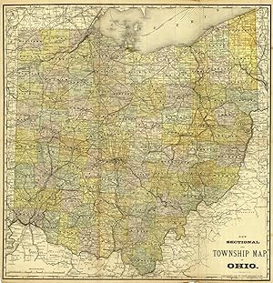
New Sectional and Township Map of Ohio
Publication Date: 1882
Seller: Art Source International Inc., Boulder, CO, U.S.A.
Seller rating 5 out of 5 stars
This antique map originally appeared in the "Historical Hand-Atlas" produced in 1882 by H.H. Hardesty & Co. These maps show many details including cities and towns, lakes and rivers, and most important the existing railroad network. This map measures 24 inches by 25 inches.