Plan Strasbourg Environs (6 results)
Language: French
Published by o.J.
Seller: Antiquariat Bläschke, Darmstadt, , GermanyAntiquariat Bläschke
Contact seller4-star sellerCondition: Used - Very good
US$ 9.42
US$ 51.42 shippingShips from Germany to U.S.A.Quantity: 1 available
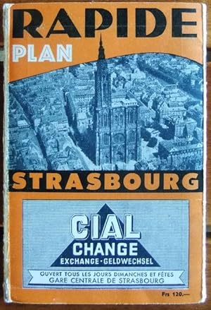
Kl.-8°, kt. Condition: Gut. 1 gefalteter Stadtplan + Straßenverzeichnis, zahlreiche Werbanzeigen 3-sprachig franz. - deutsch - engl. - Leichte Gebrauchsspuren; gut erhalten. Sprache: Französisch Gewicht in Gramm: 250.

Language: German
Published by L`Office de Tourisme de Strasbourg et sa Région, 2013 sowie o.J. + Stuttgart: Müller und Schindler, 1971 + Kirchenrat des Straßburger Münsters, 1975
- Softcover
Seller: Buch-Galerie Silvia Umla, DE, , GermanyBuch-Galerie Silvia Umla
Contact seller5-star sellerCondition: Used
US$ 14.12
US$ 68.56 shippingShips from Germany to U.S.A.Quantity: 1 available
66, 103, 31 Seiten sowie 2 Falblätter, jeweils mit zahlreichen Illustrationen und eine Karte. Teils leichte Gbrsp. HX-2 Sprache: Deutsch Gewicht in Gramm: 950 28 cm x 21 cm, O.Broschur + 25 cm x 19,5 cm, Faltblatt + 21 cm x 10 cm, Faltblatt + 20 cm x 12,5 cm, O.Broschur + 21,5 cm x 14,5 cm, o.broschiert und geheftet + Karte 66 x… 54 cm, beidseitig bunt bedruckt.

Published by Strasbourg 1735
- Map
Seller: Shapero Rare Books, London, United KingdomShapero Rare Books
Contact seller5-star sellerCondition: Used
US$ 10,915.45
US$ 19.87 shippingShips from United Kingdom to U.S.A.Quantity: 1 available
Watercolour map on thick paper, the title on a flap. Dimensions: 540 x 1017 mm. Mounted. Large manuscript plan of Strasbourg - a unique item with fine colours, very unusual. The map, dating from 1753, depicts a plan of the French city with the river Rhine running through it, alongside that of the German city of Kehl and markings… of nearby castles. It pays tribute to Strasbourg as a historical city, showing the old quarters as well as the medieval fortification wall built in 1412. The map also contains a depiction of the Vauban citadel built between the city and the Rhine in 1681 and designed by one of France's most famous military engineers. Kehl, depicted on the map, is equally an example of Vauban's work. The city in its entirety, is said to have been designed by him in 1683, following the French take-over in 1678. Kehl was first joined to Strasbourg in 1338 by the bridge seen on the map, although this has since been replaced, and stands as a monument to the changing relationship between France and Germany. It is even said that on one of the small islands between Strasbourg and Kehl, Marie Antoinette was officially handed over to France by Austria in 1770. Such maps of Strasbourg are rare. We could trace only a similar, very detailed map in Strasbourg's public library, showing to the west a scene of the local justice and to the east the castle of Kehl (BNS, m. caret 10. 686).

Published by Paris 1695
- Map
Seller: raremapexchange, Neuendettelsau, , Germanyraremapexchange
Contact seller2-star sellerCondition: Used - Good
US$ 41.19
US$ 68.56 shippingShips from Germany to U.S.A.Quantity: 1 available
Kein Einband. Condition: Befriedigend. Original engraving from: De Fer: Les forces de l´europe. Published Paris, 1695. Sheetsize: 39 x 27 cm. Condition: please see photo - slight surface wrinkling.

Language: German
Seller: Antiquariat Martin Barbian & Grund GbR, Saarbruecken, , GermanyAntiquariat Martin Barbian & Grund GbR
Contact seller5-star sellerCondition: Used
US$ 176.54
US$ 51.42 shippingShips from Germany to U.S.A.Quantity: 1 available
Kupferstich von Nicolas Person aus "Quotidiani Martis Labores .", Mainz, 1692,17,5x27 cm. Gravure sur cuivre de Nicolas Person, Mayence, 1692, 17,5x27 cm.
 More images
- Map
Seller: Magnus, Paris, , FranceMagnus
Contact seller4-star sellerCondition: Used - Near fine
US$ 176.54
US$ 33.14 shippingShips from France to U.S.A.Quantity: 1 available
Pas de couverture. Condition: Bon. Plan manuscrit daté et signé par l'ingénieur Conrad en vue de la reconstruction du pont Guillaume (actuellement Saint Guillaume) au centre ville de Strasbourg. environ 68X52 cm; bon état; dessiné sur plusieurs feuille de papier fort réunies; intéressant document sur l'histoire de Strasbourg.bon… état.


