Order Total (1 Item Items):
Shipping Destination:

Plymouth by Ordnance Survey (140 results)
Skip to main search results
Product Type
- All Product Types
- Books (120)
- Magazines & Periodicals
- Comics
- Sheet Music
- Art, Prints & Posters
- Photographs
- Maps (20)
- Manuscripts & Paper Collectibles
Condition
Binding
Collectible Attributes
Free Shipping
Seller Location
Seller Rating
-

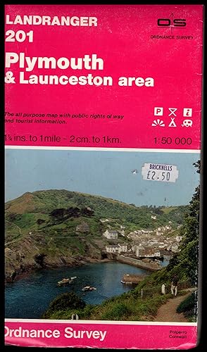
Landranger Maps: Plymouth and Launceston Area Sheet 201 (OS Landranger Map)
Published by Ordnance Survey
ISBN 10: 0319222012ISBN 13: 9780319222010
Book
Paperback. Condition: Very Good. The book has been read, but is in excellent condition. Pages are intact and not marred by notes or highlighting. The spine remains undamaged.
-

Lower Tamar Valley and Plymouth: Sheet 108 (Explorer Maps)
Published by Ordnance Survey, 1702
ISBN 10: 031921740XISBN 13: 9780319217405
Book
Paperback. Condition: Very Good. The book has been read, but is in excellent condition. Pages are intact and not marred by notes or highlighting. The spine remains undamaged.
-

Plymouth and Launceston, Tavistock and Looe (LANDRANGER MAPS)
Published by Ordnance Survey, 2003
ISBN 10: 0319228487ISBN 13: 9780319228487
Book
Paperback. Condition: Good. Connecting readers with great books since 1972! Used books may not include companion materials, and may have some shelf wear or limited writing. We ship orders daily and Customer Service is our top priority!.
More buying choices from other sellers on AbeBooks
New offers from US$ 29.48
Used offers from US$ 4.48
Also find Softcover
-

Plymouth & Launceston, Tavistock & Looe (OS Landranger Map): Sheet 201
Published by Ordnance Survey, 2012
ISBN 10: 0319232875ISBN 13: 9780319232873
Book
Paperback. Condition: Very Good. The book has been read, but is in excellent condition. Pages are intact and not marred by notes or highlighting. The spine remains undamaged.
More buying choices from other sellers on AbeBooks
Used offers from US$ 2.47
-

Paperback. Condition: Very Good. The book has been read, but is in excellent condition. Pages are intact and not marred by notes or highlighting. The spine remains undamaged.
More buying choices from other sellers on AbeBooks
New offers from US$ 18.69
Used offers from US$ 2.62
Also find Softcover
-

Landranger Map 201 Plymouth and Launceston, Tavistock and Looe: Sheet 201
Published by Ordnance Survey
ISBN 10: 0319223051ISBN 13: 9780319223055
Book
Paperback. Condition: Very Good. The book has been read, but is in excellent condition. Pages are intact and not marred by notes or highlighting. The spine remains undamaged.
-

Paperback. Condition: Very Good. The book has been read, but is in excellent condition. Pages are intact and not marred by notes or highlighting. The spine remains undamaged.
-

Condition: Good. 1972. Revised edition. Unpaginated. Ordnance survey map in colour. Paperback covers. Map remains bright and clear. Only minor creasing present. Covers have moderate tanning with creasing and reading lines. Sticker to front.
-

Plymouth and Launceston, Tavistock and Looe (OS Landranger Map): Sheet 201
Published by Ordnance Survey, 2009
ISBN 10: 0319231461ISBN 13: 9780319231463
Book
Condition: Good. Most items will be dispatched the same or the next working day.
-

Lower Tamar Valley and Plymouth (Explorer Maps): Sheet 108 (OS Explorer Map)
Published by Ordnance Survey, 2010
ISBN 10: 0319237095ISBN 13: 9780319237090
Book
Condition: VeryGood. Most items will be dispatched the same or the next working day.
-

Lower Tamar Valley and Plymouth
Published by ORDNANCE SURVEY
ISBN 10: 0319243109ISBN 13: 9780319243107
Book
Condition: As New. Unread book in perfect condition.
More buying choices from other sellers on AbeBooks
New offers from US$ 16.04
Used offers from US$ 14.04
Also find Softcover
-

Lower Tamar Valley and Plymouth
Published by Ordnance Survey, 2015
ISBN 10: 0319469891ISBN 13: 9780319469897
Book
Condition: New.
More buying choices from other sellers on AbeBooks
New offers from US$ 17.69
Used offers from US$ 17.88
Also find Softcover
-

Plymouth & Launceston, Tavistock & Looe
Published by Ordnance Survey, 2016
ISBN 10: 0319475247ISBN 13: 9780319475249
Book
Condition: As New. Unread book in perfect condition.
More buying choices from other sellers on AbeBooks
New offers from US$ 22.07
Used offers from US$ 17.88
Also find Softcover
-

Plymouth and Launceston, Tavistock and Looe: Sheet 201 (Landranger Maps)
Published by Ordnance Survey, 2002
ISBN 10: 0319228010ISBN 13: 9780319228012
Book
map. Condition: Good. All orders are dispatched the following working day from our UK warehouse. Established in 2004, we have over 500,000 books in stock. No quibble refund if not completely satisfied.
-

Lower Tamar Valley and Plymouth: Sheet 108 (Explorer Maps)
Published by Ordnance Survey
ISBN 10: 0319235270ISBN 13: 9780319235270
Book
Condition: Good. Most items will be dispatched the same or the next working day. Minor shelf wear.
-

One-Inch Map of Great Britain PLYMOUTH Sheet 187
Published by Director General of the Ordinance Survey, Chessingotn, Surrey, 1961
Book
Soft cover. Condition: Good. No Jacket. Good condition paperback of a map of Plymouth. Fully revised 1957-58. Major Road added 1964. Corner of front cover a little scuffed.
-

Soft cover. Condition: Very Good. Dust Jacket Condition: Very Good. 5th or later Edition. Printed and Published by the Director General of the Ordnance Survey, Chessington 1946. Base C-. Cover clean apart from some neat index infilling with pencil. Paper map unmarked, clean and crisp. Nice sheet! Reduced postage for multiple sheet orders.
-

Lower Tamar Valley and Plymouth (OS Explorer Map Active)
Published by Ordnance Survey, 2008
ISBN 10: 0319462552ISBN 13: 9780319462553
Book
Soft Cover. Condition: Very Good. map Size: 8vo - over 7�" - 9�" tall.
-

Plymouth Sheet 187: New Popular One Inch Map with Military Overprint
Published by Ordnance Survey, Chessington, 1951
Map
Map. Condition: Very Good. GSGS Geographical Section, General Staff edition with purple grid overprint. Crudely hand folded, no cover. Small chips to border.
-
Ordnance Survey Map: PLYMOUTH & LAUCESTON AREA 1984 The Landranger Series of Great Britain: Sheet No.201 1:50,000
Published by Ordnance Survey, Southampton, England, Southampton, Hampshure, England, 1984
Map
Soft cover. Condition: Very Good. No Jacket. ## Ordnance Survey Map: PLYMOUTH & LAUNCESTON AREA 1984 The Landranger Series of Great Britain: Sheet No.201 1:50,000 ## ## Please note: The map's condition, not its cover, determines its categorisation. All maps are pre-owned and may show signs of wear if folded incorrectly. The images displayed on our site are of our actual maps in stock, not generic ones. They are allowing you to assess the condition of the cover before purchase. While the cover may exhibit various degrees of creasing, wear and tear, or damage, the maps are generally in good condition and categorised accordingly. Please refer to the provided images for more details.## ## THIS MAP: Categorised as VERY GOOD. The 1984 edition was revised in 1980, including the low water mark plotted from air photographs dated 1969-77. Selected revisions 1983 ## ## The paper slipcover has general wear and tear, proportional to age. The detailing of these early maps is remarkable. ## PLEASE READ ON for interesting information and details. SEE THE IMAGES. ### ## Ordnance Survey (O.S.) is the national mapping agency of Great Britain, producing detailed and accurate maps for various purposes. Its origins date back to the 18th century as a military project to survey the Scottish Highlands and the southern coasts of England in response to the Jacobite rebellion and the French Revolution. The name Ordnance Survey reflects its connection to the Board of Ordnance, the defence ministry of the time.## ## One of the pioneers of O.S. was William Roy, a young engineer who conducted the first small-scale survey of Scotland from 1747 to 1755, using simple instruments such as compasses and chains. He later undertook a more ambitious project to geodetically connect the Royal Observatories of Greenwich and Paris, using a sophisticated theodolite by Jesse Ramsden. This project, which started in 1784 and lasted until 1790, laid the foundation for the trigonometrical survey of Britain, which aimed to create a network of accurately measured triangles across the country.## ## The trigonometrical survey, also known as the Principal Triangulation, was officially initiated in 1791, marking the birth of O.S. It involved measuring baselines on flat ground, such as Hounslow Heath, and then extending the triangles to hills and mountains, where observatories were built to house the theodolites. The surveyors had to deal with various challenges like weather, terrain, visibility, and accuracy. The survey was completed in 1853, covering over 300,000 square kilometres and 5,000 stations.## ## The trigonometrical survey provided the basis for the first accurate map of Britain, published by O.S. in 1801. It was a one-inch-to-the-mile map of Kent, showing roads, rivers, hills, settlements, and land cover. It was followed by maps of other counties and regions, using different scales and symbols. O.S. also produced maps of overseas British colonies, such as India, Africa, and the Caribbean, under the Directorate of Colonial Surveys and the Directorate of Overseas Surveys.## ##Over the years, O.S. has evolved and adapted to the changing needs and technologies of mapping. It has introduced new methods and standards of surveying, such as levelling, photogrammetry, aerial photography, and satellite positioning. It has diversified its products and services, such as digital mapping, online platforms, mobile apps, and geospatial data. Today, O.S. is one of the world's leading mapping agencies, aiming to provide the most up-to-date and comprehensive geospatial information about Great Britain.## ### INTERNATIONAL BUYERS: Please Note. FREE SHIPPING IS FOR THE UK ONLY. Please get in touch with me for a shipping quotation. ####.
-
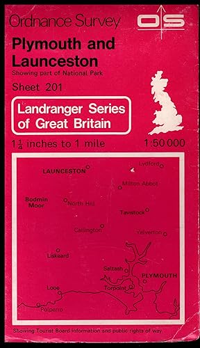
Ordnance Survey Map: PLYMOUTH & LAUCESTON: 1984 Showing part of National Park: The Landranger Series of Great Britain: Sheet No.201 1:50,000
Published by Ordnance Survey, Southampton, England, Southampton, Hampshure, England, 1984
Map
Soft cover. Condition: Very Good. No Jacket. ## Ordnance Survey Map: PLYMOUTH & LAUNCESTON: 1984 Showing part of National Park: The Landranger Series of Great Britain: Sheet No.201 1:50,000 ## ## Please note: The map's condition, not its cover, determines its categorisation. All maps are pre-owned and may show signs of wear if folded incorrectly. The images displayed on our site are of our actual maps in stock, not generic ones. They are allowing you to assess the condition of the cover before purchase. While the cover may exhibit various degrees of creasing, wear and tear, or damage, the maps are generally in good condition and categorised accordingly. Please refer to the provided images for more details.## ## THIS MAP: Categorised as VERY GOOD. The 1984 edition was revised in 1980, including the low water mark plotted from air photographs dated 1969-77. Selected revisions 1983 ## ## The paper slipcover has general wear and tear, proportional to age. The detailing of these early maps is remarkable. ## PLEASE READ ON for interesting information and details. SEE THE IMAGES. ### ## Ordnance Survey (O.S.) is the national mapping agency of Great Britain, producing detailed and accurate maps for various purposes. Its origins date back to the 18th century as a military project to survey the Scottish Highlands and the southern coasts of England in response to the Jacobite rebellion and the French Revolution. The name Ordnance Survey reflects its connection to the Board of Ordnance, the defence ministry of the time.## ## One of the pioneers of O.S. was William Roy, a young engineer who conducted the first small-scale survey of Scotland from 1747 to 1755, using simple instruments such as compasses and chains. He later undertook a more ambitious project to geodetically connect the Royal Observatories of Greenwich and Paris, using a sophisticated theodolite by Jesse Ramsden. This project, which started in 1784 and lasted until 1790, laid the foundation for the trigonometrical survey of Britain, which aimed to create a network of accurately measured triangles across the country.## ## The trigonometrical survey, also known as the Principal Triangulation, was officially initiated in 1791, marking the birth of O.S. It involved measuring baselines on flat ground, such as Hounslow Heath, and then extending the triangles to hills and mountains, where observatories were built to house the theodolites. The surveyors had to deal with various challenges like weather, terrain, visibility, and accuracy. The survey was completed in 1853, covering over 300,000 square kilometres and 5,000 stations.## ## The trigonometrical survey provided the basis for the first accurate map of Britain, published by O.S. in 1801. It was a one-inch-to-the-mile map of Kent, showing roads, rivers, hills, settlements, and land cover. It was followed by maps of other counties and regions, using different scales and symbols. O.S. also produced maps of overseas British colonies, such as India, Africa, and the Caribbean, under the Directorate of Colonial Surveys and the Directorate of Overseas Surveys.## ##Over the years, O.S. has evolved and adapted to the changing needs and technologies of mapping. It has introduced new methods and standards of surveying, such as levelling, photogrammetry, aerial photography, and satellite positioning. It has diversified its products and services, such as digital mapping, online platforms, mobile apps, and geospatial data. Today, O.S. is one of the world's leading mapping agencies, aiming to provide the most up-to-date and comprehensive geospatial information about Great Britain.## ### INTERNATIONAL BUYERS: Please Note. FREE SHIPPING IS FOR THE UK ONLY. Please get in touch with me for a shipping quotation. ####.
-
Ordnance Survey Map: PLYMOUTH & LAUCESTON: 1984 Showing part of National Park: The Landranger Series of Great Britain: Sheet No.201 1:50,000
Published by Ordnance Survey, Southampton, England, Southampton, Hampshure, England, 1984
Map
Soft cover. Condition: Very Good. No Jacket. ## Ordnance Survey Map: PLYMOUTH & LAUCESTON: 1984 Showing part of National Park: The Landranger Series of Great Britain: Sheet No.201 1:50,000 ## ## Please note: The map's condition, not its cover, determines its categorisation. All maps are pre-owned and may show signs of wear if folded incorrectly. The images displayed on our site are of our actual maps in stock, not generic ones. They are allowing you to assess the condition of the cover before purchase. While the cover may exhibit various degrees of creasing, wear and tear, or damage, the maps are generally in good condition and categorised accordingly. Please refer to the provided images for more details.## ## THIS MAP: Categorised as VERY GOOD. The 1984 edition was revised in 1980, including the low water mark plotted from air photographs dated 1969-77. Selected revisions 1981 ## ## The paper slipcover has general wear and tear, proportional to age. The detailing of these early maps is remarkable. ## PLEASE READ ON for interesting information and details. SEE THE IMAGES. ### ## Ordnance Survey (O.S.) is the national mapping agency of Great Britain, producing detailed and accurate maps for various purposes. Its origins date back to the 18th century as a military project to survey the Scottish Highlands and the southern coasts of England in response to the Jacobite rebellion and the French Revolution. The name Ordnance Survey reflects its connection to the Board of Ordnance, the defence ministry of the time.## ## One of the pioneers of O.S. was William Roy, a young engineer who conducted the first small-scale survey of Scotland from 1747 to 1755, using simple instruments such as compasses and chains. He later undertook a more ambitious project to geodetically connect the Royal Observatories of Greenwich and Paris, using a sophisticated theodolite by Jesse Ramsden. This project, which started in 1784 and lasted until 1790, laid the foundation for the trigonometrical survey of Britain, which aimed to create a network of accurately measured triangles across the country.## ## The trigonometrical survey, also known as the Principal Triangulation, was officially initiated in 1791, marking the birth of O.S. It involved measuring baselines on flat ground, such as Hounslow Heath, and then extending the triangles to hills and mountains, where observatories were built to house the theodolites. The surveyors had to deal with various challenges like weather, terrain, visibility, and accuracy. The survey was completed in 1853, covering over 300,000 square kilometres and 5,000 stations.## ## The trigonometrical survey provided the basis for the first accurate map of Britain, published by O.S. in 1801. It was a one-inch-to-the-mile map of Kent, showing roads, rivers, hills, settlements, and land cover. It was followed by maps of other counties and regions, using different scales and symbols. O.S. also produced maps of overseas British colonies, such as India, Africa, and the Caribbean, under the Directorate of Colonial Surveys and the Directorate of Overseas Surveys.## ##Over the years, O.S. has evolved and adapted to the changing needs and technologies of mapping. It has introduced new methods and standards of surveying, such as levelling, photogrammetry, aerial photography, and satellite positioning. It has diversified its products and services, such as digital mapping, online platforms, mobile apps, and geospatial data. Today, O.S. is one of the world's leading mapping agencies, aiming to provide the most up-to-date and comprehensive geospatial information about Great Britain.## ### INTERNATIONAL BUYERS: Please Note. FREE SHIPPING IS FOR THE UK ONLY. Please get in touch with me for a shipping quotation. ####.
-
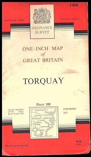
Ordnance Survey Map: PLYMOUTH Sheet 188: 1961 A edition: One-Inch Map of Great Britain
Published by Ordanance Survey, Chessington, Surrey, 1961
Map
CLOTH MAP. Condition: Very Good. ### Ordnance Survey Map: PLYMOUTH Sheet188: 1961: A edition: One-Inch Map of Great Britain ### ## THIS CLOTH MAP: Classified as VERY GOOD. Revised in1957 to 1958 This edition published in 1961. The cover has some bumping to the corners. . The map inside is clean and tidy. ## ## YOU MAY FIND INTERESTING: The origins of the Ordnance Survey lie in the aftermath of the Jacobite rising of 1745. Prince William, Duke of Cumberland, realised that the British Army did not have a good map of the Scottish Highlands to locate Jacobite dissenters such as Simon Fraser and 11th Lord Lovat so they could be tried. In 1747, Lieutenant-Colonel David Watson proposed the compilation of a Highlands map to help subjugate the clans. In response, King George II charged Watson with making a military survey of the Highlands under the command of the Duke of Cumberland. Among Watson's assistants were William Roy, Paul Sandby and John Manson. The survey was produced at a scale of 1 inch to 1000 yards (1:36,000) and included "the Duke of Cumberland's Map" (primarily by Watson and Roy), now held in the British Library.## ## Roy later had an illustrious career in the Royal Engineers (RE), rising to the rank of General. He was largely responsible for the British share of the work in determining the relative positions of the French and British royal observatories. This work was the starting point of the Principal Triangulation of Great Britain (1783?1853) and led to the creation of the Ordnance Survey. Roy's technical skills and leadership set the high standard for which Ordnance Survey became known. Work was begun in earnest in 1790 under Roy's supervision when the Board of Ordnance (a predecessor of part of the modern Ministry of Defence) began a national military survey starting with the south coast of England. Roy's birthplace near Carluke in South Lanarkshire is today marked by a memorial in the form of a large OS trig point.## ## By 1791, the Board received the newer Ramsden theodolite, and work began mapping southern Great Britain using a five-mile baseline on Hounslow Heath that Roy himself had previously measured; it crosses the present Heathrow Airport. In 1991 Royal Mail marked the bicentenary by issuing postage stamps featuring maps of the Kentish village of Hamstreet. ## In 1801 the first one-inch-to-the-mile (1:63,360 scale) map was published, detailing the county of Kent, with Essex following shortly afterwards. The Kent map was published privately and stopped at the county border, while the Essex maps were published by Ordnance Survey and ignored the county border, setting the trend for future Ordnance Survey maps. ## In the next 20 years, a third of England and Wales was mapped at the same scale under the direction of William Mudge as other military matters took precedence. It took until 1823 to re-establish the relationship with the French survey made by Roy in 1787. By 1810 one inch to the mile maps of the south of England were completed and withdrawn from sale between 1811 and 1816 because of security fears. By 1840 the one-inch survey had covered all of Wales and all but the six northernmost counties of England.## ## Surveying was hard work. For instance, Major Thomas Colby, the longest-serving Director General of the Ordnance Survey, walked 586 miles (943 km) in 22 days on a survey in 1819. In 1824, Colby and most of his staff moved to Ireland to work on a six-inches-to-the-mile (1:10,560) valuation survey. The study of Ireland, county by county, was completed in 1846. The suspicions and tensions it caused in rural Ireland are the subjects of Brian Friel's play Translations. ## ### INTERNATIONAL BUYERS: Please Note. FREE SHIPPING IS UK ONLY. PLEASE, contact me for a shipping quotation. ###. No Author signature.
-
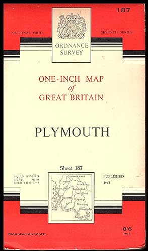
Ordnance Survey Map: PLYMOUTH Sheet 187: 1961 A/* edition: One-Inch Map of Great Britain
Published by Ordanance Survey, Chessington, Surrey, 1961
Map
CLOTH MAP. Condition: Very Good. ### Ordnance Survey Map: PLYMOUTH Sheet 187: 1961 A/* edition: One-Inch Map of Great Britain ### ## THIS CLOTH MAP: Classified as VERY GOOD. Revised in1957 to 1958 This edition published in 1961. The cover has some bumping to the corners. . The map inside is clean and tidy. ## ## YOU MAY FIND INTERESTING: The origins of the Ordnance Survey lie in the aftermath of the Jacobite rising of 1745. Prince William, Duke of Cumberland, realised that the British Army did not have a good map of the Scottish Highlands to locate Jacobite dissenters such as Simon Fraser and 11th Lord Lovat so they could be tried. In 1747, Lieutenant-Colonel David Watson proposed the compilation of a Highlands map to help subjugate the clans. In response, King George II charged Watson with making a military survey of the Highlands under the command of the Duke of Cumberland. Among Watson's assistants were William Roy, Paul Sandby and John Manson. The survey was produced at a scale of 1 inch to 1000 yards (1:36,000) and included "the Duke of Cumberland's Map" (primarily by Watson and Roy), now held in the British Library.## ## Roy later had an illustrious career in the Royal Engineers (RE), rising to the rank of General. He was largely responsible for the British share of the work in determining the relative positions of the French and British royal observatories. This work was the starting point of the Principal Triangulation of Great Britain (1783?1853) and led to the creation of the Ordnance Survey. Roy's technical skills and leadership set the high standard for which Ordnance Survey became known. Work was begun in earnest in 1790 under Roy's supervision when the Board of Ordnance (a predecessor of part of the modern Ministry of Defence) began a national military survey starting with the south coast of England. Roy's birthplace near Carluke in South Lanarkshire is today marked by a memorial in the form of a large OS trig point.## ## By 1791, the Board received the newer Ramsden theodolite, and work began mapping southern Great Britain using a five-mile baseline on Hounslow Heath that Roy himself had previously measured; it crosses the present Heathrow Airport. In 1991 Royal Mail marked the bicentenary by issuing postage stamps featuring maps of the Kentish village of Hamstreet. ## In 1801 the first one-inch-to-the-mile (1:63,360 scale) map was published, detailing the county of Kent, with Essex following shortly afterwards. The Kent map was published privately and stopped at the county border, while the Essex maps were published by Ordnance Survey and ignored the county border, setting the trend for future Ordnance Survey maps. ## In the next 20 years, a third of England and Wales was mapped at the same scale under the direction of William Mudge as other military matters took precedence. It took until 1823 to re-establish the relationship with the French survey made by Roy in 1787. By 1810 one inch to the mile maps of the south of England were completed and withdrawn from sale between 1811 and 1816 because of security fears. By 1840 the one-inch survey had covered all of Wales and all but the six northernmost counties of England.## ## Surveying was hard work. For instance, Major Thomas Colby, the longest-serving Director General of the Ordnance Survey, walked 586 miles (943 km) in 22 days on a survey in 1819. In 1824, Colby and most of his staff moved to Ireland to work on a six-inches-to-the-mile (1:10,560) valuation survey. The study of Ireland, county by county, was completed in 1846. The suspicions and tensions it caused in rural Ireland are the subjects of Brian Friel's play Translations. ## ### INTERNATIONAL BUYERS: Please Note. FREE SHIPPING IS UK ONLY. PLEASE, contact me for a shipping quotation. ###. No Author signature.
-
Paperback. Condition: Good-. Fifth Edition. 12mo. A good reference copy . nd, but boundaries revised to 1939. blue edged illustrated card front cover has some wear to edges. pos on back cover. Cloth map torn on one fold, with some wear in corners of other folds. Some sellotape repairs. Immediate despatch from the UK. Book.
-
PLYMOUTH AND LAUNCESTON , ORDNANCE SURVEY, SHEET 201 , ORDNANCE SURVEY MAP, 1: 50 000
Published by ORDNANCE SURVEY, Southampton
Seller: K Books Ltd ABA ILAB, York, YORKS, United Kingdom
Association Member: ABA ILAB PBFA
Seller Rating:

Map
Soft cover. Condition: Very Good. No Jacket. Reprint. This is a slightly worn copy of this OS MAP , . Folded with original printed covers as issued. . SOFT COVER, NO JACKET, N0 MARKINGS, EXCELLENT CONDITION, SPLENDID VALUE . PLYMOUTH AND LAUNCESTON , ORDNANCE SURVEY, SHEET 201 , ORDNANCE SURVEY MAP, 1: 50 000.
-

Map. Condition: Very Good. Worn covers have a previous owner's address label on the front, map unmarked. Orders received by 3pm Sent from the UK that weekday.
-
England & Wales Sheet 144 Plymouth 5th edition style one inch to one statute mile
Published by War Office, London, 1941
Map. Condition: G+. War Revision 1940. A good copy with minor wear and slight discolouration at edges and slight foxing around somd folds. Book.
-
England & Wales Sheet 144 Plymouth 5th edition style one inch to one statute mile
Published by War Office, London, 1941
Map. Condition: G+. War Revision 1940. A good copy with minor wear and slight discolouration at edges, small stain to back and very small holes at some folds. filed with AB5755 - 2 maps together. Book.
-

Ordnance Survey One-inch Map of England and Wales: Plymouth
Published by Ordnance Survey, Chessington, Surrey, 1946
Condition: Good. 1946. No Edition Remarks. Unpaginated. Paperback book with pictorial cover. Pages remain bright and clean with minimal tanning and foxing. Paper cover has mild shelf wear with some creasing to corners and rubbing to spine ends. Some scuffing and marking to surfaces.