

Order Total (1 Item Items):
Shipping Destination:

Schweiz by Lowenberg (3 results)
Skip to main search results
Search filters
Product Type
- All Product Types
- Books (2)
- Magazines & Periodicals (No further results match this refinement)
- Comics (No further results match this refinement)
- Sheet Music (No further results match this refinement)
- Art, Prints & Posters (No further results match this refinement)
- Photographs (No further results match this refinement)
- Maps (1)
- Manuscripts & Paper Collectibles (No further results match this refinement)
Condition Learn more
- New (No further results match this refinement)
- As New, Fine or Near Fine (No further results match this refinement)
- Very Good or Good (No further results match this refinement)
- Fair or Poor (No further results match this refinement)
- As Described (3)
Binding
- All Bindings
- Hardcover (1)
- Softcover (No further results match this refinement)
Collectible Attributes
- First Edition (No further results match this refinement)
- Signed (No further results match this refinement)
- Dust Jacket (No further results match this refinement)
- Seller-Supplied Images (3)
- Not Print on Demand (3)
Language (1)
Price
- Any Price
- Under US$ 25 (No further results match this refinement)
- US$ 25 to US$ 50 (No further results match this refinement)
- Over US$ 50
Free Shipping
- Free Shipping to U.S.A. (No further results match this refinement)
Seller Location
Seller Rating
-
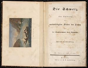
Die Schweiz. Eine Schilderung der merkwürdigsten Stellen des Landes und der Hauptmomente ihrer Geschichte, von Julius Loewenberg.
Published by Artist: Löwenberg Julius ( - 1893 ) Berlin ca : 1870, 1800
Seller: Antique Sommer& Sapunaru KG, München, Germany
Seller rating 4 out of 5 stars

Technic: Copper print, colorit: colored, condition: Binding in hardcover, size (in cm): 20,5 x 13,5, Copper print book describes Swizerland with 1 title page, foreword and page of content, tex pages from 1 - 224 in german language. With steelprints( lake Geneve), 4 copper aquatinta (Jungfrau Gebirge, Staubach, Aar-Brücke, Teufelsbrücke), on map ( ballte of Murten) one folding map of Swizerland and the mountains frofile.
-

Die Schweiz (Switzerland)
Publication Date: 1839
Seller: Art Source International Inc., Boulder, CO, U.S.A.
Seller rating 5 out of 5 stars

In a word, these early 19th century Germany maps could be called refined. This map is from an uncommon set of maps published by Lowenberg in 1839. These fine engravings many times focused on a specific theme (such as an empire or campaign) or included interesting historical notations. This map is a fine example of how advanced German cartography was for the time, with deftly engraved topography, clear and distinct notations, and well laid out composition, these maps included a wealth of information on a sheet. While these sheets are toned with age, it is not unusually harsh or dark, and doesn"t affect the charm of the image. This map measures 10 inches by 13 inches.
-

Die Schweiz.
Publication Date: 1846
Seller: Geographicus Rare Antique Maps, Brooklyn, NY, U.S.A.
Association Member: ABAA ESA ILAB
Seller rating 4 out of 5 stars
Map
Very good. Even overall toning. Blank on verso. Size 5.5 x 6.5 Inches. A delightfully whimsical 1846 map of Switzerland, from a German kinderatlas or children's atlas. The map covers all of Switzerland from Germany and France to Italy. The whole is surrounded by a wide border featuring charming vignettes meant to illustrate the peoples and cultures of the region. These include an archer aiming his bow and arrow at horsemen, a man and woman chatting, a sportsman, bridged cliffs, etc. The map is accompanied by its adjacent page, which includes a poetic history of Switzerland in German gothic type. The wonderful and rare map was drawn by Anst. V A. Boeden of Berlin for inclusion as plate no. XIV in the 1846 issue of Julius Loewenberg's Geographische Landerfibel .

