Uganda Map (47 results)
Seller: BooksRun, Philadelphia, PA, U.S.A.BooksRun
Contact seller5-star sellerCondition: Used - Fair
US$ 8.22
Free ShippingShips within U.S.A.Quantity: 1 available
Map. Condition: Fair. The item might be beaten up but readable. May contain markings or highlighting, as well as stains, bent corners, or any other major defect, but the text is not obscured in any way.
Seller: Stony Hill Books, Madison, WI, U.S.A.Stony Hill Books
Contact seller5-star sellerCondition: Used - Very good
US$ 8.00
US$ 5.50 shippingShips within U.S.A.Quantity: 1 available
Map. Condition: Very Good. Large folding map in glossy pictorial card covers, graphics different than in stock picture, multi-lingual text, appears never opened VG++ condition.
- Map
Seller: Blindpig Books, salt lake city, UT, U.S.A.Blindpig Books
Contact seller5-star sellerCondition: Used - Good
US$ 11.91
US$ 3.99 shippingShips within U.S.A.Quantity: 1 available
map. Condition: Used - Good. Some wear. Very readable copy.

Published by London, Adam & Charles Black, [ 1968
- Hardcover
Seller: Hammer Mountain Book Halls, ABAA, Schenectady, NY, U.S.A.Hammer Mountain Book Halls, ABAA
Contact seller5-star sellerHardcover. Covers faintly dust-soiled; inside margin and pages adjacent to plates slightly foxed; otherwise very good condition in slightly worn, clipped dust jacket. No markings. ]. 96p. Illus.
Published by Tourguide Publications 2011
Seller: Bank of Books, Ventura, CA, U.S.A.Bank of Books
Contact seller5-star sellerCondition: Used - Very good
US$ 8.00
US$ 4.25 shippingShips within U.S.A.Quantity: 1 available
map. Condition: Very Good. We have 75,000 books to choose from -- Ship within 24 hours -- Satisfaction Guaranteed.
Language: English
Published by Union Castle Mail Steamship Company. Robert Hale Ltd London, London 1951
- Hardcover
Seller: Westside Stories, Hamilton, ON, CanadaWestside Stories
Contact seller5-star sellerCondition: Used - Very good
US$ 22.09
US$ 13.50 shippingShips from Canada to U.S.A.Quantity: 1 available
Hardcover. Condition: Very Good. No Jacket. First Thus. A Very Solid Book, Slight Aging To Pages Over 100 Pages Of Adverts, 16 Pages Of Maps And A Folded Map In A Front Pocket. Ribbon Marker Still Attached And Tied To An Integral Stand Bank Of South Africa Book Mark. Previous Owners Name On The First Page, Though It Appear The F…fep Has Been Removed. Very Slight Fraying To Edge Of Front Pages . Red Boards Cloth Covered And Very Slightly . Shaken But Holding Very Well. Gilt Title On Front Board And Slightly Faded Gilt Title On Spine. Only Minor Bumping Particularly To Spine Ends.
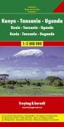
Published by Freytag & Berndt
Seller: Wonder Book, Frederick, MD, U.S.A.Wonder Book
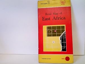
Contact seller5-star sellerCondition: Fair. Acceptable condition. No date stated, ca. 1990s. [9783850842211] (East Africa, Road Maps) A readable, intact copy that may have noticeable tears and wear to the spine. All pages of text are present, but they may include extensive notes and highlighting or be heavily stained. Includes reading copy only books.
 More images
Language: English
Published by Robert Hale, London, UK 1964
- Hardcover
Seller: All Lost Books, Wollaston, , United KingdomAll Lost Books
Contact seller5-star sellerCondition: Used - Very good
US$ 24.86
US$ 27.08 shippingShips from United Kingdom to U.S.A.Quantity: 1 available
Hardcover. Condition: Very Good. Dust Jacket Condition: Good. Includes 13*colour maps (one folding) and many b/w maps and several colour illustrations. xxxiv+352+16pp. DJ rubbed and nicked at edges. 1.5cm closed tear to lower rear DJ edge, Red cloth boards with gilt lettering.

Published by National Geographic Society 2020
- Softcover
- Periodical
Seller: Shore Books, London, United KingdomShore Books
Contact seller5-star sellerCondition: Used - Very good
US$ 20.71
US$ 14.75 shippingShips from United Kingdom to U.S.A.Quantity: 1 available
Soft cover. Condition: Very Good. 138 pages. Illustrated.
 More images
Published by The Times, London 1920
- Softcover
- First Edition
- Map
Seller: Bailgate Books Ltd, Doncaster, , United KingdomBailgate Books Ltd
Contact seller5-star sellerCondition: Used - Very good
US$ 26.52
US$ 19.44 shippingShips from United Kingdom to U.S.A.Quantity: 1 available
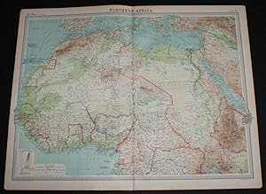
Softcover. Condition: Very Good. No Dust Jacket. First Edition. Disbound single sheet with vertical centre fold from the 1920 "The Times Survey Atlas of the World". Map is in colour and suitable for framing. Colour on both land and sea according to contour with borders marked in red. Map at scale 1:12,000,000. Map covers; Morocc…o, Algeria, Libya, Egypt, Senegal, French West Africa, Nigeria, Cameroon, Uganda, Ivory Coast, Gold Coast, French Guinea, Borku, Chad, Abyssinia (part), Belgian Congo (part), Madeira Islands, Canary Islands, Spain (part), Red Sea, Gulf of Guinea, Mediterranean Sea (part), Arabia (part), etc. Slightly darkened edges with occasional light foxing in margins but sheet is otherwise clean and crisp. Item Type: Map. Single sheet map/chart which is suitable for framing and will be shipped rolled and in a cardboard tube. Quantity Available: 1. Shipped Weight: under 1 kg. Pictures of this item not already displayed here available upon request. Inventory No: 45020034028. All our books are sent by tracked mail.
 More images
Published by The Times, London 1920
- Softcover
- First Edition
- Map
Seller: Bailgate Books Ltd, Doncaster, , United KingdomBailgate Books Ltd
Contact seller5-star sellerCondition: Used - Very good
US$ 26.52
US$ 19.44 shippingShips from United Kingdom to U.S.A.Quantity: 1 available
Softcover. Condition: Very Good. No Dust Jacket. First Edition. Disbound single sheet with horizontal centre fold from the 1920 "The Times Survey Atlas of the World". Map is in colour and suitable for framing. Colour on both land and sea according to contour with borders marked in red. Map at scale 1:5,000,000. Map covers; Lake…Victoria, Lake Nyasa, Lake Tanganyika, Lake Albert, Uganda, Kenya Colony, Tanganyika Territory, Belgian Congo (part), Northern Rhodesia (part), Nyasaland Protectorate, Portuguese East Africa (part), Zanzibar, Azanian Sea, etc. Slightly darkened edges with occasional light foxing in margins but sheet is otherwise clean and crisp. Item Type: Map. Single sheet map/chart which is suitable for framing and will be shipped rolled and in a cardboard tube. Quantity Available: 1. Shipped Weight: under 1 kg. Pictures of this item not already displayed here available upon request. Inventory No: 45020034032. All our books are sent by tracked mail.
Language: English
Published by London, A. Gordon-Brown 1952
- Hardcover
Seller: Antiquariat Weinek, Salzburg, AustriaAntiquariat Weinek
Contact seller3-star sellerCondition: Used
US$ 50.07
US$ 29.51 shippingShips from Austria to U.S.A.Quantity: 1 available
XXXII + 435 + 16 + 107 S. OLwd. In Englisch. - Mit allen Karten u. Mappe. - Ebd. stärker berieben u. fleckig, sonst leichte Gbrsp.

Seller: Sell Books, Elland, YORKS, United KingdomSell Books
Contact seller5-star sellerCondition: Used - Fair
US$ 45.85
US$ 16.29 shippingShips from United Kingdom to U.S.A.Quantity: 1 available
map. Condition: Acceptable. Please see the condition note after this for details, if this is missing please consider Acceptable to mean poor quality that could include major staining, water damage, writing, missing dustjacket, etc etc. Our books are dispatched from a Yorkshire former cotton mill. We list via barcode/ISBN so plea…se note that the images are stock images and may not be the exact copy you receive, furthermore the details about edition and year might not be accurate as many publishers reuse the same ISBN for multiple editions and as we simply scan a barcode or enter an ISBN we do not check the validity of the edition data when listing. If you're looking for an exact edition please don't order (at least not without checking with us first, although we don't always have time to check). We aim to dispatch prompty, the service used will depend on order value and book size. We can ship to most countries, see our shipping policies. Payment is via Abe only.
 More images
Published by London: Duckworth & Co. 1908
- Hardcover
Seller: Westwood Books Sedbergh, Sedbergh, , United KingdomWestwood Books Sedbergh
Contact seller5-star sellerCondition: Used - Good
US$ 27.62
US$ 26.81 shippingShips from United Kingdom to U.S.A.Quantity: 1 available
Condition: Good. 8vo: xvi, 345pp. 28 tipped in plates and one folding map. Rubbed orange cloth, faded on spine, without dust wrapper. Black lettering and decor on spine and covers. Former ownership inscription on half title page. Tanned endpapers. Minor tanning from plates on opposing pages.
Published by London, Duckworth & Co., 1908
- Hardcover
- First Edition
Seller: Cobnar Books, Deal, , United KingdomCobnar Books
Contact seller4-star sellerCondition: Used
US$ 28.58
US$ 28.40 shippingShips from United Kingdom to U.S.A.Quantity: 1 available
xvi, 11-345 p. Folded map, illustrations. First edition. 20 cms. Publisher's printed green cloth. Endpapers toned and the rear free enpaper missing but a good solid reading copy.
 More images
Published by Reclus
- Art Print
Seller: Artisans-lane Maps & Prints, Sidney, BC, CanadaArtisans-lane Maps & Prints
Contact seller4-star sellerCondition: Used - Very good
US$ 14.73
US$ 19.00 shippingShips from Canada to U.S.A.Quantity: 1 available
no binding. Condition: very good. The Republic of Uganda, or Uganda, is a country in East Africa, bordered in the east by Kenya, in the north by Sudan, by the Democratic Republic of Congo in the west, Rwanda in the southwest and Tanzania in the south. The southern part of the country includes a substantial portion of Lake Victor…ia, within which it shares borders with Kenya and Tanzania. Uganda takes its name from the historical Buganda kingdom, which encompasses a portion of the south of the country, including the capital Kampala. Little is known about the history of the region now covered by Uganda until the arrival of the Arabs and Europeans in the mid 1800s. Humans are known to have lived in the area since at least the first millennium BC. When Arabs and Europeans arrived in the 19th century, they encountered a number of kingdoms in the area. They included Ankole, Buganda, Bunyoro, Busoga, and Toro. The largest of these kingdoms was Buganda, which exists as part of Uganda today. Islam and Christianity were introduced to these kingdoms. The area was placed under the charter of the British East Africa Company in 1888, and was ruled as a protectorate by the United Kingdom from 1894.MAP SHOWS STANLEY ROUTES. Overall Size including borders : 10 1/2 x 7 Ins . CONDITION: Clear and sharp with beautiful detail. As scanned. These beautiful prints would look great matted and framed. Or an art supply store can provide you with a selection of frames for old art treasures. NOTE THE FOLLOWING BEFORE YOU PURCHASE: This is a GENUINE ANTIQUE VINTAGE 1880s PRINT. It is NOT a modern reproduction, ie. a laser scan, photocopy etc. It is the original from the antique or vintage atlas or book publication. This print was published on the date mentioned, or circa of the date mentioned at the top of the page. The print I have for sale, like many antique vintage prints and maps that you see online, originate from an antique vintage book or atlas publication. The publication may not always be known. If you have any questions, emails are welcome.

Published by London : Smith, Elder 1910
- Hardcover
Seller: MW Books, New York, NY, U.S.A.MW Books
Contact seller5-star seller2nd impression. Very good copy in the original gilt-blocked cloth. Top edge gilt. Spine bands and panel edges somewhat dulled and rubbed as with age. Light foxing. Remains quite well-preserved overall. Physical description: xi, 233 p., [41] leaves of plates : ill., fold. map ; 23 cm. Subjects: Uganda Description and travel. Keny…a Description and travel. Africa, East ; Handbooks, manuals, etc. 3 Kg.
Language: English
Published by London, Foldex
- Map
Seller: ABC Versand e.K., Aarbergen, , GermanyABC Versand e.K.
Contact seller5-star sellerCondition: Used - Very good
US$ 21.70
US$ 47.93 shippingShips from Germany to U.S.A.Quantity: 1 available
Condition: Gut. 1 Straßenkarte Straßenkarte von Ost-Afrika (Tanganijka, Kenia und Uganda) mit leichten altersbedingten Gebrauchsspuren, ohne Jahresangabe, ca. 1950er-Jahre, Kartendeckel leicht angestaubt, Ecken und Kanten bestoßen, Karte farbig, sehr gut erhalten, Sprache: EN; diese Karte schließt an an Abschnitt 1 der Shell Roa…d Map von Ost-Afrika Ordner9 Sprache: Englisch Gewicht in Gramm: 202.
Published by Tourguide Publications, UGANDA
- Softcover
Seller: Richard Sylvanus Williams (Est 1976), WINTERTON, , United KingdomRichard Sylvanus Williams (Est 1976)
Contact seller5-star sellerCondition: Used
US$ 7.23
US$ 42.90 shippingShips from United Kingdom to U.S.A.Quantity: 1 available
Paperback. Condition: nrVG. 560 x 80 mm.map folded to 140 x 200mm. In nice condition BUT one or two tears to folds.

Published by London : Smith, Elder 1910
- Hardcover
Seller: MW Books Ltd., Galway, , IrelandMW Books Ltd.
Contact seller5-star sellerCondition: Used
US$ 53.64
US$ 16.14 shippingShips from Ireland to U.S.A.Quantity: 1 available
2nd impression. Very good copy in the original gilt-blocked cloth. Top edge gilt. Spine bands and panel edges somewhat dulled and rubbed as with age. Light foxing. Remains quite well-preserved overall. Physical description: xi, 233 p., [41] leaves of plates : ill., fold. map ; 23 cm. Subjects: Uganda Description and travel. Keny…a Description and travel. Africa, East ; Handbooks, manuals, etc. 1 Kg.
 More images
Language: English
Published by Standard-Vacuum Oil Company (East Africa) Limited, Nairobi, Kenya 1955
- Softcover
Seller: Hornseys, Ripon, , United KingdomHornseys
Contact seller5-star sellerCondition: Used
US$ 131.18
US$ 33.52 shippingShips from United Kingdom to U.S.A.Quantity: 1 available
Soft cover. Condition: Very Good Plus. Date: 1955. Printed lithographically in Nairobi. Double-sided folding map. Revised to April, 1955 after the original 1954 edition. Size: 75.3cm x 51.1cm when opened. Folds to 15.3cm x 25.7cm. Wrappers slightly creased and rubbed. Very slight foxing otherwise the maps are bright and clean an…d in very good plus condition with original fold-lines. Scarce. Worldcat lists only five copies in total of all three editions from 1954-1957.

- Softcover
Seller: Buchpark, Trebbin, , GermanyBuchpark
Contact seller5-star sellerCondition: Used - Fine
US$ 60.30
US$ 121.52 shippingShips from Germany to U.S.A.Quantity: 1 available
Condition: Sehr gut. Zustand: Sehr gut | Seiten: 48 | Sprache: Englisch | Produktart: Bücher | Keine Beschreibung verfügbar.
- Hardcover
Seller: D2D Books, Berkshire, , United KingdomD2D Books
Contact seller5-star sellerCondition: Used - Good
US$ 31.63
US$ 26.68 shippingShips from United Kingdom to U.S.A.Quantity: 1 available
Hardcover. Condition: Good. No Jacket. Hodder & Stoughton, 1890. First Edition. Hardcover, in green cloth. Gilt motif to front. Gilt titles to spine viii, 488p., plus folded map , soiling and scuffs to covers, fep torn out, foxing to feps and extreme page edges but inside in VERY GOOD CLEAN TIGHT READING ORDER. Full refund if no…t satisfied. 24 hour despatch.

Seller: Libreria 7 Soles, Galapagar, MA, SpainLibreria 7 Soles
Contact seller5-star sellerCondition: Used
US$ 9.54
US$ 36.92 shippingShips from Spain to U.S.A.Quantity: 1 available
1930, Pretoria, International Geological Congress, mapa doblado, 24x13, desplegado, 49x50, buen estado.
 More images
- Map
Seller: RareMapsandBooks, Dover, NH, U.S.A.RareMapsandBooks
Contact seller4-star sellerCondition: Used - Fair
US$ 30.00
US$ 6.95 shippingShips within U.S.A.Quantity: 1 available
Condition: Fair. Central Africa.(Old Maps, 19th Century Maps, Africa, Central Africa, Congo, Kenya, Angola, Uganda). Issued 1885, Edinburgh by J. Bartholomew. Nicely detailed and fairly uncommon late-19th century color lithographed map. Minor light toning and small scattered age spotting as typical for maps of this vintage, perh…aps small minor paper flaws, but to our eyes and for most people, an entirely acceptable and nice looking example of this antique map. Sheet measures c. 10 1/4" x 6 1/4". Printed area measures c. 9" x 5 1/4". Tooley's Dictionary of Mapmakers, vol. 1, pp. 90-92.[B13729].
 More images
- Hardcover
Seller: T S Hill Books, Dorking, , United KingdomT S Hill Books
Contact seller5-star sellerCondition: Used - Fair
US$ 27.62
US$ 40.22 shippingShips from United Kingdom to U.S.A.Quantity: 1 available
Hardcover. Condition: Fair. 2nd Edition. A reasonable copy only of the second edition, missing the dust jacket. Blue cloth with gilt title lettering to spine. The boards and spine are lightly marked (please see the 3 images), and the front free endpaper is missing (the neat remains are pictured). There is some foxing to all 3 ed…ges, most noticeably the fore edge. The binding is sound and secure and the contents are clean. Overall, a good reference copy (better than a working copy) with a bit of shelf wear and foxing, lacking the ffep.

Seller: WeBuyBooks, Rossendale, LANCS, United KingdomWeBuyBooks
Contact seller5-star sellerCondition: Used - Good
US$ 32.12
US$ 8.02 shippingShips from United Kingdom to U.S.A.Quantity: 1 available
Condition: Good. Most items will be dispatched the same or the next working day. A copy that has been read but remains in clean condition. All of the pages are intact and the cover is intact and the spine may show signs of wear. The book may have minor markings which are not specifically mentioned. A good condition vintage book.… No dust jacket. Toning to the contents and notable fading to the spine. Still an unfaded copy with a decent binding. An original 1962 printing in red hardcover boards.
 More images
Language: German
Published by London, Edward Arnold, Publisher to the India Office, . 1911
- Hardcover
- First Edition
Seller: avelibro OHG, Dinkelscherben, , Germanyavelibro OHG
Contact seller5-star sellerCondition: Used - Very good
US$ 71.52
US$ 11.57 shippingShips from Germany to U.S.A.Quantity: 1 available
Condition: Gut. 0. New Edition. 20,5 x 14 cm XVI, 362 S., 1 mehrfach gefaltete, farbige Karte, 8 S. Verlagsanzeigen Hardcover. Original Leineneinband mit goldbedrucktem Vorderdeckel und Buchrücken. Kanten und Ecken etwas stärker berieben bzw. bestoßen. Vorderdeckel mit Blindprägung. - Full cloth binding with gilt title and decor…ation on spine. Edges and corners rubbed and bumped. Seiten durchgehend leicht gebräunt. Zu Beginn und vor allem der Seitenschnitt stockfleckig. Sonst innen sauber. Seiten ungleich beschnitten. - Inside with slight browning. Foxing at margins and on the first few pages. Otherwise good, clean condition. Mit mehreren Tafeln mit Zeichnungen vom Verfasser sowie eine mehrfach gefaltete farbige Karte in sehr gutem Zustand. DX-202|10837BB Sprache: Deutsch Gewicht in Gramm: 700.
 More images
- Map
Seller: RareMapsandBooks, Dover, NH, U.S.A.RareMapsandBooks
Contact seller4-star sellerCondition: Used - Good
US$ 32.50
US$ 6.95 shippingShips within U.S.A.Quantity: 1 available
Condition: good. Kenya Uganda.(Old Maps, 20th Century Maps, Africa, Kenya, Uganda, Lake Victoria, Nairobi). Issued 1958, Edinburgh by John Bartholomew & Son for the Geographic Institute. Mid 20th century color folio sheet color lithographed map. A large oversized map with a remarkable level of detail capturing this area shortly…after the Second World War. The scale of the map makes it particularly interesting to those looking for more detail than typically seen on commercial American produced maps of this era. The key locates "main civil airports". Well preserved, clean, nice looking example with pleasing age patina. Original center fold as issued. Sheet Measures c. 19 1/4" H x 24" W. Engraved Area Measures c. 17" H x 22" W. Cartographic Reference (s):Tooley's Dictionary of Mapmakers, vol. 2.[R31399].

- Art Print
Seller: Pictura Prints, Art & Books, Overasselt, , NetherlandsPictura Prints, Art & Books
Contact seller5-star sellerCondition: Used
US$ 17.88
US$ 23.15 shippingShips from Netherlands to U.S.A.Quantity: 1 available
Original colour lithograph. on paper. Size in cm: The overall size is ca. 29.8 x 24.1 cm. The image size is ca. 27.6 x 20.8 cm. Size in inch: The overall size is ca. 11.7 x 9.5 inch. The image size is ca. 10.9 x 8.2 inch.Map: 'Aquatorial-Afrika.' (Map of Equatorial/Central Africa). This includes Congo, Tanzania, Zambia, Mozambiq…ue, lake Victoria and Tanganyika, as well as Mt. Kilimanjaro. This attractive original old antique print / plate / map originates from 1885-1907 editions of a famous German encyclopedia: 'Meyers grosses Konversations-Lexikon.', published in Leipzig and Vienna. Meyers Konversations-Lexikon was a major German encyclopedia that existed in various editions from 1839 until 1984, when it merged with the Brockhaus encyclopedia. Several of the plates were also used in Dutch Encyclopedia's like Winkler Prins.Artists and Engravers: The original founder and publisher who initiated this famous encyclopedia was Joseph Meyer (1796-1856, Hildburghausen, Germany).Condition: Excellent, given age. Original middle fold, as issued. General age-related toning and/or occasional minor defects from handling. Please study scan carefully.Keywords: ANTIQUE MAP-CENTRAL AFRICA-ANGOLA-MOZAMBIQUE-KONGO-UGANDA-MEYERS(PCOMAN) A168-08.


