

Order Total (1 Item Items):
Shipping Destination:

West Indies Map (429 results)
Skip to main search results
Search filters
Product Type
- All Product Types
- Books (298)
- Magazines & Periodicals (2)
- Comics (No further results match this refinement)
- Sheet Music (No further results match this refinement)
- Art, Prints & Posters (20)
- Photographs (No further results match this refinement)
- Maps (108)
- Manuscripts & Paper Collectibles (1)
Condition Learn more
Binding
Collectible Attributes
Language (6)
Free Shipping
Seller Location
Seller Rating
-

Pamphlet. Condition: Very Good. March, 1954, pp. 331-362, Profusely illus Incl Color Photos, Extracted from orig vol, begins with title page, trimmed & stapled, thus is like a pamphlet, VG (Lge Color FoldOut Map Supplement "West Indies" Laid In).
-
National Geographic. March, 1954 map of the West Indies
Published by National Geographic Society, Washington, 1954
Map. Condition: Good. The map has a little wear to its edges.
-
National Geographic Magazine March, 1954 with West Indies Supplemental map
Published by National Geographic, 1954
First Edition
Magazine. Condition: Good. First Edition. this magazine is in Good+ condition. overall, clean, tight and bright. front cover slightly discolored. West Indies Map Supplement in Fine condition (appears as though it has never been unfolded, and is bright). articles include: the Greener fields of Georgia; National geographic map portrays romantic, strategic west Indies; Jamaica -- hub of the caribbean; shooting rapids in Dinosaur country; night life in the gulf stream; Lifelike man preserved 2,000 years in peat. fully illustrated by black & white, as well as Color photographs.
-
map. Condition: New. Map; hv.
-
National Geographic Map supplement only. March, 1954 West Indies
Published by National Geographic, 1954
Map
No Binding. Condition: Fair. This wall map is in Fair conditoin. slight insect damage, else, complete and solid. Originally came as a multi-folded supplement in the National Geograpic Magazine.
-
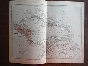
Johnson's Map of West Indies and Central America - Original (1895)
Language: English
Published by A. J. Johnson Company, 1895
Seller: Imperial Books and Collectibles, Wauwatosa, WI, U.S.A.
Seller rating 5 out of 5 stars

No Binding. Condition: Very Good. This rare original hand colored map of the West Indies and Central America is from Volume VIII of the 1895 edition the highly acclaimed Johnson's Universal Cyclopaedia. This map depicts a snapshot of the political landscape of the West Indies and Central America just prior to the Spanish-American War. T. Plate size: - 10" x 12" (25 x 30 cm); Margins: - Min 1/2in (1.2 cm). Condition: Very Good; light soiling along margins. Central fold, as issued.
-

Universal Cyclopaedia and Atlas Map of the West Indies and Central America - Original (1902)
Language: English
Published by D. Appleton and Company, 1902
Seller: Imperial Books and Collectibles, Wauwatosa, WI, U.S.A.
Seller rating 5 out of 5 stars
No Binding. Condition: Fine. This rare original hand colored map of the West Indies and Central America is from Volume XII of the 1902 edition of the acclaimed Universal Cyclopaedia and Atlas Cities, towns, roads, rail lines and geographical features are clearly depicted. . Plate size: - 9" x 12" (23 x 30.5 cm); Margins: - Min 1/2 in (12.7 mm). Fine;light age toning along margin; central fold as issued.
-
Johnson's Map of West Indies and Central America - Original (1897)
Language: English
Published by A. J. Johnson Company, 1897
Seller: Imperial Books and Collectibles, Wauwatosa, WI, U.S.A.
Seller rating 5 out of 5 stars
No Binding. Condition: Fine. This rare original hand colored map of Central America is from Volume 8 of the 1897 edition the highly acclaimed Johnson's Universal Cyclopaedia. This map depicts a snapshot of the political landscape of Central America just prior to the Spanish-American War. The maps published by A. J. Johnson Company are known for their detail, accuracy and vivid hand-coloring. As a result, they are very popular with both map collectors and historians. The size of this map makes it ideal for matting and framing. This extraordinary example of 19th century mapmaking is a work of art and history that makes a perfect conversation piece for home or office. There is a book of knowledge contained in a well-crafted map. Plate size: - 10" x 12" (25 x 30 cm); Margins: - Min 1/2in (1.2 cm). Condition: Fine; light age toning along margins. Central fold, as issued. Some parts of the map go to the edge of the paper.
-
US$ 10.02 30% off
US$ 7.02
US$ 5.85 shipping
Ships within U.S.A.Quantity: 1 available
Add to basketNo Binding. Condition: VG. Sized about 8 x 12 inches, clean and bright. With an inset of Puerto Rico, and the Bermuda Islands. Unrelated map on verso.
-
Condition: Very Good. Map - VG - Map is without defect.
-
West Indies Atlas Plate 23: December, 1962 Compiled & Drawn in the Cartographic Section of the National Geographic Society for the National Geographic Magazine (Map)
Published by National Geographic Society,, 1962
unbound, Condition: Good, National Geographic Magazine, 1962, folded color map, G $.
-
West Indies Printed for the Special Publication Isles of the Caribees Compiled & Drawn in the Cartographic Section of the National Geographic Society for the National Geographic Magazine (Map)
Published by National Geographic Society,, 1968
unbound, Condition: Good, National Geographic Magazine, 1968, folded color map, G $.
-
National Geographic December 1962 Map Supplement Only: West Indies
Published by National Geographic, 1962
Map
No Binding. Condition: Very Good. This map is in very good condition. Complete, bright, colorful, no tears. Tiny hole in corner fold. Separate foldout wall-map issued by the National Geographic Society. This is the Map supplement Only.
-
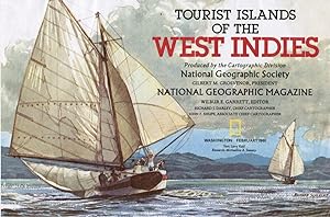
Tourist Islands of the West Indies: Full-Color National Geographic Map - February 1981
Published by National Geographic, 1981
Map
Map. Condition: G. Illustrated by Richard J. Darley, Ohn F. Shupe, Cartographers (illustrator). Fold-out map of the West Indies AND Central America. Tourist Islands of the West Indies on the back.
-
map. Condition: Very Good. Folded double-sided map. We have 75,000 books to choose from -- Ship within 24 hours -- Satisfaction Guaranteed!
-

PAP. Condition: New. New Book. Shipped from UK. Established seller since 2000.
-
National Geographic Map - The Making of America - West Indies - November 1987 (MAP ONLY)
Published by National Geographic Society, 1987
map. Condition: New. Large folded map.
-
No Binding. Condition: Near Fine. Fine condition! Double-sided, folded wall-size poster/map. Ships quickly from NC to the eastern half of the USA. All maps are sealed in plastic, packaged securely, and shipped via USPS First Class Mail with tracking information. (2C.).
-

Condition: good. A former elementary school library book with all the expected stamps, stickers and markings. Some shelf, storage or usage wear present. The binding is tight and all pages are present. The pages appear unmarked. Pictures available upon request. Individually inspected by Scott. Thanks for supporting an independent bookseller!
-
Pamphlet. Condition: Very Good. Map is 9.5 x 13.5 inches, Pastels, Fold in middle, else VG, 9th Ed.
-
Soft cover. Condition: Fine. Bright, tight, clean and flawless. The Atlas Map Supplement: West Indies IS INCLUDED. Contents: Puerto Ricos Seven-League Bootstraps, Cuba-troubled Caribbean Shown on New Atlas Map, A New Look at Medieval Europe, Our Changing Atlantic Coastline, and The Presidents Message to Members. Santa Coke ad on back cover. Discount on multiple purchases. See our homepage for specifics. To see all the National Geographics I have listed, click on Bookstores, type in Outta Shelves, hit enter, then click on Outta Shelves and finally on National Geographic Catalog. SANTA COKE AD, PUERTO RICO, MEDIEVAL EUROPE.
-
Soft cover. Condition: Very Good +. New 10-color Map of the West Indies IS INCLUDED in very good condition. The magazine is bright and tight. Undresea life photos are in excellent condition. Contents: The Greener Fields of Georgia, National Geographic Map Portrays Romantic Strategic West Indies, JamaicaHub of the Caribbean, Shooting Rapids in Dinosaur Country, Night Life in the Gulf Stream, and Lifelike Man Preserved 2,000 Years in Peat. Discount on multiple purchases. See our homepage for specifics. To see all the National Geographics I have listed, click on Bookstores, type in Outta Shelves, hit enter, then click on Outta Shelves and finally on National Geographic Catalog. GEORGIA, JAMAICA.
-

A Summary Account Of The Present Flourishing State Of The Respectable Colony Of Tobago, In The British West Indies. Illustrated With A Map Of The Island, And A Plan Of Its Settlement,
Language: English
Published by Gale Ecco, Print Editions, 2018
ISBN 10: 1379435641 ISBN 13: 9781379435648
Condition: New.
-

A Summary Account of the Present Flourishing State of the Respectable Colony of Tobago, in the British West Indies. Illustrated With a map of the Isla (Hardback or Cased Book)
Language: English
Published by Gale Ecco, Print Editions 4/18/2018, 2018
ISBN 10: 1379435641 ISBN 13: 9781379435648
Hardback or Cased Book. Condition: New. A Summary Account of the Present Flourishing State of the Respectable Colony of Tobago, in the British West Indies. Illustrated With a map of the Isla. Book.
-
Bibliotheca Americana: Being a Choice Collection of Books Relating to North and South America and the West-Indies, Including Voyages to the Southern Hemisphere, Map, Engravings and Medals (Classic Reprint)
Seller: PBShop.store UK, Fairford, GLOS, United Kingdom
Seller rating 5 out of 5 stars
US$ 29.36
US$ 5.49 shipping
Ships from United Kingdom to U.S.A.Quantity: 15 available
Add to basketPAP. Condition: New. New Book. Shipped from UK. Established seller since 2000.
-
West Indies (The Making of America) (map) (Supplement to National Geographic, November, 1987)
Published by National Geographic Society, Washington, D. C., 1987
Map
Unbound. Condition: Fine. No Jacket. A double-sided map of the West Indies and their settlement.
-

National Geographic Map Of West Indies Mar 1954
Published by National Geographic, United States, 1954
Map First Edition
soft. Condition: See Pic.
-

National Geographic Map Of West Indies Mar 1954
Published by National Geographic, United States, 1954
Map First Edition
soft. Condition: See Pic.
-

National Geographic Map Of West Indies And Central America Jan 1970
Published by National Geographic, United States, 1970
Map First Edition
soft. Condition: See Pic.
-

National Geographic Map Of The West Indies Mar 1954
Published by National Geographic, United States, 1954
Map First Edition
soft. Condition: See Pic.


