Order Total (1 Item Items):
Shipping Destination:

World Map by Mitchell Augustus (93 results)
Skip to main search results
Search filters
Product Type
- All Product Types
- Books (88)
- Magazines & Periodicals (No further results match this refinement)
- Comics (No further results match this refinement)
- Sheet Music (No further results match this refinement)
- Art, Prints & Posters (1)
- Photographs (No further results match this refinement)
- Maps (4)
- Manuscripts & Paper Collectibles (No further results match this refinement)
Condition Learn more
Binding
Collectible Attributes
- First Edition (1)
- Signed (No further results match this refinement)
- Dust Jacket (No further results match this refinement)
- Seller-Supplied Images (64)
- Not Print on Demand (49)
Language (2)
Free Shipping
Seller Location
Seller Rating
-

PAP. Condition: New. New Book. Shipped from UK. Established seller since 2000.
-

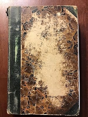
hardcover, Condition: Very Good, S.Augustus Mitchell, Phila. 1844. (c.1843), 8vo. 572pp. + 4pp. of U.S.population by county. 1/2 leather, marbled boards, rubbed & scuffed boards, front cover almost detached, contents foxed, ow VG $.
-
An Accompaniment to Mitchell's Map of the World On Mercator's Projection Classic Reprint
Seller: PBShop.store UK, Fairford, GLOS, United Kingdom
Seller rating 5 out of 5 stars

US$ 36.99
US$ 7.81 shipping
Ships from United Kingdom to U.S.A.Quantity: 15 available
Add to basketPAP. Condition: New. New Book. Shipped from UK. Established seller since 2000.
-

An Accompaniment to Mitchell's Map of the World: On Mercator's Projection; Containing an Index to the Various Countries, Cities, Towns, Islands, &c., ... Five Great Divisions of the Globe, America,
Seller: Ria Christie Collections, Uxbridge, United Kingdom
Seller rating 5 out of 5 stars
US$ 37.11
US$ 15.93 shipping
Ships from United Kingdom to U.S.A.Quantity: Over 20 available
Add to basketCondition: New. In.
-
An Accompaniment to Mitchell's Map of the World, on Mercator's Projection; containing An Index to the Various Countries, Cities, Towns, Islands, etc.
Language: English
Published by S. Augustus Mitchell, PHILADELPHIA, 1845
Hardcover. Condition: Good. Marbled boards with green corners and gilt lettering on green spine. 572 pages. Chips to all extremities and spine ends. Bumps and rubs and soiling to cover. A few pencil notes on blank endpaper. Fold-out map in front has been removed. (Scans available upon request.) Size: 8vo - over 7¾" - 9¾" tall.
-

An Accompaniment to Mitchell's Map of the World: On Mercator's Projection; Containing an Index to the Various Countries, Cities, Towns, Islands, &c., ... Five Great Divisions of the Globe, America,
Seller: Ria Christie Collections, Uxbridge, United Kingdom
Seller rating 5 out of 5 stars
US$ 46.94
US$ 15.93 shipping
Ships from United Kingdom to U.S.A.Quantity: Over 20 available
Add to basketCondition: New. In.
-
The World - Mercator's Projection Map 1870
Language: English
Published by 1870, 1870
Seller: Manning's Books & Prints, ABAA, Pacifica, CA, U.S.A.
Seller rating 3 out of 5 stars

No Binding. Condition: Fine. 25" X 15¼". Mitchell's New General Atlas Hand Colored Map From 1870. Published In Ny. Hand Colored Engraving.
-

Gebunden. Condition: New.
-

An Accompaniment to Mitchell's Map of the World: On Mercator's Projection; Containing an Index to the Various Countries, Cities, Towns, Islands, &c.
Language: English
Published by Creative Media Partners, LLC Jul 2023, 2023
ISBN 10: 1021333735 ISBN 13: 9781021333735
Map
Taschenbuch. Condition: Neu. Neuware - This guide to Mitchell's map of the world offers useful background information and a comprehensive index of the map's features. With detailed descriptions of the countries and regions represented, as well as a discussion of the different geographical regions of the world, this guide is an essential tool for anyone using Mitchell's world map.This work has been selected by scholars as being culturally important, and is part of the knowledge base of civilization as we know it.This work is in the 'public domain in the United States of America, and possibly other nations. Within the United States, you may freely copy and distribute this work, as no entity (individual or corporate) has a copyright on the body of the work.Scholars believe, and we concur, that this work is important enough to be preserved, reproduced, and made generally available to the public. We appreciate your support of the preservation process, and thank you for being an important part of keeping this knowledge alive and relevant.
-
US$ 26.18
Free Shipping
Ships from United Kingdom to U.S.A.Quantity: Over 20 available
Add to basketPaperback. Condition: New. Print on Demand. This book is a comprehensive guide to the geographical and natural features of North America. Focused on presenting an overview of the continent's physical geography, the author discusses mountain ranges, river systems, lakes, plains, and animal life, detailing the geographic location of each and presenting scientific information in accessible language. The book places special emphasis on the unique characteristics of North America's geography and the interplay between the continent's physical features and its development, concluding with the significance of this interplay on the study of geography. This book is a reproduction of an important historical work, digitally reconstructed using state-of-the-art technology to preserve the original format. In rare cases, an imperfection in the original, such as a blemish or missing page, may be replicated in the book. print-on-demand item.
-
Condition: Sehr gut. Zustand: Sehr gut | Seiten: 578 | Sprache: Englisch | Produktart: Bücher | Keine Beschreibung verfügbar.
-

An Accompaniment to Mitchell's Map of the World: On Mercator's Projection; Containing an Index to the Various Countries, Cities, Towns, Islands, &c.
Language: English
Published by Creative Media Partners, LLC Aug 2024, 2024
ISBN 10: 1019636238 ISBN 13: 9781019636237
Map
Buch. Condition: Neu. Neuware - This guide to Mitchell's map of the world offers useful background information and a comprehensive index of the map's features. With detailed descriptions of the countries and regions represented, as well as a discussion of the different geographical regions of the world, this guide is an essential tool for anyone using Mitchell's world map.
-

An Accompaniment to Mitchell's Map of the World
Language: English
Published by Creative Media Partners, LLC Feb 2019, 2019
ISBN 10: 052632922X ISBN 13: 9780526329229
Buch. Condition: Neu. Neuware.
-

Condition: Hervorragend. Zustand: Hervorragend | Seiten: 576 | Sprache: Englisch | Produktart: Bücher | Keine Beschreibung verfügbar.
-
US$ 126.03
US$ 33.25 shipping
Ships from United Kingdom to U.S.A.Quantity: 1 available
Add to basketHardcover. Condition: New. NEW. SHIPS FROM MULTIPLE LOCATIONS. book.
-

Map of the World in Hemispheres.
Published by Philadelphia:, 1870
Seller: Nicholas D. Riccio Rare Books, ABAA, Florham Park, NJ, U.S.A.
Seller rating 4 out of 5 stars

Unbound, colored engraved map, decorative boarder, 14" x 11". Slight toning, darkening and aging, top and bottom margina little narrow, but still ample; otherwise fairly bright and clean and in very good condition. Maps are wrapped with acid free board, or in rigid sleeves.ÃÂ The Mitchell family started to produce atlases in 1846, and continued into the early 1890s. Around 1860, S. Augustus Mitchell Jr. took over, and the atlas would be called Mitchell's New General Atlas. This is an attractive hemispheric map of the world from the 1870 installment of that atlas.ÃÂ Ristow 311-313.
-
Map of the World in Hemispheres.
Published by Philadelphia:, 1869
Seller: Nicholas D. Riccio Rare Books, ABAA, Florham Park, NJ, U.S.A.
Seller rating 4 out of 5 stars
Unbound, colored engraved map, decorative boarder, 14" x 11". Slight toning, darkening and aging, bottom margin narrow, upper margin with a few edge chips, and a little rough; still fairly bright and clean and in very good condition. Maps are wrapped with acid free board, or in rigid sleeves.ÃÂ The Mitchell family started to produce atlases in 1846, and continued into the early 1890s. Around 1860, S. Augustus Mitchell Jr. took over, and the atlas would be called Mitchell's New General Atlas. This is an attractive hemispheric map of the world from the 1869 installment of that atlas.ÃÂ Ristow 311-313.
-
A New Universal Atlas Containing Maps of the various Empires, Kingdoms, States and Republics of the World; With a special Map of each of the United States, plans of Cities, &c. Comprehended in seventy five sheets, and forming a series of One Hundred and Twenty Nine Maps Plans and Sections
Language: English
Published by Cowperthwait, Desilver & Butler, 1855
Seller: Ed's Editions LLC, ABAA, West Columbia, SC, U.S.A.
Seller rating 5 out of 5 stars
Hardcover. Condition: Good. Rebound in green cloth boards. 2 plates are missing, #18 North Carolina and #19 South Carolina. All other plates are included. The following plates have old tape applied to a backside edge (none are attached to the map side), most are simple small strips with none being more than 4 inches in length and most being 1 or 2 inches in length. #6 Eastern side of double sheet map of USA, #10 Connecticut, #20 Georgia, #44 Chili La Playa and Uruguay, #45 and #46 Double sheet map of Europe, #53 Germany, #71 China, #73 Egypt. The applied tape is either unseen or only lightly seen on the map sides. The Georgia map photo can be viewed as an example. Colors are bright and clear. No marks or notations. Folio. Ships insured with signature confirmation to domestic US customers.
-
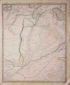
World Map.
Published by Philadelphia, Pa.: Mitchell, S. Augustus., 1860
Seller: Wittenborn Art Books, San Francisco, CA, U.S.A.
Seller rating 5 out of 5 stars
Art / Print / Poster
Condition: Good. Map. Mercator Pro|ectlon. Engraved. Colored. 14 x 18 inches. Marginal tears.
-

Map of the World of the Mercator Projection Exhibiting the American Continent at its Centre.
Published by S. Augustus Mitchell, Philadelphia, 1860
Map
18 x 13 3/4 inches. Condition: Very good condition. Handsomely decorated map that was vividly hand colored at the time of publication in 1860. The map is centered on the United States with Asia on the left and right and Europe and Africa on the right. It would be most attractive framed and hung on the wall.
-
no 1 Map of the World ( Equatorial Projection/ No. 2 Map of the World Polar Projection
Language: English
Published by Mitchell, 1839
No Binding. Condition: Good. 9 X 12.
-
Map of the World
Published by Bradley, Philadelphia, 1882
Seller: Nicholas D. Riccio Rare Books, ABAA, Florham Park, NJ, U.S.A.
Seller rating 4 out of 5 stars
Unbound, colored engraved map, decorative boarder, 22 1/2"x 14 1/2". Some toning and aging, a couple of small chips in margins, no impact on image or boarder; otherwise very good. Maps are wrapped with acid free board, or in rigid sleeves. The Mitchell family started to produce atlases in 1846, and continued into the early 1890s. Around 1860, S. Augustus Mitchell Jr. took over, and the atlas would be called Mitchell's New General Atlas. This is an attractive double page map of the world from the 1882 installment that atlas. Ristow 311-313 Phillips 907.
-
Map of the World
Published by Philadelphia, 1865
Seller: Nicholas D. Riccio Rare Books, ABAA, Florham Park, NJ, U.S.A.
Seller rating 4 out of 5 stars
Unbound, colored engraved map, decorative boarder, 22 1/2"x 14 1/2". Some toning and aging; otherwise very good. Maps are wrapped with acid free board, or in rigid sleeves. The Mitchell family started to produce atlases in 1846, and continued into the early 1890s. Around 1860, S. Augustus Mitchell Jr. took over, and the atlas would be called Mitchell's New General Atlas. This is an attractive double page map of the world from the 1865 installment that atlas. Ristow 311-313 Phillips 907.
-
Map of the World
Published by Philadelphia, 1870
Seller: Nicholas D. Riccio Rare Books, ABAA, Florham Park, NJ, U.S.A.
Seller rating 4 out of 5 stars
Unbound, colored engraved map, decorative boarder, 22 1/2"x 14 1/2". Some toning and aging, a little staining in margins; otherwise very good. Maps are wrapped with acid free board, or in rigid sleeves. The Mitchell family started to produce atlases in 1846, and continued into the early 1890s. Around 1860, S. Augustus Mitchell Jr. took over, and the atlas would be called Mitchell's New General Atlas. This is an attractive double page map of the world from the 1870 installment that atlas. Ristow 311-313 Phillips 907.
-
An Accompaniment to Mitchell's Map of the World: On Mercator's Projection; Containing an Index to the Various Countries, Cities, Towns, Islands, andc.,
Language: English
Published by Creative Media Partners, LLC, 2023
ISBN 10: 1021333735 ISBN 13: 9781021333735
PAP. Condition: New. New Book. Shipped from UK. THIS BOOK IS PRINTED ON DEMAND. Established seller since 2000.
-
An Accompaniment to Mitchell's Map of the World, on Mercator's Projection; Containing an Index to the Various Countries, Cities, Towns, Islands, &c., Represented on the Map Also, a General Description of the Five Great Divisions of the Globe, America, Europe, Africa, Asia, and Oceania, with their Several Empires, States, Territories, &c.
Published by Hinman and Dutton, Philadelphia, 1837
Seller: ROBIN RARE BOOKS at the Midtown Scholar, Harrisburg, PA, U.S.A.
Seller rating 5 out of 5 stars
Hardcover. Condition: Poor. No Jacket. An Accompaniment to Mitchell's Map of the World, on Mercator's Projection; Containing an Index to the Various Countries, Cities, Towns, Islands, &c., Represented on the Map Also, a General Description of the Five Great Divisions of the Globe, America, Europe, Africa, Asia, and Oceania, with their Several Empires, States, Territories, &c. By Samuel Augustus Mitchell and printed in Philadelphia by Hinman and Dutton. 1837. 572 pp. 9" x 5.75". 8vo. Hardcover contemporary 3/4 leather. As-is, with scuffing to boards and loss of marbling. Superficial losses to binding on spine. Cracking to hinges at front and rear. Loss of front end page and frontispiece map. Assorted staining remnants. Light markings. General age-related toning to pages, along with periodic foxing and wear. Please see photographs and ask any questions prior to purchasing. A scarce work meant to accompany Samuel Augustus Mitchell's world map. Includes a consulting index at front of map locations of cities, along with a general introduction to nations of the world, of which the Republic of Texas is included.
-
An Accompaniment To Mitchell's Map of The World
Published by S. Augustus Mitchell, Philadelphia, 1845
Seller: Rooke Books PBFA, Bath, United Kingdom
Association Member: PBFA
Seller rating 5 out of 5 stars
US$ 157.54
US$ 26.59 shipping
Ships from United Kingdom to U.S.A.Quantity: 1 available
Add to basketCloth. Condition: Near Fine. None (illustrator). A companion volume to Mitchell's 'Map of The World'. This volume has a wealth of information on varying countries, from individual states of the United States to continents. Written by Samuel Augustus Mitchell, an American geographer. He published many geography textbooks and maps. This work is the companion textbook to his previously published map of the world. Lacking the map. In a quarter cloth binding with paper covered boards. Externally, excellent with minor shelfwear to the head and tail of spine. Internally, firmly bound. Pages are bright with spots to the first and last few pages. Near Fine. book.
-
Map of the World
Published by Philadelphia, 1861
Seller: Nicholas D. Riccio Rare Books, ABAA, Florham Park, NJ, U.S.A.
Seller rating 4 out of 5 stars
Unbound, colored engraved map, decorative boarder, 22 1/2"x 14 1/2". Some toning and aging; otherwise very good. Maps are wrapped with acid free board, or in rigid sleeves. The Mitchell family started to produce atlases in 1846, and continued into the early 1890s. Around 1860, S. Augustus Mitchell Jr. took over, and the atlas would be called Mitchell's New General Atlas. This is an attractive double page map of the world from the 1861 installment that atlas. Ristow 311-313 Phillips 907.
-
An Accompaniment to Mitchell's Map of the World: On Mercator's Projection; Containing an Index to the Various Countries, Cities, Towns, Islands, andc.,
Language: English
Published by Creative Media Partners, LLC, 2023
ISBN 10: 1021333735 ISBN 13: 9781021333735
Seller: PBShop.store UK, Fairford, GLOS, United Kingdom
Seller rating 5 out of 5 stars
US$ 37.25
US$ 7.81 shipping
Ships from United Kingdom to U.S.A.Quantity: Over 20 available
Add to basketPAP. Condition: New. New Book. Delivered from our UK warehouse in 4 to 14 business days. THIS BOOK IS PRINTED ON DEMAND. Established seller since 2000.
-

An Accompaniment to Mitchell's Map of the World, on Mercator's Projection Containing an Index to the Various Countries, Cities, Towns, Etc.
Published by R. L. Barnes, Philadelphia, PA, 1841
Three-Quarter Leather. Condition: Good. Dust Jacket Condition: No Dust Jacket. Good three quarter leather edition, no names or marks. There is foxing throughout the text. Leather and marbled boards are rubbed and scuffed. Binding is tight and sound. ; 572 pages.