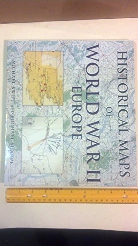
Historical Maps of World War II : Europe
Swift, Michael, Sharpe, Mike
From
Better World Books, Mishawaka, IN, U.S.A.
Seller rating 5 out of 5 stars
![]()
AbeBooks Seller since August 3, 2006
About this Item
Description:
Used book that is in excellent condition. May show signs of wear or have minor defects. Seller Inventory # GRP66117294
Synopsis:
Historical Maps of World War II: Europe does not try to retell every point in the story of the war in Europe, rather it seeks to provide - through contemporary or near contemporary documents - a different view of the war and suggest avenues for further research.
Bibliographic Details
Title: Historical Maps of World War II : Europe
Publisher: PRC Publishing
Publication Date: 2000
Binding: Hardcover
Condition: Very Good
Edition: First Edition.
Top Search Results from the AbeBooks Marketplace
Historical Maps of World War II : Europe
Seller: Better World Books Ltd, Dunfermline, United Kingdom
Condition: Good. First Edition. Ships from the UK. Used book that is in clean, average condition without any missing pages. Seller Inventory # 5349809-6
Quantity: 1 available
Historical Maps of World War II : Europe
Seller: Better World Books, Mishawaka, IN, U.S.A.
Condition: Good. First Edition. Used book that is in clean, average condition without any missing pages. Seller Inventory # 5349809-6
Quantity: 4 available
Historical Maps of World War II Europe
Seller: Rodney Rogers, Shrewsbury, United Kingdom
Hardcover. Condition: Near Fine. Dust Jacket Condition: Near Fine. First edition. Laminated pictorial hardcover, in similar dust-jacket. 290 x 253 x 18mm. 144pp. Intro. of 20pp or so, followed by map section, with coloured maps on every page; with index. A little very light edgewear to jacket; apart from a slight lean to spine, book appears as new both inside and out. NB: An extra shipping charge may be requested for heavier or more valuable items. All our 'Seller Images' show the actual item you will receive. Seller Inventory # 005941
Quantity: 1 available
Historical Maps of World War II Europe
Seller: Enterprise Books, Chicago, IL, U.S.A.
Long Hardcover, illus. Condition: As New. Dust Jacket Condition: As New. First British Edition; First Printing. Book and DJ As New. NO defecys. NO notes or ANY markings. DJ not clipped. ; Oblong Small 4to tall; 144 pages. Seller Inventory # 68590
Quantity: 1 available
Historical Maps of World War II Europe
Seller: Buybyebooks, Honiton, United Kingdom
Laminated Board. Condition: Virtually as New. Dust Jacket Condition: Virtually as New. Public Records Office (illustrator). 1st Edition. Colour plastic laminated board covers as new excepting knock to spine middle with colour d/w slight shelf wear, two scrape marks to spine. 144 numbered pages with huge number of colour WW2 maps, fascinating. Binding as new. Size 28.7 x 15.2 cm. Seller Inventory # 008830
Quantity: 1 available
Historical Maps of World War II, Europe
Seller: Michael Patrick McCarty, Bookseller, New Castle, CO, U.S.A.
Hard cover. Condition: As New. Dust Jacket Condition: Fine. First edition. Seller Inventory # SKU2010023046
Quantity: 1 available
Historical Maps of World War II Europe
Seller: Brillig's Books, Kingston, NY, U.S.A.
Hardcover. Condition: Very Good. Dust Jacket Condition: Good (mylar). 1st Edition. 144 pps. Titles: frt. & sp. Illust. w/ colour & b/w maps (listed). Glossy pictorial bds. Interior leaves are clean and tight. Includes narrative text and index of maps. Examples of naval and land maps of Allied and Axis operations in Europe during World War II. A clean copy. Seller Inventory # 008641
Quantity: 1 available
Historical Maps of World War II Europe
Seller: Granada Bookstore, IOBA, Woodlawn, IL, U.S.A.
Hardcover. Condition: Fine. Dust Jacket Condition: Fine. 1st Edition. First Edition (Statement Of First Published With The Year). Includes Index Of Maps. Illustrated With Color Maps. Pictorial Hardcover With Matching Jacket. Seller Inventory # 034794
Quantity: 1 available
Historical Maps of World War II Europe
Seller: Books by White/Walnut Valley Books, Winfield, KS, U.S.A.
Hardcover. Condition: Fine. Dust Jacket Condition: Fine. 1st Edition. PRC Publishing, London, UK. 2000. Hardcover. Stated First Published in 2000. Book is tight, square, and unmarked. Book Condition; Fine. DJ: Fine. Pictorial laminated boards and spine with black lettering on the spine and front board; DJ matching illustrations on boards. 144 pp 4to. This book does not try to retell every point in the story of the war in Europe, rather, it seeks to provide a different view of the war and suggest avenues for further research. In over a hundred maps, it looks at both the broad sweep of events and at details to provide a fascinating sample of how events during the war were mapped out. A clean very presentable copy. Seller Inventory # 016484
Quantity: 1 available
Historical maps of World War II, Europe / Michael Swift and Michael Sharpe
Seller: MW Books Ltd., Galway, Ireland
1st Edition. Near fine cloth copy in a near-fine, very slightly edge-nicked and dust-dulled dust wrapper, now mylar-sleeved. Remains particularly well-preserved overall; tight, bright, clean and strong. Physical description: 1 atlas (144 pages): illustrations, chiefly colour maps; 25 x 29 cm. Notes: "All the maps illustrated in this book have been drawn from the large collection held by the Public Record Office (PRO) at Kew in west London"--Page 21. Subjects: Great Britain Public Record Office. World War, 1939-1945 Campaigns Europe; Maps. World War, 1939-1945 Cartography. Europe History, Military 20th century; Maps. Second World War, 1939-1945. 1 Kg. Seller Inventory # 338671
Quantity: 1 available

