About this Item
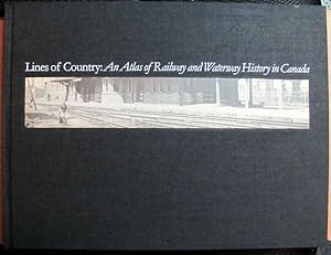
Size: Folio. Text body is clean, and free from previous owner annotation, underlining and highlighting. Binding is tight, covers and spine fully intact but boards sprung/bowed. Black cloth over boards with black-and-white photographic paste down on front cover, 12 1/2" x 16 1/2", 238 oversize pages (ix, [1], 228 pages), thirty-nine full-page color maps, 560 archival and contemporary photographs, maps and drawings, Abbreviations, Bibliography, Index of Railways and Train Ferries, Index of Canals, Index of Portage Railways, Index to the Text. Covers lightly scuffed, but the principal defect of this volume is that the boards are bowed/sprung, most likely from improper storage (not moisture). Includes the original advertising sleeve attached to the back cover. "Over twenty years in the making, this book will prove to be a vital reference for many decades to come. This is, first of all, an atlas of Canada's railway lines and commercial waterways. This reference work, packed with dates, names, and technical information, to help, among others, historians, geographers, and transportation planners. Second, this volume provides a brief account of how railways and waterways have changed the landscape of Canada." This is a large, heavy book which will require extra shipping charges. Illustrator: Matthews, Geoffrey [Cartography]. Quantity Available: 1. Shipped Weight: 8 lbs 0 oz. Category: Railways; Geography & Maps. ISBN: 1550461338. ISBN/EAN: 9781550461336. Pictures of this item not already displayed here available upon request. Inventory No: 011002.
Seller Inventory # 011002
Contact seller
Report this item


