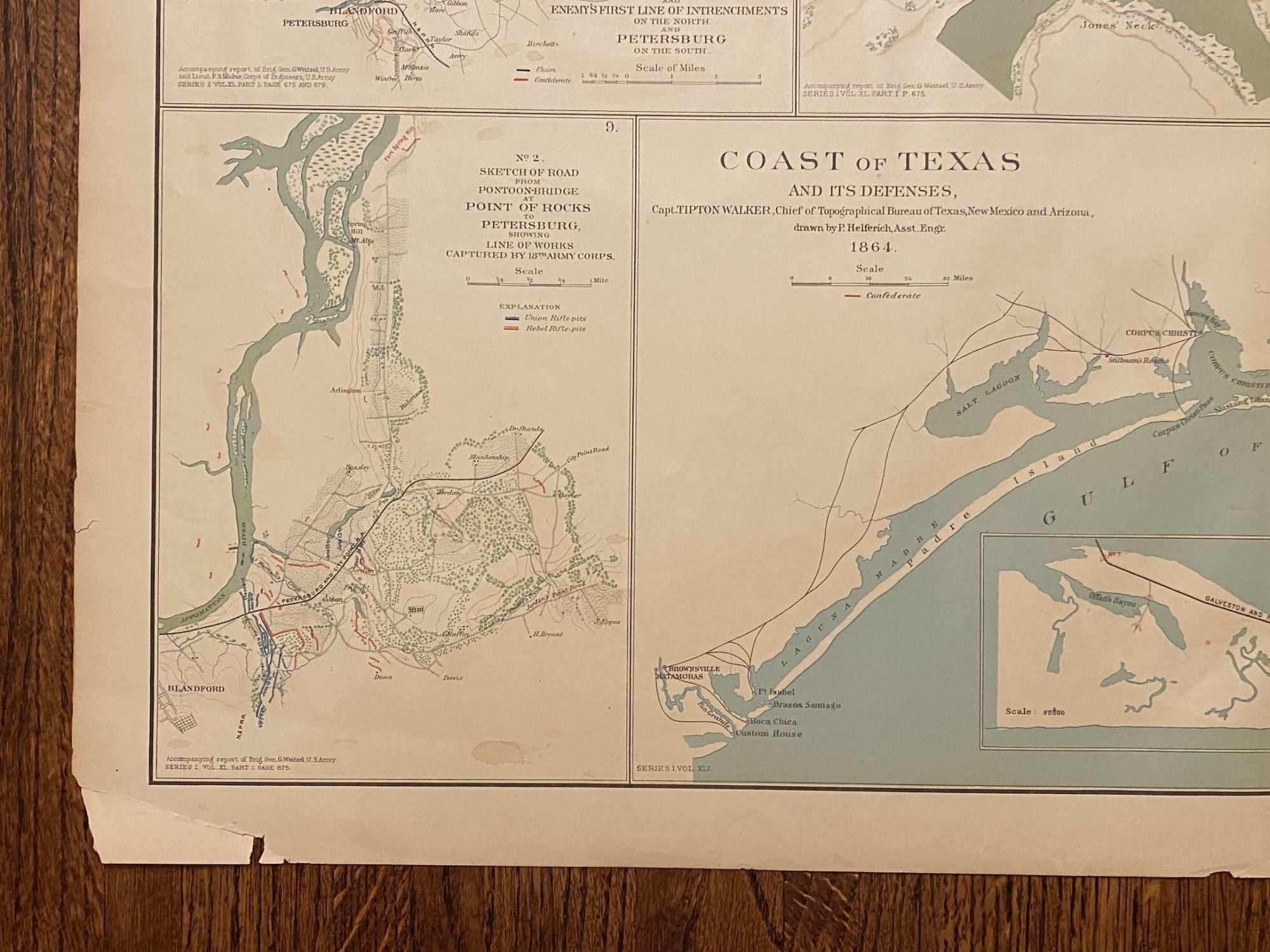
About this Item
Original lithograph: folio map (image size: 29" x 18") unframed. Edges with some chipping or loss in the margins (SEE IMAGES), tear along fold at top edge extending ca. 4.5"). An informative map of the Coast of Texas which itself contains ten maps, the largest of which covers the coast of Texas from the mouth of the Rio Grande to Orange, the easternmost city in the state. In the largest maps there is an inset in the upper right corner, showing minor details for 14 individual forts (these are numbered on the main chart). This is Plate LXV extracted from "Atlas to Accompany the Official Records of the Union and Confederate Armies 1861-1865" (Washington: GPO, 1890) lithographed by Julius Bien. Metadata from David Rumsey: "Coast of Texas and its defenses, Capt. Tipton Walker, Chief of Topographical Bureau of Texas, New Mexico and Arizona, drawn by P. Helferich, Asst. Engr. 1864. (with) Engineer Office, 10th Army Corps, sketch no. 8 of road between Bermuda Hundred and enemy's first line of intrenchments on the north and Petersburg on the south. T.B. Brooks, Maj. A.D.C. and Directing Engineer. (with Marietta, Ga., June 10-July 3, 1864). Original marked "Thomas and Schofield." (with Marietta, Ga., June 10-July 3, 1864). Original marked "Garrard." (with) Schofield crossing the Chattahoochee. (with Marietta, Ga., June 10-July 3, 1864). (with) No. 3. Sketch of defensive works at Deep Bottom, Va. (with) Section through Dutch Gap, James River, Va. (with) Plan of Dutch Gap Canal and fortifications, James River, Va., Sept. 10, 1864. P.S. Michie. (with) No. 2. Sketch of road from pontoon-bridge at Point of Rocks to Petersburg, showing line of works captured by 18th Army Corps. Julius Bien & Co., Lith., N.Y. (1891-1895).". Seller Inventory # 4023
Contact seller
Report this item