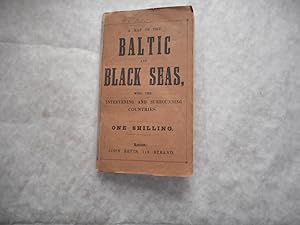
A Map of the Baltic and Black Seas, with the Intervening and Surrounding Countries
Betts John
From Sue Lloyd-Davies Books, CARMARTHEN, United Kingdom
Seller rating 5 out of 5 stars
AbeBooks Seller since May 6, 1999
From Sue Lloyd-Davies Books, CARMARTHEN, United Kingdom
Seller rating 5 out of 5 stars
AbeBooks Seller since May 6, 1999
About this Item
Dull-pink paper wraps printed black. Covers split at the spine and has a strip of modern clear tape securing it. Rear cover stained and scruffy edged. The Map is loose in the covers, but meant to fold into the black printed paper wrappers, with title and price of One Shilling. Large fold out map (50. 5 cm x 38 cm) c. 20" x 15" including the blank borders - some hand colouring and 2 'insets' - St. Petersburg and Cronstadt, - and Sevastopol. The map has some light staining, mainly to the edges, and tiny repaired and reinforced folds / splits (to the reverse of the map with clear archive tape) with NO loss. NO date but the covers are pasted onto paper with 2 Publishers adverts on the reverse of the front cover = One is a different Map of The Black Sea, but the second advert is for " Recently published, price Ninepence 'The Despatches of Captain McClure.' With a Map, shewing the North-West Passage and other discoveries in the Arctic Regions". This would indicate that the date is c. 1855, as the McClure Arctic Expedition of 1850, was among numerous British search efforts to determine the fate of the Franklin's lost expedition, and is distinguished as the voyage during which Robert McClure became the first person to confirm and transit the Northwest Passage by a combination of sea travel and sledging. McClure and his crew spent three years locked in the pack ice aboard HMS Investigator before abandoning it, and making their escape across the ice. Rescued by HMS Resolute, McClure returned to England in 1854, where he was knighted and rewarded for completing the passage." . So 1855 seems to be about right. See Images. ; 12mo 7" - 7½" tall. Seller Inventory # 114447
Bibliographic Details
Title: A Map of the Baltic and Black Seas, with the...
Publisher: John Betts, London
Publication Date: 1855
Binding: Paperback
Condition: Good
Dust Jacket Condition: No Dust Jacket
Edition: Unknown (Possibly 1st Thus?).
Store Description
TERMS
Payment: Please pay to - Sue Lloyd-Davies, 94 St Catherine Street, Carmarthen, SA31 1RF. +44(0)1267 235462. email: books46@sky.com
The cost of books are given in £ sterling. Payments to me DIRECTLY may be by CREDIT CARD via PAYPAL (you do NOT have to have a Paypal account to pay by Credit Card) ; By Paypal (Official PP Invoice sent on request): Personal Cheque (STERLING ONLY) or Bank Transfer (UK ONLY), Wire Transfer via WISE.com (International) or Cash (STERLING only). I am unable to take...
Orders usually ship within 2 business days. Shipping costs are based on books weighing 2.2 LB, or 1 KG. If your book order is heavy or oversized, we may contact you to let you know extra shipping is required.
All items posted by Airmail Internationally or by Standard (Second Class) Post in the UK unless requested otherwise. We will post abroad by whatever method you request but the standard is by Airmail. Other methods may require an Extra charge.
Proof of posting certificates are obtained for all books posted. Postal delivery times are ESTIMATES not Guarantees!. Most Parcels are Tracked.
We provide PROOF OF POSTING, NOT PROOF of DELIVERY.
All postings are insured.
We normally post every other day, although we can provide a speedier service for an extra cost.
If unhappy with a purchase, a full refund will be given if returned within 14 days, in the same condition that it left us.
Payment Methods
accepted by seller