About this Item
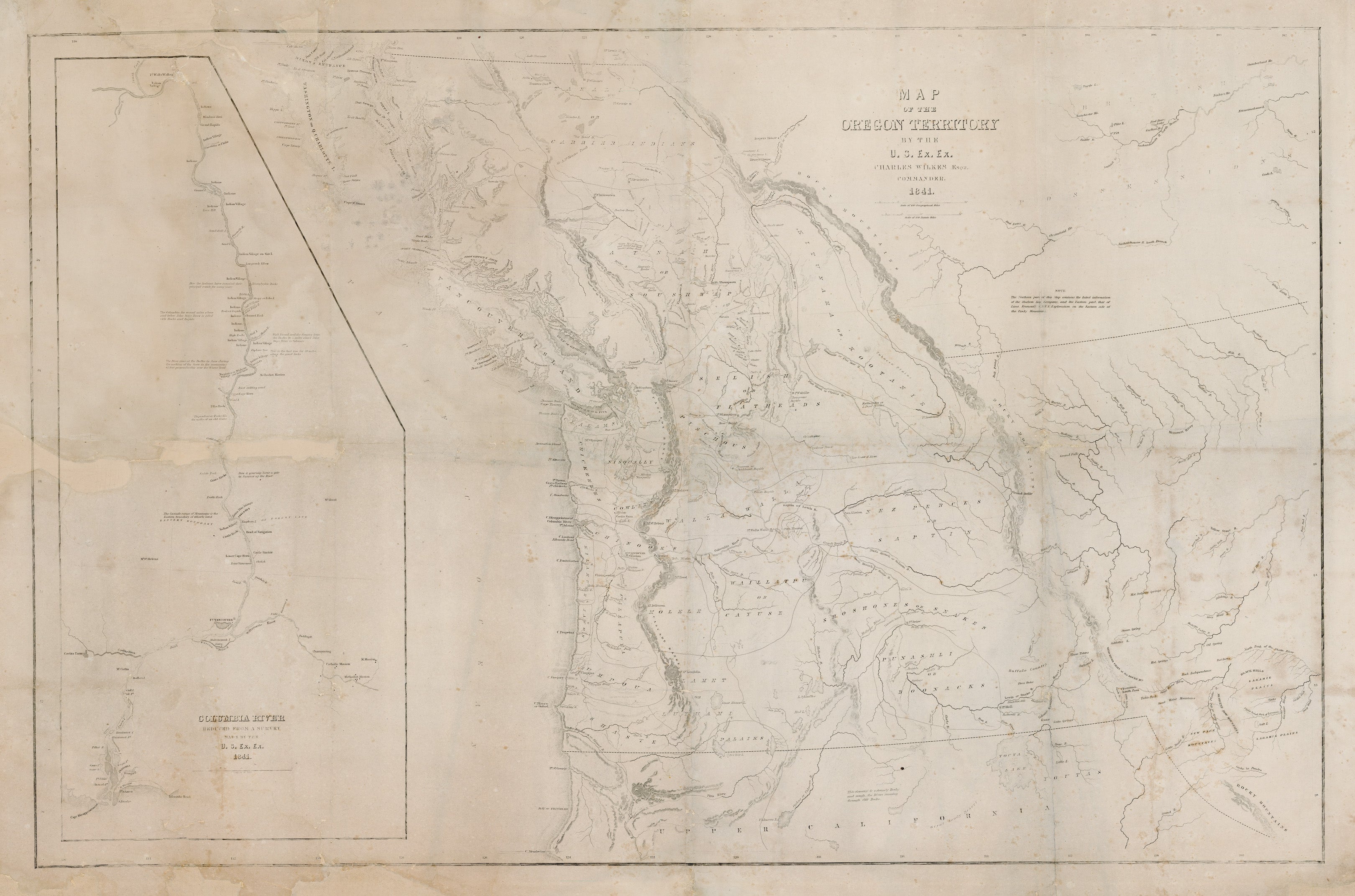
By: Charles WilkesDate:1841 (dated) Proof PrintingDimensions: 23 x 35 inches (58.5 x 89 cm)This is a rare proof state example of the wildly important map of the Oregon Territory by Commander Charles Wilkes Esq. While the map presents much of the same cartographic information of the more common 1844 example, it lacks a lot of the "space filler" details such vast forests and meadows or grasslands the abound in the 1844 map.Another example of this map in proof state can be found on DavidRumsey.comThis map of the Oregon Territory, created by Charles Wilkes in 1841 during the U.S. Exploring Expedition (U.S. Ex. Ex.), is a landmark in early American cartography of the Pacific Northwest. The map was one of the first comprehensive American surveys of this region, detailing the Columbia River and the surrounding areas with a remarkable level of precision for its time. It was published as part of Wilkes broader efforts to document the largely uncharted territories of the Pacific Coast, including what is now Washington, Oregon, and northern California.Stretching from British Columbia to California, the map provides a detailed view of the land extending from the Pacific Coast inland to the Rocky Mountains. The geographic details are extensive, including topographical features such as mountains, rivers, and coastlines, and the presence of forts and Native American settlements. A notable inset focuses on the Columbia River, from Fort Walla Walla to the river s mouth at Cape Disappointment, marking critical navigational points. This map represented a significant advance in the understanding of the region and was a crucial tool during a time when the U.S. was asserting its territorial ambitions.Significance of the Wilkes Map of the Oregon TerritoryThe Oregon Territory was a region of intense international interest, particularly during the early 19th century. Both the United States and Great Britain laid claim to large portions of the territory, leading to disputes over its rightful ownership. Wilkes map was essential in this context because it provided an American perspective, using detailed surveys and explorations to map the region, which bolstered U.S. territorial claims. The accuracy and depth of detail in the map helped solidify U.S. assertions of sovereignty over much of the territory. By including Indigenous place names alongside European names, the map reflected the complex cultural and political landscape of the region before widespread American settlement.Wilkes map was not only used by the government and military but also circulated among settlers and explorers heading west, as it provided one of the clearest navigational aids available at the time. It was instrumental during the period of westward expansion when the U.S. was keen to explore, settle, and eventually integrate the Oregon Territory into the union.The 54-40 or Fight ControversyOne of the most significant aspects of Wilkes map is its connection to the "54-40 or Fight" controversy. This slogan, popularized during the 1844 U.S. presidential election, referred to the northern boundary of the Oregon Territory at latitude 54�40? the southernmost boundary of Russian Alaska. Many expansionist politicians, such as Senator Lewis Linn and President James K. Polk, argued that the United States should claim the territory up to this latitude, which would include all of present-day British Columbia. Wilkes supported this view in his surveys, though his map did not extend far enough north to fully depict this boundary.The dispute over the Oregon boundary became one of the central issues in U.S. foreign policy in the 1840s. The Treaty of 1818 had established joint occupation of the territory by Britain and the U.S., but as more American settlers began to arrive via the Oregon Trail, the issue of ownership became increasingly contentious. Although the "54-40 or Fight" slogan called for aggressive expansion, the eventual resolution in 1846 set the boundary at the 49th parallel, avoidin.
Seller Inventory # 12883
Contact seller
Report this item