
Antique Map ENGLAND & WALES with Part of Scotland, J.Pigot, Hand Coloured c1830
Used
From
Lindisfarne Prints, Shrewsbury, SHROP, United Kingdom
Seller rating 5 out of 5 stars
![]()
AbeBooks Seller since August 29, 2017
This book is no longer available. AbeBooks has millions of books. Please enter search terms below to find similar copies.
About this Item
Description:
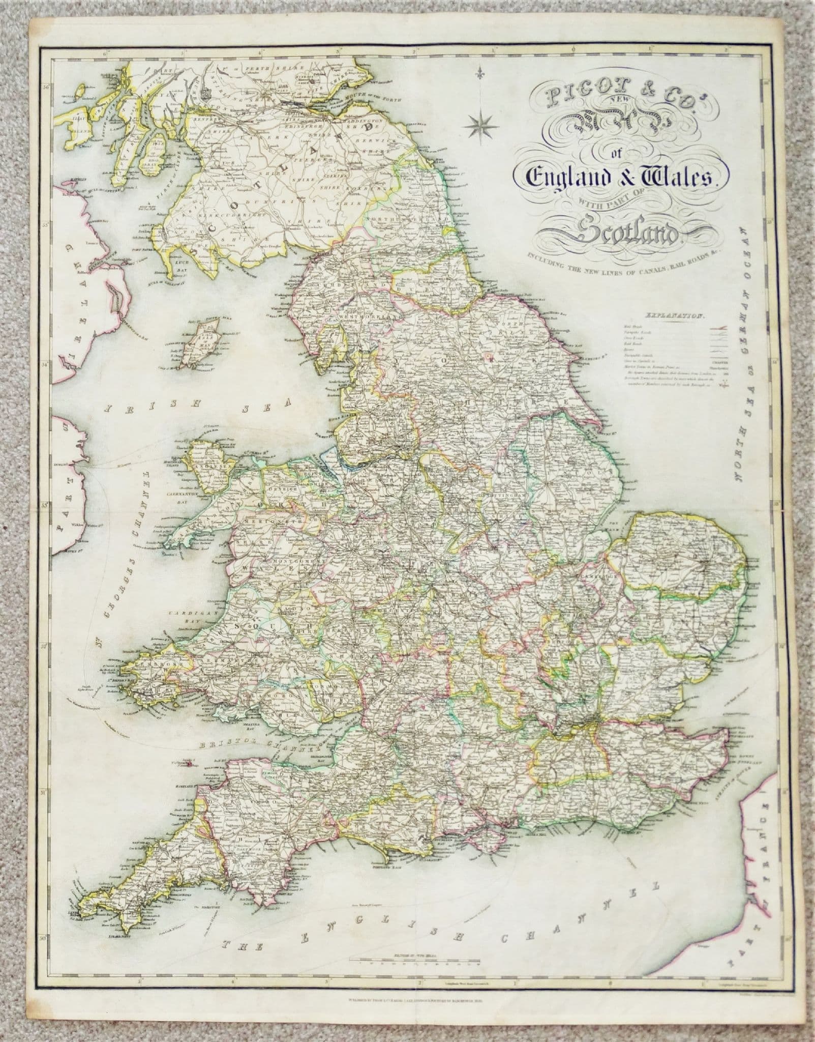
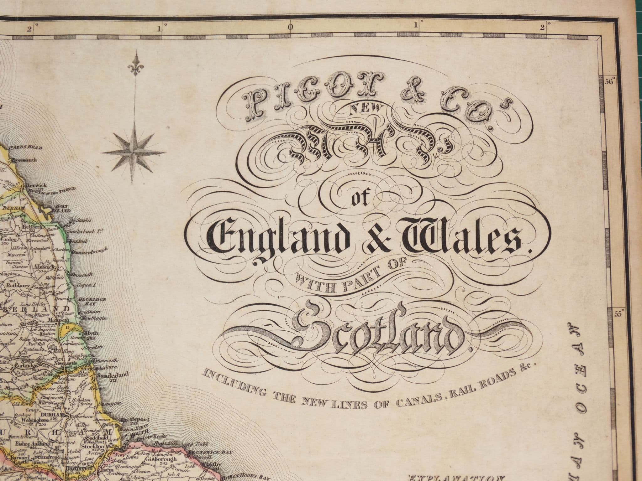
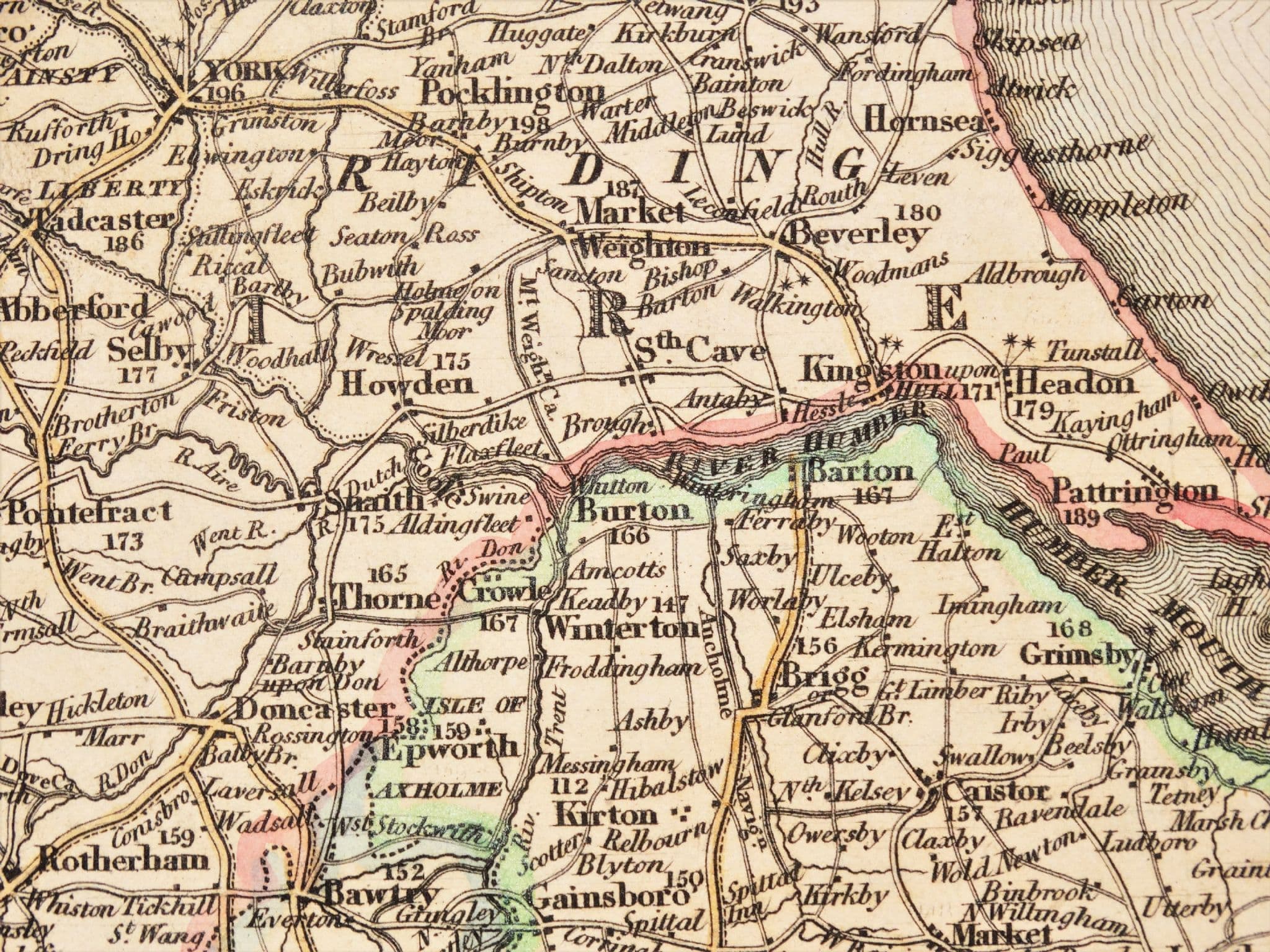
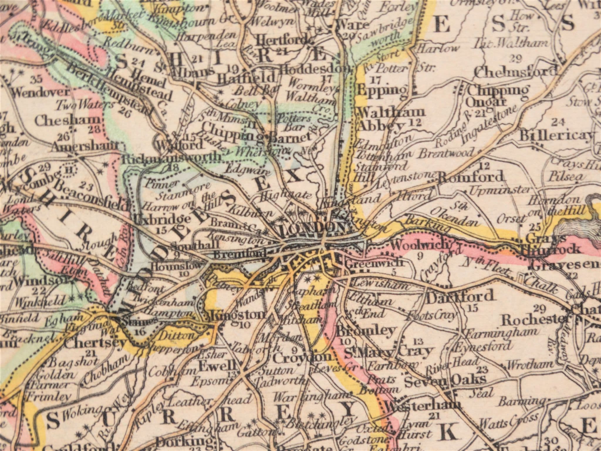
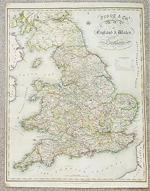
Antique Map�Pigot & Co's New Map ofENGLAND & WALES with Part of Scotland,Including the New Lines of Canals, Rail Roads & c.by James PigotPublished London & Manchester circa 1830 by Pigot & Co. in their "British Atlas of the Counties of England"An original 19th century steel engraved antique linen backed map of England and Wales with southern Scotland. An attractive and good sized map with original hand colouring and a wealth of detail which can be appreciated from the close up images provided.Fine condition other than some very minor wear to the intersection of fold lines and some light overall soiling. Free of repairs or restoration, linen backed with fold lines as issued i.e.one vertical and one horizontal fold.Approx. 28" x 21" (710mm x 530mm) overall as shown. D921. Seller Inventory # 22543
Bibliographic Details
Title: Antique Map ENGLAND & WALES with Part of ...
AbeBooks offers millions of new, used, rare and out-of-print books, as well as cheap textbooks from thousands of booksellers around the world. Shopping on AbeBooks is easy, safe and 100% secure - search for your book, purchase a copy via our secure checkout and the bookseller ships it straight to you.
Search thousands of booksellers selling millions of new & used books
New & Used Books

New and used copies of new releases, best sellers and award winners. Save money with our huge selection.
Rare & Out of Print Books

From scarce first editions to sought-after signatures, find an array of rare, valuable and highly collectible books.
