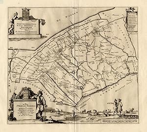
Antique Map-FERWERDERADEEL-NETHERLANDS-Halma-1718
Sold by ThePrintsCollector, Zeeland, Netherlands
AbeBooks Seller since April 3, 2017
Used
Ships from Netherlands to U.S.A.
Quantity: 1 available
Add to basketSold by ThePrintsCollector, Zeeland, Netherlands
AbeBooks Seller since April 3, 2017
Quantity: 1 available
Add to basketMap: Ferwerdera Deel, de tweede Grietenije van Ooster Goo- This regional map of the Ferwerderadeel, part of the Province of Friesland, The Netherlands shows the situation around 1718. Grietenijen later turned into the present day towns. On this detailed map you will find: Nyekerk, Marrum, Hallum, Blye, Wanswerd and much more detailed information. With the coat of arms of the Heringa Grovestins family. Copperplate engraving on verge type hand laid paper with watermark. Description: This detailed original antique map originates from: 'Uitbeelding der Heerlijkheit Friesland '', by B. Schotanus a Sterringa and published by F. Halma in 1718. This Atlas is considered the best atlas of Friesland, the Netherlands.Artists and Engravers: The author is Bernardus Schotanus a Sterringa (1640-1704). The publisher is Francois Halma (1653-1722). Some of the Grietenije kaarten in this work are signed by Jan and Gaspar Luyken / Luiken as the engravers. Condition: Fine. General age related toning and occasional light staining from handling as visible on image. Storage location: B21-15 The overall size is ca. 25.6 x 21.7 inch. The image size is ca. 18.7 x 16.5 inch. The overall size is ca. 65 x 55 cm. The image size is ca. 47.5 x 42 cm.
Seller Inventory # 11409
| Order quantity | 6 to 16 business days | 6 to 16 business days |
|---|---|---|
| First item | US$ 21.01 | US$ 21.01 |
Delivery times are set by sellers and vary by carrier and location. Orders passing through Customs may face delays and buyers are responsible for any associated duties or fees. Sellers may contact you regarding additional charges to cover any increased costs to ship your items.