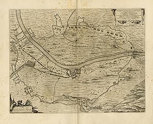
Antique Map-Siege of Gennep by Frederik Hendrik of Orange-80 years War-1649
Sold by ThePrintsCollector, Zeeland, Netherlands
AbeBooks Seller since April 3, 2017
Used
Condition: Used - Very good
Quantity: 1 available
Add to basketSold by ThePrintsCollector, Zeeland, Netherlands
AbeBooks Seller since April 3, 2017
Condition: Used - Very good
Quantity: 1 available
Add to basketAntique Map, titled: 'Arcis Gennepensis [.].' - Map of the siege of Gennep by Frederik Hendrik of Orange during the Eighty-years War. Map of the siege of Gennep by Frederik Hendrik of Orange during the Eighty-years War. Gennep. Published by Joan Blaeu (1596-1673). From the famous city Atlas: 'Toneel der Steeden'. Latin tekst verso. Engraving on laid paper. Watermark: Monogram PH Very good, given age. Large margins, with the central fold as published. General age-related toning and/or occasional minor defects from handling. Please study scan carefully. The overall size is ca. 62.5 x 52.2 cm. The image size is ca. 52 x 40.2 cm. The overall size is ca. 24.6 x 20.6 inch. The image size is ca. 20.5 x 15.8 inch. Storage location: B65-28.
Seller Inventory # 74438