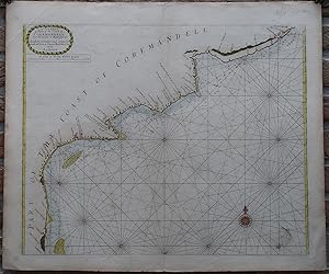
Antique Print-SEA CHART-INDIA-COROMANDEL-ARMAGAON-PETEPOLY-Thronton-1750
Sold by ThePrintsCollector, Zeeland, Netherlands
AbeBooks Seller since April 3, 2017
Used
Condition: Used - Good
Quantity: 1 available
Add to basketSold by ThePrintsCollector, Zeeland, Netherlands
AbeBooks Seller since April 3, 2017
Condition: Used - Good
Quantity: 1 available
Add to basketAntique print, titled: 'A New Chart of Part of the Coast of Coremandell from Armegon to Bimlepatam.' - A map/chart of the Eastern coast of India. Places included are Armegon (Armagaon, the second colony of the East India Company), Petepoly, Bimlepatnam (Bheemunipatam) and Nassipore (Narasapuram). Colonies have their nationality (English or Dutch) indicated with little flags. Description: From an edition of Mount & Page's 'The English Pilot', London: ca. 1750. This state mentions it is corrected and compared with the French chart of 1745.Artists and Engravers: Made by an anonymous engraver after 'Samuel Thornton'. Samuel Thornton (d.1715) was the son the English mapmaker John Thornton, an eminent English mapmaker of the late seventeenth and early eighteenth century. After his father's death in 1708, Samuel Thornton continued to re-issue his father s map (often with his imprint substituted). Engraving with handcolouring on hand laid paper. Anonymous. Good, given age. Original middle fold, as issued. Some offsetting, the margins a little soiled. General age-related toning and/or occasional minor defects from handling. Please study scan carefully. The overall size is ca. 36 x 25.5 cm. The image size is ca. 24.5 x 22 cm. The overall size is ca. 14.2 x 10 inch. The image size is ca. 9.6 x 8.7 inch. Storage location: Overasselt-303.
Seller Inventory # 63716