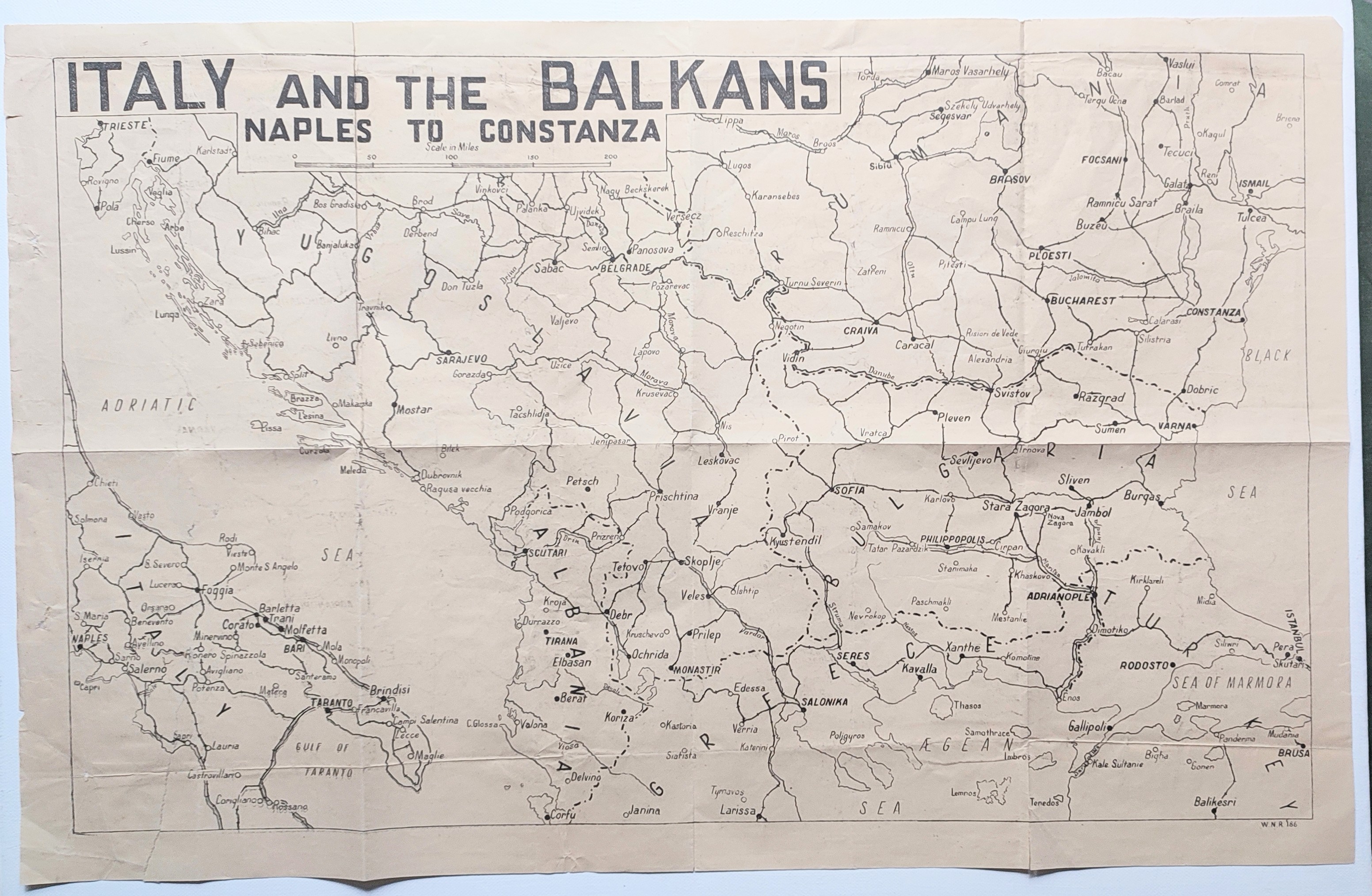
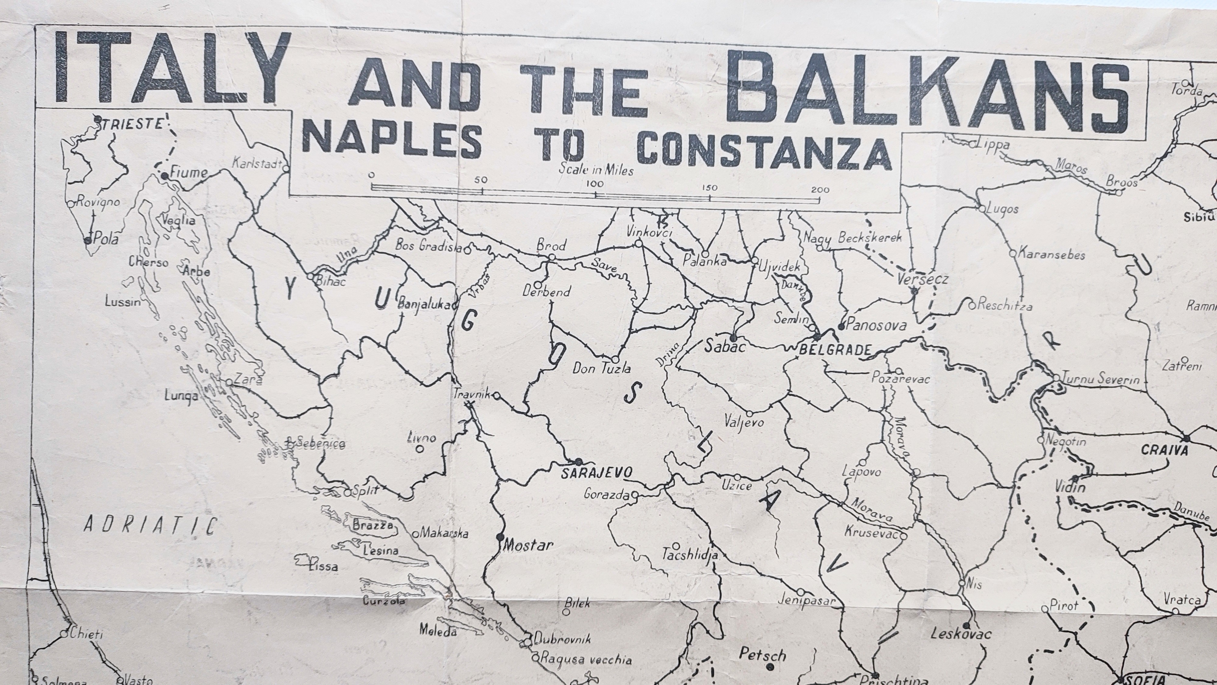
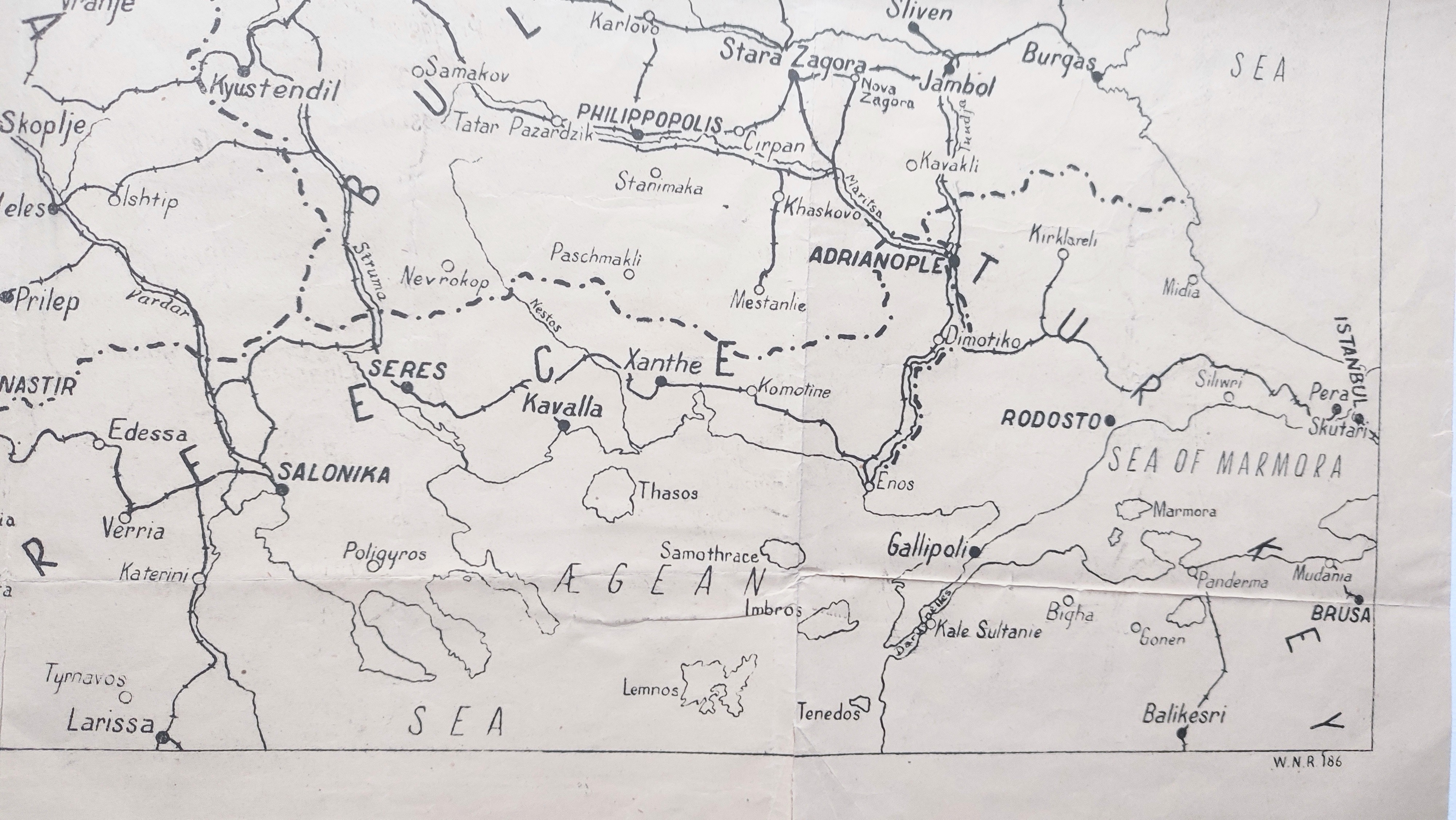
About this Item
Rare British Indian b/w propaganda map 68x44cm, printed on economy paper. Good only, folded with creasing and closed tears, some small perforations, and tape repairs to verso. "WNR" identifies this as part of a series of maps produced to accompany the World News Report issued by the Director of War Publicity, National War Front. Undated, c1942. Centred on Yugoslavia, it covers the area bounded by Trieste (NW), the Black Sea coast (E), Brusa (SE), and Naples (SW) on a scale of @1 inch to 30 miles. Features include international boundaries, major settlements and connecting routes including railways. This poster supported the British Indian Government's comprehensive propaganda operation to keep the population onside. With India providing over 2 million troops and several million others to the war effort at home, it tied the war to the fate of India, praised Indian contributions, and countered Axis propaganda. It began in 1940 with Provincial and District War Committees coordinated from Calcutta, and continued with the National War Front (NWF) from 1942, under the Director of War Publicity at Victory House in Madras. The NWF operated through Directors at Presidency level supported by District and Divisional organisers, and an array of lecturers, propagandists, village leaders, and inspectors reaching deep into the grassroots. In support, Victory House published the weekly "Madras War Review", and served as a Central Information Bureau with a Showroom displaying its models for railway cars, charts, maps, posters, and other material, which were replicated in local NWF "Victory Houses" across India. Very few of these materials survive. This one is not recorded on Worldcat or Library Hub. (References: Tamil Digital Library; P. Priya, "Popular Distress and the Second World War: Malabar, 1939-45, Proceedings of the Indian History Congress, Vol. 74 (2013), pp. 602-610).
Seller Inventory # 5813
Contact seller
Report this item