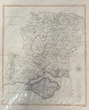
Cary's New English Atlas - Of Map Hampshire
CARY, John
Sold by YattonBookShop PBFA, Bristol, United Kingdom
Association Member:
AbeBooks Seller since October 21, 2002
Used
Condition: Used - Very good
Quantity: 1 available
Add to basketSold by YattonBookShop PBFA, Bristol, United Kingdom
Association Member:
AbeBooks Seller since October 21, 2002
Condition: Used - Very good
Quantity: 1 available
Add to basketCounty map from actual surveys, 1806. South Wales map only. Map with orig. hand col. Occ repaired closed tears to margins. Occ staining. map approx 550mm x 500mm. Additional photos are available upon request. When securely packed this item will weigh in the region of 500g. Unless specifically mentioned, all our books are photographed so you can see what you are buying. ABE may, however, display a stock image whilst processing ours. (YBP Ref: 033574:1-L1) Size: Elephant Folio - over 15" - 23" tall Language: ENG 500 G.
Seller Inventory # 033574
Every effort is made to accurately describe books. All books are checked before despatch. Photos available on request - questions always welcome.
Yatton Books & Prints, a wholly owned subsidiary of Ambulavi Ltd.
46 High St, Yatton, Somerset, BS49 4HJ. Tel 01934 838870.
Antony Wakeford, E-mail sales@yattonbookshop.co.uk
Registered in England. Registered Office: 46 High Street, Yatton, Somerset, BS49 4HJ, UK.
VAT Registration 341606915GB. Company Registration Number: 012402015.
Orders usually shipped within 2 business days. Shipping costs typically based on books weighing 2.2 LB, or 1 KG. If your book order is heavy or oversized, we may contact you to let you know extra shipping is required. International (non UK) Orders: postage will be charged at cost. If your book is light, postage will be reduced during order acceptance.