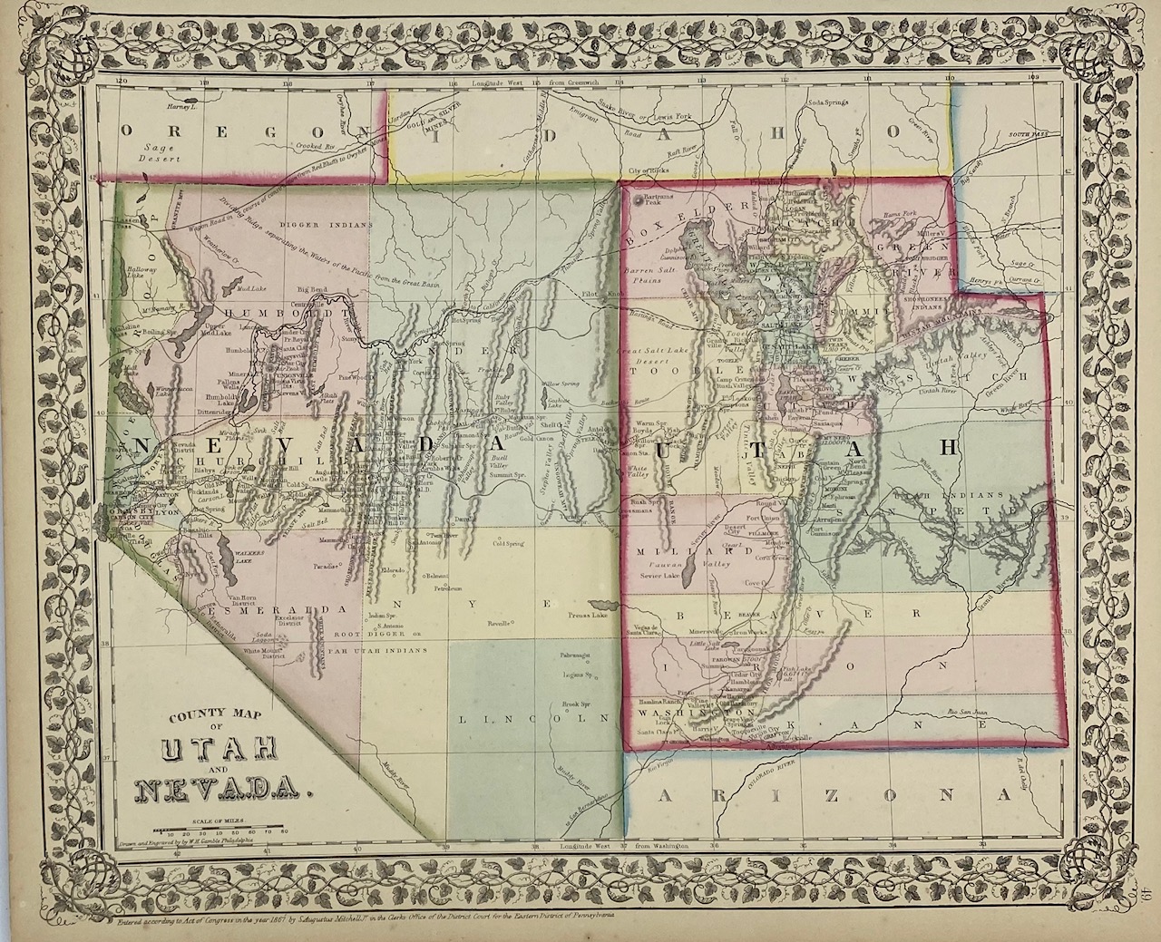
County Map of Utah and Nevada
Gamble, W.H.
Sold by Tschanz Rare Books, Salt Lake City, UT, U.S.A.
Association Member:
AbeBooks Seller since May 9, 2017
Sold by Tschanz Rare Books, Salt Lake City, UT, U.S.A.
Association Member:
AbeBooks Seller since May 9, 2017
Map [25 cm x 32 cm] on a single sheet [31 cm x 38 cm]. The territorial boundaries and counties have been hand tinted and the map is within a decorative printed border. Colors are bright. Minor age toning to extremities with a few small nicks. A nicely colored county map of the territory of Utah and the state of Nevada that locates the (unfinished) U.P. / Central Pacific line, California Trail, Hasting's Cutoff and Gunnison's route. Kane County is shown but not Piute, Sevier or Rich. Green River County is located within Utah (Wyoming was established in 1868). Camp Floyd is labeled 'Camp Crittendon.' From Mitchell's New General Atlas. Moffat 88. Wheat 1205. Phillips 3563a.
Seller Inventory # 4324
We guarantee every item we sell. All items are returnable within fourteen days in same condition sold. Please notify us in advance of a return.
Shipping costs are based on books weighing 2.2 LB, or 1 KG. If your book order is heavy or oversized, we may contact you to let you know extra shipping is required
| Order quantity | 5 to 14 business days | 3 to 6 business days |
|---|---|---|
| First item | US$ 5.00 | US$ 10.00 |
Delivery times are set by sellers and vary by carrier and location. Orders passing through Customs may face delays and buyers are responsible for any associated duties or fees. Sellers may contact you regarding additional charges to cover any increased costs to ship your items.