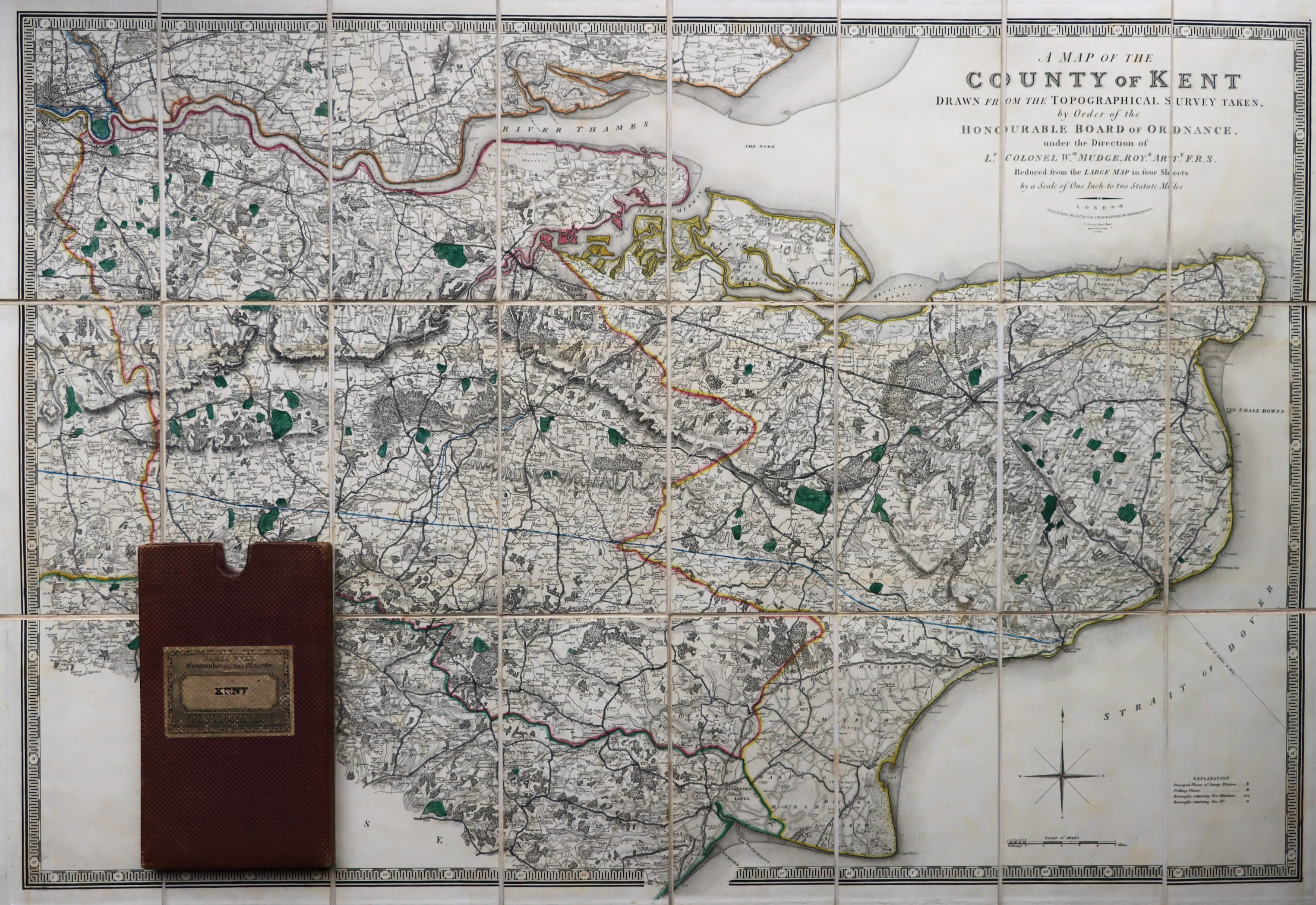
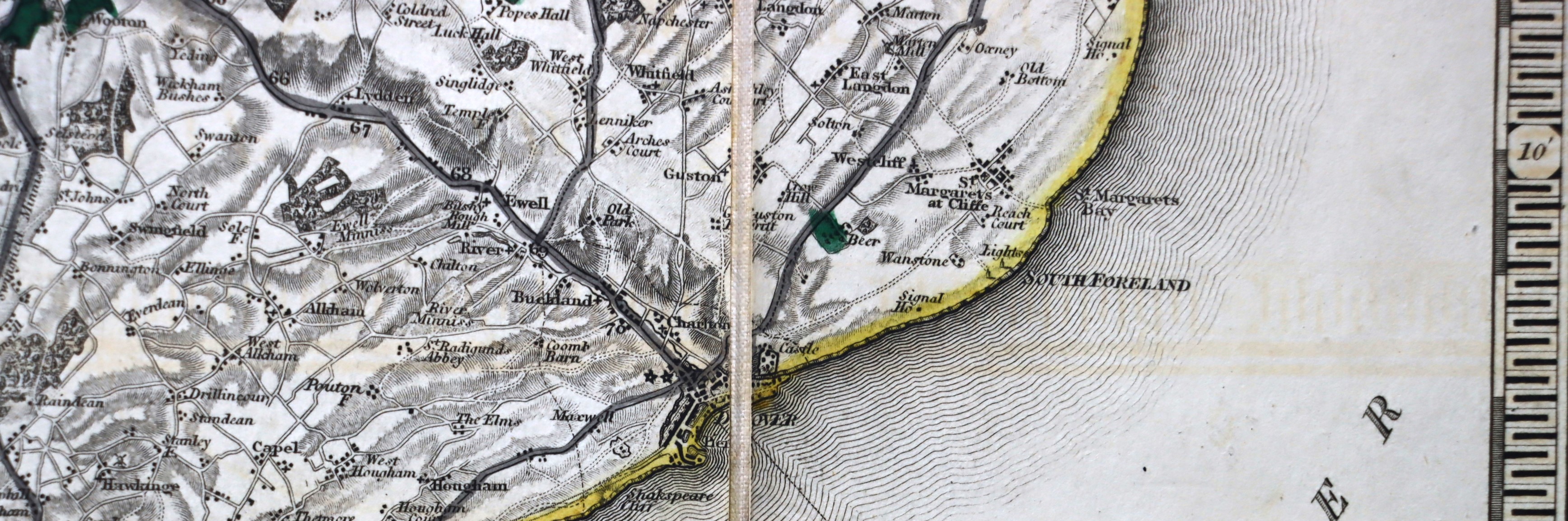
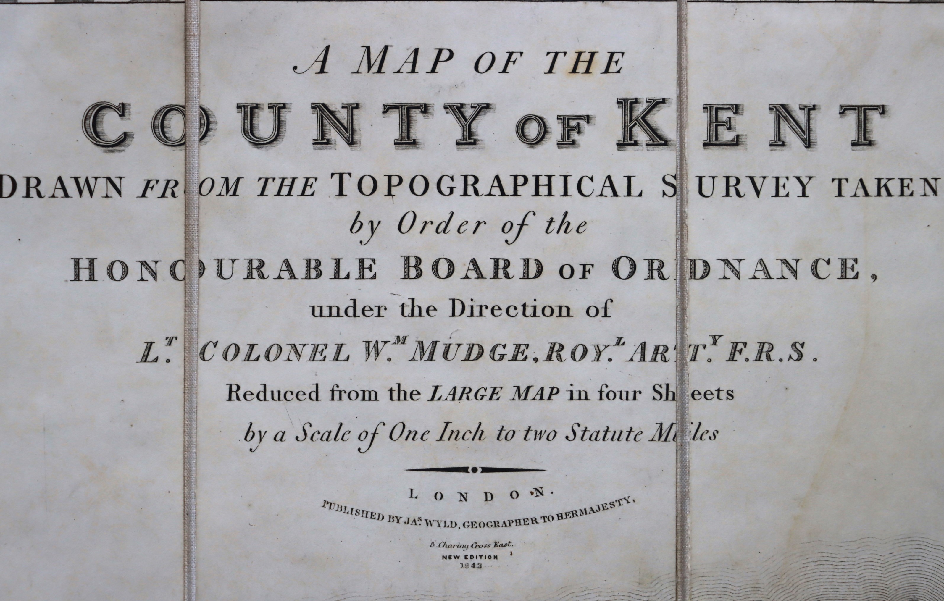
Morning Mist Books and Maps is an independent online secondhand book and map business, with a focus on carefully chosen book titles, accurately and individually described, along with a large collection of folded maps. The map part of the business contains a large number of Ordnance Survey Maps as well as many other brands like Barts and especially the very earliest folded maps. Your purchase will be posted in high quality packaging, enabling it to arrive safely. Queries are answered promptly and further information or images can always be provided, giving you confidence in your purchase. Customer service is a key part of the business: dispatch emails are always sent and for items over �20, tracking numbers are provided.
Visit Seller's Storefront
Seller's business information
Morning Mist Books and Maps
United Kingdom
Sale & Shipping Terms
Terms of Sale
While every effort will be made to ensure that all items shown are in stock, There is no guarantee of availability and this electronic publication does not constitute an offer for sale. Goods are normally dispatched within 48 hours, using Royal Mail second class postage. If items exceed the weight limits for this postage, they will be sent with UPS or with another reputable courier. Items over a certain value, will require a signature on receipt. If your order cannot be dispatched within 7 days ...
More Information
Shipping Terms
Within the UK, postage is set for books and maps up to 2Kg (Royal Mail Tracked 48 with signature). For heavier or larger items, you may be required to pay for more postage depending on the cost/weight of the item concerned. For items going to Europe, the rate set is up to 1.25Kg but in certain circumstances extra postage may be required. If unsure, please make contact in advance of ordering. For heavier items or special delivery you will be charged more for postage. Postage to North America covers books and maps up to 1.25 Kg and to a value of �50. For large, heavy or expensive items extra postage may well be required. If this this not agreeable, the order can be cancelled. If in doubt, please make contact and ask for a quote before ordering. All international parcels are sent fully tracked. For postage to other countries, please ask for a quote. Often the costs will be significant as no parcels are sent without full tracking but full details of the cost breakdown will be provided on request. All valuable items are sent using a courier tracking system to try to ensure that items don't get lost in transit. on ordering, you are provided with the tracking details, so that you can follow the progress of your parcel. International postage for parcels over 2Kg in weight are usually sent with UPS. The aim is to provide a reliable service with robust & sensible packaging, which enables products to arrive safely and in good order, with the minimum risk of getting lost in transit.
Shipping rates from United Kingdom to U.S.A.
Shipping rates from United Kingdom to U.S.A.
| Order quantity |
12 to 45 business days |
10 to 15 business days |
| First item |
US$ 60.33 |
US$ 120.66 |
Delivery times are set by sellers and vary by carrier and location. Orders passing through Customs may face delays and buyers are responsible for any associated duties or fees. Sellers may contact you regarding additional charges to cover any increased costs to ship your items.