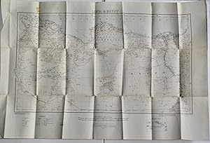
About this Item
Colour map, 1/3M or 47.35 miles to the inch, 97x62cm. Good, slightly unevenly folded, with some patches of staining, and small holes at intersections. Originally published in 1918, this includes revisions to boundaries and railways with minor corrections dated 1931. It was printed at the War Office in 1932, contemporary with pioneering explorations in the Libyan Desert. This is shown in some detail, including the Oases of Kharga, Dakhla, Farafra, Baharia, Siwa, Kufra, and smaller ones, dune fields by stippling. Of great interest are the numerous tracks, among them Darb el Arbain, Darb el Tawil, the Great Caravan Route to Wadai, Caravan Route to Kufra etc, as well as traces of an old route to passing through an uninhabited oasis with little water south of Kufra. G. Owenat (Jebel Uweinat) is marked at the very lower edge. Notes describe the extent of vegetation, incidence of water, and the nature of the desert surface (eg, stone or sand). Spot heights. Seller Inventory # 3923
Contact seller
Report this item