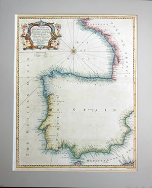
Mapa Antiguo - Old Map : A correct CHART of the BAY of BISCAY, Part of the WESTERN OCEAN & MEDITERRANEAN SEA, Describing the Coasts of SPAIN and PORTUGAL with Part of FRANCE, From Moarlaix to Valencia; Done from the latest & best

Published by Estrasburgo, 1744

Seller: LIBRERÍA MAESTRO GOZALBO, Carcaixent, V, SpainLIBRERÍA MAESTRO GOZALBO

5-star seller

AbeBooks seller since February 28, 2018

Condition: Used - Very good

US$ 339.65

US$ 51.77 shipping 
Ships from Spain to U.S.A.

Quantity: 1 available

Add to basket
Free 30-day returns

Item description from seller

1 lámina sin enmarcar Buen estado Discoveries; For Mr Tindal's Continuation of Mr Rapin's History. Carta Náutica. Coloreado a mano.

Seller Inventory # 147643

Bibliographic details

Title
Mapa Antiguo - Old Map : A correct CHART of the BAY of BISCAY, Part of the WESTERN OCEAN & MEDITERRANEAN SEA, Describing the Coasts of SPAIN and PORTUGAL with Part of FRANCE, From Moarlaix to Valencia; Done from the latest & best
Author
TINDAL, RAPIN, Richard William SEALE (del et sculp)
Publisher
Estrasburgo
Publication year
1744
Condition
Buen estado
Dimensions
37x47 cm mapa + márgenes
Seller catalogs
Cartografía, geografía

LIBRERÍA MAESTRO GOZALBO

Carcaixent, V, Spain

5-star seller

AbeBooks seller since February 28, 2018

Shipping rates from Spain to U.S.A.

Item15 to 25 business days8 to 14 business days
First itemUS$ 51.77US$ 225.09
Delivery times are set by sellers and vary by carrier and location. Orders passing through Customs may face delays and buyers are responsible for any associated duties or fees. Sellers may contact you regarding additional charges to cover any increased costs to ship your items.

Payment methods

  • Visa
  • Mastercard
  • American Express
  • Apple Pay
  • Google Pay
  • Bank Wire Transfer
  • Paypal

Store description

Todo tipo de coleccionismo, cosas curiosas, raras o únicas.

Specialty

Postales, revistas, posters, láminas, grabados, estampas, etc

Seller's business information

LIBRERÍA MAESTRO GOZALBO

V, Spain