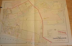
PART OF LONG BRANCH NJ MAP. FROM WOLVERTON'S "ATLAS OF MONMOUTH COUNTY," 1889
WOLVERTON, Chester
From Antic Hay Books, Asbury Park, NJ, U.S.A.
Seller rating 4 out of 5 stars
AbeBooks Seller since June 5, 1997
From Antic Hay Books, Asbury Park, NJ, U.S.A.
Seller rating 4 out of 5 stars
AbeBooks Seller since June 5, 1997
About this Item
Very Good. An original 30-inch by 22-inch linen-backed color map published in 1889. Map depicts Long Branch from the Atlantic Ocean to Pleasure Bay and from Broadway to the South Shrewsbury River. Shows types of structures erected at the time. The original hand-colored map (Plate 8), not a reproduction! Wolverton maps are among the best you can get of Monmouth County. Very Good. Seller Inventory # 56908
Bibliographic Details
Title: PART OF LONG BRANCH NJ MAP. FROM WOLVERTON'S...
Publisher: Chester Wolverton, NY
Publication Date: 1889
Store Description
Payment: Checks or Paypal- all accepted.
Postage by United States Postal Service
--USA: USPS Media mail: $4.75; Priority Mail $15.00
--Canada: First Class: $22.00; Priority Mail: $40.00
--Other Countries: First Class: $35.00; Priority Mail: $60.00
Special charged may apply for large, heavy, or insured items. Some items may be mailed cheaper if able to ship in Flat Rate Envelope
Shipping costs are based on books weighing 2.2 LB, or 1 KG. If your book order is heavy or oversized, we may contact you to let you know extra shipping is required.
Payment Methods
accepted by seller