About this Item
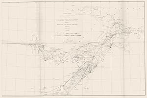
MARYLAND WEST VIRGINIA VIRGINIA PENNSYLVANIA. USCGS Triangulation 1881 old map. Antique map; Scale 1:1000,000; United States Coast & Geodetic Survey (1881). 46.0 x 69.0cm, 18 x 27 inches; this is a folding map. Condition: Fair: Tears along folds. There is nothing printed on the reverse side, which is plain. National Geodetic Survey National Geodetic Survey, formerly called the U.S. Coast and Geodetic Survey (U.S.C.G.S.), is a United States federal agency that defines and manages a national coordinate system, providing the foundation for transportation and communication; mapping and charting; and a large number of applications of science and engineering. Since 1970, it has been part of the National Oceanic and Atmospheric Administration (NOAA), of the U.S. Department of Commerce. The original predecessor agency of the NGS was the United States Coast Survey, created by Congress in 1807 to conduct a "Survey of the Coast". This organization represented the Jefferson administration's interest in science and stimulation of international trade. The Jackson administration expanded and extended the coast surveys scope and organization.:468 Progress moved ahead slowly and haltingly during the first 25 years. Not until August 29, 1811, did F. R. Hassler sail for Europe to purchase the proper instruments. He remained in Europe during the War of 1812, and then he returned to the United States, arriving on August 16, 1815. Hassler's plan was to employ triangulation to establish his system. Work began in the vicinity of New York City in 1816. The first baseline was measured and verified in 1817. A further Act of Congress in 1818 interfered with Hassler's work. The U.S. Army and U.S. Navy were placed in charge of the survey work. This generated a lull in activity which lasted from 1818 to 1832. The Coast survey existed without a superintendent during the 14 years from 1818 to 1832. Little work was carried out until another Federal law was enacted on July 10, 1832. It renewed the original law of 1807. Hassler was reappointed as the agency's superintendent, and field work was resumed in April 1833. Association with United States Navy The U.S. Department of the Navy was given the control of the coast and geodetic survey from 1834 to 1836, but the U.S. Department of the Treasury resumed the administration of the survey on March 26, 1836. Hassler died in 1843. The Navy retained close connection with the hydrographic efforts of the Survey under law requiring Survey ships to be commanded and crewed by naval officers and men when the Navy could provide such support. Under this system many of the most famous names in hydrography for both the Survey and Navy of the period are linked. It was while attached to the Survey that Lieutenant Commander Charles Dwight Sigsbee, U.S.N., Assistant in the Coast Survey, surveyed, developed his sounding machine and commanded the ship Blake during the first true bathymetric surveys in the Gulf of Mexico. Survey civilians were also assigned to the ships, along with famous scientist of the day, such as Alexander Agassiz, for technical operations. That system remained effective until changed under appropriation law approved June 6, 1900 to the effect that beginning July 1, 1900 "all necessary employees to man and equip the vessels" were funded as opposed to the previous scheme using naval personnel. By prearrangement all naval personnel would remain with the ships until the first call at the home port where the transfer would be made with the Survey reimbursing Navy for pay after July 1 for those personnel. Growth years Professor Alexander Dallas Bache became superintendent of the Survey in 1843. Earlier in his life, he had established the first magnetic observatory. During his years as superintendent, he expanded the Survey southward along the Atlantic coast into the Florida Keys. He instituted regular and systematic observations of the tides and the Gulf Stream, and investigated magnetic forces and directions. During t. Seller Inventory # P-6-037316
Contact seller
Report this item

