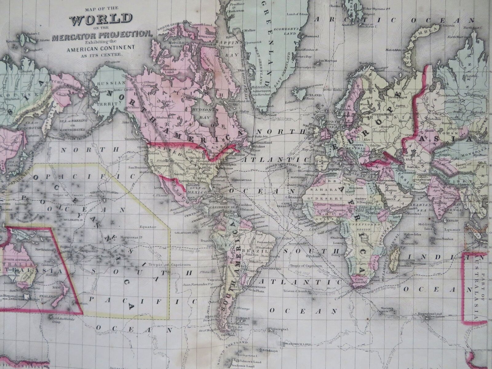
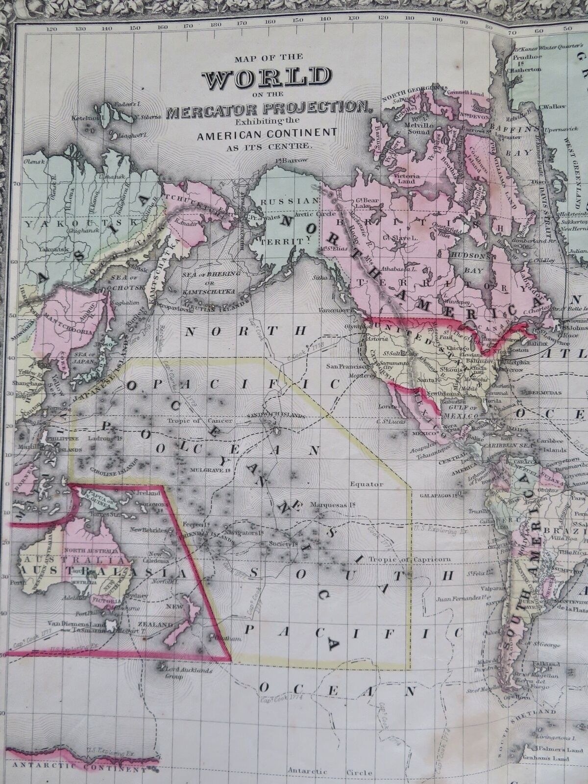
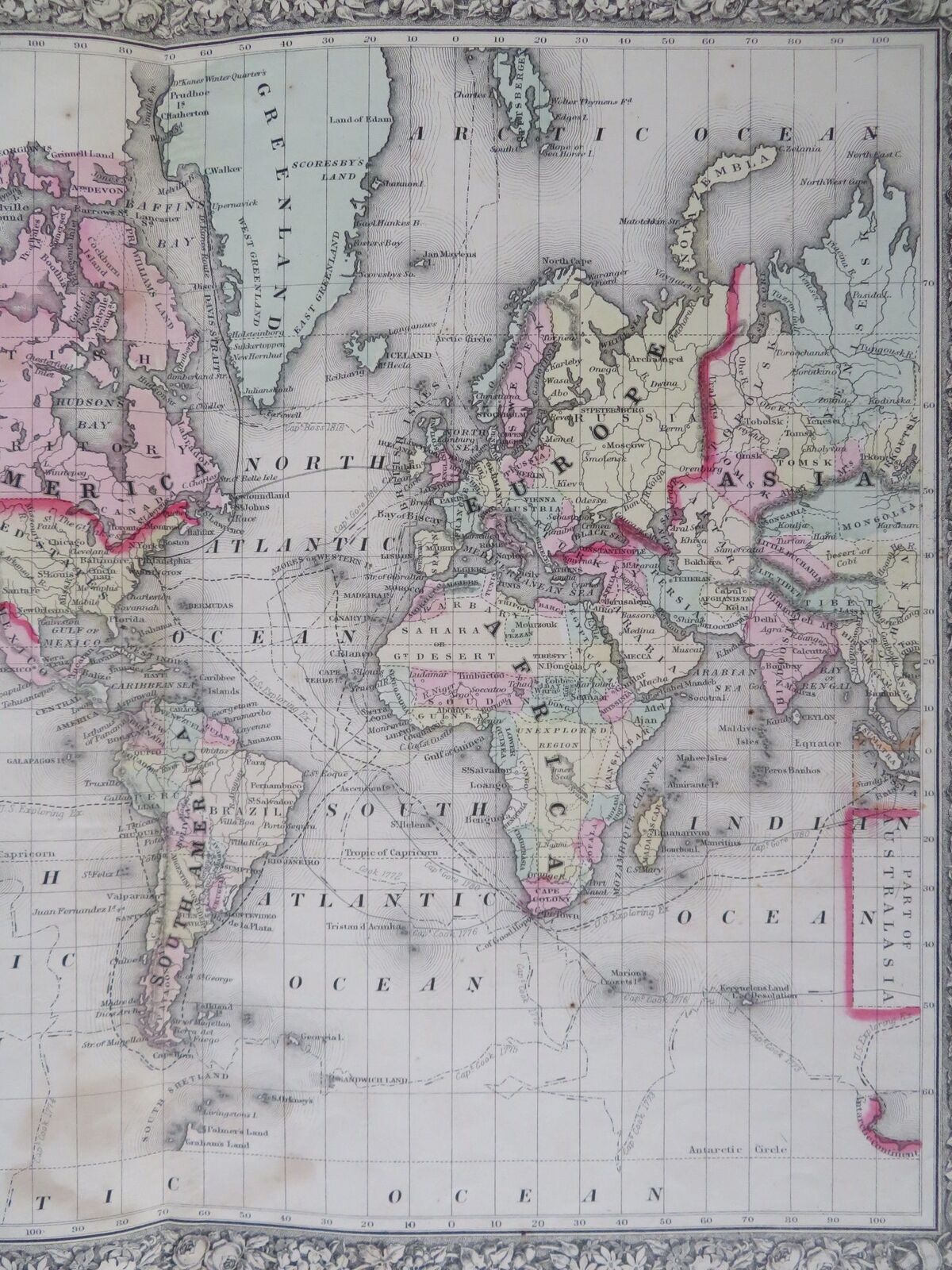

World Map Mercator's Projection Americas Australia Europe Asia 1860 Mitchell map
Publication Date: 1860
Used
From
RareMapsandBooks, Dover, NH, U.S.A.
Seller rating 4 out of 5 stars
![]()
AbeBooks Seller since November 27, 2015
This book is no longer available. AbeBooks has millions of books. Please enter search terms below to find similar copies.
About this Item
Description:
Map of the World on the Mercator Projection Exhibiting the American Continent As Its Center.(Old Maps, 19th Century Maps, Mercator's Projection, North America, South America, Africa, Europe, Asia, Oceania, Australia, New Zealand, Polynesia). Issued 1860, Philadelphia by S. Augustus Mitchell. There are many variant issues of this map, with differing borders and interior details. A comparison with other Mitchell maps of the 1860's-80's era will reveal this on close inspection. Numerous exploration tracks shown across the oceans, including Capt. Cook, the U. S. Exploring Exped., Capt. Ross and Capt. Gore. Note the incorrect prominent hook shape assigned to Lake Torrens within Southern Australia. Mid 19th century� antique engraved map with original hand color. Decorative border greatly enhances visual appeal. Well preserved, some light old staining near bottom of centerfold, nice looking example with pleasing age patina. Original center fold as issued. Sheet Measures c. 25" x 15". Engraved Area Measures c. 21" x 14". Cartographic Reference (s):Tooley's Dictionary of Mapmakers, vol. 3.[R34005]. Seller Inventory # R34005
Bibliographic Details
Title: World Map Mercator's Projection Americas ...
Publication Date: 1860
Condition: good
AbeBooks offers millions of new, used, rare and out-of-print books, as well as cheap textbooks from thousands of booksellers around the world. Shopping on AbeBooks is easy, safe and 100% secure - search for your book, purchase a copy via our secure checkout and the bookseller ships it straight to you.
Search thousands of booksellers selling millions of new & used books
New & Used Books

New and used copies of new releases, best sellers and award winners. Save money with our huge selection.
Rare & Out of Print Books

From scarce first editions to sought-after signatures, find an array of rare, valuable and highly collectible books.
