
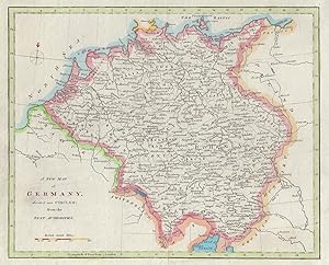
A new map of Germany divided into Circles from the best authorities
Anonymous
Publication Date: 1811
Used
From
Antiqua Print Gallery, London, United Kingdom
Seller rating 4 out of 5 stars
![]()
AbeBooks Seller since January 14, 2022
About this Item
Description:
A new map of Germany divided into Circles. Austria Switzerland NL Belgium 1811. Antique hand coloured copperplate map; Anonymous, after Robert Wilkinson (1811). 22.5 x 27.5cm, 8.75 x 10.75 inches; this is a folding map. Condition: Good. There is nothing printed on the reverse side, which is plain. Seller Inventory # P-6-103358
Bibliographic Details
Title: A new map of Germany divided into Circles ...
Publication Date: 1811
Condition: Good
Top Search Results from the AbeBooks Marketplace

A New Map of Germany Divided into Circles from the Best Authorities (1807)
Used
Seller: Waimakariri Books and Prints Limited, Oxford, New Zealand
Seller rating 4 out of 5 stars
![]()
No Binding. Condition: Very Good. Presentable map of Germany by Alexander Cooke, from 1807. Image area 239 x 219 mm approx, two folds as published, good margins, light marking to the margins but a crisp and clean image with good colours. Free standard airmail worldwide. Seller Inventory # 13472
Quantity: 1 available

Seller Image
A New and Accurate Map of Germany divided into circles from the best authorities.
Published by
Edinburgh: 1801, 1801
Used
Seller: Peter Harrington. ABA/ ILAB., London, United Kingdom
Seller rating 5 out of 5 stars
![]()
A clear map of Germany, Austria, the Central States, the Netherlands and the United Provinces. Thomas Brown was an Edinburgh Bookseller and Publisher of the late 18th and early 19th century. The maps from his General Atlas are on the cusp between the decorative maps of the eighteenth century and the more accurate maps of the nineteenth century Size: 322 x 407 mm. Copper engraving. Later colour. Fine condition. Seller Inventory # 78565
Quantity: 1 available
A New map of the Empire of Germany Divided into Circles Drawn from the best Authorities
Used
Seller: Antiqua Print Gallery, London, United Kingdom
Seller rating 4 out of 5 stars
![]()
Condition: Good. A new map of the Empire of Germany divided into Circles ROLLOS 1766 old. Antique copperplate map; George Rollos (1766). 20.5 x 30.0cm, 8.25 x 11.75 inches; this is a folding map. Condition: Good. There is nothing printed on the reverse side, which is plain. Seller Inventory # P-6-101154
Quantity: 1 available
Seller Image
A New Map of Germany, divided into Circles, from the Best Authorities.
Used
First Edition
Seller: Geographicus Rare Antique Maps, Brooklyn, NY, U.S.A.
Seller rating 5 out of 5 stars
![]()
Very good. Minor marginal soiling. Original platemark visible. Blank on verso. Size 8.25 x 10.75 Inches. A finely detailed first edition 1794 map of Germany by Robert Wilkinson. The map covers all of modern day Germany and Austria, and divides the area into the imperial circles devised by the Holy Roman empire to administer, tax, and defend the empire (covering most of what is now Central europe).� engraved by Thomas Conder for the 1794 first edition of Robert Wilkinson's General Atlas . Seller Inventory # Germany-wilkinson-1794
Quantity: 1 available