Items related to MAPTECH PAPER CHARTS Maptech ChartKit Book w/Companion...
MAPTECH PAPER CHARTS Maptech ChartKit Book w/Companion CD - Norfolk VA to Florida and the Intracoastal Waterway - Softcover
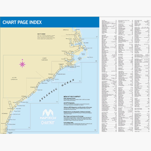

CHARTKIT� Bookw/ Companion CDNorfolk VA to Florida and the Intercoastal WaterwayNorfolk VA to Fernandina Beach FL inside and outside. Includes ICW navigation advice and Bridge Table. Full-color charts GPS waypoints courses and distances and Yeoman reference points. Save hundreds of dollars on charts. 22" X 17" 83 chart pages.Product OverviewUsed by generations of boaters ChartKits are full-color reproductions of U.S. government and private charts spiral bound into popular cruising regions. The convenient-sized books are large enough to allow for manual plotting yet small enough to sit on your nav-station or lapGPS ReadyNew features make ChartKits easy to use with your GPS. Most charts include one-minute lat./long. Grids to make vessel positioning a breeze and major navigation aids are identified with named GPS waypoints.Small and Large Scale ChartsChartKits include small-scale wide area charts as well as large-scale detailed charts of harbors and approaches. The Chart Page Index (inside front cover) and "Go-To" page numbers make it simple to quickly find the chart you want.Pre-Plotted CoursesMaptech's navigation editors add magic courses between major navigation aids with distances in nautical miles. ChartKits are also designed to help you do the calculations yourself. Each page includes a Compass Rose with annual increase in variation and plete scale information.Aerial PhotosColor aerial photos of harbors and anchorages help you know what to expect before you get there.Companion CDIt's all here...digital charts and the software tools to use them. And the great thing is the digital charts are the same identical charts with GPS waypoints and course lines - just like in the Chartbooks.PlanChartbook Companion CDs include "Offshore Navigator Lite" navigation software. Click your mouse to put a waypoint on a chart. Click again and you're creating a route. It's that easy. Distances bearings and GPS positions are calculated and displayed instantly.PrintPrint your
"synopsis" may belong to another edition of this title.
- PublisherMAPTECH PAPER CHARTS
- ISBN 10 0743610547
- ISBN 13 9780743610544
- BindingSpiral-bound
Top Search Results from the AbeBooks Marketplace

Stock Image
NORFOLD, VA. TO FLORIDA AND THE INTRACOASTEAL WATERWAY, REGION 6, 10TH EDITION
Published by
MAPTECH
(2007)
ISBN 10: 0743610547
ISBN 13: 9780743610544
Used
Helical Metal Binder
Quantity: 1
Seller:
Rating
Book Description Helical Metal Binder. Condition: Fine. 10th Edition. This is a fine condition giant paperback collection of charts. Wire lay flat binding. 17 x 44 inches when opened. In the original plastic protector. 83 pages of charts, 63 color aerial photos, bridge table, etc. No CD. MEDIA SHIPPING ONLY, extra for airmail or international shipping. Size: Elephant Folio - over 15" - 23" tall. Seller Inventory # 071614
Buy Used
US$ 95.00
Convert currency