About this Item
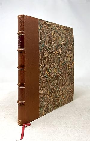
First edition. London: Printed for the Author, 1791. First edition. Quarto (10 11/16" x 8 3/4", 272mm x 222mm): binder's blank, [pi]4(-[pi]1) A-Pp4, binder's blank [$2 signed]. 155 leaves, pp. [2] (title, blank), i-iii iv-x (2pp. dedication, 4 pp. subscribers, 4pp. preface), [2] (errata, blank), 1 2-295, blank. With an engraved folding map "Sketch of the Western Countries of Canada 1791." Collated complete against Howes. Bound in modern quarter morocco over marbled bards. On the spine, five raised bands. Title gilt to red sheep in the second panel. Some rubbing and bumps to the extremities of the boards. A light crease to the lower fore-corner of the text-block, not affecting the text. Some offsetting to the map. A good clean copy with excellent margins (e.g., S1 fore-deckle preserved) of 50-65mm. The author is unknown outside the autobiographical details he offers within the Voyages and Travels. The order of his descriptors -- Indian Interpreter first, then Trader -- is circumstantial. He came to Montreal in 1768 as a clerk, and in the course of his mercantile duties he came to converse well in the languages of those people with whom he traded. Ojibwa was the common tongue for fur-traders, but Long went further, embedding himself -- he describes an "adoption" by the Ojibwa chief Madjeckewiss (Mudjekeewis, a spirit) -- and learning about their culture. The American Revolution interrupted trade along what is now the U.S.-Canadian border, and Long writes of travels through Wisconsin, Quebec and Ontario, largely aiming to skirt armed conflict in favor of continued trade. He remained in North America through the late 1780's, his fortunes having declined somewhat, and sold his story in London, publishing this first edition in 1791. As a first-hand account it falls within an established genre from the period. Where the work stands out is its lengthy vocabularies at the end, including Esquimeaux (the Eskimo-Aleut language family) Iroquois (the Iroquoian family), Algonkin (the Algonquian family), Chippeway (Ojibwa), Mohegan (Mohegan-Pequot, part of the Algonquian family) and Shawanee (Shawnee, also Algonquian). The map extends to the west of Ontario and modern Minnesota and north to James Bay, and is thought to be the work of Long himself; it is an important map of the Great Lakes region. Ayer Indian Linguistics 28; Field 946; Graff 2527; Howes L 443; Sabin 41878; Streeter VI:3651. Seller Inventory # JLR0362
Contact seller
Report this item
![]()


