About this Item
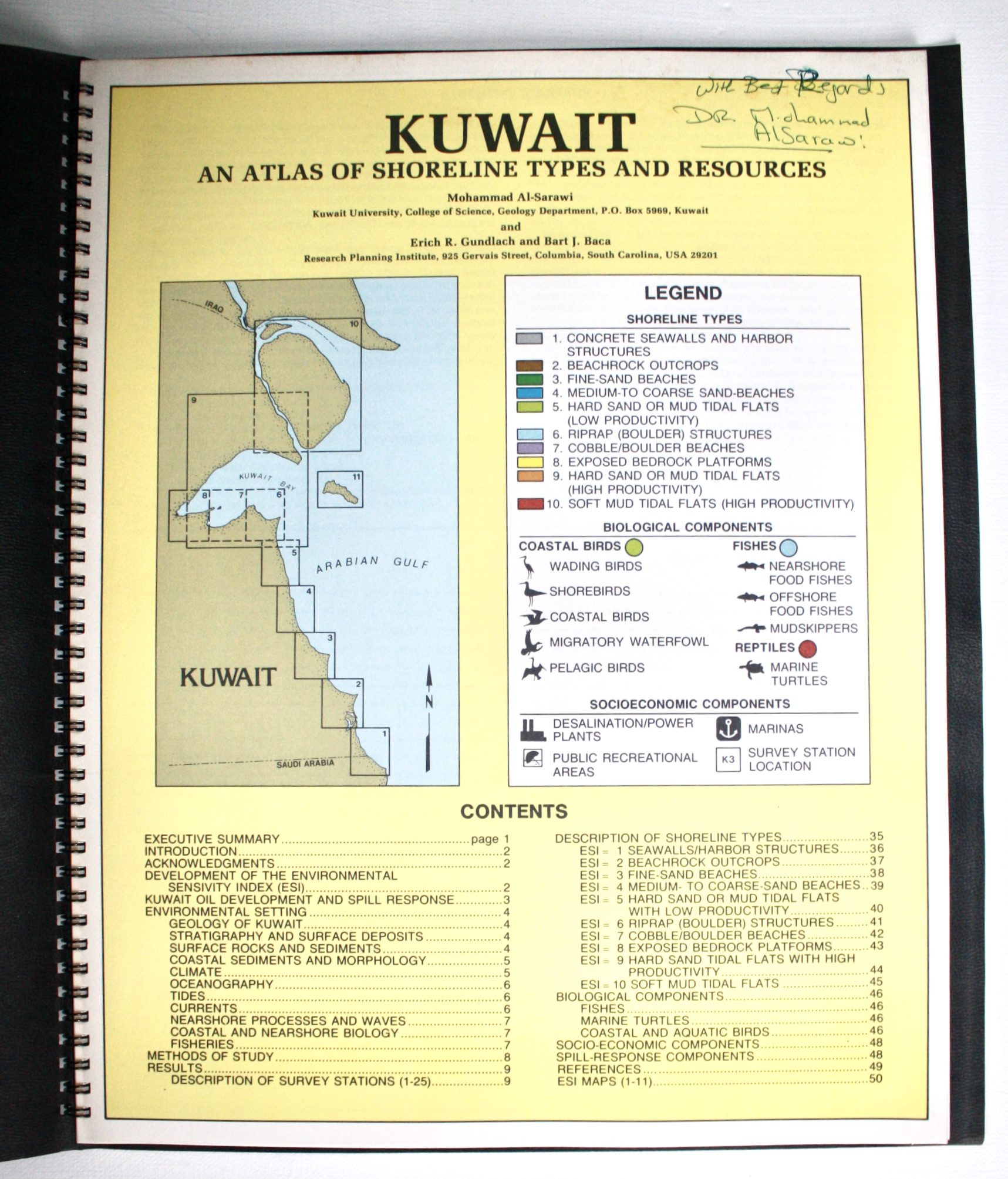
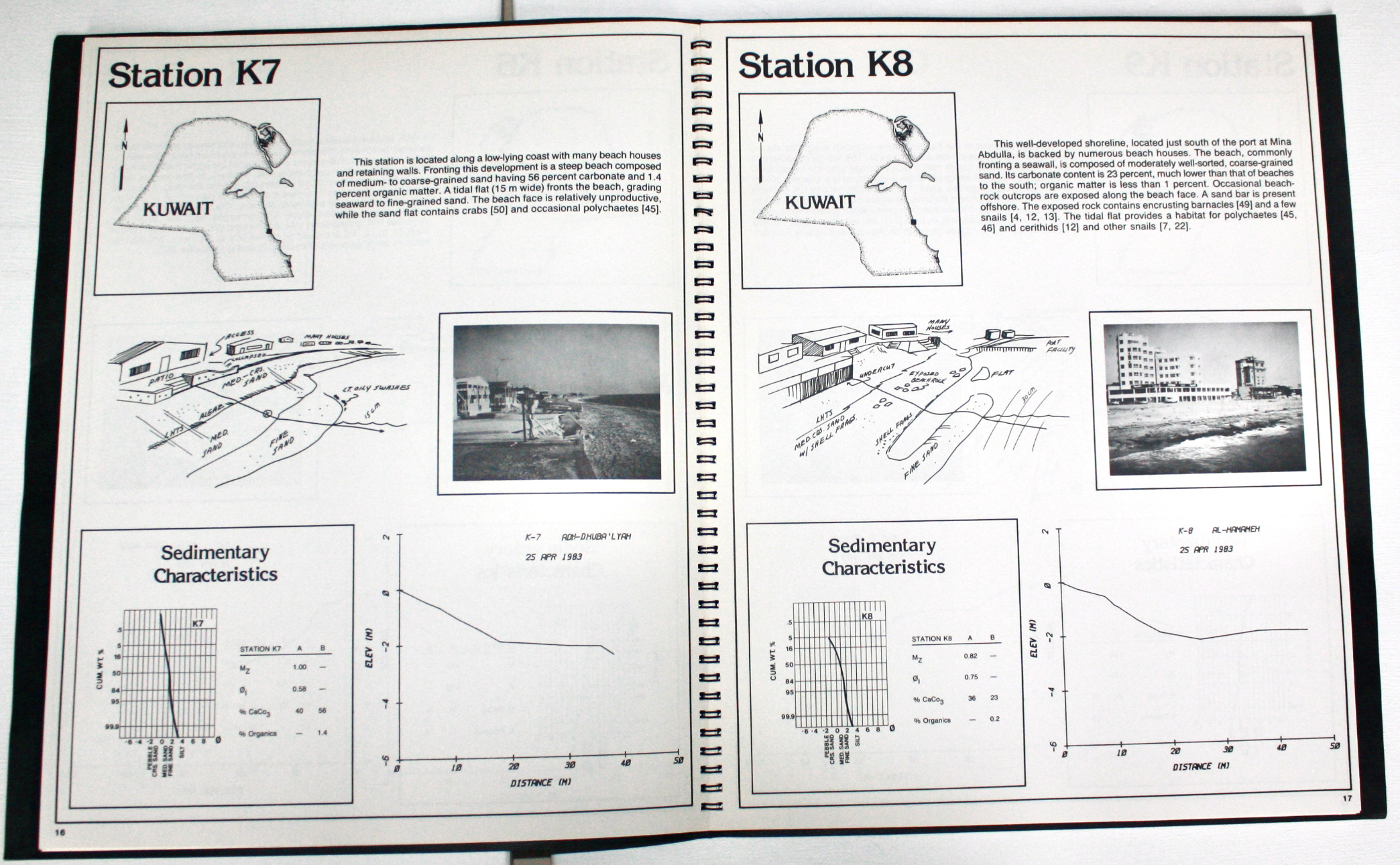
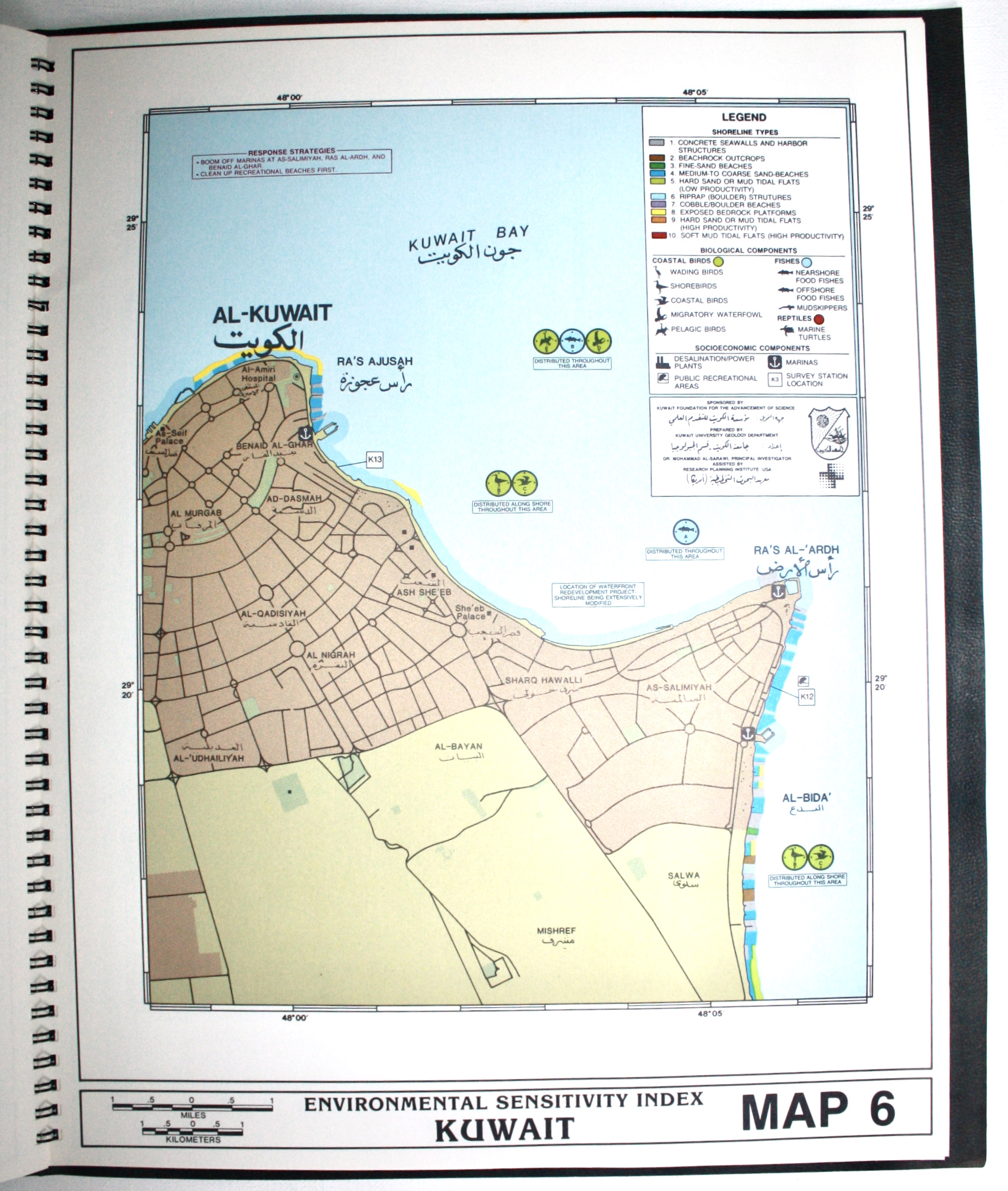
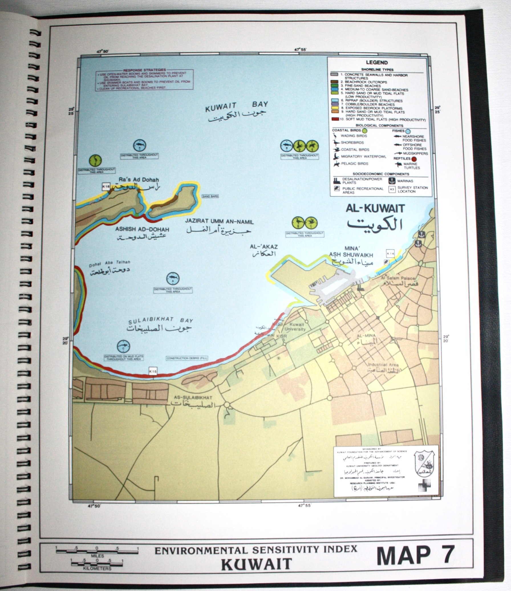
The basis for Kuwait's oil spill contingency plans. Spiral-bound black grained wraps 32x40cm, with gilt University logo and English and Arabic titles. (1)pp title with contents, index map and legend; 49pp English text with many b/w photos, drawings, maps, and an Executive Summary in Arabic; 11 full-page colour maps; (1)pp Addendum. Near fine, inscribed to the title "With Best Regards / Dr Mohammad Al Sarawi". Al Sarawi was Professor in Environmental Science at Kuwait University who would later contribute to the "Atlas of the State of Kuwait from Satellite Images". Erich Gundlach was Vice President, and Bart Baca a marine biologist at the US Research Planning Institute. Kuwait hosted the first Arabian Gulf Conference on Environment and Pollution in 1982. This Atlas was prepared as the basis for its oil spill contingency plans, noting the country has so far been lucky to avoid a major spill from the Iran-Iraq War, but is being affected by small spills. The National Environmental Committee for Oil Spill Contingency Planning was formed with representation from oil companies (KOC, KNPC) and harbours (Public Harbour Company, Shuaibah and Alzoor) among others, who contributed boats, equipment and training (p3). The Atlas is based on aerial and ground surveys of 25 coastal sites including Bubyan and Failaka Islands, conducted during 1983-84 with support from the Defence and Oil Ministries and the Municipality. These were used to prepare an internationally recognised Environmental Sensitivity Index (ESI) grading the coastline from 1 (concrete seawalls and harbour structures) to 10 (soft mud tidal flats), shown in a series of ESI maps. The maps locate the survey station, and major sites including settlements, palaces, ports, oil and industrial installations, social clubs, hotels, University, border station with Saudi, etc. They also give Response Strategies, eg Map 7: "Use open water booms and skimmers to prevent oil from reaching the desalination plant at Shuwaikh / Use skimmer boats and booms to prevent oil from entering Sulaibikhat Bay / Clean up recreational beaches first". The text explains the ESI with maps and photos, Kuwait's spill response, environmental setting, methods, results (with map, drawings, photos and charts for each of the 25 sites), bird and sea life, and infrastructural and recreational features. Rare with 6 locations on Worldcat and Library Hub (Reading University, Danish Union Catalogue, Royal Danish Library, UN Geneva, LoC, National Geospatial Intelligence Agency).
Seller Inventory # 4523
Contact seller
Report this item