
Items related to Atlas of the World
Synopsis
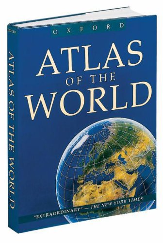
When Oxford's Atlas of the World debuted, it was widely praised for the incredible beauty and accuracy of its maps and for its wealth of geographical information. Now in a new Eighth Edition, it remains the finest top-of-the-line atlas available, with hundreds of stunning full-color, large-format maps produced by Europe's finest cartographers.
As in past editions, the Atlas also boasts 66 maps of major metropolitan areas worldwide, an extensive index, and a colorful 48-page Introduction to World Geography, providing a wealth of information on such topics as climate, the greenhouse effect, plate tectonics, agriculture, population and migration, global conflicts, and much more. For the eighth edition, there is an eight-page section of satellite images, providing insight into how cities expand and rivers create life in the desert. It also boasts an innovative new map program-a feature without rival among world atlases--new digital metro mapping with detailed city center plans for more than half of the major cities of the world. These digital maps allow readers to get a much clearer sense of the physical and cultural disposition of important cities, showing major streets and points of interest such as museums, monuments, and other sites of historical or cultural significance. This section also boasts its own 10,000 entry index for instant access to the places readers want to find most.
Providing the finest global coverage available, Atlas of the World is the benchmark by which all other international atlases will be measured.
"synopsis" may belong to another edition of this title.
Review
The only world atlas updated annually, the fifteenth edition of Oxford's Atlas of the World offers exceptional value at a reasonable price. Full of crisp, clear cartography, it contains maps of 69 cities and nearly 100 different regions around the globe as well as striking satellite views of the Earth's surface.
Take a Look at the Stunning Illustrations in The Atlas of the World
(Click on images to enlarge)
| Topography of Europe | Topography of Africa | Topography of Southeast Asia |
| The landmass Pangea and today's continents. Learn more about continental drift | A diagram of faultlines in the earth's crust. Learn more about earthquakes |
From Library Journal
Two atlases, both from reputable publishers, both the same title and price, both incorporating the most current political information, and both well designed and presented--what a delightful quandary to be in, trying to select only one! The answer depends upon your library's audience. The Hammond has a slightly higher percentage of maps of North America, the Oxford of Europe. The Hammond devotes more space to matters like "interpreting maps"; the Oxford has more pages of indexes plus a 32-page section of city maps. The Hammond atlas is the first such atlas to be generated completely from computer databases (it took five years and $5 million); the Oxford depends on the tried-and-true skills of the George Philip Group. The Oxford shows relief by hypsometric tints, the Hammond by color, shaded relief, and spot heights. They are both good buys, so if your users are oriented toward the United States and your map library has a good collection of large-city maps, try the Hammond; if Euro-centered, buy Oxford.
- Mary L. Larsgaard, Univ. of California-Santa Barbara Map & Imagery Lab Lib.
Copyright 1993 Reed Business Information, Inc.
"About this title" may belong to another edition of this title.
Search results for Atlas of the World

Stock Image
Atlas of the World
Published by
Oxford University Press, 2000
ISBN 10: 0195216849
ISBN 13: 9780195216844
Used
Hardcover
Seller: More Than Words, Waltham, MA, U.S.A.
Seller rating 5 out of 5 stars

Condition: Very Good. . . All orders guaranteed and ship within 24 hours. Before placing your order for please contact us for confirmation on the book's binding. Check out our other listings to add to your order for discounted shipping. Seller Inventory # WAL-J-1a-003277
Stock Image
Atlas of the World
Published by
Oxford University Press, Incorporated, 2000
ISBN 10: 0195216849
ISBN 13: 9780195216844
Used
Hardcover
Seller: Better World Books: West, Reno, NV, U.S.A.
Seller rating 5 out of 5 stars
Condition: Very Good. 8th Edition. Former library copy. Pages intact with possible writing/highlighting. Binding strong with minor wear. Dust jackets/supplements may not be included. Includes library markings. Stock photo provided. Product includes identifying sticker. Better World Books: Buy Books. Do Good. Seller Inventory # 10820982-75
Stock Image
Atlas of the World
Published by
Oxford University Press, 2000
ISBN 10: 0195216849
ISBN 13: 9780195216844
Used
Hardcover
Seller: Sunshine State Books, Lithia, FL, U.S.A.
Seller rating 4 out of 5 stars

hardcover. Condition: Very Good. Hardback--DUST COVER DIFFERENT THAN LISTING--dust cover shows moderate wear--cover shows slight wear otherwise excellent condition. Seller Inventory # CL251121002B4
Stock Image
Atlas of the World (Atlas of the World, 8th ed.)
Published by
Oxford University Press, 2000
ISBN 10: 0195216849
ISBN 13: 9780195216844
Used
Hardcover
Seller: A Squared Books (Don Dewhirst), South Lyon, MI, U.S.A.
Seller rating 5 out of 5 stars
Hardcover. Condition: As New. Dust Jacket Condition: Like New. 8. 2000; Oxford; black illustrated glossy paper dust jacket with gold titles; dust jacket is in like new condition; interior clean and unmarked; Folio, 12 to 15 inches tall; 304 pages; Additional shipping charges may need to be requested due to size or weight of book. Seller Inventory # SKU1151201
Stock Image
Atlas of the World - Eighth Edition
Published by
Oxford University Press, US, 2000
ISBN 10: 0195216849
ISBN 13: 9780195216844
Used
Hardcover
Seller: Keeper of the Page, Enumclaw, WA, U.S.A.
Seller rating 4 out of 5 stars
Hardcover. Condition: Near Fine. Dust Jacket Condition: Near Fine DJ. 8th Edition. Oxford University Press 2000 8th Edition Near Fine/Near Fine DJ Beautiful grey cloth binding with gold lining and lettering is lightly shaken at front hinge with tiny tear in cloth at bottom of front and back gutter o/w Fine. Color illustrated throughout "Extraordinary". Includes Satellite imagery 48 pages, City Maps 40 pages. Bright glossy dust jacket neatly reinforced at upper corners o/w Fine. 2+48+40 Pages + World maps 304+2 pages with inextensive index. OVERSIZE VERY HEAVY ITEM 8.0 Pounds. Size: 14 7/8 x 11 3/8 x 1 3/8 inches. No Exp. Seller Inventory # 364701