Items related to Old Faithful Day Hikes: Yellowstone National Park Map...
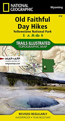
Old Faithful Day Hikes: Yellowstone National Park Map (National Geographic Trails Illustrated Map, 319)
Synopsis
� Waterproof � Tear-Resistant � Topographic Map
National Geographic's Trails Illustrated map of the Old Faithful area of Yellowstone National Park is designed to meet the needs of visitors with unmatched detail of the upper and midway geyser sections of the national park. Expertly researched and created in partnership with local land management agencies, this map features key points of interest including the Old Faithful geyser area, Midway Geyser Basin, Old Faithful, and Fountain Paint Pots. A list of recommend day hikes includes distances and difficulties. The Continental Divide Trail passes through this map.
With many miles of mapped trails and marked Bear Management Zones the Old Faithful Day Hikes map can guide you off the beaten path and back again. The clearly marked trails include mileages between intersections. The map base includes contour lines and elevations for summits, passes and many lakes. Some of the many recreation features include: visitor centers, campgrounds, trailheads, hydrothermal features and interpretive trails.
Every Trails Illustrated map is printed on "Backcountry Tough" waterproof, tear-resistant paper. A full UTM grid is printed on the map to aid with GPS navigation.
Other features found on this map include: Yellowstone National Park.
- Map Scale = 1:30,000 & 1:15,000
- Sheet Size = 22" x 32"
- Folded Size = 4" x 7.5"
"synopsis" may belong to another edition of this title.
About the Author
Founded in 1915 as the Cartographic Group, the first division of National Geographic, National Geographic Maps has been responsible for illustrating the world around us through the art and science of mapmaking.Today, National Geographic Maps continues this mission by creating the world's best wall maps, recreation maps, atlases, and globes which inspire people to care about and explore their world.
"About this title" may belong to another edition of this title.
- PublisherNatl Geographic Society Maps
- Publication date2021
- ISBN 10 156695665X
- ISBN 13 9781566956659
- BindingMap
- Number of pages2
Buy New
Learn more about this copy
US$ 17.61
Shipping:
FREE
Within U.S.A.
Top Search Results from the AbeBooks Marketplace
Stock Image
Old Faithful Day Hikes: Yellowstone National Park Map (National Geographic Trails Illustrated Map, 319)
Seller: Irish Booksellers, Portland, ME, U.S.A.
Seller rating 5 out of 5 stars
![]()
Condition: Good. SHIPS FROM USA. Used books have different signs of use and do not include supplemental materials such as CDs, Dvds, Access Codes, charts or any other extra material. All used books might have various degrees of writing, highliting and wear and tear and possibly be an ex-library with the usual stickers and stamps. Dust Jackets are not guaranteed and when still present, they will have various degrees of tear and damage. All images are Stock Photos, not of the actual item. book. Seller Inventory # 156695665X-R
Quantity: 1 available
Seller Image
Old Faithful Day Hikes: Yellowstone National Park (National Geographic Trails Illustrated Map, 319) by National Geographic Maps - Trails Illustrated [Map ]
Published by
Natl Geographic Society Maps, 2021
ISBN 10: 156695665X
ISBN 13: 9781566956659
New
No Binding
Seller: booksXpress, Bayonne, NJ, U.S.A.
Seller rating 4 out of 5 stars
![]()
No Binding. Condition: new. Seller Inventory # 9781566956659
Quantity: 1 available
Stock Image
Old Faithful Day Hikes Trails Illustrated Other Rec Areas National Geographic Trails Illustrated Map
Seller: PBShop.store US, Wood Dale, IL, U.S.A.
Seller rating 5 out of 5 stars
![]()
UNK. Condition: New. New Book. Shipped from UK. Established seller since 2000. Seller Inventory # IB-9781566956659
Quantity: 1 available
Stock Image
Old Faithful Day Hikes: Yellowstone National Park (National Geographic Trails Illustrated Map (319))
Seller: Russell Books, Victoria, BC, Canada
Seller rating 5 out of 5 stars
![]()
Map. Condition: New. 2012th Edition. Special order direct from the distributor. Seller Inventory # ING9781566956659
Quantity: 1 available
Stock Image
Old Faithful Day Hikes: Yellowstone National Park Map
Seller: PBShop.store UK, Fairford, GLOS, United Kingdom
Seller rating 5 out of 5 stars
![]()
UNK. Condition: New. New Book. Shipped from UK. Established seller since 2000. Seller Inventory # EA-9781566956659
Quantity: 3 available
Stock Image
National Geographic Old Faithful Day Hikes: Yellowstone National Park Map: Trails Illustrated Other Rec. Areas
Seller: Revaluation Books, Exeter, United Kingdom
Seller rating 5 out of 5 stars
![]()
Map. Condition: Brand New. fol map il edition. 2 pages. 7.50x4.00x0.25 inches. In Stock. Seller Inventory # x-156695665X
Quantity: 1 available
Seller Image
Old Faithful Day Hikes: Yellowstone National Park Map
Seller: AHA-BUCH GmbH, Einbeck, Germany
Seller rating 5 out of 5 stars
![]()
Karte. Condition: Neu. Neuware - National Geographic's Trails Illustrated map of Geyser Basin is a two-sided, waterproof map designed to meet the needs of outdoor enthusiasts with unmatched durability and detail. This map was created in conjunction with local land management agencies and is loaded with valuable recreation information. Trails Illustrated maps are expertly researched and frequently updated. The maps are printed in the United States on durable synthetic paper, making them waterproof, tear-resistant, and trail tough capable of going anywhere you do. The map is two-sided, and can be folded to a packable size of 4.25 x 9.25; unfolded size is 26 x 38. Net proceeds from the sale of this map go to support the nonprofit mission of the National Geographic Society. Key Features: - Waterproof and tear-resistant - Clearly marked trails for hiking, biking, horseback riding, ATV, and more - Detailed topography and clearly defined, color-coded boundaries of state parks, national recreation areas, wilderness areas, marine sanctuaries and wildlife refuges - Hundreds of points-of-interest, including scenic viewpoints, campgrounds, boat launches and canoe carry downs, swimming areas, fishing access points, and more - UTM and Latitude/Longitude grid, as well as selected waypoints and a scale bar for easy and accurate navigation. - Detailed road network - Useful travel information on parks and key trails - Important safety information and tips - Information about local organizations and land management agencies. Seller Inventory # 9781566956659
Quantity: 1 available
Stock Image
Old Faithful Day Hikes (Folded)
Published by
National Geographic Maps, Evergreen, 2012
ISBN 10: 156695665X
ISBN 13: 9781566956659
New
Seller: AussieBookSeller, Truganina, VIC, Australia
Seller rating 5 out of 5 stars
![]()
Folded. Condition: new. Folded. National Geographic's Trails Illustrated Maps are the most detailed and up-to-date topographic recreation maps available for US National Parks, National Forests and other popular outdoor recreation areas. A necessity for exploring the outdoors, each map is printed on waterproof, tear-resistant material. They also contain key safety and contact information, GPS and compass coordinates, Leave No Trace ethical guidelines and hundreds of points-of-interest, including scenic viewpoints, campgrounds, boat launches, swimming areas, marine sanctuaries and wildlife refuges. National Geographic's Trails Illustrated Maps are the most detailed and up-to-date topographic recreation maps available for US National Parks, National Forests and other popular outdoor recreation areas. A necessity for exploring the outdoors, each map is printed on waterproof, tear-resistant material. They also contain key safety and contact information, GPS and compass coordinates, Leave No Trace ethical guidelines and hundreds of points-of-interest, including scenic viewpoints, campgrounds, boat launches, swimming areas, marine sanctuaries and wildlife refuges. Scale : 1:35,000 Flat Size : 965 x 660 mm. Shipping may be from our Sydney, NSW warehouse or from our UK or US warehouse, depending on stock availability. Seller Inventory # 9781566956659
Quantity: 1 available
Stock Image
Old Faithful Day Hikes (Folded)
Published by
National Geographic Maps, Evergreen, 2012
ISBN 10: 156695665X
ISBN 13: 9781566956659
New
Seller: CitiRetail, Stevenage, United Kingdom
Seller rating 5 out of 5 stars
![]()
Folded. Condition: new. Folded. National Geographic's Trails Illustrated Maps are the most detailed and up-to-date topographic recreation maps available for US National Parks, National Forests and other popular outdoor recreation areas. A necessity for exploring the outdoors, each map is printed on waterproof, tear-resistant material. They also contain key safety and contact information, GPS and compass coordinates, Leave No Trace ethical guidelines and hundreds of points-of-interest, including scenic viewpoints, campgrounds, boat launches, swimming areas, marine sanctuaries and wildlife refuges. National Geographic's Trails Illustrated Maps are the most detailed and up-to-date topographic recreation maps available for US National Parks, National Forests and other popular outdoor recreation areas. A necessity for exploring the outdoors, each map is printed on waterproof, tear-resistant material. They also contain key safety and contact information, GPS and compass coordinates, Leave No Trace ethical guidelines and hundreds of points-of-interest, including scenic viewpoints, campgrounds, boat launches, swimming areas, marine sanctuaries and wildlife refuges. Scale : 1:35,000 Flat Size : 965 x 660 mm. Shipping may be from our UK warehouse or from our Australian or US warehouses, depending on stock availability. Seller Inventory # 9781566956659
Quantity: 1 available
Seller Image
Old Faithful Day Hikes: Yellowstone National Park
Seller: moluna, Greven, Germany
Seller rating 5 out of 5 stars
![]()
Condition: New. Seller Inventory # 904333184
Quantity: 1 available