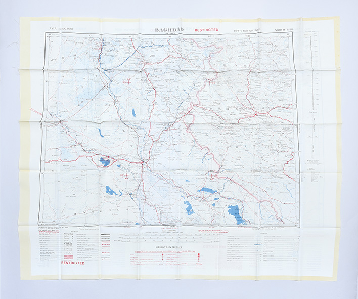
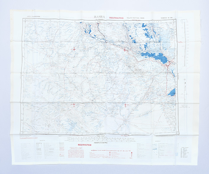
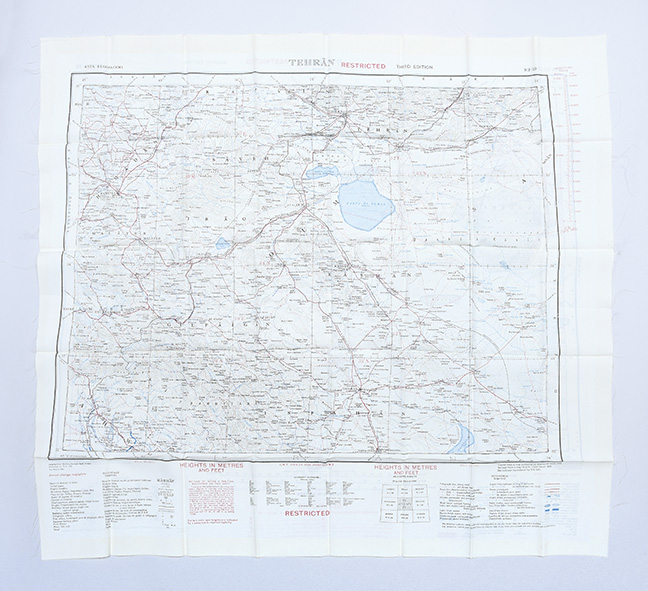
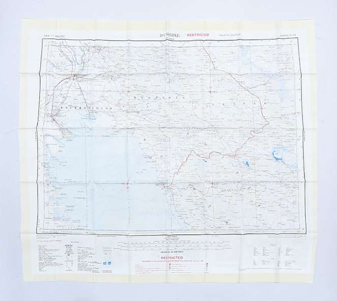
About this Item
Later editions, marked "restricted", revised from those produced by the War Office in 1941-42 and with isogonals correct to 1953. They show the international borders between Iran and Iraq but warn that they are still under negotiation. These maps are in a variety of later editions, all printed in 1951 (Baghdad, fifth; Basra, eighth; Tehran, third; Bushehr, fourth). This was a critical year in Iranian politics, as the country underwent the Abadan Crisis, saw the assassination of Razmara, and the election of Mosaddeq. In the same period Iraq saw a number of anti-government protests, including the 1952 Iraqi Intifada against the Anglo-Iraqi Treaty. Over these years British and American forces kept close watch on the region's development and likely printed these maps, printed on rayon as escape items, to issue to forces in case fighting broke out. Escape maps were first introduced by MI9 during the Second World War, designed to be easily smuggled into POW camps. They were printed on silk, and for "good reasons: silk is flexible and durable, in a way that paper is not and it is noiseless when hidden about one's person" (Bond). They continued to be issued throughout the 20th century and into the modern day, especially during the 1960s and the Vietnam War. Barbara A. Bond, "Escape and evasion maps of World War II", The British Library, 2016. 2 sheets of rayon (596 x 715 mm; 610 x 676 mm), colour map on each side, key on map of Tehran; text in English and French. Sometime folded, edges fraying, more so to sheet of Baghdad and Basra: a very good copy.
Seller Inventory # 182329
Contact seller
Report this item