


Handy Royal Atlas of Modern Geography exhibiting the present condition of geographical discovery and research in the several countries, empires, and states of the world. -
Johnston, Alexander Keith
Published by Edinburg; London: William Blackwood and sons., 1871
Used
Hardcover
From
Antiquariat Tautenhahn, Lübeck, Germany
Seller rating 5 out of 5 stars
![]()
AbeBooks Seller since January 13, 2012
This specific copy is no longer available. Here are our closest matches for Handy Royal Atlas of Modern Geography exhibiting the present condition of geographical discovery and research in the several countries, empires, and states of the world. - by Johnston, Alexander Keith.
About this Item
Description:
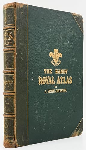
4 Bll., 45 doppelblattgroße Kartenblätter, 98 Seiten, 1 Bl. Verlagsanzeigen, goldgeprägter OHLdrbd., Goldschnitt, 36,5 x 25 cm. Enthält 45 grenzkolorierte Kartenblätter. - Der Schotte Alexander Keith Johnston (1804-1871) war Geograph und Kartograph in der Tradition Humboldts. Sein "Handy Royal Atlas" erschien von 1868 an in verschiedenen Auflagen. Mit dem vorliegenden Erscheinungsjahr 1871 nicht im Dictionary of National Biography (verzeichnet die Ausgaben von 1868, 1873, 1887 und 1890). Dictionary of National Biography 30, 55. Weitere Ausgaben erschienen bis in die Zeit des Ersten Weltkriegs. - Einband: mutmaßlich ein Verlagseinband. Der Vorderdeckel mit goldgeprägter Laubkrone mit drei Straußenfedern, darunter Spruchband mit dem Motto "Ich dien". Der vordere Spiegel mit blindgeprägter Buchbindersignatur (G. MacDonald, 3 Assembly Lane). G. MacDonald nicht identifiziert; mutmaßlich handelt es sich um den Nachfolger des 1861 verstorbenenen Buchbinders John Grey in der East Assembly Lane in Edinburgh. - Provenienz: getilgter Namenszug auf dem Titelblatt (datiert London, 1913; nicht identifiziert). - Deutlich berieben und bestoßen; das Leinen der Deckel etwas gewellt; innen teils minimal fleckig (die Vorsätze etwas stärker). Sonst und insgesamt gutes Exemplar. Seller Inventory # 97491HB
Bibliographic Details
Title: Handy Royal Atlas of Modern Geography ...
Publisher: Edinburg; London: William Blackwood and sons.
Publication Date: 1871
Binding: Hardcover
Top Search Results from the AbeBooks Marketplace

Handy Royal Atlas of Modern Geography exhibiting the present condition of geographical discovery and research in the several countries, empires, and states of the World
Published by
W. & A. K. Johnson, Edinburgh & London, 1877
Used
Hardcover
Seller: George Jeffery Books, HERTFORDSHIRE, United Kingdom
Seller rating 5 out of 5 stars
![]()
Half Calf. Condition: Very Good. Book measures 38x27.cm. [8],101pp, 45 double page coloured maps, 1 double page coloured chart. Bound in period half calf, calf corners, cloth boards, raised bands, gilt lines, crest and lettering, full gilt edges, coloured endpapers. Binding rubbed, scuffed, wear on joints, but binding holding firm. Internally, pages and maps clean thrioughout. A nice clean copy, in a good binding. Size: Small Folio. Seller Inventory # 015174
Quantity: 1 available
Handy Royal Atlas of Modern Geography exhibiting the Present Condition of Geographical Discovery and Research in the Several Countries, Empires and States of the World
Published by
Published by W. & A.K. Johnston, Edinburgh and London, 1892
Used
Hardcover
Seller: Keoghs Books, Skipton, United Kingdom
Seller rating 5 out of 5 stars
![]()
, 52 large double page coloured maps with index to rear Later edition , light rubbing to spine, corners and joints, hinges reinforced, maps and pages clean, very good condition , half morocco and stippled cloth, five raised bands and gilt titles to spine, gilt titles to front, full gilt edges, patterned endpapers , large quarto, 38 cm 27 cm Hardback ISBN: Seller Inventory # 77197
Quantity: 1 available
Handy Royal Atlas of Modern Geography Exhibiting the Present Condition of Geographical Discovery and Research in the Several Countries, Empires, and States of the World
Published by
Edinburgh, Edinburgh, 1883
Used
Hardcover
Seller: High Ridge Books, Inc. - ABAA, South Deerfield, MA, U.S.A.
Seller rating 5 out of 5 stars
![]()
1/2 red leather with gilt-stamped cloth, well worn and rubbed at extremities and along joints. 45 double-page maps in full color with borders highlighted. AEG. Editions of this fine world atlas were published from 1869 until early into the 20th century. Seller Inventory # a00180
Quantity: 1 available