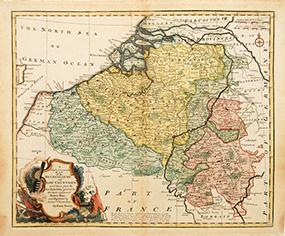
A New & Accurate Map of the Netherlands or Low Countries
BOWEN, Emanuel.
From Peter Harrington. ABA/ ILAB., London, United Kingdom
Seller rating 5 out of 5 stars
AbeBooks Seller since July 26, 1999
From Peter Harrington. ABA/ ILAB., London, United Kingdom
Seller rating 5 out of 5 stars
AbeBooks Seller since July 26, 1999
About this Item
Ornamental cartouche at lower left. This attractive and detailed map covers modern day Belgium, and northern France, but not Holland, which, on the map is called, 'The Seven United Provinces.' Copper engraving. Fine condition, slightly age toned. Later colouring. Size: 43 x 36 cm. Seller Inventory # 52375
Bibliographic Details
Title: A New & Accurate Map of the Netherlands or ...
Publisher: London. 1752
Store Description
All major credit cards are accepted. Both UK pounds and US dollars (exchange rate to be agreed) accepted. Books may be returned within 14 days of purchase for any reason, but please notify first of returned goods.
National and international delivery service is operational and unaffected by COVID-19. All shipped items are expertly packed and fully insured. All books to be sent by Recorded Delivery (UK) or signed-for Air Mail (overseas) service. UPS Express shipping also available. Packaging and insurance costs are included. Orders usually ship within 2 business days. Shipping costs are based on books weighing 2.2 LB, or 1 KG. If your book order is heavy or oversized, we may contact you to let you know extra shipping is required.
Payment Methods
accepted by seller