


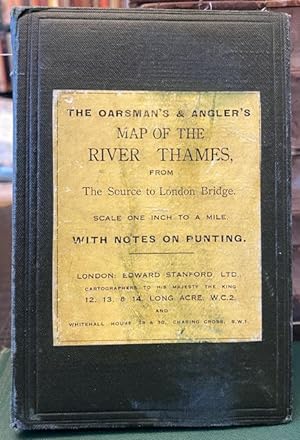
The Oarsman's and Angler's Map of the River Thames. From Its Source to London Bridge. One Inch to a Mile
Stanford's
Published by Edward Stanford ca. 1927, London, 1901
Used
Cloth
From
Foster Books - Stephen Foster - ABA, ILAB, & PBFA, London, United Kingdom
Seller rating 5 out of 5 stars
![]()
AbeBooks Seller since March 3, 1999
This specific copy is no longer available. Here are our closest matches for The Oarsman's and Angler's Map of the River Thames. From Its Source to London Bridge. One Inch to a Mile.
About this Item
Description:
22, plus map, pp. Original green cloth boards with yellow title label to front board. Rubbing to extremities, marks to title label. Map clean. 22 pages of text followed by linen-backed concertina style folding map. Coloured map extends to 267cm. Accompanying text highlights hotels, inns, boatyards, etc. In6 Very Good condition. 12mo. Map. Seller Inventory # 68728
Bibliographic Details
Title: The Oarsman's and Angler's Map of the River ...
Publisher: Edward Stanford ca. 1927, London
Publication Date: 1901
Binding: Cloth
Condition: Very Good
Top Search Results from the AbeBooks Marketplace

The Oarsman's and Angler's Map of the River Thames. From its Source to London Bridge. One Inch to a Mile.
Published by
James Reynolds & Sons, 1889
Used
Softcover
Seller: Anybook.com, Lincoln, United Kingdom
Seller rating 5 out of 5 stars
![]()
Condition: Good. This is an ex-library book and may have the usual library/used-book markings inside.This book has soft covers. Clean from markings. In good all round condition. Reprinted by Old Folding Maps, no date specified. Map, approx 170x13 cm. Cloth-backed with 8vo slipcase. Please note the Image in this listing is a stock photo and may not match the covers of the actual item,200grams, ISBN: Seller Inventory # 9921770
Quantity: 1 available

Seller Image
The oarsman's and angler's map of the River Thames from its source to London Bridge: One inch to a mile
Published by
Edward Stanford, 1901
Used
Seller: Cotswold Internet Books, Cheltenham, United Kingdom
Seller rating 5 out of 5 stars
![]()
Condition: Used - Good. Good map. New edition. Folding linen-backed map, in blind-stamped dark green boards with gilt. Owner's name inside front cover; some annotations & dirty marks on map; spine of cover a little worn. Seller Inventory # BOOKS314757I
Quantity: 1 available
Ravenstein's Oarsman's and Angler's Map of the River Thames.: From its Source to London Bridge, On a Scale of One Inch to a Mile, Showing the
Published by
James Reynolds 1880 (circa), London, 1880
Used
Hardcover
Seller: Tarrington Books, Tarrington, HEF, United Kingdom
Seller rating 5 out of 5 stars
![]()
Hardback. Condition: Good. Undated early printing, circa 1880. Housed in a custom made black cloth folder, retaining the original printed cover. Map has been extensively restored and is now mounted on new canvas. Library stamps to the folder and to the reverse of the map. The map has some small areas of loss and light staining. The river has been rather crudely coloured in dark red. Map dimensions: 88 x 57 cm (34.25 x 22.5 inches). Scarce. . Overall condition is Good. International postage will be less than the stated rate. Actual costs are Europe �11.35; USA �15.00; Oceania �16.00; Rest of World �16.00. A postage refund will be made after the order has been placed. Size: 4.5 x 6.25 inches (12 x 16 cm). Seller Inventory # 1124E057
Quantity: 1 available
THE OARSMAN'S AND ANGLER'S MAP OF THE RIVER THAMES From its Source to London Bridge. One Inch to a Mile.
Published by
James Reynolds & Sons, 1891
Used
Hardcover
Seller: Francis Edwards ABA ILAB, Hay on Wye, United Kingdom
Seller rating 5 out of 5 stars
![]()
New Ed. 8pp. Linen backed colour printed folding map measuring 16 x 265cm. Lightly browned, folding into gilt lettered brown embossed cloth, spine sl. rubbed. First published in 1861.With details of locks, fishes and fishing, places for good bathing, heights of bridges, scenery along the way, notable landmarks, tolls, the river is annotated with mile markers from London Bridge. US$107. Seller Inventory # 289441
Quantity: 1 available
The Oarsman's and Angler's Map of the River Thames, From It's Source to London Bridge, One Inch to a Mile
Published by
Edward Stanford Ltd, London, 1901
Used
Hardcover
Seller: Charles Vivian Art & Antiques, Rosscarbery, CORK, Ireland
Seller rating 3 out of 5 stars
![]()
Hardcover. Condition: Very Good. New Edition. 16mo, pp. 16, concertina folded linen-backed map, blind stamped green cloth with gilt lettering with some rubbing and a few light marks, interior with owner's name to fep and some pencil comments, offsetting to the first and last page of text, map with some underlining of town and hotel names otherwise fresh, binding sound. Seller Inventory # 001882
Quantity: 1 available
The Oarsman's and Angler's Map of the River Thames. From Its Source to London Bridge. One Inch to a Mile
Published by
James Reynolds [1861], London, 1861
Used
Hardcover
First Edition
Seller: Foster Books - Stephen Foster - ABA, ILAB, & PBFA, London, United Kingdom
Seller rating 5 out of 5 stars
![]()
Cloth. Condition: Very Good. First Edition. Original green cloth boards with gilt lettering & blind-stamping to front board. Linen-backed concertina style folding map, with the Thames coloured blue. Map extends to 272 cm. A Very Good copy of the scarce first edition, with just a few short tears to folds. Map. Seller Inventory # 66097
Quantity: 1 available