Order Total (1 Item Items):
Shipping Destination:

Back Captain George (16 results)
Skip to main search results
Search filters
Product Type
- All Product Types
- Books (16)
- Magazines & Periodicals (No further results match this refinement)
- Comics (No further results match this refinement)
- Sheet Music (No further results match this refinement)
- Art, Prints & Posters (No further results match this refinement)
- Photographs (No further results match this refinement)
- Maps (No further results match this refinement)
- Manuscripts & Paper Collectibles (No further results match this refinement)
Condition Learn more
- New (No further results match this refinement)
- As New, Fine or Near Fine (No further results match this refinement)
- Very Good or Good (9)
- Fair or Poor (1)
- As Described (6)
Binding
Collectible Attributes
Language (2)
Price
- Any Price
- Under US$ 25 (No further results match this refinement)
- US$ 25 to US$ 50
- Over US$ 50
Free Shipping
Seller Location
Seller Rating
-

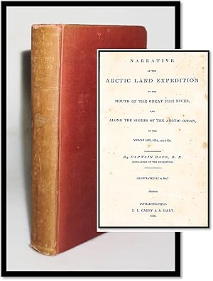
Narrative of the Arctic Land Expedition to the Mouth of the Great Fish River, and Along the Shores of the Arctic Ocean, in the Years 1833, 1834, and 1835
Language: English
Published by Hurtig, Edmonton, 1970
Seller: Benjamin Books, Ottawa, ON, Canada
Seller rating 5 out of 5 stars

Hardcover. Condition: Very Good. Dust Jacket Condition: Very Good. Illustrated by a map and Plates.
-
Narrative of the Arctic Land Expedition to the Mouth of the Great Fish River, and Along the Shores of the Arctic Ocean, in the Years 1833, 1834 and 1835. Illustrated By a Map
Published by E. L. Carey and A. Hart, Philadelphia, 1837
Seller: Resource Books, LLC, East Granby, CT, U.S.A.
Association Member: SNEAB
Seller rating 5 out of 5 stars
Hardcover. Condition: Fair. Philadelphia: E. L. Carey and A. Hart, 1837. Stated second edition, 1837, this edition published without the plates included in the 1836 edition. Journal of an expedition in Canada from Great Slave Lake, Northwest Territories, northeast to the Fish River and the Arctic Coast, illustrated with a folding frontis map. Worn ex-library copy in tan hardcover with tan cloth spine, paper spine label, page edges untrimmed, 456 pages, two pages of publisher ads and a list of testimonials at front. Covers heavily worn and chipped, paper spine label darkened but legible with a chip to the bottom corner, internally better with good hinges, sound text block, pages clean with fairly uniform light to moderate foxing throughout, map lightly foxed and without chips or tears. Library blindstamp on title page, bookplate inside front cover, no other internal library markings. . Hard Cover. Fair. 8vo - over 7�" - 9�" tall.
-

Narrative of The Arctic Land Expedition, to the Mouth of The Great Fish River, and along the shores of The Arctic Ocean, in the years 1833, 1834, and 1835
Published by Charles E. Tuttle, Rutland, VT, 1970
Seller: Lorne Bair Rare Books, ABAA, Winchester, VA, U.S.A.
Association Member: ABAA ILAB IOBA
Seller rating 5 out of 5 stars
First Edition
First Thus. Octavo. 19.5cm. Publisher's dark blue cloth titled in gilt and black to spine. Dustjacket. [xxv]; 663pp. Strong and bright, very light wear to extremities; internally clean and fresh, illustrated throughout; in a strong, clean dustjacket with some light marginal creasing. A very good copy indeed. A facsimile edition of the 1836 first edition, faithfully and rather attractively reproduced by the Tuttle Co. who seem to have had extensive interests publishing books in Japan. An accessible account of Back's dramatic exploratory voyages.
-
Narrative of the Arctic Land Expedition to the Mouth of the Great Fish River, and Along the Shores of the Arctic Ocean in the Years 1833, 1834, and 1835
Published by E. L. Carey & A. Hart, Philadelphia, PA, 1836
Seller: R & G Bliss Books, Excelsior, MN, U.S.A.
Association Member: IOBA
Seller rating 5 out of 5 stars
First Edition
US$ 250.00 30% offUS$ 175.00
US$ 5.85 shipping
Ships within U.S.A.Quantity: 1 available
Add to basketHardcover. Condition: Very Good. No Jacket. 1st Edition. Sm4to. 4 (ads), fold-out map, viii, [9]-456pp. Very good, first American edition book, no dust jacket. Original brown paper covered boards, blue cloth on spine with paper label. Boards and spine are soiled and stained. Waterstain in the lower fore-edge corners of front and back covers. Edges and corners at head and tail of board spine are split and frayed. Most edges including fore-edge corners are rubbed through. External page edges are age- and soil-darkened. Side and lower edges untrimmed. With a mid-19th century inscription on the front pastedown: "J. H. Riker 'Loaned' Yorkville Library Association Jan/51." Also with the inscription "John H. Riker" on the title page. Fold-out Map of the Discoveries and Route of the Arctic Land Expedition in the Years 1833 & 1834, Surveyed and Drawn by Captain Back, R.N. Map is located at the title page; map is foxed, tear in the primary fold of the map repaired on the verso. Foxing throughout but very legible. Text block is sound. Please use close-up options for best inspection and in support of condition descriptions. Additional photos available at your request.
-
Narrative of the Arctic Land Expedition to the Mouth of the Great Fish River, and Along the Shores of the Arctic Ocean, in the Years 1833, 1834, and 1835
Published by A. and W. Galignani and Co., Paris, 1836
First Edition
Three Quarter Vellum. Condition: Good. Dust Jacket Condition: No DJ. First Edition. Pp: viii + 338. Gilt titles: sp. Frontis (map). Illust. w/ b/w tables. The volume is foxed throughout. Frontis fold-in map is torn and detached, else intact. Some chipping to bd. edges. Marbled bds. Inkstains to f.p.d.p. Interior leaves age-toned and fx-ed, else interior leaves are clean, tight and readable. A detailed account of the sub- Arctic expedition led by Captain Back, RN, 1833-1835 to the Great Slave Lake in northern Canada. Includes Appendices & List of Subscribers to the Expedition. A nice copy with some evident wear.
-
A Topographical Description of the Western Territory of North America Containing A Succinct Account of Its Soil, Climate, Natural History, Population, Agriculture, Manners, and Customs. With an ample Description of he several Divisions into which that Country is partitioned. To which is added The Discovery, Settlement, and State of Kentucky. And An Essay towards the Topography and Natural History of that important Country by John Filson. To which is added, I. The Adventures of Col. Daniel Boon, one of the First Settlers, comprehending every important Occurrence in the Political History of that Province. II. The Minutes of the Plankashaw Council, held at Post St. Vincent's, April 15, 1784. III. An Account of the Indian Nations inhabiting within the Limits of the Thirteen United States; their Manners and Customs; and Reflections on their Origin. Illustrated with correct Maps of the Western Territory of North America; of the State of Kentucky, as divided into Counties, from the latent Sur
Published by Printed for J. Debrett, London, 1793
Seller: Americana Books, ABAA, Stone Mt, GA, U.S.A.
Association Member: ABAA ESA ILAB IOBA
Seller rating 5 out of 5 stars
Three-quarter leather. Condition: Good. Octavo. [1], xvi, 433 pages, [1] page blank, [19] page index, [1] page errata, [2] pages advertisements, [1]. Recased binding with three-quarter brown leather and marbled paper covered boards. Gilt title and five raised bands on the spine. Newer front and rear end papers and one front blank end sheet inserted. The original rear end sheet is present. The folding frontispiece map is toned on the verso with an old repair made also on the verso. Some light edge wear to the map. The folding view of the Rapids of the Ohio and the State Map of Kentucky are in very good condition with light toning. Pages 417-433 includes a "Report of the Secretary of State, to the President of the United States, of the Quantity and Situation of the Lands not Claimed by the Indians, Nor Granted to, Nor Claimed by Any Citizens, Within the Territory of the United States. Read in the House of Representatives, Nov. 10, 1791" by Thomas Jefferson. Howes I 12; Howes Reference Filson - F 129; Sabin 34355; Streeter III 1523; Clark II 41, "An early account of the western country.which was produced by a man who left Kentucky without settling his obligations, who seems to have been involved in efforts to organize a French expedition to take the lower Mississippi Valley, and who treated Mary Wollstonecraft Shamelessly. This book was written in the form of letters from Kentucky to a friend in England. In all probability they were written in Europe." The Second Edition, with Considerable Additions.
-
Narrative of the Arctic Land Expedition to the Mouth of the Great Fish River, and Along the Shores of the Arctic Ocean, in the Years 1833, 1834, and 1835
Published by London John Murray 1836, 1836
Seller: Aquila Books(Cameron Treleaven) ABAC, Calgary, AB, Canada
Association Member: ABAC ILAB PBFA
Seller rating 5 out of 5 stars
Signed
x,(2),663 pp. Octavo. Original diced grey cloth with blind decoration on the boards. Gilt title on spine. Spine very lightly faded as usual. Corners bumped and have been professionally renewed. Coated yellow endpapers. Untrimmed. 16 plates and large folding map at the end. Plates have a small amount of foxing otherwise the book is very clean. Very scarce in this condition. Contemporary signature on top of title page. Arctic Biblio. 851; Streeter 3705. Back, who had been with Franklin on both of his overland expeditions, was here sent out to locate John Ross, unreported after three winters in the Arctic. He traveled overland to Great Slave Lake, where he received news of Ross' return to England; Back however continued on, descending the Fish (now Back) River then unexplored, to the Arctic Ocean. This copy belonged to Henry Wemyss Feilden the naturalist that accompanied the Nares Expedition 1874/75 on the Alert. In 1895 and 1897, accompanying Henry J. Pearson, Feilden participated in expeditions to Novaya Zemlya, Kolguyev, Spitsbergen, Lapland and the Kara Sea. The book is nicely signed the top of the title page in his usual purple ink. This very attractive copy of the Back has the noble provenance to have been owned by a fellow early arctic explorer.
-
Narrative of the Arctic Land Expedition to the Mouth of the Great Fish River, and Along the Shores of the Arctic Ocean, in the Years 1833, 1834, and 1835
Published by London John Murray 1836, 1836
Seller: Aquila Books(Cameron Treleaven) ABAC, Calgary, AB, Canada
Association Member: ABAC ILAB PBFA
Seller rating 5 out of 5 stars
x[2], 663[1]pp. Quarto (23 X 28 cm). Large-Paper Admiralty Issue. Original full calf boards with a new calf spine to match; five raised decorative bands and gold gilt lettering and decorations stamped to the spine with two Morocco title labels--one maroon and one black. Original marbled endpapers and edges to match. Sixteen mounted proof plates. Large folding map has some offsetting, very mild foxing and a 1" tear near the hinge that has been professionally repaired. Previous owner's bookplate to front pastedown. Occasional foxing throughout. Generally, a tight and clean copy in an attractive binding. Artic Biblio. 851; Streeter 3705. Back, who had been with Franklin on both of his overland expeditions, was here sent out to locate John Ross, unreported after three winters in the Arctic. He traveled overland to Great Slave Lake, where he received news of Ross's return to England; Back however continued on, descending the Fish (now Back) River-- then unexplored--to the Arctic Ocean. This is the very scarce large paper Admiralty issue of the book that was produced to match the quarto issue of Beechey's Narrative. This was Thomas Sidney's copy, with his bookplate present on the front pastedown. Sidney was a City Counsellor for Farringdon Ward in 1843/4, and shortly afterwards in 1844, as Alderman of Billingsgate, a position he held for 36 years.
-
Narrative Of The Arctic Land Expedition To The Mouth Of The Great Fish River, And Along The Shores Of The Arctic Ocean, In The Years 1833, 1834, And 1835.
Published by London: John Murray, 1836., 1836
Seller: D & E LAKE LTD. (ABAC/ILAB), Toronto, ON, Canada
Seller rating 3 out of 5 stars

First Edition
Hardcover. Condition: Very Good. 1st Edition. 4to. pp. x, [1 leaf]list of plates, 663, [1]. large folding engraved map & 16 engraved & lithographed plates on india paper, mounted. 8 wood-engraved text illus. (incl. map). modern bds. (very occasional light foxing, some offsetting from plates). First Edition: Large-Paper Admiralty Issue. Back had previously gained considerable experience as an arctic explorer through his participation in the abortive Buchan expedition and Franklin's two overland expeditions. Back was "one of the first competent artists to penetrate into the Canadian Arctic"; the many watercolours and drawings which he produced and which enhance his narratives and those of Franklin "are now considered an invaluable record of early northern history" (DCB). Although Back was highly valued by the British Admiralty, he was not a popular personality and he developed a fairly controversial reputation as a dandy, womanizer and hopeless egocentric. The privately financed, government-assisted expedition described in this narrative was undertaken in 1833, for the purpose of aiding members of the Second Ross expedition, from whom no one had heard since 1828. They were also to conduct scientific investigations and a geographical survey of an unknown section of arctic coast. They travelled overland from Montreal to Slave River and Great Slave Lake, and descended the Thleweechodozeth or Great Fish River (later renamed the Back River) to the arctic coast, thence along Chantrey Inlet to Ogle Point. The work also includes a valuable appendix on natural history and scientific subjects by Back, Richardson, Hooker, Children, Fitton and King, a discussion of Hearne's journey, 1769-72, by Richardson (chapt. 5), observations on the Netsilik Esquimaux at the mouth of the Back River, &c. A list of subscribers to the expedition occupies pp. 638-63. Arctic Bib. 851. Field 63 (17 plates). Lande 935. Sabin 2613. cfSmith 393. cfTPL 1873. DCB X pp. 26-29. Story p. 44.
-
Narrative Of The Arctic Land Expedition To The Mouth Of The Great Fish River, And Along The Shores Of The Arctic Ocean, In The Years 1833, 1834, And 1835.
Published by London: John Murray, 1836., 1836
Seller: D & E LAKE LTD. (ABAC/ILAB), Toronto, ON, Canada
Seller rating 3 out of 5 stars
First Edition
Hardcover. Condition: Very Good. 1st Edition. 8vo. pp. x, [1 leaf]list of plates, 663, [1]. large folding engraved map & 16 engraved & lithographed plates. 8 wood-engraved text illus. (incl. map). untrimmed in full modern calf by Annegret Hunter-Elsenbach, spine richly gilt (map neatly backed on rice paper, some leaves with light marginal dampstains). First Edition. Back had previously gained considerable experience as an arctic explorer through his participation in the abortive Buchan expedition and Franklin's two overland expeditions. Back was "one of the first competent artists to penetrate into the Canadian Arctic"; the many watercolours and drawings which he produced and which enhance his narratives and those of Franklin "are now considered an invaluable record of early northern history" (DCB). Although Back was highly valued by the British Admiralty, he was not a popular personality and he developed a fairly controversial reputation as a dandy, womanizer and hopeless egocentric. The privately financed, government-assisted expedition described in this narrative was undertaken in 1833, for the purpose of aiding members of the Second Ross expedition, from whom no one had heard since 1828. They were also to conduct scientific investigations and a geographical survey of an unknown section of arctic coast. They travelled overland from Montreal to Slave River and Great Slave Lake, and descended the Thleweechodozeth or Great Fish River (later renamed the Back River) to the arctic coast, thence along Chantrey Inlet to Ogle Point. The work also includes a valuable appendix on natural history and scientific subjects by Back, Richardson, Hooker, Children, Fitton and King, a discussion of Hearne's journey, 1769-72, by Richardson (chapt. 5), observations on the Netsilik Esquimaux at the mouth of the Back River, &c. A list of subscribers to the expedition occupies pp. 638-63. Arctic Bib. 851. Sabin 2613. Smith 393. TPL 1873. cfField 63 (17 plates). cfLande 935. DCB X pp. 26-29. Story p. 44.
-
Narrative Of The Arctic Land Expedition To The Mouth Of The Great Fish River, And Along The Shores Of The Arctic Ocean, In The Years 1833, 1834, And 1835.
Published by London: John Murray, 1836., 1836
Seller: D & E LAKE LTD. (ABAC/ILAB), Toronto, ON, Canada
Seller rating 3 out of 5 stars
First Edition
Hardcover. Condition: Very Good. 1st Edition. 8vo. pp. x, [1 leaf]list of plates, 663, [1]. large folding engraved map & 16 engraved & lithographed plates. 8 wood-engraved text illus. (incl. map). original blind-stamped cloth (joints repaired, pp. 109-112 misbound after p. 100). First Edition. Back had previously gained considerable experience as an arctic explorer through his participation in the abortive Buchan expedition and Franklin's two overland expeditions. Back was "one of the first competent artists to penetrate into the Canadian Arctic"; the many watercolours and drawings which he produced and which enhance his narratives and those of Franklin "are now considered an invaluable record of early northern history" (DCB). Although Back was highly valued by the British Admiralty, he was not a popular personality and he developed a fairly controversial reputation as a dandy, womanizer and hopeless egocentric. The privately financed, government-assisted expedition described in this narrative was undertaken in 1833, for the purpose of aiding members of the Second Ross expedition, from whom no one had heard since 1828. They were also to conduct scientific investigations and a geographical survey of an unknown section of arctic coast. They travelled overland from Montreal to Slave River and Great Slave Lake, and descended the Thleweechodozeth or Great Fish River (later renamed the Back River) to the arctic coast, thence along Chantrey Inlet to Ogle Point. The work also includes a valuable appendix on natural history and scientific subjects by Back, Richardson, Hooker, Children, Fitton and King, a discussion of Hearne's journey, 1769-72, by Richardson (chapt. 5), observations on the Netsilik Esquimaux at the mouth of the Back River, &c. A list of subscribers to the expedition occupies pp. 638-63. Field 63 (17 plates). Lande 935. Sabin 2613n. cfArctic Bib. 851. cfSmith 393. cfTPL 1873. DCB X pp. 26-29. Story p. 44.
-
Narrative of the Arctic Land Expedition to the Mouth of the Great Fish River, and Along the Shores of the Arctic Ocean, in the Years 1833, 1834, and 1835
Published by John Murray, London, 1836
Seller: Argosy Book Store, ABAA, ILAB, New York, NY, U.S.A.
Seller rating 5 out of 5 stars
hardcover. Condition: very good. Illustrated with a large folding map, 16 engraved plates, some text illustrations. x, [2], 663pp., thick 8vo, 3/4 brown calf; (rubbed, corners bumped, light foxing on some pages and plate margins, full page inscription by previous owner on flyleaf). London: John Murray, 1836. Very good. A fine source for both the early exploration of the far North as well as ethnology, includes details about Back's commerce with the Cree, Chippewa, and Coppermine Indians, and information relating to Arctic flora and fauna. Streeter Sale 3704. Sabin 2613. Wagner-Camp 58b.
-
Narrative of the Arctic Land Expedition to the Mouth of the Great Fish Rover, and Along the Shores of the Arctic Ocean, in the years 1833, 1834, and 1835;
Publication Date: 1836
Seller: Maggs Bros. Ltd ABA, ILAB, PBFA, London, United Kingdom
Association Member: ABA ILAB PBFA
Seller rating 5 out of 5 stars
First Edition
US$ 373.17
US$ 36.23 shipping
Ships from United Kingdom to U.S.A.Quantity: 1 available
Add to basketFirst Paris edition. Folding map. 8vo. Half calf over marbled boards. Black calf label to spine with gilt lettering. Glued tears to map, slight foxing to early quires. Bookplate to front pastedown and blind book stamp of J. Candy to both pastedowns. viii, 338pp. Paris, A. & W. Galignani and Co., Published in the same year as the first English, this edition was issued without the plates and illustrations that accompanied the English and American editions.� Back's overland expedition was sent to discover the fate of and potentially rescue the Ross expedition, which had not been heard of since departing for the Arctic in 1829. Along the way, Back also continued to explore the region, especially the rivers leading into the Arctic Ocean, traveling via Montreal to Slave River to Hoarfrost River, down the Great Fish River (now renamed the Back River) and then to the Arctic coast.� Hill, 42. Sabin 2613.�.
-
Narrative of the Arctic Land Expedition to the Mouth of the Great Fish River, and along the Shores of the Arctic Ocean in the Years 1833, 1834, and 1835
Published by E.L. Carey & A. Hart, Philadelphia, 1836
Seller: Blind-Horse-Books (ABAA-FABA-IOBA), DeLand, FL, U.S.A.
Association Member: ABAA ESA FABA ILAB IOBA
Seller rating 5 out of 5 stars
First Edition
Condition: Very Good. Dust Jacket Condition: No Dust Jacket. Red cloth, spine lettered in gilt. 9.5 inches tall; 456 pp. Without the four page publisher's ads at the front. Illustrated with folding frontispiece map. First U.S. Edition. Ex-library (Bowdoin College, withdrawn bookplate), and pencil marks on the rear paste-down are the only markings. Moderate wear to cloth, spine sunned; foxing, repairs to map; Clean text with occasional margin spotting. The First American edition of Back's overland expedition narrative from Montreal to the central Arctic, aimed at aiding the second Ross expedition members, received acclaim from Field as a crucial resourceequivalent to Franklin's workfor comprehending the indigenous peoples of the North. During its publication, "The Quarterly Review" lauded its literary style as surpassing any prior accounts on the subject. Notably, the edition's map is a smaller segment derived from the original map featured in the first London edition released in the same year. Back covered over 7500 miles, 1200 of which were previously unknown territory. His narrative holds literary esteem and is "full of details about the Cree, Chippewa, Coppermine Indians, and other tribes, upon whom members of the exhibition were obliged to depend during a terrible winter" [Hill] Back was commissioned to complete the survey of the coast between Prince Regent's Inlet and Turnagain Point but the Terror was beset by ice for nearly a year (August 1837- July 1837), drifting in the pack off northeast Southampton Island. Ref: Field 65; Sabin 2613; Wagner-Camp 58b:3. First Edition, First Printing. [American].
-
Narrative of the Arctic Land Expedition to the Mouth of the Great Fish
Seller: G.S. MacManus Co., ABAA, Bryn Mawr, PA, U.S.A.
Seller rating 5 out of 5 stars
First Edition
BACK, Captain [George]. Narrative of the Arctic Land Expedition to the Mouth of the Great Fish River, and Along the Shores of the Arctic Ocean, in.1833, 1834 and 1835. Phila.: E.L. Carey & A. Hart, 1836. 1st American ed. Folding map. 456pp. plus advts. A very good untrimmed copy in orig. cloth-backed boards with printed paper label on spine.
-
NARRATIVE OF THE ARCTIC LAND EXPEDITION TO THE MOUTH OF THE GREAT FISH RIVER, AND ALONG THE SHORES OF THE ARCTIC OCEAN, IN THE YEARS 1833, 1834, AND 1835.
Published by London: John Murray, 1836., 1836
Seller: William Reese Company, New York, NY, U.S.A.
Association Member: ABAA ESA ILAB SNEAB
Seller rating 5 out of 5 stars
First Edition
A fresh, clean copy of "One of the fundamental books on Arctic exploration" Hill. George Back entered the Royal Navy in 1808, and was taken prisoner by the French in 1809, who detained him for nearly five years. Following his release he reenlisted, and served under Sir John Franklin in 1818. A true veteran of Arctic exploration, Back accompanied Franklin on both of his first two expeditions in 1819 and 1825-27, making this 1833-1835 expedition, undertaken originally as a relief mission for John Ross, his third foray. Back and his party went from Montreal to Great Slave Lake, then overland to the Arctic Ocean. The detailed descriptions of the geography, native flora and fauna, and indigenous inhabitants of Northwest Canada, supplemented by beautiful engravings made after Back's own sketches, quickly made this narrative a roaring success, and it was printed in three languages and four editions by the end of the year. Some copies, usually referred to as "large paper copies," were printed in a quarto volume from the same setting of type as this octavo edition. "Captain Back's Narrative is crowded with details of his intercourse with the Crees, Chippewyans, Dog Rib, and Coppermine Indians, upon whom he, as well as Captain Franklin, was obliged to depend in great measure for subsistence during the terrible privations of an Arctic winter. No intelligent comprehension of.the frozen regions of North America can be obtained without reading the narratives of Captains Franklin and Back; both of whose Journals of their overland expeditions are very largely occupied with descriptions of Indian life and peculiarities" Field. "After Franklin, the most important early explorer of the Canadian Northwest was George Back" Reese. "Regarded as one of the finest travel books of the nineteenth century" Howgego. ARCTIC BIBLIOGRAPHY 851. STREETER SALE 3704. FIELD 63. SABIN 2613. HILL 42. HOWGEGO II:B3. WAGNER-CAMP 58b:2. REESE, BEST OF THE WEST 47 (note). Modern calf, raised bands. Spine lettering worn. Light foxing to plates, an occasional paper flaw. Some offsetting to map, small repaired tear near gutter. Very good.