Captain Commander Expedition (7 results)

Published by Henry Colburn, London, 1843
- Hardcover
Seller: Excalibur Books, Penzance, United KingdomExcalibur Books
Contact seller3-star sellerCondition: Used - Good
US$ 586.70
US$ 33.51 shippingShips from United Kingdom to U.S.A.Quantity: 1 available
Half-Leather. Condition: Good+. "Published under the Authority of the Lords Commanders of the Admiralty". Vol. II only (of 2 published). Chapter I deals with the visits to Tahiti and Raratonga. Other visits are to the Feejee Islands, Port Carteret, Port Gower & Turtle Bay, Port Victoria, Guinea Coast, Arimoa, Floating Islands, J…obie, Pigeon Island, Amboina, bouro, Maccasar, Solombo and Singapore, where they recieve instructions to proceed to China. Then follows the Naval actions in Canton River and attacks on the Forts of Chuenpee and Tycocktow, possesion of Hing Kong, storming the Forts of the Bocca Tigris and much more until the Sulphur returns to Singapore. The remaining voyage takes in Ceylon and the seychelles and includes Natural History observations. St Helena, Ascension Islands and Cape Blanco are the last visits before returning to England. Interesting Appendices include Nicaragua, Marquesas, Kuikahi and, most importantly, a large Appendix on "The Regions of Vegetation; being an analysis of the Distribution of Vegetable Forms over the surface of the Globe, in connexion with Climate and Physical Agents, by Richard Brinsley Hines, Surgeon R.N., which includes Australia and New Zealand. This last Appendix occupies Pages 325 to 460. Followed by the Index. Well illustrated with 11 Full-Page Engraved Plates and 9 Vignette illustrations. Frontis Plates illustrates the attack on the Chinese War Junks at Chuenpee Creek. Contemporary Green Half-Leather Binding with 5 Raised Bands to spine. Gilt Title on Red Ground in 2nd compartment and Gilt Decoration filling the others. Green cloth covered boards with Leather corners. 474 Pages, 900g, 8 1/2" Tall. Some edge wear, corners worn through. Previous owner's name on ffep and blank preliminary page. No other inscriptions. Some light foxing to plates. Only an occasional spot on text pages. Hinges sound and text block firm. Size: 8vo - over 7¾" - 9¾" tall.
 More images
JOURNAL OF A SECOND VOYAGE FOR THE DISCOVERY OF A NORTH-WEST PASSAGE FROM THE ATLANTIC TO THE PACIFIC; Performed in the Years 1821 - 22 - 23, in His Majesty's Ships Fury and Hecla ;- CAPTAIN RAINIER'S COPY.
Parry (Captain William Edward) , R.N., F.R.S., and Commander of the Expedition ;-
Published by London ;- John Murray, 1824
- Hardcover
- First Edition
Seller: HALEWOOD AND SONS ABA ILAB Est. 1867., PRESTON, United KingdomHALEWOOD AND SONS ABA ILAB Est. 1867.
Contact seller2-star sellerCondition: Used - Very good
US$ 621.22
US$ 16.22 shippingShips from United Kingdom to U.S.A.Quantity: 1 available
Hardcover. Condition: Very Good. No Jacket. 1st Edition. IMPORTANT ASSOCIATION COPY PRESENTED TO CHARLES RAINIER "FROM HIS AFFECTIONATE MOTHER, NOV. 28TH, 1846. Captain Rainier's Bookplate. First Edition. Quarto. Hardback. Contemporary Diced Calf (rebacked leather / recased) Complete with Folding Charts & plates. Rainier Family…inscriptions to front free-endpaper. xxx + 571pps. + A SUPPLEMENT TO THE APPENDIX OF CAPTAIN PARRY'S VOYAGE FOR THE DISCOVERY OF A NORTH-WEST PASSAGE, IN THE YEARS 1819 - 20, CONTAINING AN ACCOUNT OF THE SUBJECTS OF NATURAL HISTORY. London, John Murray. 1824. pps. clxxxiii - cccx + 6 plates. Marbled endpapers & foredges. (some mild foxing / soiling throughout) Superb ! Mount Rainier in Washington, U.S.A. was named after the family.
Narrative of a Journey to the Shores of the Polar Sea in the Years 1819, 20, 21, and 22
Franklin, John, Captain R.N., F.R.S. (and Commander of the Expedition)
Published by John Murray, London, 1824
- Hardcover
Seller: Schooner Books Ltd.(ABAC/ALAC), Halifax, NS, CanadaSchooner Books Ltd.(ABAC/ALAC)
Contact seller4-star sellerCondition: Used
US$ 600.00
US$ 25.00 shippingShips from Canada to U.S.A.Quantity: 1 available
Second Edition. xix,370,(1) & iv,(2),399,(2) Pp. Vol. I has a large partial coloured map as frontis and Vol. II has 3 large folding maps in the rear The record of Franklin's first Arctic expedition, fraught with hardship and tragedy, constitutes one of the classics in the annals of travel literature. In all, the party travelled…5,500 miles overland and with the aid of canoes, exploring the territory from York Factory to the mouth of the Coppermine River on Coronation Gulf, east along the Arctic coast as far as Point Turnagain, and back across the Barren Lands. Provisions were poor and scant, and on the return journey, many crew members died of cold and starvation; the young naval artist Robert Hood was murdered and another executed for the crime. The work also includes accounts by Richardson and Back of the last leg of the desperate journey across the Barren Lands. This edition omits the appendix on the natural history of the region and scientific observations on the aurora borealis and the magnetic needle. Arctic Bib. 5195. Sabin 25625. TPL 1249. Lande 1181-82. Peel 151n. Rebound with the original marbled boards and new brown calf spines. The dedication page has been expertly repaired as well as one of the folding maps in Vol. II. Later brown calf with marbled boards and gilt titles to spine.
 More images
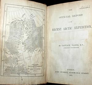
Published by John Murray, London, 1876
- Hardcover
- First Edition
Seller: Bailgate Books Ltd, Doncaster, United KingdomBailgate Books Ltd
Contact seller5-star sellerCondition: Used - Good
US$ 640.54
US$ 19.43 shippingShips from United Kingdom to U.S.A.Quantity: 1 available
Hardcover. Condition: Good. No Dust Jacket. First Edition. Report to the Admiralty of the expedition that left Upernivick on 22 July 1875 and returning in October 1876. This is an ex-library copy with flaws as described. Black half-leather binding with banded spine and dark blue covers are lightly rubbed at edges, binding is sou…nd with strengthened inner hinges. Crossed and stamped large library label is pasted to the inside of the front cover, additional end-papers (darkened), no half-title-page, frontis map has been pasted to previous end-paper with resultant wrinkles on both surfaces and a stamp of "Free Public Library Westminster S.W." on the obverse of the frontis shows through the pasted end-paper (although not visible from the map. Title-page is darkened, has a crossed out reference number in the upper leading corner and a psted paper rectangle covering a "Free Public Library Westminster S.W." stamp, small feint stamp on reverse and short closed tear (approx 1cm) on leading edge. Pages are little darkened with some smudge marks mainly in margins, page 84 to 91have a very small ink mark on the lower corner, "Free Public Library Westminster S.W." stamp acorss the bottom of the final page. Quantity Available: 1. Shipped Weight: under 1 kg. Pictures of this item not already displayed here available upon request. Inventory No: 61115030126. All our books are sent by tracked mail.
 More images
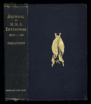
Published by Sampson Low, Marston, Searle, & Rivington., London, 1889
- Hardcover
- First Edition
Seller: Sapience Bookstore, Hexham, United KingdomSapience Bookstore
Contact seller3-star sellerCondition: Used - Good
US$ 3,727.30
US$ 29.89 shippingShips from United Kingdom to U.S.A.Quantity: 1 available
Hardcover. Condition: Good. No Jacket. 1st Edition. Good. Publishers cloth, embossed with gilt lettering and emblem to upper cover. Front hinge cracked. Gift inscription in contemporaneous hand to free front endpaper. A touch of foxing. Two of the maps have a dog-eared fore-edge where they have not been folded quite flush with t…he page edges. Illustrated with tissue-guarded colour frontispiece of the ship, tissue-guarded portrait of the author and 6 fold-out maps. xi, [i], 531pp, 32pp of publishers ads to rear. FIRST EDITION of the posthumously published journal by the captain who came closest to the site where Franklin's expedition ended. "In 1849 Collinson was appointed to command an expedition for the relief of Sir John Franklin, by way of the Bering Strait; he himself had command of the Enterprise, and with him was Commander Robert Le Mesurier McClure in the Investigator. The two ships sailed together from Plymouth on 20 January 1850 but unfortunately separated in the neighbourhood of Cape Horn and did not meet again. The Enterprise passed Point Barrow, Alaska, on 21 August, but the ice forced Collinson to return south and winter in Hong Kong. In 1851 he was again hampered by ice and in 1852 was frozen in at Cambridge Bay for the winter. In 1853 the Enterprise was caught in the ice at Camden Bay, and there passed a third winter. She reached Point Barrow on 8 August 1854, after being shut up in the Arctic, entirely on her own resources, for upwards of three years. Of the many who had searched for Franklin, Collinson came closest to the place where the expedition had ended. Collinson's addition to geographical knowledge on this Arctic trip was very considerable, and would have been tantamount to the discovery of the north-west passage, had this not been already actually achieved by the men of the Investigator" (DNB). Arctic Bibliography 3351; Hill 337; Ricks p 68; Tourville 986.
Narative Of A Journey To The Shores Of The Polar Sea, In The Years 1819, 20, 21, and 22
Franklin, John Captain R. N., F. R. S. And Commander Of The Expedition
Published by London, John Murray, Albemarle Street, 1823
- Hardcover
- First Edition
Seller: Terrace Horticultural Books, St. Paul, MN, U.S.A.Terrace Horticultural Books
Contact seller4-star sellerCondition: Used - Very good
US$ 7,890.00
US$ 6.99 shippingShips within U.S.A.Quantity: 1 available
Hardcover. Condition: Very Good. 1st Edition. Very Good, Clean, Some Wear To Boards And Calf At Extremities, Fade at Upper Spine Area, Sm Quarto, Half Calf, Spine and Corners Wrapped, Marbled Boards, xv,PP.783, Twenty Six Plates, There are Eleven Hand Colored Plates and a second Identical Extra-Illustraterd Uncolored Plates Iden…tical Illustrations with Publisher and Illustrator Credits in The Same Weight Paper ( not Proof Before Letters), B & W Engraving And A Second Hand Colored, Followed By Four Plates Of Plants At The End Of The Appendix And Followed By Four Maps The Order Of Which and Titles Are Different Than the Book Index shows: Chart of the Discoveries & Route Northern Land Expedition Under The Command Of Captain Franklin, An Outline To Show The Connected Discoveries Of Captains Ross, Parry, & Franklin in the Years 1818, 19, 20, 21, 22 & 23 Which is Hand Colored Showing the Outline Of Water and A Route In Red Line, Route From York Factory To Isle A Cumberland House and The Summer & Winter Tracks From There To Isle A La Cross in 1819 & 1820,And The Fourth Map is Route Of The Expedition From Isle A LA Cross TO Fort Providence in 1819 & 20, Provenance: from the Sitwell Family Library At Weston Hall U. K. The Sitwell Family Seat For 300 Years. This Book Likely Arrived At Weston Hall During The time Of Harriet W. Wrightson 1788-1864 and Col. Henry Hely- Hutchinson Who Was The Nephew of General Lord Hutchinson (later 2nd Earl Of Dronoughmore. It Remained Their Until The Family Sold The Library at Auction in 2021.
 More images
Published by John Murray, 1823
- Hardcover
- First Edition
Seller: Koster's Collectible Books, Farmingville, NY, U.S.A.Koster's Collectible Books
Contact seller5-star sellerCondition: Used - Good
US$ 1,895.00
US$ 4.99 shippingShips within U.S.A.Quantity: 1 available
Hardcover. Condition: Good+. No Dust Jacket. First Edition. Hardcover; Hardcover. Brown leather boards with gold design at board edges. Title in gold over black leather label on gold decorated spine. Boards are noticeably scuffed and worn. Frayed edges, some sunning. Marbleized edges match marbleized endpapers. Occasional foxing… throughout. 4 maps, 30 plates of which 11 are hand colored. All are in nice condition, some light foxing/soil. Always carefully wrapped and shipped in cardboard boxes to protect your purchase.; B/w Illus; 4TO.


