
Order Total (1 Item Items):
Shipping Destination:

Dunphy Angus (43 results)
Skip to main search results
Search filters
Product Type
- All Product Types
- Books (24)
- Magazines & Periodicals (No further results match this refinement)
- Comics (No further results match this refinement)
- Sheet Music (No further results match this refinement)
- Art, Prints & Posters (No further results match this refinement)
- Photographs (No further results match this refinement)
- Maps (19)
- Manuscripts & Paper Collectibles (No further results match this refinement)
Condition Learn more
- New (24)
- As New, Fine or Near Fine (No further results match this refinement)
- Very Good or Good (16)
- Fair or Poor (1)
- As Described (2)
Binding
Collectible Attributes
- First Edition (4)
- Signed (No further results match this refinement)
- Dust Jacket (6)
- Seller-Supplied Images (3)
- Not Print on Demand (43)
Language (2)
Free Shipping
- Free Shipping to U.S.A. (No further results match this refinement)
Seller Location
Seller Rating
-
Coombeswood 1914: Worcestershire Sheet 5.09 (Old Ordnance Survey Maps of Worcestershire)
Seller: WorldofBooks, Goring-By-Sea, WS, United Kingdom
Seller rating 5 out of 5 stars

Paperback. Condition: Very Good. The book has been read, but is in excellent condition. Pages are intact and not marred by notes or highlighting. The spine remains undamaged.
-

Upper Penn 1901: Staffordshire Sheet 62.14 (Old O.S. Maps of Staffordshire)
Seller: WorldofBooks, Goring-By-Sea, WS, United Kingdom
Seller rating 5 out of 5 stars
Paperback. Condition: Very Good. The book has been read, but is in excellent condition. Pages are intact and not marred by notes or highlighting. The spine remains undamaged.
-
Sedgley (SE) with Swan Village and West Coseley 1901: Staffordshire Sheet 1901 (Old O.S. Maps of Staffordshire)
Seller: WorldofBooks, Goring-By-Sea, WS, United Kingdom
Seller rating 5 out of 5 stars
Paperback. Condition: Very Good. The book has been read, but is in excellent condition. Pages are intact and not marred by notes or highlighting. The spine remains undamaged.
-
Gornal and Wren's Nest 1901: Staffordshire Sheet 67.11 (Old O.S. Maps of Staffordshire)
Seller: WorldofBooks, Goring-By-Sea, WS, United Kingdom
Seller rating 5 out of 5 stars
Paperback. Condition: Very Good. The book has been read, but is in excellent condition. Pages are intact and not marred by notes or highlighting. The spine remains undamaged.
-
Penn Common 1900: Staffordshire Sheet 67.02 (Old O.S. Maps of Staffordshire)
Seller: WorldofBooks, Goring-By-Sea, WS, United Kingdom
Seller rating 5 out of 5 stars
Paperback. Condition: Very Good. The book has been read, but is in excellent condition. Pages are intact and not marred by notes or highlighting. The spine remains undamaged.
-

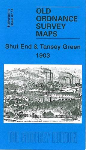
Gornalwood and Himley Coalfield 1901: Staffordshire Sheet 67.10 (Old O.S. Maps of Staffordshire)
Language: English
Published by Alan Godfrey Maps, United Kingdom, Co Durham, 1999
ISBN 10: 1841510599 ISBN 13: 9781841510590
Seller: WorldofBooks, Goring-By-Sea, WS, United Kingdom
Seller rating 5 out of 5 stars
Paperback. Condition: Very Good. The book has been read, but is in excellent condition. Pages are intact and not marred by notes or highlighting. The spine remains undamaged.
-
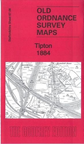
Tipton 1884: Staffordshire Sheet 67.08a (Old Ordnance Survey Maps of Staffordshire)
Seller: WorldofBooks, Goring-By-Sea, WS, United Kingdom
Seller rating 5 out of 5 stars
Paperback. Condition: Very Good. The book has been read, but is in excellent condition. Pages are intact and not marred by notes or highlighting. The spine remains undamaged.
-
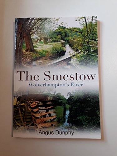
The Smestow: Wolverhampton's River
Language: English
Published by Black Country Society, 2012
ISBN 10: 0904015815 ISBN 13: 9780904015812
Seller: WorldofBooks, Goring-By-Sea, WS, United Kingdom
Seller rating 5 out of 5 stars
Paperback. Condition: Very Good. The book has been read, but is in excellent condition. Pages are intact and not marred by notes or highlighting. The spine remains undamaged.
-

Abstract of the Title of Sir Horace St Paul, Baronet to Freehold Property called Little Daddocks, 1853
Language: English
Published by Ellowes Hall School/Dudley Teachers' Centre, Dudley, 1977
Seller: Salsus Books (P.B.F.A.), Kidderminster, United Kingdom
Association Member: PBFA
Seller rating 5 out of 5 stars
First Edition
Soft cover. Condition: Good. F. A. Barnett (illustrator). 1st Edition. 14pp printed one page of each leaf, map and illustrations by F A Barnett, of Black Country interest.
-
Condition: New. 2018. map. . . . . . Books ship from the US and Ireland.
-
Tipton 1884: Staffordshire Sheet 67.08a (Old Ordnance Survey Maps of Staffordshire)
Seller: Kennys Bookshop and Art Galleries Ltd., Galway, GY, Ireland
Seller rating 5 out of 5 stars
Condition: New. 2018. map. . . . . .
-
Map. Condition: Very Good. Map unmarked. Shipped from the UK in recyclable card packaging.
-
US$ 11.86
US$ 13.41 shipping
Ships from United Kingdom to U.S.A.Quantity: 1 available
Add to basketMap. Condition: Brand New. 8.20x4.80x0.40 inches. In Stock.
-
US$ 12.25
US$ 13.41 shipping
Ships from United Kingdom to U.S.A.Quantity: 1 available
Add to basketMap. Condition: Brand New. In Stock.
-

US$ 12.25
US$ 13.41 shipping
Ships from United Kingdom to U.S.A.Quantity: 1 available
Add to basketMap. Condition: Brand New. In Stock.
-
US$ 12.91
US$ 13.41 shipping
Ships from United Kingdom to U.S.A.Quantity: 1 available
Add to basketMap. Condition: Brand New. 4.72x4.41x0.08 inches. In Stock.
-
Abstract of the Title of Sir Horace St Paul Baronet to Freeehold Property Called Little Daddocks 1853
Published by Dudley Teachers' Centre, 1977
Seller: Red-books ( Member of P.B.F.A. ), Hanley Swan, United Kingdom
Association Member: PBFA
Seller rating 5 out of 5 stars
First Edition
US$ 11.74
US$ 13.41 shipping
Ships from United Kingdom to U.S.A.Quantity: 1 available
Add to basketPaperback. Condition: Very Good. 1st Edition. 14pp, not price clipped, no inscriptions. Internally excellent condition, no turned over page corners. Wraps very good, very slight rubbing, no creasing or fading, spine has been reinforced with specialist cloth repair tape.
-

Old Ordnance Survey Maps of Staffordshire
Publication Date: 2000
ISBN 10: 1841511714 ISBN 13: 9781841511719
Seller: Better World Books Ltd, Dunfermline, United Kingdom
Seller rating 5 out of 5 stars
Condition: Good. Former library copy. Pages intact with minimal writing/highlighting. The binding may be loose and creased. Dust jackets/supplements are not included. Includes library markings. Stock photo provided. Product includes identifying sticker. Better World Books: Buy Books. Do Good.
-
Tipton 1884: Staffordshire Sheet 67.08a
Seller: THE SAINT BOOKSTORE, Southport, United Kingdom
Seller rating 5 out of 5 stars
US$ 11.32
US$ 21.46 shipping
Ships from United Kingdom to U.S.A.Quantity: 1 available
Add to basketSheet map, folded. Condition: New. New copy - Usually dispatched within 3 working days.
-
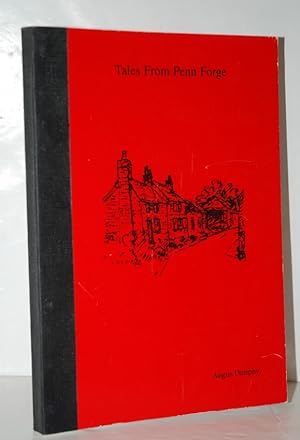
Tales from Penn Forge Penn, Wolverhampton
Seller: Nugget Box (PBFA), Stafford, United Kingdom
Association Member: PBFA
Seller rating 5 out of 5 stars
US$ 27.62
US$ 18.77 shipping
Ships from United Kingdom to U.S.A.Quantity: 1 available
Add to basketPaperback. Condition: Fair. General wear to the book, cover, edges and corners, light scratches plus sticker residue mark to vack cover. Internally Very Good - clean and tidy copy in tight binding. A Very Good personal copy. **372g ** All orders are sent with a tracking /signature service for your peace of mind, so that you can keep tabs on your parcel. For overseas customers - on some sites we use, parcels weighing over the standard rate may incur an additional charge and we will then contact you with the additional shipping fee required. This is for the postage only we do not charge you for our time or our excellent packaging, which we are noted for. Dispatched in cardboard mailers within 24/48 Hours Mon - Friday 2pm, except bank holidays, otherwise next business day - excellent service guaranteed. AANBE10459.
-
Sedgley (SE) with Swan Village and West Coseley 1901: Staffordshire Sheet 1901 (Old O.S. Maps of Staffordshire)
Seller: GENERATIONS GONE BY, Manchester, United Kingdom
Seller rating 5 out of 5 stars
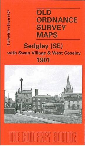
No Binding. Condition: New. Here are the details of maps for Sedgley SE: Staffs Sheet 67.07a Sedgley (SE) & West Coseley 1901 - published 1997; intro by Angus Dunphy. ISBN.978-0-85054-938-6 Staffs Sheet 67.07b Sedgley (SE) & West Coseley 1938 - published 2015; intro by Malcolm Nixon. ISBN.978-1-84784-860-4 We have published two versions of this map, showing how the area changed across the years. It covers an area stretching from the SE corner of Sedgley, including All Saints church, southward to Spills Meadow and eastward to Woodsetton and Swan Village. Roseville is in the top right corner. Features include tramways and tram depot, windmill (disused), Sedgley UDC Offices, Modenhill, Turlshill House, Woodsetton House, High Arcal Farm, The Coppice, Hockley Colliery and tramway, Claycroft Colliery, Parkes' Hall, Mons Hill, old limestone pits, West Coseley, Providence Row, Branfield Colliery (disused) etc, St Chad's church etc. Various directory extracts are included on the reverse. The map links up with Staffordshire sheets 67.03 Sedgley NE to the north, 67.06 Sedgley West to the west, 67.08 Tipton to the east, 67.11 Gornal to the south.
-

Penn to Paper
Language: English
Published by Angus Dunphy, Staffordshrie, 1996
ISBN 10: 0952200406 ISBN 13: 9780952200406
Seller: Castle Hill Books, Llandrindod Wells, United Kingdom
Seller rating 5 out of 5 stars
US$ 31.76
US$ 25.27 shipping
Ships from United Kingdom to U.S.A.Quantity: 1 available
Add to basketPaperback. Condition: Very Good. 102pp, illustrastions, bound in yellow ring bound card covers ; Penn, Wolverhampton; 8vo 8" - 9" tall.
-
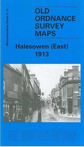
Halesowen (East): Worcestershire Sheet 5.13
Seller: GENERATIONS GONE BY, Manchester, United Kingdom
Seller rating 5 out of 5 stars
Map
No Binding. Condition: New. No Jacket. ere are the details of maps for Halesowen (E): Worcestershire Sheet 5.13 Halesowen (East) 1913 - published 1999; intro by John Maddison. ISBN.978-1-84151-053-8 This detailed map covers the eastern part of Halesowen, with coverage extending eastward to Lapal Farm and Carter's Lane. Features include Halesowen & Northfield railway with Halesowen station, Dudley Canal, Heywood Bridge, Hagley Street and Cornbow area of Halesowen town, The Grange, St Mary's Abbey, Furnace Hill, Lapal House, The Leasows, Webb's Green. On the reverse we include a list of private residents for Halesowen in 1896, plus a railway timetable for the Halesowen-Rubery line. The map links up with Worcestershire sheets 4.16 Halesowen West to the west, 5.09 Coombeswood to the north.
-
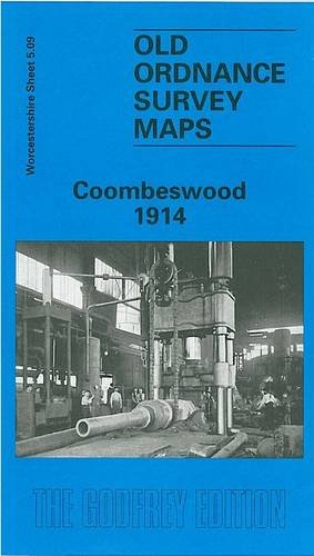
Coombeswood 1914: Worcestershire Sheet 5.09
Seller: GENERATIONS GONE BY, Manchester, United Kingdom
Seller rating 5 out of 5 stars
Map
No Binding. Condition: New. No Jacket. Here are the details of maps for Coombeswood: Worcestershire Sheet 5.09 Coombeswood 1914 - published 1998; intro by Angus Dunphy. ISBN.978-1-84151-002-6 This detailed map covers part of the Halesowen hamlets of Hill, Cakemore and Coombeswood. Coverage stretches from Lewis Lane eastward to Ridgacre Road, and from Maltmill Lane southward to Furnace Lane. Features include a short stretch of the GWR Netherton & Halesowen line, The Furnace, Heywood Forge with mineral railway, Mucklow Hill, Greenhill Farm, Long Lane area, Coombeswood Tube Works, Gorsty Hill, Cockshot, Olivehill Farm, Haggs Farm, Coombes Wood Colliery, Dudley Canal etc. On the reverse we include a section of the 1st Edition 1883 map for the Mucklow Hill area westward to The Furnace. The map links up with Worcestershire sheets 4.12 Cradley South to the west, 5.10 Quinton to the east and 5.13 Halesowen East to the south; and Staffordshire sheet 72.05 Rowley Regis to the north.
-
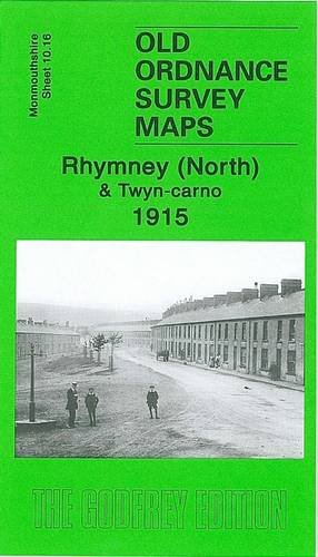
Rhymney (North) and Twyn-carno 1915: Monmouthshire Sheet 10.16 (Old O.S. Maps of Monmouthshire)
Seller: GENERATIONS GONE BY, Manchester, United Kingdom
Seller rating 5 out of 5 stars
Map
No Binding. Condition: New. No Jacket. Here are the details of maps for Rhymney: Monmouthshire Sheet 10.16 Rhymney (North) & Twyn-carno 1915 - published 2006; intro by Angus Dunphy. ISBN.978-1-84151-944-9 This very detailed map covers the northern part of Rhymney. The map covers the area of Rhymney around High Street, from Tre-York Street and Manest Street northward to Twyn-carno and Ras Bryn-oer; features include the Brewery, Queens Crescent, Church Street, St David's church, Royal Arms Hotel, Carno House. Several old quarry and mine workings are shown, including the disused Waun-fawr and Twyn-carno pits. The eastern part of the map is moorland, helping put Rhymney into the context of its landscape. On the reverse we include a directory of Rhymney in 1906. The map links up with sheet 11.13 Tredegar South to the east, 16.04 Rhymney South to the south.
-
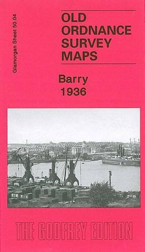
Barry 1936: Glamorgan Sheet 50.04 (Old Ordnance Survey Maps of Glamorgan)
Seller: GENERATIONS GONE BY, Manchester, United Kingdom
Seller rating 5 out of 5 stars
Map
No Binding. Condition: New. No Jacket. Here are the details of maps for Barry: Glamorgan 50.04a Barry 1898 - published 2007; intro by Angus Dunphy. ISBN.978-1-84784-069-1 Glamorgan 50.04b Barry 1936 - published 2013; intro by Derrick Pratt. ISBN.978-1-84784-646-4 We have published two versions of this map, showing how the area changed across the years. The maps cover much of the town of Barry, which sprang up rapidly after 1884 as a mighty coal exporting port. Coverage stretches from Pontypridd Road and Salisbury Road eastward to Morel Street and George Street, and from North Walk southward to the No.1 Dock. The northern part of the No.1 Dock is shown, with detail including a dozen of the coal hoists, with railway sidings, the detail even including mooring posts. Other features on the map include GWR General Offices, locomotive repairing works, Jenner Park football ground, municipal buildings, Memorial Hall, Glamorgan Training College, Alexandra Gardens, St Paul's church and many streets of housing. Each map includes extracts from a 1906 directory. The map links up with sheet 50.08 Barry Island to the south.
-
Cradley (South) 1901: Worcestershire Sheet 4.12 (Old Ordnance Survey Maps of Worcestershire)
Seller: GENERATIONS GONE BY, Manchester, United Kingdom
Seller rating 5 out of 5 stars
No Binding. Condition: New. No Jacket. Here are the details of maps for Cradley (E): Worcestershire Sheet 4.12 Cradley (South) 1901 - published 2001; intro by Angus Dunphy. ISBN.978-1-84151-243-3 This detailed map covers the eastern part of Cradley, southern part of Cradley Heath, the Haden Hill and Haden Cross area, and a rural portion of Hawne parish. Features include Corngreaves Works, Hightown and Overend areas of Cradley, Toy's Green, Colonial Works, Colley Orchard, New Hawne Colliery with mineral railway, Colmanhill House, Timbertree Colliery with tramway, Corngreaves Hall, Surfeit Hill, St Peter's church (split by margin), disused Codsall Colliery, Haden Hill, Haden Cross, Old Hawne Colliery (disused), Gunbarrel Mill, Tadpole Hole, Granville & Gorstyhill Colliery (disused), stretch of GWR Netherton & Halesowen branch, River Stour etc. On the reverse we include an 1896 Cradley directory. The map links up with Worcestershire sheets 4.11 Lye to the west, 5.09 Combeswood to the east, 4.16 Halesowen West to the south and Staffordshire sheet 71.08 Cradley Heath to the north.
-
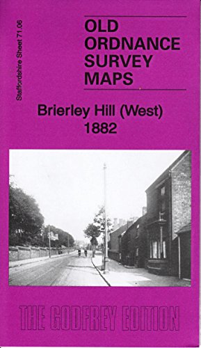
Brierley Hill (West) 1882: Staffordshire Sheet 71.06a (Old Ordnance Survey Maps of Staffordshire)
Seller: GENERATIONS GONE BY, Manchester, United Kingdom
Seller rating 5 out of 5 stars
Map
No Binding. Condition: New. Dust Jacket Condition: New. Here are the details of maps for Brettell Lane: Staffs 71.06a Brierley Hill (West) 1882 - published 2015; intro by Angus Dunphy. ISBN.978-1-84784-869-7 Staffs 71.06b Brierley Hill (West) & Brettell Lane 1901 - published 1997; intro by John Boynton. ISBN.978-0-85054-909-6 We have published two versions of this map, covering a busy industrial area including the western part of Brierley Hill, with the Brettell Lane and Audnam areas. They show how the area changed across the years. Coverage stretches from Audnam House eastward to Hill St, Brierley Hill. Features include Audnam Glass Works, Camp Hill, Stourbridge Canal, Dudley Canal, Brierley House, Buckpool, Nagersfield Fire Brick Works, Dennis Park, Brettell Lane area with Fire Brick Works, GWR railway with Brierley Hill and Brettell Lane stations, Clattershall Works, Brettell Lane House, Brierley Iron Foundry, Delph Works, tramways, Church Hill, Chapel Hill, St Michael's church, Glass Works, Bottle Works, Silver End area, Turners Lane Colliery etc. The map links up with Staffordshire sheets 71.02 Brockmoor to the north, 71.05 Wordsley to the west, 71.07 Brierley Hill East to the east and Worcestershire sheet 4.10 Stourbridge North to the south.
-
Gornalwood and Himley Coalfield 1901: Staffordshire Sheet 67.10
Seller: GENERATIONS GONE BY, Manchester, United Kingdom
Seller rating 5 out of 5 stars
Map
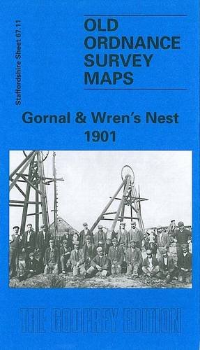
No Binding. Condition: New. Dust Jacket Condition: New. Here are the details of maps for Gornalwood: Staffordshire Sheet 67.10 Gornalwood & Himley Coalfield 1901 - published 199; intro by Angus Dunphy. ISBN.978-1-84151-059-0 This detailed map covers the covers Gornalwood, and the area westward to Straits Green (in the centre of the map) and Himley Wood. Features on the map include St John's church, chapels, Redhall, old coal shafts, Ruiton Farm, Ellowes Hall, brick works, Straits Green, Turner's Hill Wood, Turner's Hill, Wallows Wood, Gordon's Place, Straits House, Himley Colliery, Higharcal, mineral railway and tramway, Himley Wood etc. On the reverse we include a section of the Revision of 1913, showing the Himley Colliery area at a later date. The map links up with sheets 67.06 Sedgley West to the north, 67.11 Gornal to the east, 67.14 Shut End to the south.
-
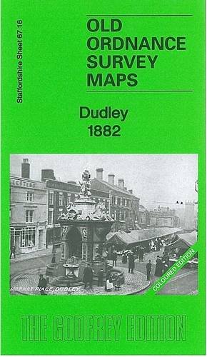
Dudley 1882: Staffordshire Sheet 67.16a (Old Ordnance Survey Maps of Staffordshire)
Seller: GENERATIONS GONE BY, Manchester, United Kingdom
Seller rating 5 out of 5 stars
Map
No Binding. Condition: New. Dust Jacket Condition: New. Here are the details of maps for Dudley: Staffs Sheet 67.16a Dudley 1882 - published 2012; intro by Angus Dunphy. ISBN.978-1-84784-588-7 Staffs Sheet 67.16b Dudley 1901 - published 1997; intro by David Radmore & Samantha Robins. ISBN.978-0-85054-937-9 Staffs Sheet 67.16c Dudley 1914 - published 2017; intro by Barrie Trinder. ISBN.978-1-78721-111-7 We have published three versions of this detailed map, showing how the area developed across the years: it covers the central area of Dudley, and coverage then extends eastward to Kate's Hill, Cawney Hill and Oakham. The map covers parts of both Staffordshire and Worcestershire and doubles as Worcs sheet 1.16. Features on this busy map include Dudley town centre in detail, with individual buildings neatly delineated, including Town Hall, Market Place, High Street area, St Thomas church, St Edmund's church, Waddam's Pool Works, St Mary & St Thomas RC Chapel, Netherton station, Paradise. Features elsewhere include Tansleyhill Colliery, Dixon's Green, Prince of Wales Pit (disused), Cawneyhill House, St John's church, Roseland Farm, Oakham Lodge, Burnt Tree Colliery (disused), industrial tramway and incline, Oakham Colliery (disused), line of Netherton Tunnel, Tansley Hill, old coal shafts etc. The 1882 version is fully coloured, taken from the OS 1st Edition handcoloured map. The map links up with sheets 67.12 Dudley Castle to the north, 67.15 Dudley West to the west, 68.13 Brades Village to the east, 71.04 Netherton to the south.

