

Order Total (1 Item Items):
Shipping Destination:

Ely Colton (4 results)
Skip to main search results
Search filters
Product Type
- All Product Types
- Books (3)
- Magazines & Periodicals (No further results match this refinement)
- Comics (No further results match this refinement)
- Sheet Music (No further results match this refinement)
- Art, Prints & Posters (No further results match this refinement)
- Photographs (No further results match this refinement)
- Maps (1)
- Manuscripts & Paper Collectibles (No further results match this refinement)
Condition Learn more
- New (No further results match this refinement)
- As New, Fine or Near Fine (No further results match this refinement)
- Very Good or Good (No further results match this refinement)
- Fair or Poor (No further results match this refinement)
- As Described (4)
Binding
- All Bindings
- Hardcover (2)
- Softcover (No further results match this refinement)
Collectible Attributes
- First Edition (No further results match this refinement)
- Signed (No further results match this refinement)
- Dust Jacket (No further results match this refinement)
- Seller-Supplied Images (2)
- Not Print on Demand (4)
Language (1)
Price
- Any Price
- Under US$ 25 (No further results match this refinement)
- US$ 25 to US$ 50 (No further results match this refinement)
- Over US$ 50
Free Shipping
Seller Location
Seller Rating
-

Map of the New York Wilderness and the Adirondacks.
Published by G.W. and C.B. Colton and Co., New York, 1880
Seller: Jeffrey H. Marks, Rare Books, ABAA, Rochester, NY, U.S.A.
Seller rating 5 out of 5 stars

About 30 x 26 inches, folded as issued to 12mo. publisher's gilt-lettered cloth portfolio. A beautiful copy. This map copyrighted by G.W. & C.B. Colton & Co, 1873.
-
Colton's Map of the New York Wilderness
Published by New York: G.W and C.B. Colton and Co., 1872., 1872
Seller: Arader Galleries - AraderNYC, New York, NY, U.S.A.
Seller rating 5 out of 5 stars
Hardcover. Single sheet (29 4/8 x 29 inches). 15-pages text. Fine lithographed map with original hand-colour in full, surrounded by an elaborate border of scallop shells and acanthus leaves. Original publisher's black cloth, gilt. "The New York Wilderness embraces a large part of the northern portion of the State - being about seventy-five miles in extent from east to west and from north to south. The southern portion of Clinton, Franklin, and St. Lawrence Counties, nearly all of the Hamilton and Warren Counties, and parts of Essex, Herkimer, and Lewis Counties are comprised in this territory. The wild and rugged character of the Wilderness, the grandeur of its mountain scenery, the beauty of its lakes, rivers, and forests, have made it one of the most popular resorts in our country; while invalids bear favorable testimony to the efficacy of its pure, bracing air, and the excitements incident to travel and life in the woods" (pages [1] -3). Joseph Hutchins Colton had begun publishing maps in New York in the 1830s. Between 1831 and 1890, the Colton firm dominated American map publishing, although Colton had no formal training in geography or cartography; he began by purchasing copyrights of maps prepared by other individuals or companies, and his principal role was to manage the production and distribution of the maps. His first maps were drawn by the esteemed cartographer David H. Burr in the 1830s. By the 1850s Colton was also publishing guidebooks, atlases and immigrant and railroad maps. The firm was renamed G.W. & C.B. Colton in the 1860s when Colton was succeeded by his sons, George and Charles.
-
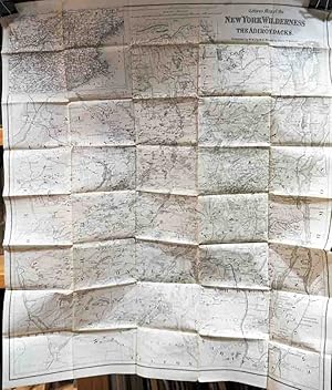
Map of the New York Wilderness and the Adirondacks
Published by New York, New York, 1881
Seller: High Ridge Books, Inc. - ABAA, South Deerfield, MA, U.S.A.
Association Member: ABAA ESA ILAB SNEAB
Seller rating 5 out of 5 stars
Uncolored folding map of the Adirondack region of New York State (all or parts of Saratoga, Warren, Washington, Fulton, Herkimer, Hamilton, Lewis, St. Lawrence, Essex, Oneida, Clinton and Franklin Counties) in fine condition. Inset map of New England and New York State at upper left. The source of this particular map are unclear, as there is no evidence of attachment to a folder or binding into a book or pamphlet. Shows all of Lake Champlain and Lake George. This is a later issue of Ely's map of the region, first published in 1869 and reissued in reduced format, of which this is an example, into the 1890's. Along with an 1881 publication date, this copy also has an 1881 copyright date. This was a very popular map which identified, with heights, most of the mountains and higher hills in this region.
-

Colton's Map of the New York Wilderness and the Adirondacks.
Publication Date: 1894
Seller: Geographicus Rare Antique Maps, Brooklyn, NY, U.S.A.
Association Member: ABAA ESA ILAB
Seller rating 4 out of 5 stars

Map
Good. Wear along original fold lines. Infill at every fold intersection. Manuscript signatures on recto near title. Size 31.5 x 27.5 Inches. This is Colton's 1894 updated edition of William Watson Ely's map of New York's Adirondack Mountains. Coverage extends from Saint Lawrence, Franklin, and Clinton counties in the north, to parts of Oneida and Saratoga counties in the south. An inset map in the upper left marks the location of the Adirondacks in relation to the rest of New York State, and New England as a whole. Colton's updates to Ely's map were supplied at least in part by Edwin R. Wallace, who included the map in his Descriptive Guide to the Adirondacks , which from its first printings in the 1875 would be the essential guidebook for travelers in the wilderness of northern New York. The present example contains further updates to 1894, some quite specific to the famous Adirondack Great Camps. The Wilderness of the Adirondacks With its lush wilderness, rich wildlife, and plethora of lakes and rivers, the Adirondack Mountains were a popular sporting and fishing destination for much of the 19th century. As early as the 1850s it was a favorite stomping ground for such luminaries as James Russell Lowell, Louis Agassiz, and Ralph Waldo Emerson. Nonetheless, it wasn't until 1867 that a reliable map appeared. The Adirondacks' rugged rurality, lakes, mountains, and rivers proved a daunting obstacle for 19th century surveyors and cartographers. The work of Rochester physician and enthusiastic Adirondack sportsman W. W. Ely finally opened this region cartographically. This map, the product of Ely's efforts and experience, was praised by his successor Wallace: To Dr. W. W. Ely, as the pioneer in recording these unmapped portions, and making reasonably plain to those who should follow the devious windings of stream and trail, is due to the gratitude of thousands who have acknowledged the benefit derived from his valuable map of 'the New York wildness,' which, up to the present time, has been the only one worthy of name as such. And indeed Dr. Ely produced a magnificent map. Spacious in size and with a focus on detail, this map notes roads, paths, lakes, rivers, rapids, mines, waterfalls, villages, lodges, and farmsteads throughout the region. As the first reasonably accurate map of the Adirondacks, 'The New York Wilderness' enjoyed an immediately popularity and would continue to be reprinted and edited in various editions for the rest of the 19th century. The Coltons The first formal mention of his map appeared in a letter from Ely to his friend Louis H. Morgan, dated August 19, 1866: I shall not admit that the Adirondacks are behind your country I am ahead of you, for the publishers are soliciting my production - the Coltons have applied for my map and I am playing coy. They want the contribution but do not think the investment would be remunerative, but would publish, I would give it to them. If they will give me due credit for Authorship, I think I will let them have the map, but not to use for the purpose of compilation and take all the glory to themselves. Ely must have come to some understanding with the Colton's, for the map was first published one year later 1867. Nonetheless, Ely was correct in his fears that the publishers would take all credit for the map, as many later editions removed Ely's name from the cover and title. The Updates The present state of the map shows a far more accessible Adirondacks than Ely's 1867 map. Where even the 1869 edition only contained two railroads penetrating partway into the wild - the partially constructed Whitehall and Plattesburg, and the incomplete, Hudson-River-hugging Adirondack Railroad. By the time this 1894 edition was produced railways reached every county except Hamilton. Some of the most famous of the Great Camps, such as Long Lake's faux-rustic Sagamore, have been included in the present edition. Areas formerly difficult to reach and ill mapped, such as the Fulton Chain of lake.


