Order Total (1 Item Items):
Shipping Destination:

Fremont John 1813 (38 results)
Skip to main search results
Search filters
Product Type
- All Product Types
- Books (36)
- Magazines & Periodicals (No further results match this refinement)
- Comics (No further results match this refinement)
- Sheet Music (No further results match this refinement)
- Art, Prints & Posters (2)
- Photographs (No further results match this refinement)
- Maps (No further results match this refinement)
- Manuscripts & Paper Collectibles (No further results match this refinement)
Condition Learn more
- New (6)
- As New, Fine or Near Fine (No further results match this refinement)
- Very Good or Good (8)
- Fair or Poor (No further results match this refinement)
- As Described (24)
Binding
Collectible Attributes
Language (2)
Free Shipping
Seller Location
Seller Rating
-
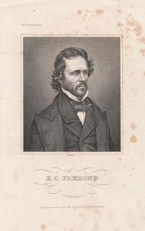
"F. C. Fremont". Stahlstich-Portr�t von Nordheim.
Published by Hildburghausen, Bibliographisches Institut um 1850., 1850
Seller: Antiquariat Dennis R. Plummer, Bingen am Rhein, Germany
Seller rating 5 out of 5 stars

Art / Print / Poster
1 Blatt, verso wei�. Condition: Akzeptabel. Bild ca. 10,5 x 9 cm, Blatt ca. 21 x 14 cm. Brustbild-Portait. John Charles Fr�mont (1813-1890) war US-amerikanischer Entdecker und Politiker. - Recht stockfleckig, gering gebr�unt, sonst gutes Exemplar. Sprache: Deutsch Gewicht in Gramm: 150.
-

Oregon and California: the Exploring Expedition to the Rocky Mountains, Oregon and California
Language: English
Published by HardPress Publishing, 2013
ISBN 10: 1314290932 ISBN 13: 9781314290936
Seller: THE SAINT BOOKSTORE, Southport, United Kingdom
Seller rating 5 out of 5 stars
US$ 32.27
US$ 23.30 shipping
Ships from United Kingdom to U.S.A.Quantity: Over 20 available
Add to basketPaperback. Condition: New. New copy - Usually dispatched within 4 working days.
-

The Exploring Expedition to the Rocky Mountains, Oregon and California
Language: English
Published by HardPress Publishing, 2013
ISBN 10: 1313093882 ISBN 13: 9781313093880
Seller: THE SAINT BOOKSTORE, Southport, United Kingdom
Seller rating 5 out of 5 stars
US$ 32.27
US$ 23.13 shipping
Ships from United Kingdom to U.S.A.Quantity: Over 20 available
Add to basketPaperback. Condition: New. New copy - Usually dispatched within 4 working days.
-

Oregon and California. The Exploring Expedition to the Rocky Mountains, Oregon and California
Language: English
Published by HardPress Publishing, 2013
ISBN 10: 1314290940 ISBN 13: 9781314290943
Seller: THE SAINT BOOKSTORE, Southport, United Kingdom
Seller rating 5 out of 5 stars
US$ 32.27
US$ 23.25 shipping
Ships from United Kingdom to U.S.A.Quantity: Over 20 available
Add to basketPaperback. Condition: New. New copy - Usually dispatched within 4 working days.
-

The Exploring Expedition to the Rocky Mountains, Oregon and California: To Which Is Added a Description of the Physical Geography of California: With
Language: English
Published by HardPress Publishing, 2013
ISBN 10: 1313093521 ISBN 13: 9781313093521
Seller: THE SAINT BOOKSTORE, Southport, United Kingdom
Seller rating 5 out of 5 stars
US$ 32.27
US$ 23.06 shipping
Ships from United Kingdom to U.S.A.Quantity: Over 20 available
Add to basketPaperback. Condition: New. New copy - Usually dispatched within 4 working days.
-

The Life of Col. John Charles Fremont: And His Narrative of Explorations and Adventures, in Kansas, Nebraska, Oregon and California; The Memoir by Sam
Language: English
Published by HardPress Publishing, 2013
ISBN 10: 1313691364 ISBN 13: 9781313691369
Seller: THE SAINT BOOKSTORE, Southport, United Kingdom
Seller rating 5 out of 5 stars
US$ 33.91
US$ 23.85 shipping
Ships from United Kingdom to U.S.A.Quantity: Over 20 available
Add to basketPaperback. Condition: New. New copy - Usually dispatched within 4 working days.
-

Fremont, John Charles - American Explorer - an Engraved Portrait
Language: English
Seller: K Books Ltd ABA ILAB, York, YORKS, United Kingdom
Association Member: ABA ILAB PBFA
Seller rating 5 out of 5 stars
US$ 34.38
US$ 26.04 shipping
Ships from United Kingdom to U.S.A.Quantity: 1 available
Add to basketNo Binding. Condition: Very Good. A splendid engraved portrait, printed in circa 1830 Mounted and ready to frame. This is an excellent opportunity to purchase an attractive and decorative engraved portrait.
-
THE EXPEDITIONS OF JOHN CHARLES FR�MONT [Four volumes]
Language: English
Published by University of Illinois Press, Urbana, 1970
ISBN 10: 0252000862 ISBN 13: 9780252000867
Seller: Second Story Books, ABAA, Rockville, MD, U.S.A.
Seller rating 4 out of 5 stars

Hardcover. Octavo, Four volumes. In Very Good condition with Very Good dust jackets. Spines are tan with black print. Price clipped in first volume; price unclipped in second volume: "$17.50". Boards in brown cloth with gold print. Illustrated: b&w frontispieces and plates, some folded, maps. CONTENTS: Vol. 1. Travels from 1838 to 1844 (1970; ISBN 0252000862) xliv, 854 pages - Vol. 2. The Bear Flag Revolt and the Court-Martial (1973; ISBN 0252002490) lii, 519 pages - Vol. 3. Travels from 1848 to 1854 (1984; ISBN 0252004167) lxxxiii, 641 pages - [Vol. 4.] Map Portfolio (1970; portfolio in slipcase; portfolio contains a 16 page commentary by D. Jackson and 5 maps of the Fr�mont expeditions, map 4 being in 7 sections. [Oversized book(s). Additional postage necessary for expedited/international orders. Economy International shipping unavailable due to size/weight restrictions. For international/expedited customers, please inquire for rates]. NOTE: Shelved in Locked Annex Area, Multi-Volume Area (ND-MV). 1376575. FP New Rockville Stock.
-

Portr�t. Original - Stahlstich von Nordheim, 23,5 x 14,5 cm, ca. 1850.
Seller: Antiquariat Michael Eschmann, Gro�-Gerau, Germany
Seller rating 5 out of 5 stars
Art / Print / Poster
0. Sprache: Deutschu.
-
THE EXPLORING EXPEDITION TO THE ROCKY MOUNTAINS, OREGON AND CALIFORNIA, OREGON AND CALIFORNIA? TO WHICH IS ADDED A DESCRIPTION OF THE PHYSICAL GEOGRAPHY OF CALIFORNIA WITH RECENT NOTICES OF THE GOLD REGION FROM THE LATEST AND MOST AUTHENTIC SOURCES
Published by Geo. H. Derby and Co, Buffalo, 1851
Seller: poor man's rare books (mrbooks) IOBA NJB, Vineland, NJ, U.S.A.
Association Member: IOBA
Seller rating 4 out of 5 stars
Hardcover. Condition: Good with no dust jacket. B&W Illustrations; 456 pages; Graff 1435. Sabin 25842. 4 wood engraved plates including frontis'. Shallow chipping to upper front hinge and crown. Signature starting at 291 slightly protruding. Publisher's blindstamped cloth. 5.25" x8".
-
OREGON AND CALIFORNIA. [rule] THE | EXPLORING EXPEDITION | TO THE | ROCKY MOUNTAINS, | OREGON AND CALIFORNIA, | BY BREVET COL. J. C. FREMONT. | TO WHICH IS ADDED A DESCRIPTION OF THE | PHYSICAL GEOGRAPHY OF CALIFORNIA. | WITH RECENT NOTICES OF | THE GOLD REGION | FROM THE LATEST AND MOST AUTHENTIC SOURCES. [rule] BUFFALO: | GEO. H. DERBY AND CO., PUBLISHERS, | DERBY AND MILLER, AUBURN: H. W. DERBY AND CO., CINNCINNATI: | C. L. DERBY AND CO., SANDUSKY. [rule] 1851.
Published by GEO. H. DERBY AND CO., PUBLISHERS, DERBY AND MILLER, H. W. DERBY, CO. C. L. DERBY AND CO., BUFFALO, AUBUR, CINNCINNATI, SANDUSK, 1851
Hardcover. Condition: Good. 5th or later Edition. 16th edition supplemented for the gold rush, 456 pp., duodecimo 18 x 12 cm. [WCB 115:16, Graff 1435, Smith 3360], two portraits as frontispieces and one illustration of Fremont climbing the highest peak. Rebound in blue cloth. Pages 435 to 454 loose, foxing, otherwise very good. This sixteenth edition of the best selling book published in 1845 was reprinted for the gold rush. The 30 pages of new text is of great interest.
-
The Exploring Expedition To The Rocky Mountains, Oregon And California, Oregon And CaliforniaTo Which Is Added A Description Of The Physical Geography Of California. With Recent Notices Of The Gold Region from the Latest And Most Authentic Sources.
Published by Buffalo: Geo. H. Derby And Co., 1851., 1851
Seller: D & E LAKE LTD. (ABAC/ILAB), Toronto, ON, Canada
Seller rating 3 out of 5 stars

12mo. pp. 456. 4 wood-engraved plates (incl. 2 frontis. portraits). original blind-stamped cloth (extremities frayed). Graff 1435. cfSabin 25842. cfWagner-Camp 115:16.
-

New Edition. Finely bound in modern aniline calf over marble boards. Raised bands with a dark morocco gilt-blocked label. Spine compartments uniformly tooled in gilt. New endpapers. An exceptional copy - scans and additional bibliographic detail on request. ; 456 pages; 456 pages, 20 cm. Lacking frontispiece portrait. Subjects: Discoveries in geography -- American. United States -- Discovery and exploration. West (U.S.) -- Description and travel. Pacific States -- Description and travel. Rocky Mountains. Gold mines and mining -- California. 3 Kg.
-
Memoirs Of My LifeIncluding In The Narrative Five Journeys Of Western Exploration, During The Years 1842, 1843-4, 1845-6-7, 1848-9, 1853-54Vol I. [All Published].
Published by Chicago & New York: Belford, Clarke & Company, 1887., 1887
Seller: D & E LAKE LTD. (ABAC/ILAB), Toronto, ON, Canada
Seller rating 3 out of 5 stars
First Edition
large 8vo. pp. vi, [iii]-xix, 655. 7 maps (4 folding 1 very large bound at end, 2 in colour, 2 tinted) & 69 (of 82) plates (1 in colour, some tinted, incl. frontis. portrait). original pictorial cloth stamped in black, blue, red, gilt & silver, recased (covers scuffed). First Edition. "Embraces his first three exploring expeditions and the part played by him in the conquest of California." (Howes) Howes F-367. Cowan p. 91.
-
Memoirs of My Life by John Charles Fremont. Including in the Narrative Five Journeys of Western Exploration, During the Years 1842, 1843-4, together with a sketch of the Lif of Senator Benton in connection with western expansion. By Jessie Benton Fremont. Vol. I
Published by Belford, Clarke and Co., Chicago & New York, 1886
First Edition
Hardcover. Condition: Good. Darley, Hamilton, Schussele, Dallas, Kern, Wallin, Butler (illustrator). 1st Edition. 27 x 19 cm, iii-xix, 655, i-viii pp., 7 maps several folding and with added color, 82 plates. The second part was never published although it is still advertised in Part I. Rebound using original boards, but binding now separated from page block which is in fine condition From Title Page: "A retrospect of Fifty Years, covering the most eventful periods of modern American history. Superbly illustrated by original portraits, descriptive plates, and, from the Missouri River to the Pacific, by a series of sketches and Daguerreotyes made during the journeys. The illustrations and masterpieces of Darley, Hamilton, Schussele, Dallas, Kern, Wallin and others. Engraved under the supervision of J. M. Butler, with maps and colored plates.".
-

New Edition. Finely bound in modern aniline calf over marble boards. Raised bands with a dark morocco gilt-blocked label. Spine compartments uniformly tooled in gilt. New endpapers. An exceptional copy - scans and additional bibliographic detail on request. ; 456 pages; 456 pages, 20 cm. Lacking frontispiece portrait. Subjects: Discoveries in geography -- American. United States -- Discovery and exploration. West (U.S.) -- Description and travel. Pacific States -- Description and travel. Rocky Mountains. Gold mines and mining -- California. 1 Kg.
-

TICKET. Steamer Fremont. For Salt River, via "Bleeding Kansas" This Ticket Entitles the Holder to a Free Passage up Salt River, on and after Novmber 5th, 1856.
Published by (n. p.), 1856
Seller: Tavistock Books, ABAA, Reno, NV, U.S.A.
Association Member: ABAA ESA ILAB IOBA
Seller rating 5 out of 5 stars
First Edition
1st printing (presumed). 8 lines of type. Verso blank. Small cut of a river packet in center. Oblong format: 1-7/8" x 2-3/4" Presidential elections were held in the United States on November 4, 1856. Democratic nominee James Buchanan defeated Republican nominee John C. Fr�mont, nicknamed the "Woolly Horse", and Know Nothing/Whig nominee Millard Fillmore. The main issue was the expansion of slavery as facilitated by the KansasNebraska Act of 1854. With slavery as the main issue, and with it came the question of the survival of the United States as it then existed. The Democrats were seen as the pro-slavery party. While the new Republican party was hostile to slavery, they limited their efforts to the politically more manageable question of the extension of slavery into federal territories (and its removal from the District of Columbia). The nativist Know Nothings (known formally as the American Party) competed with the Republicans to replace the moribund Whig Party as the primary opposition to the Democrats. They emphasized opposition to Catholic immigrants. The 1856 Republican National Convention nominated a ticket led by Fr�mont, an explorer and military officer who had served in the MexicanAmerican War. The Know Nothings, who ignored slavery and instead emphasized anti-immigration and anti-Catholic policies, nominated a ticket led by former Whig President Millard Fillmore. Domestic political turmoil was a major factor in the nominations of both Buchanan and Fillmore, who appealed in part because of their recent time abroad, when they did not have to take a position on the divisive questions related to slavery. Fr�mont won a majority of electoral votes from free states and finished second in the nationwide popular vote, while Fillmore took 21.5% of the popular vote but only carried Maryland. The Know Nothings soon collapsed as a national party, as most of its anti-slavery members joined the Republican Party after the 1857 Dred Scott v. Sandford Supreme Court ruling. This election marked the end of the Second Party System and also proved to be the last Democratic presidential victory until 1884, as Republicans emerged as the dominant party during and after the Civil War. The phrase 'to go up Salt River' or 'to be rowed up Salt River' is a colloquial political slogan or catchphrase originating from the Antebellum South era of the United States, with its earliest references from 1827 onwards. It was often used in political cartoons and speeches as a metaphor to symbolise political defeat, or even specifically synonymous with 'losing an election.' The satire of this ticket futher enhanced by the supposed agent's name, "Rifle Beecher", as this was a play on "the name given to the breech-loading Sharps rifle that were supplied to and used by the anti-slavery settlers and combatants in Kansas, during the Bleeding Kansas period (18541860)." This 'ticket' obviously used by Fremont's opposition, advising his potential supporters that voting for him would be fruitless, i.e., a loss in the election. An extremely rare survivor from this "Bleeding Kansas" period of 19th C America, e.g., we find no copy held by LCP in a search of their on-line Salt River Ephemera Collection database. Soiling & wear, with the top line of type a bit obscured. A Good copy. Now housed in an archival mylar sleeve.
-
Report of the Exploring Expedition to the Rocky Mountains in the Year 1842 and to Oregon and North California in the Years 1843-44
Published by Blair and Rivers Printers. Washington, DC, 1845
Seller: The Book Collector, Inc. ABAA, ILAB, Fort Worth, TX, U.S.A.
Association Member: ABAA ILAB IOBA TXBA
Seller rating 4 out of 5 stars
First Edition
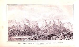
Hardcover. Condition: Very Good. 1st Edition. 1 volume in 2 parts. 581 pages with 22 lithographed plates, 4 maps and the large Preuss map in pocket at back, appendix and index. Royal octavo (9 1/4" x 6") bound in original publisher's brown cloth with gilt lettering to spine and blind-stamped decorative ruled edges. Inscribed by George Sykes. House issue, without the astronomical and meteorological observations present in the Senate issue and subsequent editions. (Cohen Mapping the West pp.130-133; Field 565; Graff 1436; Howes F-370; Sabin 25845; Streeter sale VI:3131; Wagner-Camp-Becker 115) First edition of the House issue. Fr�mont hired Edward Meyer Kern (1823-1863) to accompany him as topographical illustrator on this expedition from St. Louis to California, beginning a prolific career as a western explorer and artist. Kern gave the American public some of its earliest authentic graphic images of the landscape and peoples of the Southwest and California. His career was cut short by poor health (he had epilepsy) and he died at the age of forty. Kern River is named for him. (Best of the West 86; Graff 1436; Howes F-370; Sabin 25845; Streeter sale 3131; Wagner-Camp 115:2; Wheat Gold Regions 3266; Wheat Transmississippi West 495; Zamorano 80, no. 39) The map was to have a powerful effect on the routes taken in the California Gold Rush.The map is the House Issue and is drawn with the assistance of Charles Preuss who was born in Waldeck, Germany, in 1803. Arriving in the United States in 1834 Fremont hired him as a cartographer and draughtsman. Preuss would go on to draw both of Fremont's other highly important maps of the west. John Charles Fr�mont has been celebrated by historians as one of the most noted nineteenth-century explorers of the American West. During a period of twelve years (1842 54), he personally led and directed five western expeditions to (1) South Pass and the Wind River Range in Wyoming in 1842; (2) the interior of the Rockies and the Pacific Coast in 1843 44; (3) California through Colorado, northern Utah, and central Nevada in 1845; (4) southern California through southern Colorado, New Mexico, and southern Arizona in 1848 49; and (5) northern California through southern Colorado, southern Utah, southern Nevada, and central California in 1853 54. Significantly, during his second expedition (1843 44), he traversed the interior of the Rockies (including northern, southern, central, and eastern Utah) and the Pacific coast. Following Fremont s second expedition (1843 44), Fr�mont went to Washington, DC, where in collaboration with his wife, Jessie, he completed writing a report and producing detailed maps of both the 1842 and 1843 44 western expeditions. In 1845, Congress approved the printing of ten thousand copies of Fr�mont s Report of the Exploring Expedition to the Rocky Mountains in the Year 1842, and to Oregon and North California in the Years 1843 44. George Sykes (1802-1880) was a congressman who represented New Jersey's 2nd congressional district in the United States House of Representatives from 1843 to 1845, and was reelected in 1845 to fill a vacancy, serving until 1847. He was educated by private teachers, and became a surveyor and conveyancer. Condition: Inscribed on front end paper by George Sykes. Large map folding in separate portfolio (separated along centerfold and repaired verso) facsimile in back pocket. Some spotting and browning, title with edge wear and chips, recased. Original map in separate portfolio else about very good.
-
Report of the Exploring Expedition to the Rocky Mountains in the Year 1842, and to Oregon and North California in the Year 1843-'44.
Published by Washington: Gales and Seaton, printers, 1845., 1845
Seller: Arader Galleries - AraderNYC, New York, NY, U.S.A.
Seller rating 5 out of 5 stars
First Edition
Hard Cover. Condition: Very Good. 1st Edition. 8vo (235 x 146 mm, 9-1/4 x 5-3/4 inches): 693 pages, 2 engraved folding maps, 2 engraved maps, 22 engraved plates in text (spotting, dampstained); large folding map in rear pocket (with short tears to folds). Bound in original blind-stamped brown cloth (some wear, joints splitting). FIRST EDITION, SENATE ISSUE CONTAINING THE SCIENTIFIC DATA, OF "ONE OF THE MONUMENTAL WORKS OF WESTERN EXPLORATION" (Kurutz). Contains the astronomical and meteorological observations omitted from the House issue and subsequent editions. Fremont's report, written with the help of his wife Jessie Benton, and map "changed the entire picture of the West [and] represented as important a step forward from the earlier western maps of the period as did those of Pike, Long, and Lewis and Clark in their day. [Fremont's map] represented trustworthy direct observation, a new, welcome, and long overdue development in the myth-encrusted cartography of the West. To Fremont and his magnificent map of his Second Expedition all praise. An altogether memorable document in the cartographic history of the West, and for it alone Fremont would deserve to be remembered in history. This map marked not only the end but the beginning of an era" (Wheat). In 1842 Fremont was commissioned to head "a 25-man, four-month expedition to survey and map the region of the emerging Oregon Trail through South Pass on the Continental Divide. A Report of an Exploration . . . between the Missouri River and the Rocky Mountains . . . (1843), the lively, factually detailed government report that Fr�mont and his wife produced after the journey caught the public imagination: images of Fr�mont's guide, the then little-known Christopher "Kit" Carson, riding bareback across the prairie, and Fr�mont himself, raising a flag on a Rocky Mountain peak, entered the national mythology. "In 1843 Fr�mont set out on a far more ambitious journey to the Oregon region. Disregarding government orders to return by the same route, he went south to Nevada and, in a dangerous midwinter journey, over the snow-covered Sierra Nevada into Mexican-held California. By the time the expedition returned east across the southern rim of what Fr�mont defined as the Great Basin, they had completed a bold fourteen-month circuit of the West, traveling 6,475 miles by their own calculations. The Fr�monts' account of the journey, A Report of the Exploring Expedition to Oregon and California . . . (1845), enthralled the nation. Skillfully combining adventure, scientific data, and detailed practical information for emigrants, supplemented by a valuable map prepared by expedition cartographer Charles Preuss, it was "monumental in its breadth--a classic of exploring literature" (William H. Goetzmann, Exploration and Empire [1966], p. 248). Powerful propaganda, it stirred Americans to head west, guided, as pioneer Sarah Royce stated, "only by the light of Fr�mont's Travels" (Pamela Herr for ANB online). REFERENCES: Cohen, Mapping the West, pp. 130-133; Field 565; Graff 1436; Howes F-370; Sabin 25845; Streeter sale VI:3131; Wagner-Camp-Becker 115. Book.
-
Geographical Memoir upon Upper California in Illustration of his Map of Oregon and California.
Published by Washington: Tippin & Streeper, 1849., 1849
Seller: Arader Galleries - AraderNYC, New York, NY, U.S.A.
Seller rating 5 out of 5 stars
First Edition
Hardcover. Condition: Very Good. 1st Edition. FREMONT, John Charles (1813-1890). Geographical Memoir upon Upper California in Illustration of his Map of Oregon and California. Washington: Tippin & Streeper, 1849. 8vo., (8 4/8 x 5 4/8 inches). Folded lithographic map with original hand-color in outline: "Map of Oregon and Upper California from the Surveys of John Charles Fr�mont and other Authorities. Drawn By Charles Preuss under the Order of the Senate of the United States Washington City 1848" (35 4/8 x 29 4/8 inches) (short tear near mount). Modern red cloth, black morocco lettering-piece on the spine. Provenance: The Daniel G. Volkmann Jr. Collection of Fine Californiana -the Society of California Pioneers in San Francisco, Dorothy Sloan, February 16th 2005, lot 81 ONE OF THE EARLIEST GRAPHIC ANNOUNCEMENTS OF THE DISCOVERY OF GOLD IN CALIFORNIA First edition, the House issue, of the report of Fr�mont's third expedition, with the large-scale map rather than the smaller quadrant map. "One of the seminal maps in the history of California exploration and settlement, the Fr�mont-Preuss map of 1848 is the last of four major cartographic works documenting Lieut. John C. Fr�mont's two pioneering trans-Mississippi exploration expeditions to Oregon and Northern California in 1843-44 and to the Great Basin and Californian 1844-46. It provides the first depiction of the California region based on scientific topographic surveys, notably expanding contemporary geographic knowledge of the Sierra Nevada and Coast Ranges, and the drainage pattern of the Sacramento and San Joaquin valleys. Published on the eve of the California Gold Rush and statehood, this map also served as a powerful political document that promoted the prevailing American concept of the Manifest Destiny. It was one of the first maps to depict the creation of the Territory of Oregon and the establishment of the Mexican-United States boundary, which was ratified on July 4,1848; the first widely circulated map to announce the location of the discovery of gold deposits along the American and Feather rivers; and it introduced or perpetuated numerous California place names including Kern River, Walker Pass, Owens Lake, and the 'inspired' term, Golden Gate, designating the entrance to San Francisco Bay" (Ehrenberg). Ehrenberg , "California 49: Forty-Nine Maps of California from the Sixteenth Century to the Present" 27:Howes F366; Sabin 25837; Schwartz & Ehrenberg, The Mapping of America, plate 171, p. 278; Wheat, "Books of the California Gold Rush" 78. Catalogued by Kate Hunter.
-
Report of the Exploring Expedition in the Year 1842 and to Oregon and North California in the Years 1834-1844.
Published by Washington: Blair and Rives, for the House of Representatives, 1845., 1845
Seller: Arader Galleries - AraderNYC, New York, NY, U.S.A.
Seller rating 5 out of 5 stars
First Edition
Hardcover. 1st Edition. 8vo., (9 x 5 6/8 inches). One large lithographic folding map ". .of an Exploring Expedition to the Rocky Mountains in the year 1842 and to Oregon & North California in the years 1843-1844" (some separations and browning at folds) by Charles Preuss with waterways hand-colored in blue in pocket at the end, four lithographic maps, including two folding, and 22 plates, some tinted (some spotting and browning throughout). Contemporary brown cloth, gilt (rebacked preserving the original backstrip). Provenance: With the ownership inscription of Frederick H. Teese on the title-page (1823 - 1894), New Jersey Congressman "ONE OF THE MONUMENTAL WORKS OF WESTERN EXPLORATION" (Kurutz) First edition, House of Representatives issue. Fremont's report, written with the help of his wife Jessie Benton, and map "changed the entire picture of the West [and] represented as important a step forward from the earlier western maps of the period as did those of Pike, Long, and Lewis and Clark in their day. [Fremont's map] represented trustworthy direct observation, a new, welcome, and long overdue development in the myth-encrusted cartography of the West. To Fremont and his magnificent map of his Second Expedition all praise. An altogether memorable document in the cartographic history of the West, and for it alone Fremont would deserve to be remembered in history. This map marked not only the end but the beginning of an era" (Wheat). In 1842 Fremont was commissioned to head "a 25-man, four-month expedition to survey and map the region of the emerging Oregon Trail through South Pass on the Continental Divide. A Report of an Exploration . . . between the Missouri River and the Rocky Mountains . . . (1843), the lively, factually detailed government report that Fr�mont and his wife produced after the journey caught the public imagination: images of Fr�mont's guide, the then little-known Christopher "Kit" Carson, riding bareback across the prairie, and Fr�mont himself, raising a flag on a Rocky Mountain peak, entered the national mythology. "In 1843 Fr�mont set out on a far more ambitious journey to the Oregon region. Disregarding government orders to return by the same route, he went south to Nevada and, in a dangerous midwinter journey, over the snow-covered Sierra Nevada into Mexican-held California. By the time the expedition returned east across the southern rim of what Fr�mont defined as the Great Basin, they had completed a bold fourteen-month circuit of the West, traveling 6,475 miles by their own calculations. The Fr�monts' account of the journey, A Report of the Exploring Expedition to Oregon and California . . . (1845), enthralled the nation. Skillfully combining adventure, scientific data, and detailed practical information for emigrants, supplemented by a valuable map prepared by expedition cartographer Charles Preuss, it was "monumental in its breadth--a classic of exploring literature" (William H. Goetzmann, Exploration and Empire [1966], p. 248). Powerful propaganda, it stirred Americans to head west, guided, as pioneer Sarah Royce stated, "only by the light of Fr�mont's Travels" (Pamela Herr for ANB online). Cohen Mapping the West pp.130-133; Field 565; Graff 1436; Howes F-370; Sabin 25845; Streeter sale VI:3131; Wagner-Camp-Becker 115. Catalogued by Kate Hunter.
-
Report of the Exploring Expedition in the Year 1842 and to Oregon and North California in the Years 1834-1844.
Published by Washington: Blair and Rives, for the House of Representatives, 1845., 1845
Seller: Arader Galleries - AraderNYC, New York, NY, U.S.A.
Seller rating 5 out of 5 stars
First Edition
Hardcover. 1st Edition. 8vo., (9 x 5 6/8 inches). One large lithographic folding map ". .of an Exploring Expedition to the Rocky Mountains in the year 1842 and to Oregon & North California in the years 1843-1844" by Charles Preuss with waterways hand-colored in blue in pocket at the end (lower edge split), four lithographic maps, including two folding, and 21 (of 22) plates, some tinted (some spotting and browning). Contemporary brown cloth, gilt. Provenance: Inscribed on the recto of the first blank: "To J.F.K. Hulme Esqr From his Friend Geo. Sykes. House of Representatives Washington city 6th mo[nth] 24th 1846" "ONE OF THE MONUMENTAL WORKS OF WESTERN EXPLORATION" (Kurutz) First edition, House of Representatives issue. Fremont's report, written with the help of his wife Jessie Benton, and map "changed the entire picture of the West [and] represented as important a step forward from the earlier western maps of the period as did those of Pike, Long, and Lewis and Clark in their day. [Fremont's map] represented trustworthy direct observation, a new, welcome, and long overdue development in the myth-encrusted cartography of the West. To Fremont and his magnificent map of his Second Expedition all praise. An altogether memorable document in the cartographic history of the West, and for it alone Fremont would deserve to be remembered in history. This map marked not only the end but the beginning of an era" (Wheat). In 1842 Fremont was commissioned to head "a 25-man, four-month expedition to survey and map the region of the emerging Oregon Trail through South Pass on the Continental Divide. A Report of an Exploration . . . between the Missouri River and the Rocky Mountains . . . (1843), the lively, factually detailed government report that Fr�mont and his wife produced after the journey caught the public imagination: images of Fr�mont's guide, the then little-known Christopher "Kit" Carson, riding bareback across the prairie, and Fr�mont himself, raising a flag on a Rocky Mountain peak, entered the national mythology. "In 1843 Fr�mont set out on a far more ambitious journey to the Oregon region. Disregarding government orders to return by the same route, he went south to Nevada and, in a dangerous midwinter journey, over the snow-covered Sierra Nevada into Mexican-held California. By the time the expedition returned east across the southern rim of what Fr�mont defined as the Great Basin, they had completed a bold fourteen-month circuit of the West, traveling 6,475 miles by their own calculations. The Fr�monts' account of the journey, A Report of the Exploring Expedition to Oregon and California . . . (1845), enthralled the nation. Skillfully combining adventure, scientific data, and detailed practical information for emigrants, supplemented by a valuable map prepared by expedition cartographer Charles Preuss, it was "monumental in its breadth--a classic of exploring literature" (William H. Goetzmann, Exploration and Empire [1966], p. 248). Powerful propaganda, it stirred Americans to head west, guided, as pioneer Sarah Royce stated, "only by the light of Fr�mont's Travels" (Pamela Herr for ANB online). Cohen Mapping the West pp.130-133; Field 565; Graff 1436; Howes F-370; Sabin 25845; Streeter sale VI:3131; Wagner-Camp-Becker 115. Catalogued by Kate Hunter.
-
Report of the Exploring Expedition to the Rocky Mountains in the Year 1842, and to Oregon and North California in the Years 1843-'44. 28th Congress, 2d Session, [174].
Published by Washington: Gales and Seaton, 1845., 1845
Seller: Arader Galleries - AraderNYC, New York, NY, U.S.A.
Seller rating 5 out of 5 stars
First Edition
Hardcover. 1st Edition. 8vo., (9 � x 6 inches). (A bit spotted throughout). Large folding lithographed "Map of an Exploring Expedition to the Rocky Mountains in the year 1842 and to Oregon & North California in the years 1843-1844" by Charles Preuss, hand-colored in outline, in rear pocket (evenly browned, one or two short tears at folds); 2 folding lithographed maps; 2 full-page lithographed maps; 22 lithographed plates (a bit spotted). Original publisher's brown cloth, decorated in blind to both covers, the smooth spine in five blind-ruled compartments, gilt-lettered in one and the rest stamped in blind (rebacked, preserving most of the original spine). Provenance: Contemporary manuscript ownership inscription of William L. C. Pennington, a private in the Union Army during the Civil War, to rear pastedown; bookplate of Willard S. Morse (1856-1935) to front pastedown. First edition. Senate issue, with the astronomical and meteorological observations omitted from the House issue and subsequent editions. Fremont's report, written with the help of his wife Jessie Benton, and map "changed the entire picture of the West [and] represented as important a step forward from the earlier western maps of the period as did those of Pike, Long, and Lewis and Clark in their day. [Fremont's map] represented trustworthy direct observation, a new, welcome, and long overdue development in the myth-encrusted cartography of the West. To Fremont and his magnificent map of his Second Expedition all praise. An altogether memorable document in the cartographic history of the West, and for it alone Fremont would deserve to be remembered in history. This map marked not only the end but the beginning of an era" (Wheat). In 1842 Fremont was commissioned to head "a 25-man, four-month expedition to survey and map the region of the emerging Oregon Trail through South Pass on the Continental Divide. A Report of an Exploration . . . between the Missouri River and the Rocky Mountains . . . (1843), the lively, factually detailed government report that Fr�mont and his wife produced after the journey caught the public imagination: images of Fr�mont's guide, the then little-known Christopher 'Kit' Carson, riding bareback across the prairie, and Fr�mont himself, raising a flag on a Rocky Mountain peak, entered the national mythology. "In 1843 Fr�mont set out on a far more ambitious journey to the Oregon region. Disregarding government orders to return by the same route, he went south to Nevada and, in a dangerous midwinter journey, over the snow-covered Sierra Nevada into Mexican-held California. By the time the expedition returned east across the southern rim of what Fr�mont defined as the Great Basin, they had completed a bold fourteen-month circuit of the West, traveling 6,475 miles by their own calculations. The Fr�monts' account of the journey, A Report of the Exploring Expedition to Oregon and California . . . (1845), enthralled the nation. Skillfully combining adventure, scientific data, and detailed practical information for emigrants, supplemented by a valuable map prepared by expedition cartographer Charles Preuss, it was "monumental in its breadth - a classic of exploring literature" (William H. Goetzmann, Exploration and Empire [1966], p. 248). Powerful propaganda, it stirred Americans to head west, guided, as pioneer Sarah Royce stated, "only by the light of Fr�mont's Travels" (Pamela Herr for ANB online). Cohen Mapping the West pp.130-133; Field 565; Graff 1436; Howes F-370; Sabin 25845; Streeter sale VI:3131; Wagner-Camp-Becker 115.
-
Narrative of the Exploring Expedition to the Rocky Mountains, in the year 1842, and to Oregon and North Carolina, in the years 1843-44.
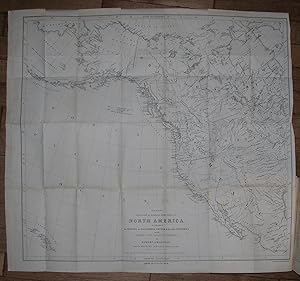
Published by London: Wiley and Putnam, 1846., 1846
Seller: Arader Galleries - AraderNYC, New York, NY, U.S.A.
Seller rating 5 out of 5 stars
First Edition
Hardcover. 1st Edition. 8vo., (9 x 5 � inches). Fine folding lithographed "Map of the Western and Middle Portions of North America, to Illustrate 'The History of California, Oregon and the Other Countries. On the North West Coast of America' by Robert Greenhow" (one or two short tears at the margins; slight spotting); lithographed frontispiece "The American Falls of Lewis Fork"; 3 lithographed plates (some spotting, pale stain). Later half morocco, cloth boards, the spine in six compartments with five raised bands, gilt-lettered in two, gilt florets in the rest (hinge starting, a bit rubbed). First English edition, first published in the United States the same year. The plates, all by Day & Haghe, are different from those included in other issues: "Hill of Columnar Basalt on the Columbia River"; "Devil's Gate"; and "The Pyramid Lake." This British edition of Fremont, which adds a preface discussing the Oregon dispute, is printed on much better paper than the U.S. editions and the plates were created by one of the prominent lithographic firms in nineteenth-century England, William Day & Louis Haghe, Lithographers to the Queen (Tooley). "John C. Fremont's Report of the Exploring Expedition to the Rocky Mountains.and to Oregon and California can only be described as one of the monumental works of Western Exploration and became the vade mecum of Manifest Destiny. Its words, maps, and pictures paved the way for future waves of overlands culminating in the flood tide of the Gold Rush" (Wheat).
-
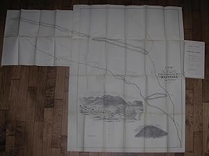
Articles of Association of the Philadelphia and California Mining Company, together with the By-Laws, Lease, Map, &c.
Published by Philadelphia: John C. Clark, 1852., 1852
Seller: Arader Galleries - AraderNYC, New York, NY, U.S.A.
Seller rating 5 out of 5 stars
First Edition
Soft cover. 1st Edition. 4to., (9 5/8 x 5 7/8 inches). Large fine folding lithographed "Map showing The Property of the Philada. & Cala. Mg. Co. Mariposa California" (very slightly toned, slight offsetting to title page). Original publisher's green paper printed wrappers, preserved in a modern cloth portfolio (just touched). First edition. "This company publication includes the terms of a lease from John C. Fremont, a letter from him to the company dated November 10, 1851, and a report of the enterprise's condition and prospects" (Kurutz). The articles stipulate that "the subscribers hereto, having acquired a lease of Six Hundred feet square of land, granted by John Charles Fremont, upon which there is a large quartz vein of gold, situate upon the river Mariposas. and which is deemed to be of great value--the title to which property the subscribers have conveyed to the Trustees of this Company, in trust for the stockholders--offer an opportunity to others to participate in the advantages and profits of said property." In October 1848 Fr�mont had set out on his ill-fated fourth expedition, "partially financed by St. Louis businessmen eager to locate a central, all-weather railroad route through the Rockies. During the unusually severe winter, the expedition lost its way in the rugged mountains of southern Colorado, and ten men, a third of the expedition, perished in the snow. While Fr�mont and several reliable men in his party blamed the guide, William S. 'Old Bill' Williams, other members blamed Fr�mont himself. Despite the tragedy, Fr�mont pushed on to California, where gold had been discovered at Las Mariposas, a seventy-square-mile tract near Yosemite Valley that he had purchased sight unseen in 1847 for $3,000. Las Mariposas made Fr�mont rich, but he was not a shrewd businessman. Until he sold it in 1864, its legal entanglements and escalating costs diminished both his profits and his energy" (Pamela Herr for ANB).
-
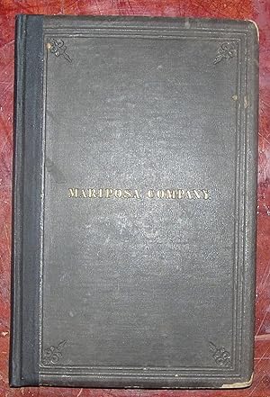
The Mariposa Company, 34 Wall Street, New York.
Published by New York: Wm. C. Bryant, 1863., 1863
Seller: Arader Galleries - AraderNYC, New York, NY, U.S.A.
Seller rating 5 out of 5 stars
First Edition
Hardcover. 1st Edition. 4to., (9 � x 6 � inches). Fine folding lithographed map with hand coloring in full, laid down on linen (some spotting). Original brown publisher's cloth, the front cover titled in gilt and both covers ruled in blind, all edges gilt (rebacked, extremities worn with loss). First edition. In October 1848 Fr�mont had set out on his ill-fated fourth expedition, "partially financed by St. Louis businessmen eager to locate a central, all-weather railroad route through the Rockies. During the unusually severe winter, the expedition lost its way in the rugged mountains of southern Colorado, and ten men, a third of the expedition, perished in the snow. While Fr�mont and several reliable men in his party blamed the guide, William S. 'Old Bill' Williams, other members blamed Fr�mont himself. Despite the tragedy, Fr�mont pushed on to California, where gold had been discovered at Las Mariposas, a seventy-square-mile tract near Yosemite Valley that he had purchased sight unseen in 1847 for $3,000. Las Mariposas made Fr�mont rich, but he was not a shrewd businessman. Until he sold it in 1864, its legal entanglements and escalating costs diminished both his profits and his energy" (Pamela Herr for ANB). This volume is a detailed prospectus of Charles Fr�mont's ill-fated Mariposa Estate Company, which spectacularly failed in 1868, only 6 years after its launch.
-
Report of the Exploring Expedition in the Year 1842 and to Oregon and North California in the Years 1834-1844.
Published by Washington: Gales and Seaton, for the Senate of the United States, 1845., 1845
Seller: Arader Galleries - AraderNYC, New York, NY, U.S.A.
Seller rating 5 out of 5 stars
First Edition
Hardcover. 1st Edition. 8vo., (8 6/8 x 5 4/8 inches). One large lithographic folding map ". of an Exploring Expedition to the Rocky Mountains in the year 1842 and to Oregon & North California in the years 1843-1844" by Charles Preuss with waterways hand-colored in blue tucked into pocket at end (one or two very small holes at folds, lightly browned, but FINE), four lithographic maps, including two folding, and 22 plates (bound with a duplicate of "Devil's Gate", "Hot Spring's Gate" loosely inserted and supplied from a copy of the "House." issue, some occasionally heavy spotting and browning). Original brown cloth (a bit rubbed). "ONE OF THE MONUMENTAL WORKS OF WESTERN EXPLORATION" (Kurutz) First edition, Senate issue, and a NEAR FINE COPY with the astronomical and meteorological observations omitted from the House issue and subsequent editions. Fremont's report, written with the help of his wife Jessie Benton, and map "changed the entire picture of the West [and] represented as important a step forward from the earlier western maps of the period as did those of Pike, Long, and Lewis and Clark in their day. [Fremont's map] represented trustworthy direct observation, a new, welcome, and long overdue development in the myth-encrusted cartography of the West. To Fremont and his magnificent map of his Second Expedition all praise. An altogether memorable document in the cartographic history of the West, and for it alone Fremont would deserve to be remembered in history. This map marked not only the end but the beginning of an era" (Wheat). In 1842 Fremont was commissioned to head "a 25-man, four-month expedition to survey and map the region of the emerging Oregon Trail through South Pass on the Continental Divide. A Report of an Exploration . . . between the Missouri River and the Rocky Mountains . . . (1843), the lively, factually detailed government report that Fr�mont and his wife produced after the journey caught the public imagination: images of Fr�mont's guide, the then little-known Christopher "Kit" Carson, riding bareback across the prairie, and Fr�mont himself, raising a flag on a Rocky Mountain peak, entered the national mythology. "In 1843 Fr�mont set out on a far more ambitious journey to the Oregon region. Disregarding government orders to return by the same route, he went south to Nevada and, in a dangerous midwinter journey, over the snow-covered Sierra Nevada into Mexican-held California. By the time the expedition returned east across the southern rim of what Fr�mont defined as the Great Basin, they had completed a bold fourteen-month circuit of the West, traveling 6,475 miles by their own calculations. The Fr�monts' account of the journey, A Report of the Exploring Expedition to Oregon and California . . . (1845), enthralled the nation. Skillfully combining adventure, scientific data, and detailed practical information for emigrants, supplemented by a valuable map prepared by expedition cartographer Charles Preuss, it was "monumental in its breadth--a classic of exploring literature" (William H. Goetzmann, Exploration and Empire [1966], p. 248). Powerful propaganda, it stirred Americans to head west, guided, as pioneer Sarah Royce stated, "only by the light of Fr�mont's Travels" (Pamela Herr for ANB online). Cohen Mapping the West pp.130-133; Field 565; Graff 1436; Howes F-370; Sabin 25845; Streeter sale VI:3131; Wagner-Camp-Becker 115.
-
Report of the Exploring Expedition in the Year 1842 and to Oregon and North California in the Years 1834-1844.
Published by Washington: Gales and Seaton, for the Senate of the United States, 1845., 1845
Seller: Arader Galleries - AraderNYC, New York, NY, U.S.A.
Seller rating 5 out of 5 stars
First Edition
Hardcover. 1st Edition. 8vo., (8 6/8 x 5 4/8 inches). One large lithographic folding map ". of an Exploring Expedition to the Rocky Mountains in the year 1842 and to Oregon & North California in the years 1843-1844" by Charles Preuss with waterways hand-colored in blue loosely inserted at end (pocket for map on inside back cover torn, small holes at folds, one or two short tears with minor loss, browned and creased), four lithographic maps, including two folding, and 21 of 22 plates (without "Outlet of Subterranean River", some occasionally heavy spotting and browning). Original brown cloth (rebacked preserving the original spine, rubbed, shaken). Modern cloth clamshell box. Provenance: Contemporary ownership inscription of Willis Johnson of Waterbury Connecticut, dated December 1848, on the front free endpaper. "ONE OF THE MONUMENTAL WORKS OF WESTERN EXPLORATION" (Kurutz) First edition, Senate issue, with the astronomical and meteorological observations omitted from the House issue and subsequent editions. Fremont's report, written with the help of his wife Jessie Benton, and map "changed the entire picture of the West [and] represented as important a step forward from the earlier western maps of the period as did those of Pike, Long, and Lewis and Clark in their day. [Fremont's map] represented trustworthy direct observation, a new, welcome, and long overdue development in the myth-encrusted cartography of the West. To Fremont and his magnificent map of his Second Expedition all praise. An altogether memorable document in the cartographic history of the West, and for it alone Fremont would deserve to be remembered in history. This map marked not only the end but the beginning of an era" (Wheat). In 1842 Fremont was commissioned to head "a 25-man, four-month expedition to survey and map the region of the emerging Oregon Trail through South Pass on the Continental Divide. A Report of an Exploration . . . between the Missouri River and the Rocky Mountains . . . (1843), the lively, factually detailed government report that Fr�mont and his wife produced after the journey caught the public imagination: images of Fr�mont's guide, the then little-known Christopher "Kit" Carson, riding bareback across the prairie, and Fr�mont himself, raising a flag on a Rocky Mountain peak, entered the national mythology. "In 1843 Fr�mont set out on a far more ambitious journey to the Oregon region. Disregarding government orders to return by the same route, he went south to Nevada and, in a dangerous midwinter journey, over the snow-covered Sierra Nevada into Mexican-held California. By the time the expedition returned east across the southern rim of what Fr�mont defined as the Great Basin, they had completed a bold fourteen-month circuit of the West, traveling 6,475 miles by their own calculations. The Fr�monts' account of the journey, A Report of the Exploring Expedition to Oregon and California . . . (1845), enthralled the nation. Skillfully combining adventure, scientific data, and detailed practical information for emigrants, supplemented by a valuable map prepared by expedition cartographer Charles Preuss, it was "monumental in its breadth--a classic of exploring literature" (William H. Goetzmann, Exploration and Empire [1966], p. 248). Powerful propaganda, it stirred Americans to head west, guided, as pioneer Sarah Royce stated, "only by the light of Fr�mont's Travels" (Pamela Herr for ANB online). Cohen Mapping the West pp.130-133; Field 565; Graff 1436; Howes F-370; Sabin 25845; Streeter sale VI:3131; Wagner-Camp-Becker 115.
-
Report of the Exploring Expedition to the Rocky Mountains in the Year 1842 and to Oregon and North California in the Years 1843-44.
Published by Washington: Gales and Seaton, for the Senate of the United States, 1845., 1845
Seller: Arader Galleries - AraderNYC, New York, NY, U.S.A.
Seller rating 5 out of 5 stars
First Edition
Hardcover. 1st Edition. 8vo., (8 6/8 x 5 4/8 inches). One large lithographic folding map ". of an Exploring Expedition to the Rocky Mountains in the year 1842 and to Oregon & North California in the years 1843-1844" by Charles Preuss with waterways hand-colored in blue loosely inserted at end (pocket for map on inside back cover torn one or two small holes at folds, lightly browned, but NEAR FINE), four lithographic maps, including two folding, and 22 plates (some occasionally heavy spotting and browning). Original brown cloth (extremities a bit scuffed). Provenance: Contemporary presentation inscription on the front free endpaper to: "Fred D. Sewall from his friend & brother XY George A. Fairfield". "ONE OF THE MONUMENTAL WORKS OF WESTERN EXPLORATION" (Kurutz) First edition, Senate issue, with the astronomical and meteorological observations omitted from the House issue and subsequent editions. Fremont's report, written with the help of his wife Jessie Benton, and map "changed the entire picture of the West [and] represented as important a step forward from the earlier western maps of the period as did those of Pike, Long, and Lewis and Clark in their day. [Fremont's map] represented trustworthy direct observation, a new, welcome, and long overdue development in the myth-encrusted cartography of the West. To Fremont and his magnificent map of his Second Expedition all praise. An altogether memorable document in the cartographic history of the West, and for it alone Fremont would deserve to be remembered in history. This map marked not only the end but the beginning of an era" (Wheat). In 1842 Fremont was commissioned to head "a 25-man, four-month expedition to survey and map the region of the emerging Oregon Trail through South Pass on the Continental Divide. A Report of an Exploration . . . between the Missouri River and the Rocky Mountains . . . (1843), the lively, factually detailed government report that Fr�mont and his wife produced after the journey caught the public imagination: images of Fr�mont's guide, the then little-known Christopher "Kit" Carson, riding bareback across the prairie, and Fr�mont himself, raising a flag on a Rocky Mountain peak, entered the national mythology. "In 1843 Fr�mont set out on a far more ambitious journey to the Oregon region. Disregarding government orders to return by the same route, he went south to Nevada and, in a dangerous midwinter journey, over the snow-covered Sierra Nevada into Mexican-held California. By the time the expedition returned east across the southern rim of what Fr�mont defined as the Great Basin, they had completed a bold fourteen-month circuit of the West, traveling 6,475 miles by their own calculations. The Fr�monts' account of the journey, A Report of the Exploring Expedition to Oregon and California . . . (1845), enthralled the nation. Skillfully combining adventure, scientific data, and detailed practical information for emigrants, supplemented by a valuable map prepared by expedition cartographer Charles Preuss, it was "monumental in its breadth--a classic of exploring literature" (William H. Goetzmann, Exploration and Empire [1966], p. 248). Powerful propaganda, it stirred Americans to head west, guided, as pioneer Sarah Royce stated, "only by the light of Fr�mont's Travels" (Pamela Herr for ANB online). Cohen Mapping the West pp.130-133; Field 565; Graff 1436; Howes F-370; Sabin 25845; Streeter sale VI:3131; Wagner-Camp-Becker 115.
-
Report of the Exploring Expedition in the Year 1842 and to Oregon and North California in the Years 1834-1844.
Published by Washington: Blair and Rives, for the House of Representatives, 1845., 1845
Seller: Arader Galleries - AraderNYC, New York, NY, U.S.A.
Seller rating 5 out of 5 stars
First Edition
Hardcover. 1st Edition. 8vo., (8 6/8 x 5 4/8 inches). One large lithographic folding map ". of an Exploring Expedition to the Rocky Mountains in the year 1842 and to Oregon & North California in the years 1843-1844" by Charles Preuss with waterways hand-colored in blue (one or two shot tears repaired on verso, small holes at folds), four lithographic maps, including two folding, and 22 plates, some tinted (some spotting and browing). Modern red cloth. Provenance: Contemporary ownership inscription of Jacob A. Preston on the title-page; slightly later library inscription on title-page; ink stamp of Henry B. Gardner on title-page. "ONE OF THE MONUMENTAL WORKS OF WESTERN EXPLORATION" (Kurutz) First edition, House of Representatives issue. Fremont's report, written with the help of his wife Jessie Benton, and map "changed the entire picture of the West [and] represented as important a step forward from the earlier western maps of the period as did those of Pike, Long, and Lewis and Clark in their day. [Fremont's map] represented trustworthy direct observation, a new, welcome, and long overdue development in the myth-encrusted cartography of the West. To Fremont and his magnificent map of his Second Expedition all praise. An altogether memorable document in the cartographic history of the West, and for it alone Fremont would deserve to be remembered in history. This map marked not only the end but the beginning of an era" (Wheat). In 1842 Fremont was commissioned to head "a 25-man, four-month expedition to survey and map the region of the emerging Oregon Trail through South Pass on the Continental Divide. A Report of an Exploration . . . between the Missouri River and the Rocky Mountains . . . (1843), the lively, factually detailed government report that Fr�mont and his wife produced after the journey caught the public imagination: images of Fr�mont's guide, the then little-known Christopher "Kit" Carson, riding bareback across the prairie, and Fr�mont himself, raising a flag on a Rocky Mountain peak, entered the national mythology. "In 1843 Fr�mont set out on a far more ambitious journey to the Oregon region. Disregarding government orders to return by the same route, he went south to Nevada and, in a dangerous midwinter journey, over the snow-covered Sierra Nevada into Mexican-held California. By the time the expedition returned east across the southern rim of what Fr�mont defined as the Great Basin, they had completed a bold fourteen-month circuit of the West, traveling 6,475 miles by their own calculations. The Fr�monts' account of the journey, A Report of the Exploring Expedition to Oregon and California . . . (1845), enthralled the nation. Skillfully combining adventure, scientific data, and detailed practical information for emigrants, supplemented by a valuable map prepared by expedition cartographer Charles Preuss, it was "monumental in its breadth--a classic of exploring literature" (William H. Goetzmann, Exploration and Empire [1966], p. 248). Powerful propaganda, it stirred Americans to head west, guided, as pioneer Sarah Royce stated, "only by the light of Fr�mont's Travels" (Pamela Herr for ANB online). Cohen Mapping the West pp.130-133; Field 565; Graff 1436; Howes F-370; Sabin 25845; Streeter sale VI:3131; Wagner-Camp-Becker 115.

![Seller image for THE EXPEDITIONS OF JOHN CHARLES FR�MONT [Four volumes] for sale by Second Story Books, ABAA](https://pictures.abebooks.com/inventory/md/md31783699472.jpg)


![Seller image for Report of the Exploring Expedition to the Rocky Mountains in the Year 1842, and to Oregon and North California in the Years 1843-'44. 28th Congress, 2d Session, [174]. for sale by Arader Galleries - AraderNYC](https://pictures.abebooks.com/inventory/md/md13582121171.jpg)