Order Total (1 Item Items):
Shipping Destination:

Haro Strait (1 results)
Skip to main search results
Search filters
Product Type
- All Product Types
- Books (1)
- Magazines & Periodicals (No further results match this refinement)
- Comics (No further results match this refinement)
- Sheet Music (No further results match this refinement)
- Art, Prints & Posters (No further results match this refinement)
- Photographs (No further results match this refinement)
- Maps (No further results match this refinement)
- Manuscripts & Paper Collectibles (No further results match this refinement)
Condition Learn more
- New (No further results match this refinement)
- As New, Fine or Near Fine (No further results match this refinement)
- Very Good or Good (No further results match this refinement)
- Fair or Poor (No further results match this refinement)
- As Described (1)
Binding
- All Bindings
- Hardcover (1)
- Softcover (No further results match this refinement)
Collectible Attributes
- First Edition (No further results match this refinement)
- Signed (No further results match this refinement)
- Dust Jacket (No further results match this refinement)
- Seller-Supplied Images (1)
- Not Print on Demand (1)
Language (1)
Price
- Any Price
- Under US$ 25 (No further results match this refinement)
- US$ 25 to US$ 50 (No further results match this refinement)
- Over US$ 50
Free Shipping
- Free Shipping to U.S.A. (No further results match this refinement)
Seller Location
Seller Rating
-
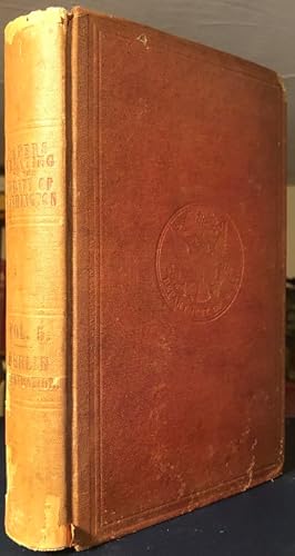
Papers Relating to The Treaty of Washington. Volume V. - Berlin Arbitration. Containing the Memorial of the United States on the Canal de Haro as Its Boundary Line; Case of the Government of Her Britannic Majesty; Reply of the United States Thereto .
Published by Washington: Government Printing Office, 1872., 1872
Seller: William Matthews/The Haunted Bookshop, Sidney, BC, Canada
Seller rating 5 out of 5 stars

Original plum cloth, U.S. official seal in blind on the front cover, spine lettered in gilt. 271pp. plus 16 folding maps. Chipped at spine ends and tips, inner rear hinge partly split, some maps have tears at folds; a very good copy. Ownership signature of Marcus Baker on title page. This is Volume 5 of a 6-Volume set published 1872-73. This volume deals with the water boundary between the USA and Canada, relating to the San Juan Islands Dispute, and the adoption of Haro Strait as the boundary (as opposed to Rosario Strait, the British choice, which would have placed the San Juan Islands within Canada). Many maps of the Georgia Strait, Haro Strait, and surrounding areas of British Columbia. Uncommon.