Order Total (1 Item Items):
Shipping Destination:

Humble George (6 results)
Skip to main search results
Search filters
Product Type
- All Product Types
- Books (5)
- Magazines & Periodicals (No further results match this refinement)
- Comics (No further results match this refinement)
- Sheet Music (No further results match this refinement)
- Art, Prints & Posters (No further results match this refinement)
- Photographs (No further results match this refinement)
- Maps (1)
- Manuscripts & Paper Collectibles (No further results match this refinement)
Condition Learn more
- New (No further results match this refinement)
- As New, Fine or Near Fine (3)
- Very Good or Good (1)
- Fair or Poor (No further results match this refinement)
- As Described (2)
Binding
- All Bindings
- Hardcover (No further results match this refinement)
- Softcover (2)
Collectible Attributes
- First Edition (3)
- Signed (No further results match this refinement)
- Dust Jacket (1)
- Seller-Supplied Images (5)
- Not Print on Demand (6)
Language (2)
Free Shipping
Seller Location
Seller Rating
-
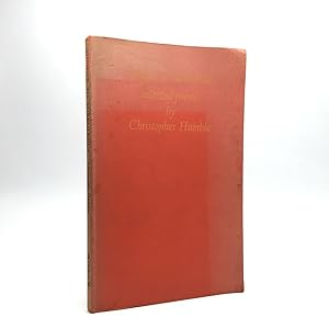
SUBJECT TO TURBULENCE Selected poems
Language: English
Published by Tamal Land Press, Fairfax, 1979
ISBN 10: 0912908092 ISBN 13: 9780912908090
Seller: marvin granlund, Emeryville, CA, U.S.A.
Association Member: IOBA
Seller rating 5 out of 5 stars

First Edition
Softcover. Condition: Near Fine. First Edition; First Printing. Near Fine red paperback first edition. First printing of 800 copies. 101 pages, unmarked. Publisher's promo flyer laid in. Foreword by George Barker. ; H Poe UO15; 9.40 X 5.80 X 0.40 inches; 101 pages.
-

The Proceedings of the Society of Antiquaries of Newcastle upon Tyne: 4th. series. Volume 8. Number 8. January 1939
Published by Published by the Society, Newcastle-upon-Tyne, 1939
Seller: Barter Books Ltd, Alnwick, NORTH, United Kingdom
Association Member: IOBA
Seller rating 5 out of 5 stars
First Edition
Grey card cover. Condition: Very Good. First Edition. VG : in very good condition without dust jacket. 210mm x 140mm (8" x 6"). 26pp.
-
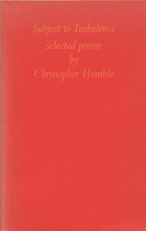
SUBJECT TO TURBULENCE: SELECTED POEMS
Language: English
Published by The Tamal Land Press, A. & C. Philpott, 1979
ISBN 10: 0912908092 ISBN 13: 9780912908090
Seller: Any Amount of Books, London, United Kingdom
Association Member: ABA ILAB PBFA
Seller rating 5 out of 5 stars
First Edition
US$ 34.53
US$ 24.81 shipping
Ships from United Kingdom to U.S.A.Quantity: 1 available
Add to basket8vo. pp [vi], 101, [1]. Red covers lettered in yellow at front and black at spine. With a foreword by George Barker, ownership signature of Sebastian Barker the poet and editor. Brochure for book loosely inserted. Issued in an edition limited to 800, with 100 reserved for distribution in England. ISBN: 0912908092 Good/fair, pages clean and bright throughout, with some fading and marking to covers, a bit rubbed at corners.
-
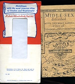
Midle-Sex (Middlesex) Described with the Most Famous Cities of London and Westminster | Authentic Replica on Antiqued Parchment No. 328 in the Series.
Published by Published by Historical Documents Co., 14 Rathbone Place, London.
Seller: Little Stour Books PBFA Member, Canterbury, United Kingdom
Association Member: PBFA
Seller rating 5 out of 5 stars
US$ 20.72
US$ 40.23 shipping
Ships from United Kingdom to U.S.A.Quantity: 1 available
Add to basketCentre map of Middlesex with two inset maps of London and Westminster and four other insets of Saint Peters and Saint Paul's. Single sheet map folded into red and white envelope. In Fine condition. Member of the P.B.F.A. CARTOGRAPHY, MAPS, PLANS.
-
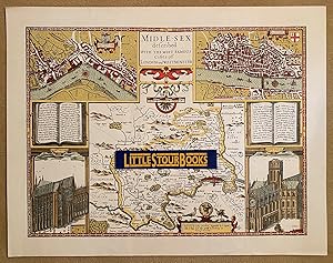
Midle-Sex (Middlesex) Described with the Most Famous Cities of London and Westminster.
Seller: Little Stour Books PBFA Member, Canterbury, United Kingdom
Association Member: PBFA
Seller rating 5 out of 5 stars
US$ 27.62
US$ 40.23 shipping
Ships from United Kingdom to U.S.A.Quantity: 1 available
Add to basketColoured facsimile reprint of the original authentic map of Middlesex and Cities of London and Westminster. 18'' x 23''. Centre map of Middlesex with two inset maps of London and Westminster and four other insets of Saint Peters and Saint Paul's. In Fine condition. Sent rolled in a tube. Member of the P.B.F.A. MIDDLESEX (Middleseaxan).
-

A NEW MAPPE OF THE ROMANE EMPIRE
Published by London, 1626
Seller: Second Story Books, ABAA, Rockville, MD, U.S.A.
Seller rating 4 out of 5 stars

Map
Original hand colored copper engraving. In Very Good condition in a Good frame. Exposed map measures w. 20 in. by h. 15.75 in. Frame measures w. 27.25 in. by h. 23 in. Matting and backing o frame non archival, minor foxing and agetoning to paper. Water damage to center of main textblock, text still legible. Minor fading to pigments, consistent with age. Not examined out of frame. Shelved Dupont. This folio carte de figure map depicts the height of the Roman Empire as understood by cartographer John Speede. It shows the southern half of Europe (with Germania to the north), the British Isles, North Africa, the Middle East, etc. There are five figures engraved on either side, representing 17th century national stereotypes. City views of Rome, Genoa, Jerusalem, Venice, Constantinople and Alexandria line the top. 1398730. Arts & Antiques.