

Order Total (1 Item Items):
Shipping Destination:

Johnson Port (13 results)
Skip to main search results
Search filters
Product Type
- All Product Types
- Books (13)
- Magazines & Periodicals (No further results match this refinement)
- Comics (No further results match this refinement)
- Sheet Music (No further results match this refinement)
- Art, Prints & Posters (No further results match this refinement)
- Photographs (No further results match this refinement)
- Maps (No further results match this refinement)
- Manuscripts & Paper Collectibles (No further results match this refinement)
Condition Learn more
- New (No further results match this refinement)
- As New, Fine or Near Fine (No further results match this refinement)
- Very Good or Good (1)
- Fair or Poor (No further results match this refinement)
- As Described (12)
Binding
Collectible Attributes
- First Edition (No further results match this refinement)
- Signed (No further results match this refinement)
- Dust Jacket (No further results match this refinement)
- Seller-Supplied Images (13)
- Not Print on Demand (13)
Language (2)
Price
- Any Price
- Under US$ 25 (No further results match this refinement)
- US$ 25 to US$ 50
- Over US$ 50
Free Shipping
- Free Shipping to U.S.A. (No further results match this refinement)
Seller Location
Seller Rating
-

SWEDEN and NORWAY, from Johnson's New Illustrated Family Atlas of the World
Published by Johnson 1866,7,8 or 9., NY, 1866
Seller: Quiet Friends IOBA, Lyndonville, NY, U.S.A.
Association Member: IOBA
Seller rating 4 out of 5 stars

Softcover. "FINE" map, hand colored, 18.5" high x 11" wide. Having been bound on the right there's no decorative border. 1865 cp date but actually 1866-9. Johnson's name (by itself, without the added "Browning", "Ward" or "and son") is printed in double faced outline and was not used until 1866. In addition the particular border style, with a five pointed star at each corner, went out in 1869. Hence the 1866-9 date. This info from Ira Lourie's Johnson Map Project. "FINE" map. Published between 1866 & 1869, tho cp date of 1865.
-

DENMARK with SLESWICK & HOLSTEIN, from Johnson's New Illustrated Family Atlas of the World
Published by Johnson 1866,7,8 or 9., NY, 1866
Seller: Quiet Friends IOBA, Lyndonville, NY, U.S.A.
Association Member: IOBA
Seller rating 4 out of 5 stars
Softcover. "FINE" map, hand colored, 18.5" high x 11" wide. Having been bound on the left there's no decorative border. 1865 cp date but actually 1866-9. Johnson's name (by itself, without the added "Browning", "Ward" or "and son") is printed in double faced outline and was not used until 1866. In addition the particular border style, with a five pointed star at each corner, went out in 1869. Hence the 1866-9 date. This info from Ira Lourie's Johnson Map Project. "FINE" map. Published between 1866 & 1869, tho cp date of 1865.
-

IRELAND, from Johnson's New Illustrated Family Atlas of the World
Published by Johnson 1866,7,8 or 9., NY, 1866
Seller: Quiet Friends IOBA, Lyndonville, NY, U.S.A.
Association Member: IOBA
Seller rating 4 out of 5 stars
Softcover. "FINE" map, hand colored, 18.5" high x 12" wide. BUT the right decorative border has been trimmed off. OTHERWISE FLAWLESS. No cp date but actually 1866-9. Johnson's name (by itself, without the added "Browning", "Ward" or "and son") is printed in double faced outline and was not used until 1866. In addition the particular border style, with a five pointed star at each corner, went out in 1869. Hence the 1866-9 date. This info from Ira Lourie's Johnson Map Project. "FINE" map. Published between 1866 & 1869.
-

AUSTRIA TURKEY in EUROPE and GREECE
Published by Johnson [1870s], NY, 1870
Seller: Quiet Friends IOBA, Lyndonville, NY, U.S.A.
Association Member: IOBA
Seller rating 4 out of 5 stars
Softcover. Hand colored map. (illustrator). FINE map. Hand colored. Bright & clean as new. No aging, foxing or soiling. Overall measures 17"x22" FINE map. 1867 cp date, but border design dates it to the 1870s.
-

SWITZERLAND, from Johnson's New Illustrated Family Atlas of the World
Published by Johnson 1866,7,8 or 9., NY, 1866
Seller: Quiet Friends IOBA, Lyndonville, NY, U.S.A.
Association Member: IOBA
Seller rating 4 out of 5 stars
Softcover. "FINE" map, hand colored, 17" wide x 14" high. FLAWLESS. No cp date but actually 1866-9. Johnson's name (by itself, without the added "Browning", "Ward" or "and son") is printed in double faced outline and was not used until 1866. In addition the particular border style, with a five pointed star at each corner, went out in 1869. Hence the 1866-9 date. This info from Ira Lourie's Johnson Map Project. "FINE" map. Published between 1866 & 1869, but no cp date.
-

CENTRAL AMERICA, from Johnson's New Illustrated Family Atlas of the World
Published by Johnson 1866,7,8 or 9., NY, 1866
Seller: Quiet Friends IOBA, Lyndonville, NY, U.S.A.
Association Member: IOBA
Seller rating 4 out of 5 stars
Softcover. "FINE" map, hand colored, 16.5" wide x 14" high. FLAWLESS but one 2" closed tear, margins with 1/8" chips & few closed tears. No cp date but actually 1866-9. Johnson's name (by itself, without the added "Browning", "Ward" or "and son") is printed in double faced outline and was not used until 1866. In addition the particular border style, with a five pointed star at each corner, went out in 1869. Hence the 1866-9 date. This info from Ira Lourie's Johnson Map Project. FINET" map. Published between 1866 & 1869, but no cp date.
-

SOUTH AMERICA from Johnson's New Illustrated Family Atlas of the World
Published by Johnson 1866,7,8 or 9., NY, 1866
Seller: Quiet Friends IOBA, Lyndonville, NY, U.S.A.
Association Member: IOBA
Seller rating 4 out of 5 stars
Softcover. "FINE" map, hand colored, 24" high x 18" wide. Fold line @ center. FLAWLESS. 1863 cp date but actually late 1860s. Johnson's name (by itself, without the added "Browning", "Ward" or "and son") is printed in double faced outline and was not used until 1866. In addition the particular border style, with a five pointed star at each corner, went out in 1869. Hence the late 1860s date. This info from Ira Lourie's Johnson Map Project. "FINE" map. Published between 1866 & 1869, tho cp date of 1863.
-

GEORGIA and ALABAMA
Published by Johnson [1870s], NY, 1870
Seller: Quiet Friends IOBA, Lyndonville, NY, U.S.A.
Association Member: IOBA
Seller rating 4 out of 5 stars
Softcover. Hand colored map. (illustrator). FINE map. Handcolored. Bright as new. Overall measures 15.5"X22". Tho there is an 1863 cp date the font of the Johnson name & the border style date this to the 1870s. FINE map. No aging, foxing, soiling, etc.
-
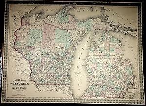
WISCONSIN and MICHIGAN
Published by Johnson [1870s], NY, 1870
Seller: Quiet Friends IOBA, Lyndonville, NY, U.S.A.
Association Member: IOBA
Seller rating 4 out of 5 stars
Softcover. Hand colored map. (illustrator). FINE map. NO aging, foxing, soiling etc. Fold line tear reenforced with archival tissue. Overall measures 17"X22.5". One 1/8" margin chip. Upper border darkened a bit. Tho cp date is 1864 the font used in printing the Johnson name & the border style date this to the 1870s. FINE map. Handcolored. Bright & clean as new. No tears.
-

GEORGIA and ALABAMA
Published by Johnson [1860 - 1862], NY, 1862
Seller: Quiet Friends IOBA, Lyndonville, NY, U.S.A.
Association Member: IOBA
Seller rating 4 out of 5 stars
Softcover. Hand colored map. (illustrator). FINE map. Overall sizes 17.5"X24". 2 insets of lithos of "Rice Mill on Savannah River" & "Tuscaloosa Observatory". Tho no printed dates this border style was only used from 1860 to 1862. FINE map. Handcolored. Bright & clean as new. A 1/4" border chip.
-

AUSTRALIA, from Johnson's New Illustrated Family Atlas of the World
Published by Johnson 1866,7,8 or 9., NY, 1866
Seller: Quiet Friends IOBA, Lyndonville, NY, U.S.A.
Association Member: IOBA
Seller rating 4 out of 5 stars
Softcover. "FINE" map, hand colored, 16.5" wide x 13.5" high. FLAWLESS. No cp date but actually 1866-9. Johnson's name (by itself, without the added "Browning", "Ward" or "and son") is printed in double faced outline and was not used until 1866. In addition the particular border style, with a five pointed star at each corner, went out in 1869. Hence the 1866-9 date. This info from Ira Lourie's Johnson Map Project. "FINE" map. Published between 1866 & 1869, but no cp date.
-

Pembrokeshire's Hidden Haven
Language: English
Published by Celtic Maritime Connections, 2008
ISBN 10: 0956049001 ISBN 13: 9780956049001
US$ 163.14
US$ 21.18 shipping
Ships from United Kingdom to U.S.A.Quantity: 1 available
Add to baskethardcover. Condition: Very Good.
-

MEXICO from Johnson's New Illustrated Family Atlas of the World
Published by Johnson 1866,7,8 or 9., NY, 1866
Seller: Quiet Friends IOBA, Lyndonville, NY, U.S.A.
Association Member: IOBA
Seller rating 4 out of 5 stars
Softcover. "FINE" map, hand colored, 13" high x 17" wide. FLAWLESS. Inset of Tehuantipec. Johnson's name (by itself, without the added "Browning", "Ward" or "and son") is printed in double faced outline and was not used until 1866. In addition the particular border style, with a five pointed star at each corner, went out in 1869. Hence the 1866-9 date. This info from Ira Lourie's Johnson Map Project. "FINE" map. Published between 1866 & 1869.

