Order Total (1 Item Items):
Shipping Destination:

Machnich (1 results)
Author:
machnich
Refine with Advanced Search
Skip to main search results
Search filters
Product Type
- All Product Types
- Books (1)
- Magazines & Periodicals (No further results match this refinement)
- Comics (No further results match this refinement)
- Sheet Music (No further results match this refinement)
- Art, Prints & Posters (No further results match this refinement)
- Photographs (No further results match this refinement)
- Maps (No further results match this refinement)
- Manuscripts & Paper Collectibles (No further results match this refinement)
Condition Learn more
- New (No further results match this refinement)
- As New, Fine or Near Fine (No further results match this refinement)
- Very Good or Good (No further results match this refinement)
- Fair or Poor (No further results match this refinement)
- As Described (1)
Binding
- All Bindings
- Hardcover (No further results match this refinement)
- Softcover (No further results match this refinement)
Collectible Attributes
- First Edition (No further results match this refinement)
- Signed (No further results match this refinement)
- Dust Jacket (No further results match this refinement)
- Seller-Supplied Images (1)
- Not Print on Demand (1)
Language (1)
Price
- Any Price
- Under US$ 25 (No further results match this refinement)
- US$ 25 to US$ 50 (No further results match this refinement)
- Over US$ 50
Free Shipping
- Free Shipping to U.S.A. (No further results match this refinement)
Seller Location
Seller Rating
-
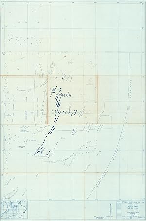
North East Rub Al Khali. B-1583-X.
Published by [Saudi Arabia], Arabian American Oil Company, 1953., 1953
Seller: Antiquariat INLIBRIS Gilhofer Nfg. GmbH, Vienna, A, Austria
Association Member: ILAB PADA VDA VDAO
Seller rating 5 out of 5 stars

Printed map on canvas, 985 x 655 mm. Scale 1:500,000. Copy no. 1520. Originally published in 1950; revised 1953. A pilot's personal map of the Empty Quarter across the border of the future United Arab Emirates and Saudi Arabia, marked "Confidential Material" and carefully annotated in pencil by the Aramco pilot R. F. Morris. - Morris had once flown one of Aramco's first transatlantic flights in a DC-3 from Texas on a long route to Saudi Arabia, and later became manager of the Aramco Aviation Department; he was quoted in a 1967 Aramco World article, discussing the difficulties of flying over this very landscape: "Flying in most of Saudi Arabia is like flying anywhere, but when you get down there, there's nothing. You'll fly for hours without seeing a living thing: man, beast or vegetation. No roads or railways, no lakes or streams, no woods, no villages. Just great stretches of sand or gravel between the rolling dunes or occasional limestone hills and escarpments". - Despite the hardship, Morris's pencil notes show an intimate knowledge of the desert landscape, and one which Aramco was particularly eager to map. He notes helpful landmarks (and some dead reckoning), but also the landscape of the oil explorations below: a truck route, a tanker, an "oil line." An X marks where "Equip moves here today" and a particular feature of oil company flying: an "oil strip", or a DIY landing strip marked with oil. Another pilot quoted in Aramco World alongside Murray describes this: "All you need is a bare expanse of gravel floor with a stretch marked out with a streak of oil, four barrels, or four flares at night and presto, there's an airstrip". - The map was made while Aramco was attempting a series of wildcat oil strikes in Rub Al Khali, but the largest discoveries, made along the border with what would become the UAE, would not be made until the 1960s. - Gentle toning along creases. Remarkably well preserved, pencil notes very clear. - Will Tracy, "Fly the Desert Sky", in: Saudi Aramco World, Nov.-Dec. 1967, pp. 1-7.